Routes
Daily stages on map
On Friday, 19 July 2002, we drove to Kolari, had the car’s oil changed and the bicycle’s inner tube replaced, and stayed there overnight.
Kilpisjärvi (customs) - The isthmus between Lake Govda and Lake Caza
On Saturday, July 20, 2002, we had morning coffee and set off by car for Kilpisjärvi shortly after 8 a.m., stopped at a sports shop in Muonio, had coffee and pastries along the way, arrived in Kilpisjärvi around noon, picked up the key at customs, paid a deposit of 100 NOK, left the car at customs, then cycled toward Norway. A sunny afternoon, after a couple of hours (21 km) of cycling, we reached the point where the road to Lavkavaggi begins, crossed the barrier, and the uphill climb turned out to be quite steep after all. After the steeper initial climb, we reached the start of Lavkavaggi, and the ascent leveled off. On the way, we took a food break next to a power plant by a stream: a bag of pasta, coffee, and cookies.
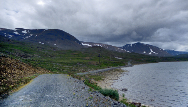
Then a gentle climb along the southern slope of Lavkavaggi, past Lake Lavkajärvi, Rieppegaisi, Ruksesgaisi, and Goahterotrassa, then along the shore of Lake Govdajärvi by bike all the way to the northern end of the isthmus between Lakes Govda and Cazajärvi (17.5 km), where there are two cabins. Arrived around 8 p.m., both cabins were locked. We wondered for a moment why we couldn’t get into the cabins, then pitched the tent in the cabin yard. Blåband bag. Spent the night in the tent. it rained a little during the night, and the wind was quite strong, but it wasn’t cold.
The isthmus between Lakes Govda and Cazajärvi - The shore of Lake Fiskelaus
On the morning of Sunday, July 21, 2002, we took down the tent and left our bikes by the side of the cabin. We started our hike along the trail that runs along the shore of Lake Cazajärvi; the weather was cloudy, with occasional light rain, and the wind was quite strong in open areas, especially at the summit of Midlerdalen, where we took a break. The journey continued along the shore of Lake Cazajärvi, circling the Moskugaisi ridge. Lunch lunch break at Poikkiharju, a packet of pasta, then an ascent to about 900 meters, with some fairly steep grassy slopes along the way, to the shore of Lake Fiskelaus, where we set up camp, we hiked about 8 km.
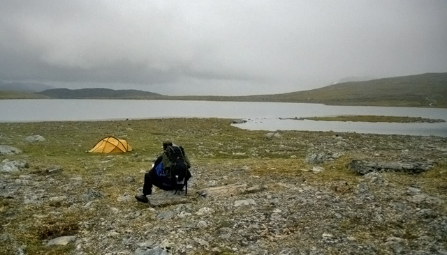
A brisk wind, low clouds, and damp weather. The lake shore was quite rocky, but we found a spot for our tent on the western shore of the lake.
Markusfjellet 1541m
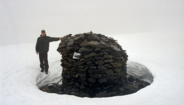
Monday, July 22, 2002: Day hike (8 km) to the summit of Markusfjelle (1,541 m), departure at 11 a.m., return at 5 p.m. At first, visibility was still decent, but at around 1,000 meters it deteriorated, with low-hanging clouds. Climbing in the fog, sometimes steeper, but mostly easy, though the rocks were slippery, climbing was easiest along patches of snow, visibility was at its worst at twenty meters or less, we used patches of snow as landmarks and placed rocks on the snow in the shape of an arrow to indicate the direction of travel; in addition, at regular intervals (10 meters), we set stones upright to mark the route. We took a break at the summit, on the way back, I fell and injured my knee, but I was able to continue the journey. Upon reaching camp, I tended to my equipment and myself.
The shore of Lake Fiskelaus - Mannfjellet - Kilpisjärvi (customs)
Tuesday, July 23, 2002: Day hike (8 km) to Mannfjellet (1,552 m), departure at 11 a.m., return at 5 p.m. The weather was a bit clearer than yesterday, and once we had climbed above 950 meters, we were treated to great views of Vassdalen, Vassdalstinden, and Lemmetgais, a little further on, views of Kitdalen and the mountains of the Lyngen Peninsula.

Then a steep climb in places, followed by a climb through snow at the end; the summit was shrouded in clouds, climbing to about 1500 meters, we didn't feel like going any further. Return, eat at the tent, take down the tent, pack the backpacks, and at 7:00 PM set off on foot toward the cabins (8 km), where we left our bikes, at the cabins by 11:00 PM. We ate muesli and fruit soup, then continued by bike toward the Skibotn road (17.5 km); there were many downhill sections along the way, but the road was in poor condition in places; arrived at the Skibotten road at 1:00 a.m. We left our backpacks there and continued by bike toward the Kilpisjärvi border crossing (21 km), arriving at the border crossing at 3:00 a.m. We then picked up our backpacks by car and drove toward Kolari, at Äkäsjokisuu, the bike rack broke and we had to stop, my parents brought another bike rack by car and the journey continued, arrived in Kolari on July 24, 2002, at 7:30 a.m. The total distance covered by bike and on foot was 115.6 km.