Routes
Daily stages on map
In summer 2021 the COVID‑19 pandemic still hindered travel abroad, so we decided to aim this year’s trip at domestic landscapes. We had previously explored parts of the Käsivarsi fell region. The area offers open fell terrain suitable for hiking, where brush and mosquitoes are not too much of a nuisance. The marked Nordkalott Trail from Kilpisjärvi toward Halti, the bridges over rivers, and the open wilderness huts make travel easier, so the area is well suited for trekking. Thus we would head there at the turn of July and August, during the busiest part of the hiking season.
Visitor Centre parking area – Duolljehuhputlattu
On Friday 30 July 2021 we began driving at 05:31, refueled in Kolari, and stopped in Sonkamuotka for coffee; a reindeer sandwich and cloudberry pastry tasted excellent. We arrived at the Kilpisjärvi Visitor Centre parking area at 12:35. The parking lot was completely full, but we found a space. The weather was partly cloudy with a light northeast wind, no immediate threat of rain, temperature +19°C. We prepared the first meal of the trip on the Trangia: pasta in cheese sauce mixed with a can of stroganoff meat, and ate. After the meal we changed into hiking clothing (fleece pants, base‑layer shirt, gloves, cap). Backpack weights were 19.06 kg and 21.38 kg. At 13:50 we set off along the Nordkalott Trail. The path was easy at first thanks to gravel surfacing. The gravel section ended at Lake Tsahkaljärvi, where a new grill shelter and other structures had been built. We continued along the lake shore; at the east end we drank from a stream and crossed it via a bridge. We continued briefly along the trail toward Termisjärvi, then left the trail and headed toward Masetvarri. After the ascent we reached an ATV track on the ridge. We took a break and ate chocolate bars. Due to COVID restrictions the Norwegian border could not be crossed, so we next aimed to summit Muurivaara (841.5 m). We remembered there was a border marker on the summit, so there was no risk of accidentally entering Norway.
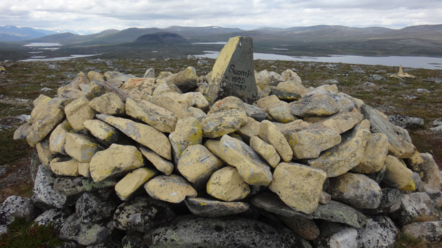
The views from Muurivaara were quite good; cloud cover had decreased and the weather was nearly sunny. We considered continuing to Salmivaarat, but decided we did not have the energy, so we navigated along the ATV track and then the Nordkalott Trail to the Saarijärvi wilderness hut. After passing the hut we crossed a stream via a bridge and sat down for a break at 18:30, eating chocolate bars and drinking water. Evening was approaching, and we thought it might be time to camp. However, nearby tent sites were occupied; overall there seemed to be many hikers in the area. We continued ascending along the Nordkalott Trail; there were few good tent sites on the slope, and most streams were dry. In the saddle between Duolljehuhput and Guonjarvarri the terrain was flatter, but there was no water. We then headed to Duolljehuhputlattu, to the lake at 925.3 m, where we found an excellent tent site by the shore. We arrived at 21:17, having walked 20.13 km.
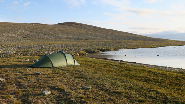
We fetched water from a stream and prepared a Reiter meal for dinner. Then it was time for rest. The first day’s weather remained dry; travel fatigue affected us, and my legs felt quite sore — thoughts of stress fractures even crossed my mind, and that I should walk more than once a year so my legs would adapt.
Duolljehuhputlattu – Kahperusvaarat – South side of Urttaspahta
On Saturday 31 July 2021 we woke at 07:05. The weather was cloudy, a light west wind fluttered the tent, and there was some light rain. Breakfast was a Reiter meal, instant coffee, and biscuits. My legs still felt the strain from the previous day. While removing debris from my boots I realized the insoles were missing — they had been left at home on the shelf where I had placed them to dry a year earlier. My worries vanished: the problem was not my legs but the boots. I would simply have to adapt; walking would become easier as the trip progressed. I also considered that in an emergency I could cut insoles from the foam sleeping pad, since I had both a foam pad and an air pad. But it was not yet an emergency. At 08:45 we set off with day‑trip gear and shell clothing toward the 1143.5 m summit of Kahperusvaarat. The rain soon stopped; clouds were fairly low. We ascended gently to the ridge and followed it to the summit. There were some views east and south; Kalkkinippa stood out pale against the surroundings.
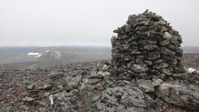
We heard an airplane and soon it emerged from the clouds, flying close by and greeting us with a wing waggle. From the summit we descended to inspect Siktagurra, a steep‑sided ravine north of the summit. We walked to the upper end of the ravine and drank from a stream. The return to the tent was quick; we arrived at 11:28. We ate dried meat and chocolate bars, then rested. Rain had begun again. After resting we broke camp and packed our backpacks; at 13:55 we set off, intending to head toward Urtas Valley and also to see Loassonibba, possibly camping near it. We first walked to the stream flowing from the 955.1 m lake, then to the lake shore. We circled the 957.7 m lake on the west side; one fisherman was camping by the shore. At the west end of the lake we took a break, eating dried meat and chocolate bars. Rain had eased at times but intensified again; clouds were around 1000 m, so there were no views. We headed north toward the 982.2 m lake. The terrain became entirely rocky; due to the rain the stones were slippery. We passed the 982.2 m lake on the west side, continued over a ridge, and reached the edge of a small hollow, then continued northwest to the 1011.4 m lake. Here the rocky terrain included some bedrock. We had walked only a bit over 8 km, but the rocky terrain made progress slow and tiring. We took a break, ate chocolate bars, and considered looking for a campsite; we knew Loassonibba was close, though hidden by clouds. We headed to the northwest end of Goddejärvi; the terrain was still pure boulder field. We walked along the lake shore, but there were no tent sites.
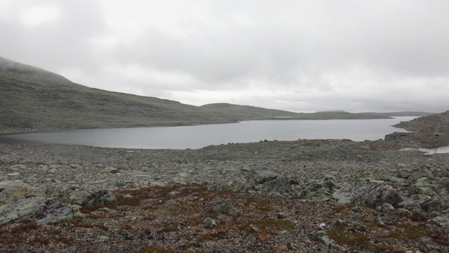
We turned east at the southeast end of Loassonibba and walked along the shores of the 999.6 m and 981.1 m lakes; neither was suitable for camping. We descended along a stream ravine until at 21:10 we found a campsite at 755 m; total distance 42.84 km. Tent pitching proved problematic: one tent pole broke while attaching the inner tent. We had a spare pole section, but it did not fit with the others — it was a newer model. With a repair sleeve and duct tape we fixed the pole. As we continued pitching, the same pole broke again in a different place. Fortunately we had another repair sleeve, and the repair went smoothly. The tent was erected, but the repeated pole failures caused concern. Had the pole metal become brittle over the years (tent purchased in 2003)? Would the tent withstand wind at all? Was it even safe to camp with it? Or had the rocky terrain simply exhausted us so much that we could no longer pitch the tent properly? The repair parts were now used up; we decided not to go much farther, so that if more problems occurred we could walk back to the car immediately. After a Reiter meal we rested at 23:30.
South side of Urttaspahta – Govddosgáisi – Shore of Lake Riimmajärvi
On Sunday 1 August 2021 we woke at 08:00. Cold wind, cloudy. Reiter breakfast, instant coffee, biscuits. Occasional light rain. At 10:31, after breaking camp, we descended into Urtas Valley, aiming to cross the valley watercourse and then camp again. Due to the wind we wore shell clothing. We crossed the narrow channel between Urtasjärvi and Riimmajärvi on stepping stones; water levels were low and our boots stayed dry. It took some time to find a suitable campsite; the small streams on the slope were dry, so water would have to be taken from the lake. We found a site at 11:45 at 701 m; total distance 45.74 km. Tent pitching went normally. We ate chocolate bars for lunch, then gathered day‑trip gear and at 13:35 set off toward the summit of Govddosgáisi. The rain had stopped. We ascended fairly directly; at times the slope was steep, at times there were flat terraces. Near the top we used our hands for balance in the rocky terrain, but reached the 1230 m summit easily. It was cloudy and there were few views, though parts of Urtas Valley were visible. We continued along the ridge to the 1219 m summit, looked at the scenery, then descended into a southeast‑facing stream ravine. We took a break in the ravine and ate chocolate bars. The slope downward was steep and rocky at first, then easier, and we descended along a gentle grassy valley to Urtas hotel.
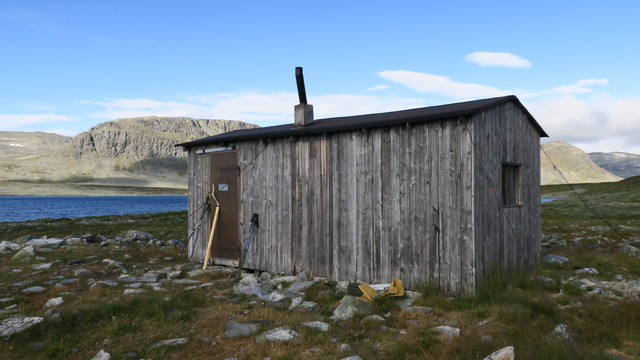
We stepped inside and signed the guestbook. To our delight, some high‑profile visitors had been there. We returned to the tent at 17:38; total distance 53.75 km. After a Reiter meal we flew the drone; the wind hindered it somewhat. Then it was time for rest. We planned to continue the next day toward Meekonlaakso, where we would be on the Nordkalott Trail and near a wilderness hut, so even if the tent failed it would not be a disaster.
Shore of Lake Riimma – Meekonvarri – South side of Saivaara
On Monday 2 August 2021 we woke at 06:00. Cold weather, +2°C outside, wind from the west, fairly clear sky, sunrise approaching. We waited for the sun for a while, then prepared a Reiter meal for breakfast, followed by instant coffee and biscuits. Two reindeer were eating their breakfast beside the tent.
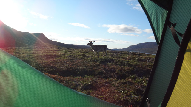
After breaking camp we set off at 09:05, wearing fleece pants, wind jacket, beanie, and neck gaiter. We walked along the shore of Lake Riimma past Urttashotelli, then crossed Urtasjoki on stepping stones. We ascended toward the Dapmotcahca saddle, taking a break to eat chocolate bars. At the saddle we turned upward toward the 1019.1 m summit of Meekonvarri. It was quite windy at the summit, with good views in all directions. Clouds occasionally arrived from the west, with light drizzle at times. We then descended; on the right side, in Bierfevaggi, there was a cliff. We found a narrow downward‑sloping crack in the cliff and descended into Bierfevaggi. A rain cloud approached from the west; we put on shell clothing, and the rain stopped immediately. We ate chocolate bars and continued, hoping for more rain. We crossed Bierfejohka on stones and headed toward Saivaara. Our route crossed the Nordkalott Trail, which was busy with hikers, but after a short wait we slipped across. To our delight a rain shower passed over us — the shell clothing was not worn in vain. We searched for a tent site near Saivaara and at 16:14 found one. Total distance 67.70 km. Water had to be fetched from the nearby 689.3 m lake/pond. We ate chocolate bars and rested. The weather was fairly sunny, so at 18:06 we set off for the 830 m summit of Saivaara. At the summit we admired the views, took photos, and flew the drone.
After descending we flew the drone some more. We returned to the tent at 19:54; total distance 69.96 km. After a Reiter meal we rested. The wind calmed in the evening.
South side of Saivaara – Jolla – Slope of Malla
On Tuesday 3 August 2021 we woke at 06:30. Thin high clouds, not very cold, no wind. Breakfast was again a Reiter meal, followed by instant coffee and biscuits. After breaking camp we set off at 09:10, walking gently uphill toward Gahperusvarri and the Nordkalott Trail. Soon it became warm and the weather turned sunnier. We reached the Nordkalott Trail and followed it for a while, then turned downhill toward Lake Siedjonjärvi. The gentle descent made walking easy. We crossed Kahperusjoki on stones and took a break on the riverbank, eating chocolate bars. We continued to Siedjonjärvi, passing it on the west side. There was some brush along the shore, but walking was easy. At the south end of the lake we took another break and flew the drone.
The terrain around Siedjonjärvi and Siedjongohppi was pleasant, and presumably in early summer, when snow patches still decorate the fell slopes, the scenery would be even more impressive. Early summer in the Far North is something we should come to see someday. Next we walked for quite a long stretch through willow thickets until we reached the beginning of Kutturankuru. We took a break in the ravine and ate chocolate bars. We then descended along the ravine for a while, until we moved to the right side of it and followed a path down into the Termisjärvi valley and toward Jolla–Malla / Dierpmes‑Malla. We camped on the slope of Jolla–Malla at 640 m at 16:36; total distance was 88.85 km. The sun was shining, the temperature inside the tent was +45°C, and we ate chocolate bars. At 17:55 we set out for the summit of Jolla–Malla; the views were quite good and the wind fairly brisk. On the way down we flew the drone again; we reached the tent at 19:02, total distance now 90.35 km. The tent interior had cooled to a comfortable temperature, so we ate a Reiter meal and went to rest.
Jolla – Malla slope – Termisvaara – Paihkasjoki
On Wednesday 4 August 2021 we woke at 07:45; the sun was already shining into the tent and it was hot. The weather was sunny, with a brisk west‑northwest wind. After eating a Reiter meal, instant coffee, and biscuits, we set out at 09:50 for a day trip to Termisvaara. We walked past the eastern end of Termisjärvi and then climbed fairly steeply to the small pond at 811.2 m. We drank water and continued ascending to the broad summit plateau of Termisvaara. The wind was strong here as well. We first walked to the higher western summit at 1028.8 m, where the views were quite good.
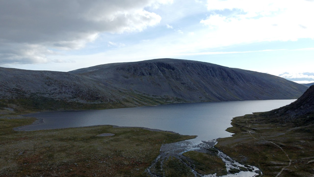
At the summit there was a metal box containing a geocache and a guestbook; we wrote our names in the book. Then we walked back toward the eastern summit. After that we descended again to the 811.2 m pond, where we took a break and ate chocolate bars. There seemed to be good tent sites here; if one were to start from Kilpisjärvi and travel via Ailakkavaara and Termisvaara, this would be a fine place to camp. We then headed east past Lake Dierpmesgohpejärvi to inspect the ravine descending from the lake. We descended the ravine for a while; its sides were steep and the rocky bottom was slippery in places. Before reaching the brush lower down, we left the ravine and headed back to the tent. We arrived at 16:05; total distance was 104.6 km. We ate chocolate bars, then broke camp. At 17:45 we set off again, walking along the shore of Termisjärvi to Salmikuru, where we flew the drone.
We continued to the Termisjärvi open and reservable huts. We had not seen this hut before, so we took a photograph. The atmosphere around the hut was lively: numerous tents on the grounds, several anglers by the lake, and diners on the hut’s terrace — the hut was apparently full. After taking the photo we continued, walking to the west end of the lake. We looked for a tent site there, but all spots were already taken. We continued to the Paihkasjoki river, where we found a free tent site at 617 m. We camped at 20:18; total distance was 112.1 km. After a Reiter meal we went to rest.
Paihkasjoki – Visitor Centre parking area
On Thursday 5 August 2021 we woke at 06:00. Cloudy but dry weather. Fairly warm, no wind. Breakfast again consisted of a Reiter meal, instant coffee, and biscuits. After breaking camp we set off at 08:05 toward the Visitor Centre parking area and the car. Walking along the ATV track was easy, though somewhat dull.
We flew the drone a few more times along the way. We reached the car at 11:35; total distance 124.5 km, elevation 492 m, temperature +16°C. We changed into driving clothes and headed south. Notes: We were fortunate with the weather; it rained only a little. Water levels in streams and lakes were low, making crossings easy. There were quite a lot of hikers in the area; airplanes and helicopters flew daily, and true wilderness quiet existed only in brief moments. This Far North region is pleasant hiking terrain — worth visiting again, perhaps in early June. The tent caused no further problems, though the poles must be replaced. As for food, the beef jerky went uneaten this time. Reiter meals, chocolate bars (3), and biscuits provide about 9086 kJ/day (2170 kcal), assuming 100% digestive efficiency. If one moves body and backpack weight over 20 km of varied terrain, the day’s energy requirement is, even by a modest estimate, about 4186 kJ / 1000 kcal higher. One would therefore need to consume quite a lot of sports drink and salted peanuts, and perhaps add an extra spoonful of sugar to the coffee, to get anywhere near the daily energy requirement. Nutrition needs further consideration in the future.