Routes
Daily stages on map
This year the chosen hiking area was Jotunheimen in Norway. The plan was to spend about a week there in mid‑August, with hopes of visiting Norway’s highest mountains, Galdhøpiggen and Glittertind. The hiking style would be traditional: camping in a tent and carrying all necessary gear and food in our backpacks. We aimed to keep the packs light by minimizing equipment and food. We assumed the area would have plenty of other hikers and that darkness would fall early in the evenings this far south.
Gjendesheim – Russvatnet
Saturday 10.8.2013: overnight driving through Sweden, four moose spotted, early‑morning roadside breakfast and one hour of sleep at Utanbergsvallarna. Refueling in Vemdalen. Coffee break at a roadside stop in Norway between Tynset and Alvdal. Arrival at Gjendesheim at 15:53 (1438 km). Car parked at the long‑term parking area (800 NOK / 10 days, about 100 euros) . Changed clothing, weighed backpacks: 19.85 kg and 19.85 kg. Elevation 977 m.
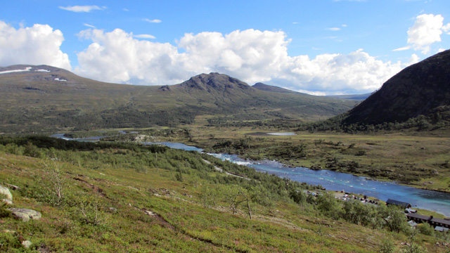
We started walking after 16:00. Due to the long drive, our only goal was to find a campsite and sleep. Sunny warm weather. First along the road toward the trailhead, with nice views over Lake Gjende. The initial climb on the trail was sweaty, and there were many hikers descending from Veslfjellet. Then the terrain leveled out. A few drinking breaks along the way. Clouds increased, and a rain cloud seemed to be approaching, so we pitched the tent by Lake Russvatnet after the bridge at 19:21, elevation 1180 m, distance 10.58 km (trip meter).
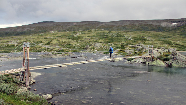
Rain began immediately after we got into the tent. Reiter mashed potatoes with meatballs / sautéed meat for dinner. It hardly rained during the night, but sleep was minimal.
Russvatnet – Glitterheim
Sunday 11.8.2013 wake‑up at 06:00. Reiter mashed potatoes with meatballs / porridge for breakfast, instant coffee, biscuits, and leftover pastries from the drive. Started walking at 08:27, aiming for the Glitterheim area. Cloudy but dry weather, good visibility lower down, but higher peaks were in clouds. No mosquitoes, no wind. First along the lakeshore trail, then climbing toward a stream, crossing it on stones at the ruins of an old bridge, then ascending toward Tjönnholet. Rocky terrain began. At 1600 meters we had a chocolate/energy bar break. Rain started, shell clothing on. Progress along the rocky lakeshore toward the steep climb at the end of the valley. Rain paused during the climb but soon returned.
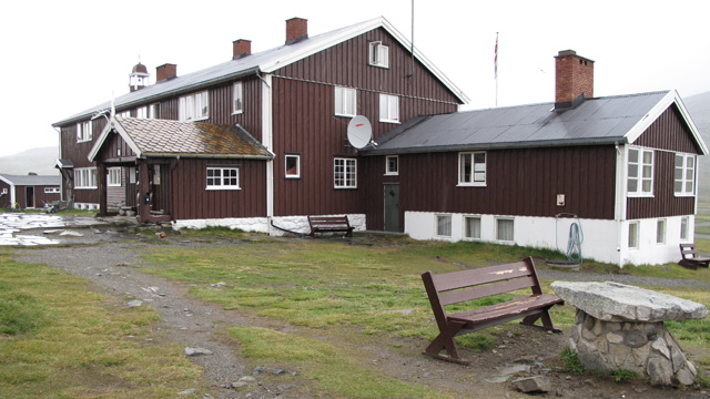
Gentle descent toward Veodalen and Glitterheim, with a chocolate‑bar break along the way. We walked across the Glitterheim yard, continued up the trail, and then left it near Nedre Steinbuvatnet. We pitched the tent in rain by the lakeshore at 15:30, elevation 1510 m, distance 16.31 km (trip meter). Reiter chicken risotto. Rest at 19:00. Rain continued all night.
Glitterheim – Glittertind – Spiterstulen
Monday 12.8.2013 wake‑ups at 04:00 (dark), 05:00 (still dark), and finally 06:00. Reiter Paella, instant coffee, biscuits for breakfast. Started around 09:00 toward Glittertind and then Spiterstulen. Cloudy, light rain, +6°C. Gentle steady ascent on rocky slope. Entered cloud at 1800 m. Rain turned to snow at 2000 m, with increasing snow on the ground. Chocolate‑bar break. Gradually we reached the summit ridge, with limited visibility toward the glacier on the far side. We followed the ridge toward the summit, first on rocks, then on snow, with 10 cm of fresh snow. Visibility was poor even at the summit, which we reached at 11:37, elevation 2473 m. The sun glowed faintly through the cloud and warmed us. No snowfall or wind at the top.
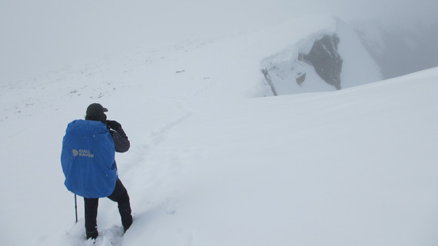
We descended gently at first through snowy rocks, soon stopping for a salami break, and after the snow ended, another chocolate‑bar break at about 2000 m. Then a steep descent to 1700 m, where we had another break. Weather cleared during the descent, and the sun appeared between clouds. The descent continued gently to 1400 m, then steeper diagonally down the slope to the Spiterstulen road.
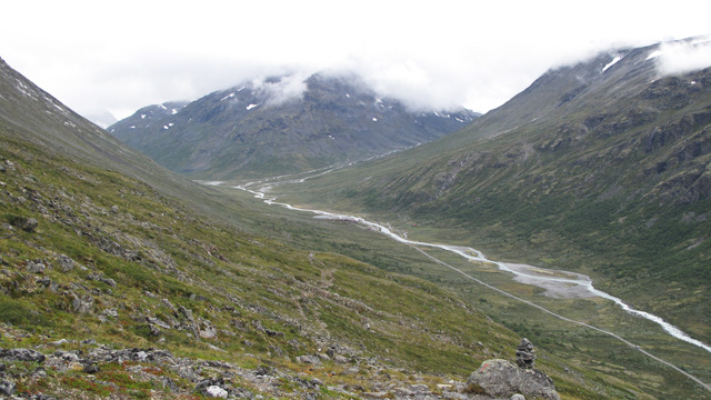
We followed the road to Spiterstulen and then a riverside trail for about a kilometer. We pitched the tent on the slope beside the trail at 18:39, elevation 1135 m, distance 19.69 km (trip meter). Reiter Beef Stroganoff. Rain began in the evening and continued all night.
Galdhøpiggen
Tuesday 13.8.2013 wake‑up at 06:00, still raining. Continued resting until 10:00. Reiter Beef Stroganoff. Still raining. We waited to see if it would stop. Coffee and biscuits. The plan was to climb Galdhøpiggen today, but we debated whether to go now, wait for better weather tomorrow, or skip the summit entirely and continue the hike. Waiting in the tent another full day felt tedious, and we did not want to skip the summit, so we packed day‑trip food and essentials into a small pack and jacket pockets and left for Galdhøpiggen at 13:45. It was still raining. After the bridge at Spiterstulen the trail climbed steeply to 1700 m, then the slope eased and became rocky. From 1800 m upward there was fresh snow and snowfall. Chocolate‑bar break. At about 2000 m we reached the summit ridge, which we followed partly on rocks, partly on snow. Visibility downward was minimal; occasionally we saw the steep southern face, but the northern glacier was hidden in cloud.
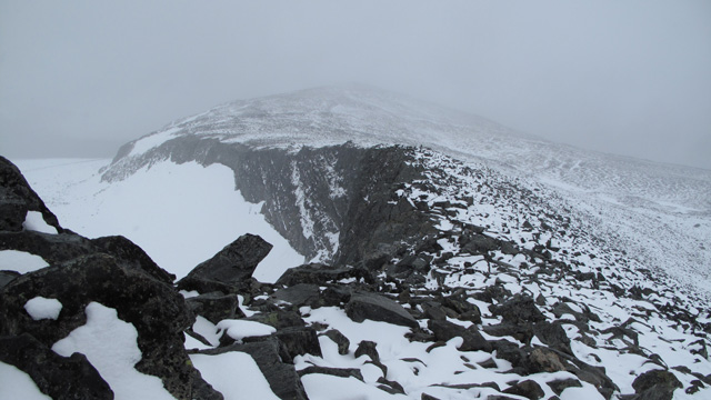
The wind increased somewhat but caused no problems. Trail markings were clear. We met two German, two Norwegian, and two Swedish hikers. We reached the summit at 17:45, elevation 2469 m. After taking photos, we ate in the summit café: coffee and thin sausages wrapped in thin flatbread (pølse i lompe) with plenty of mustard and ketchup.
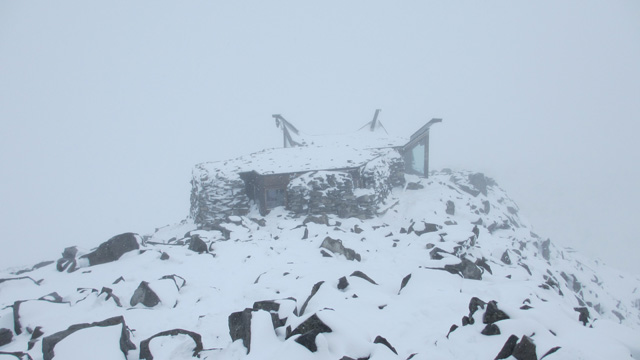
We began the descent. At about 1950 m we caught up with the two Norwegian hikers we had met earlier; one of them had developed a painful foot during the descent, possibly an overuse injury. We lent him a trekking pole and offered to carry his backpack (they had ascended from Juvasshytta across the glacier with full packs). We escorted them slowly downward. At 1700 m we also took their backpack. Progress remained very slow. Chocolate‑bar break. We reached Spiterstulen only at 23:30, after darkness had fallen.
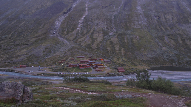
We escorted the pair to the hotel reception and then went to look for our tent. In the dark it was difficult to spot a dark green tent, and after searching for a while we checked the GPS device — fortunately the tent location had been marked. Using the device we navigated to the tent, arriving at 24:00, distance 18.75 km (trip meter). By headlamp we prepared Reiter Pasta Carbonara for supper. Rain had stopped and the weather had cleared slightly.
Spiterstulen – Hellertjönne
Wednesday 14.8.2013 wake‑up at 08:00. Reiter Beef Stroganoff, instant coffee, biscuits. On the move at 10:50, heading south, aiming to get at least through Urdadalen. Cloudy but dry weather. Easy valley trail at first, then climbing toward Urdadalen, steep at first. Chocolate‑bar break. Higher in the valley the slope eased but the terrain was very rocky. After passing a couple of small ponds, a steeper climb to the highest point of the valley, where we had a salami break. Occasional sunshine.

Descent through rocky terrain past three ponds, after which the rocks decreased. A somewhat steeper descent to 1300 m, and we camped on grassy ground by Lake Hellertjönne at 17:10, distance 17.87 km (trip meter), elevation 1277 m. Reiter Pasta Bolognese With Beef. Evening sunshine through clouds. Rest at 20:00, but little sleep due to cold.
Hellertjönne – Lågtunga
Thursday 15.8.2013 wake‑up at 08:00, cold: +2.5°C in the tent, frost on the ground and on the tent, clear sky. We waited for the sun, still behind the mountain. Once it reached us, it warmed quickly. Reiter Beef Stroganoff, coffee, biscuits. On the move at 11:40, aiming to reach Memurutunga. Sunny and warm. Descent into Storådalen beside a stream. Cattle in the valley. Chocolate‑bar break before a trail junction. Then ascent to the Memurutunga plateau, with another break along the way. We followed the trail to the lower Lågtunga area and camped by a small unnamed pond at 16:49, distance 12.7 km (trip meter), elevation 1335 m.
Reiter Pasta Carbonara. Evening sunshine, warm tent, good views north toward the Memuru glaciers. In the western sky we noticed cirrostratus clouds, which we suspected might indicate rain. Rain began during the night.
Lågtunga – Memurubu – Björnböltjönne
Friday 16.8.2013 wake‑up at 08:00. Reiter Beef Stroganoff, instant coffee, biscuits. On the move at 11:20, aiming to get near Besseggen and camp while waiting for better weather. Rain, low clouds, almost no visibility, but fairly warm. Gentle ascent to Sjugurdtinden, then descent. Clouds lifted and views opened toward Lake Gjende and Memurudalen. Finally a rather steep descent to Memurubu.
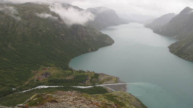
After a chocolate‑bar break we continued uphill. The climb was fairly steep, and wearing shell clothing in the rain we became thoroughly soaked. We followed the trail toward Besseggen and camped before Björnböltjönne above a small pond beside a stream at 15:30, distance 9.46 km (trip meter), elevation 1470 m. Dry clothes in the tent. Reiter Serbian Stew. A hiker we met told us the next day would have good weather, so we expected a cold night. Rain stopped during the night; it was cold.
Björnböltjönne – Besseggen – Gjendesheim
Saturday 17.8.2013 wake‑up at 06:00, +3°C outside, clear sky. Reiter Hunter’s Stew, instant coffee, biscuits. On the move at 08:20, aiming to reach Besseggen early before others arrived.
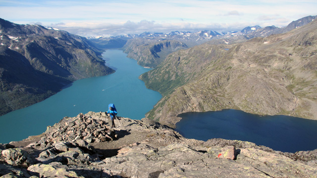
Along the way we had views toward Lake Gjende and the peaks beyond it. The weather warmed quickly. A chocolate‑bar break by a stream before Besseggen, then the ascent. No other hikers in sight. At first the climb was easy, but about halfway up we needed to use our hands, and the backpack and trekking poles made progress a bit awkward. Then a gentle ascent to the mountain top at 1743 m, where there were plenty of people.
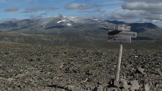
Another chocolate‑bar break, then a wide trail descending gently toward Gjendesheim, with many hikers coming the opposite way. The final descent became quite steep, and the last stretch followed the road to the parking area. At the car at 13:51, distance 13.77 km (trip meter). The total length of the hike according to the GPS trip meter was 119.13 km; according to the track log (50‑meter point interval) the distance was 101.1 km. Total ascent was 6 km 239 meters, and descent the same. Driving again at 14:50, refueling in Vemdalen. Continued driving to Sundsvall and then along the E4 toward Haparanda. Day 9, Sunday 18.8.2013: around 02:00 we tried to sleep for 45 minutes at a roadside stop, then ate and continued driving. After about an hour we pulled over again and slept another 45 minutes, after which it was already getting light. Continuing the journey, refueling in Tornio, arriving in Oulu at 12:00, 1479 km.
Notes: The terrain had considerable elevation differences, and the ascents and descents were often steep, which is why the daily distances were kept fairly short. Surprisingly few other hikers were seen; only near Veslfjellet close to Gjendesheim was there a noticeable number of people. At Spiterstulen several tents were pitched near the bridge, but otherwise there were few campers. No one was on the summit of Glittertind, and on Galdhøpiggen only the café attendant. The most common hiking style seemed to be day‑trips between mountain lodges with a small backpack; few people carried full packs. The weather was only partly favorable, but the scenery was excellent, and the area would be worth visiting again if the travel distance were not so long. It would be wise to reserve two days for the drive and sleep somewhere along the way. The food plan was the same as on the 2012 hike, but this time some of it remained uneaten — nearly all the salami and almost half of the chocolate and energy bars. The Reiter meals and biscuits were eaten as planned, one cup of instant coffee per day, and a few deciliters of sports drink. Hunger was hardly noticeable, but perhaps energy intake was a bit low for the amount of walking. Body weight dropped by 3 kg. Sleeping did not go very well; perhaps the long drive disrupted the sleep rhythm. Also, the sleeping bag was too thin (comfort +12°C), and we were often cold at night. With all clothing worn, nothing remained to use as a pillow, which reduced sleeping comfort. All in all, it was once again a pleasant and memorable hiking experience — the right amount of discomfort and physical challenge.