Routes
Daily stages on map
Ritsem – Áhkká Mountain (camp)
Monday, July 31, 2006: departure from Oulu at 06:00. Refueled the car in Tornio, coffee break in Aavasaksa at 08:25. Continued via Överkalix and Gällivare, reaching the turnoff to Ritsem at 10:52. Roadworks were underway and the road was in poor condition in places. We stopped for photos before Vietas — excellent views toward the cliffs on the opposite shore, sunny and calm weather. We drove past the Suorva dam, after which the road narrowed. Lunch break in Vakkotavare: coffee, bread, eggs, yogurt, pastries. Then we continued, stopping occasionally for photos, until we reached the Ritsem boat dock at 14:00. After changing clothes and packing our backpacks, we boarded the boat, which departed at 15:00 and arrived in Änonjalme at 15:30. The boat fare was 165 SEK per person.
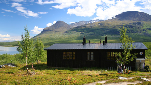
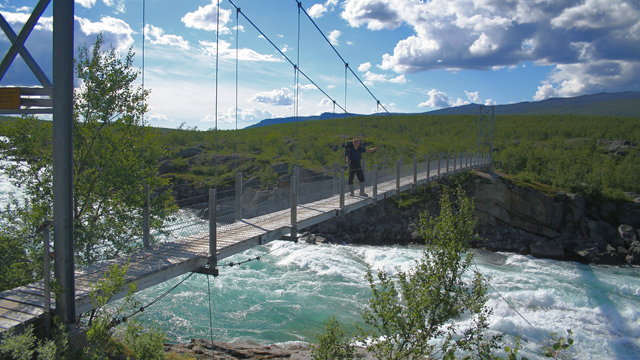
We began walking at 15:35 in hot sunshine, no wind. Clothing: T‑shirt, shorts, cap. We followed an easy 3.5 km trail with boardwalks past the Áhkká hut to the bridge over Vuojatädno, where the river flowed strongly.
After the bridge we turned left into dense birch forest. At first there was a faint trail, but soon we were walking through boggy ground and then dense birch thickets that were difficult to pass. Water sources were scarce. At Njirramjåhka we crossed where the river split into several small channels — easy to cross in hiking boots. The water was cloudy with glacial silt, so we did not drink it. We continued up the left side of the river. In the birch forest, swarms of blackflies became a problem and followed us until we reached well above the treeline where there was some wind. We continued up the Njirramjåhka valley; the river itself ran in a deep canyon, so we walked high above it on a steep slope. At the fork in the valley we continued up the left‑hand gully. By now dehydration was setting in and progress was slow. The gully walls were steep. We finally found water at 1300 m at 22:25, where the gully flattened enough to reach the bottom. From there we continued over a ridge to a flat area with small meltwater ponds and glacial moraine mounds. We found a campsite at 23:00 at about 1360 m, after moving a few stones from under the tent.
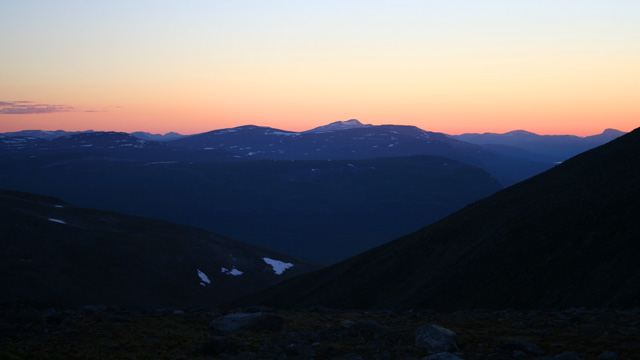
After pitching the tent we fetched water with a 5‑liter container from a stream about 150 m away. We were hungry, so before sleeping we ate a hearty 250 g Reiter meal. The first night’s sleep was reasonably good. The pedometer recorded 14,701 steps (10.29 km). The heart‑rate monitor recorded 6.5 hours of walking, max HR 199/min, average 156/min, energy expenditure 4770 kcal = 19,971 kJ. Elevation change: from 430 m to 1323 m.
Ascent of Áhkká Mountain
Tuesday, August 1, 2006: wake‑up at 08:57. Sunny, no wind, hot inside the tent. Spreading the sleeping bag over the tent helped a little. After resting a bit we made a fire and grilled sausages, then drank coffee and ate pastries. At 11:05 we began the ascent toward Áhkká’s summit. We carried backpacks with food, windproof clothing, cameras, phones, and 5 liters of water. Clothing: T‑shirt, shorts, cap, fleece gloves, trekking poles.
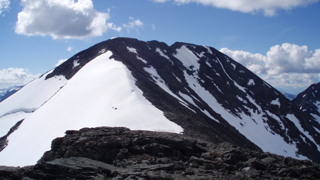
The ascent was steep with difficult boulder fields. We reached the 1916 m sub‑summit at 13:00. We took a long break, photographed, ate muesli, fruit soup, and chocolate bars, and drank water. We debated whether to continue higher — it was warm, sunny, windless, and the views were already excellent — but decided to continue. We followed a narrow ridge to about 2000 m, but the ridge became too narrow to continue safely, so we did not reach the true summit.
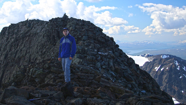
The ridge had been easy except for one short vertical step. We took another long break, enjoying the views — Kebnekaise was clearly visible. We returned to the 1916 m sub‑summit where our backpacks were. We rested in the warm sun for a long time and ate chocolate bars. We descended to the tent, arriving at 18:57. The sausage package had been kept in snow all day, so we grilled sausages again. Later we made coffee and ate the remaining pastries and cookies. In the evening we walked to a nearby lake and planned the next day’s route back to Änonjalme — we had decided we had done enough mountaineering and would not climb Áhkká’s lower side peaks. Pedometer: 7827 steps (5.47 km). Heart‑rate monitor: 4.8 hours walking, max HR 189, average 148, energy 3611 kcal = 15,118 kJ, ascent 680 m, descent the same.
Áhkká Mountain (camp) – Ritsem
Wednesday, August 2, 2006: wake‑up at 07:36. The sun warmed the tent, no clouds, no wind. Breakfast: 250 g Reiter meal, water, cookies. We aimed to catch the 15:40 boat, so we left at 09:00. Clothing: T‑shirt, windstopper pants, cap, gloves, trekking poles. The plan was to avoid the dense birch forest and insects of the first day by staying high on the fell as long as possible, then descending directly to the Vuojatädno bridge.
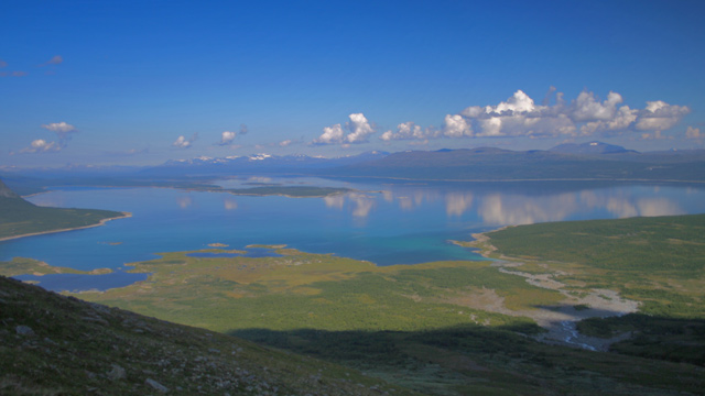
This required crossing Njirramjåhka high upstream. We first walked up and down rocky moraine ridges, then descended steeply into the Njirramjåhka gorge and crossed the river about 200 m below the glacier edge, before the tributary from the east joined it. The current was strong. We crossed carefully where the flow split into two channels, hopping from rock to rock; each of us got one boot slightly wet. We continued downstream along the river. The slope was steep and rocky at first, then grassy. When we climbed out of the gorge and saw Vuojatädno, we took a break and ate chocolate bars. Because of the steep slope we eventually had to descend into dense brush — thick birch, willow, grass, and many insects. We pushed through and then crossed wet bog, also with insects, enough that we had to put on jackets and hoods. We reached the bridge at 13:30, took a drink break, and continued at 13:50. We arrived at the boat dock at 14:50.
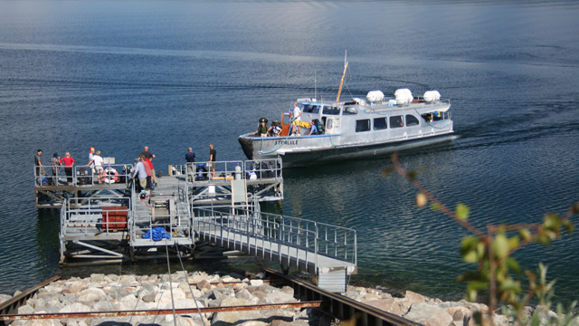
We waited a while with blackflies keeping us company. The boat arrived at 15:40. Price: 165 SEK per person. After landing in Ritsem we changed into civilian clothes, packed the car, and began driving. A few kilometers later we stopped at a lay‑by, made coffee, and ate cookies. We continued, taking photos along the way. In Gällivare we stopped at a kiosk for soda, chips, and candy. In Tornio we refueled, then continued to Oulu, arriving at 00:27. Steps: 15,527 (10.86 km). Walking time: 4 h 50 min. Average HR 141/min, max 178/min, energy 3623 kcal = 15,168 kJ.
Notes: The pedometer does not distinguish uphill from downhill — it records more energy downhill. The heart‑rate monitor, however, records nearly double energy expenditure uphill. The pedometer’s distance estimate is fairly accurate. The HR monitor’s altitude reading was slightly off, likely because it was not calibrated beforehand. Sausages keep well in snow for a day. For Reiter meals, a bag clip (e.g., from a bread bag) is useful so you don’t have to hold the bag closed while waiting. In August there may be little water and many insects in the fells; in July the opposite is often true. Dried sausage may be unnecessary in the future. An inflatable sleeping pad is worth considering for shorter trips.