Routes
Daily stages on map
In the summer of 2022 it was once again possible to travel to Sweden and Norway without COVID restrictions. We decided to head to the Kebnekaise mountain region in Sweden and chose the peak Šielmmáčohkka as our destination. According to precise laser measurements taken a few years ago, the mountain exceeds 2000 metres in height — specifically 2004 m — making it a very suitable summit objective. The usual approaches to the Kebnekaise area from Nikkaluokta and Abisko were already familiar to us, so we needed to devise an alternative route. In Norway, a road climbs quite high into the mountains at Cunovuobmi, and inquiries on fjellforum.no confirmed that the road should be drivable. So that would be our starting point. We assumed that this early in the summer there would still be plenty of snow in the mountains — helpful for travel — though larger streams would need to be avoided. As a prologue, on 26 June 2022 we drove to Kolari for an overnight stay. Driving to Kolari, refuelling, overnight stay.
Cunovuobmi – Caihnavaggi
On Monday 27 June 2022 we woke at 03:30 and, after morning coffee, began driving at 04:02. Roadworks near Junosuando forced slow driving. In Narvik we stopped to take a few photos. Then we drove along the shore of the Skjomen fjord and into the upper Skjomdalen valley, where the gravel road toward Norddalen begins.
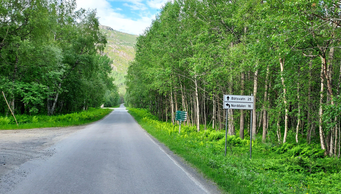
The road was somewhat bumpy; we arrived in Cunovuobmi at 10:15. We parked the car by the lake at 657 m, where the hiking route begins. The weather was sunny and warm. We prepared pasta in cream sauce with meatballs for lunch. After lunch we changed into hiking clothes. The backpacks were weighed: 21.02 kg and 21.90 kg. We started walking at 11:45. The weather was hot, and the streams carried plenty of water, so we had to detour a bit to find crossing points. There was a bridge over the Steinelva right by the lake, and we used it — we did not want to ford the stream.
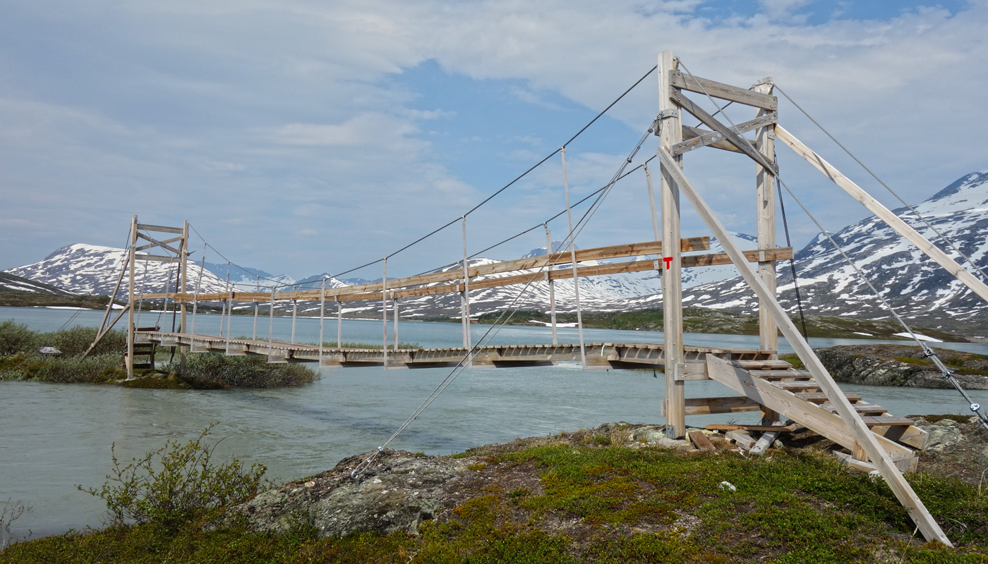
After that we climbed a little higher up the slope, where there was willow scrub. The heavy packs and hot weather had already drained our energy, so we did not feel up to following the Steinelva upstream to the route leading into the mountains. After 5 km of walking we took a break and ate chocolate bars. We then headed to check the Caihnajohka bridge, familiar from our 2005 trip. The bridge was in good condition. We did not cross it but instead followed a path into Caihnavaggi. We assumed we would not have the strength to continue into Sweden the same day, so we would need to find a campsite in Caihnavaggi. A suitable route into Sweden would cross Rivgocohkka (1582 m), so ideally we would camp near its base. First, however, we needed to cross the stream flowing through Caihnavaggi, and as we walked we looked for a snow bridge. The stream flowing from the 933 m lake ran in a deep ravine, and indeed there was still a snow bridge that allowed us to cross. Higher up in Caihnavaggi there still seemed to be plenty of snow. We found a campsite at 17:03 at 970 m on a ridge rising toward Rivgocohkka; the day’s walking distance was 11.10 km. The weather remained sunny and hot. Dinner was Reiter chicken and noodles hot pot with salted peanuts. We flew the drone in the evening. The night was uncomfortably warm.
Caihnavaggi – Geargevaggi
On Tuesday 28 June 2022 we woke at 06:20. Breakfast was Reiter beef stroganoff, followed by coffee and biscuits. The sky was cloudless — a hot day ahead. After breaking camp we started walking at 08:10. At first we climbed through rocky terrain, but soon reached snow. The snow was firm and easy to walk on. We soon reached the 1582 m summit, where we took a break, ate chocolate bars and dried meat, and flew the drone — the wind nearly carried it away.
We continued to another summit, which the GPS measured at 1580 m. Then came a descent to a saddle at about 1400 m. By coincidence I had brought along an experimental pair of “downhill skis” made by bolting two pairs of mini‑skis together and attaching snowshoe bindings. This produced stiffer skis with sturdy bindings. I decided to test them. Even with a backpack, skiing downhill worked reasonably well.
We then climbed a little and continued on snow along the edge of the Rivgojiehkki glacier. We stopped occasionally to fly the drone. We continued to border marker Nr260Aa and entered Sweden. We surveyed the terrain ahead — it looked undulating, with streams visible among the snow. We descended while avoiding the streams and, after a few detours, reached the watershed in the valley. We estimated that the Aliseatnu watercourse would be easiest to cross here at the watershed; elsewhere it might be difficult due to the high water levels. We then began climbing again, aiming to cross the ridge of Luohtticohkka and then look for a campsite. Travel on snow was easy, but on the south side of the ridge we ran into trouble with streams. The slope was too gentle for the snow to support us properly, and after a hot day the south‑facing streams carried plenty of water beneath the snow. We took a chocolate‑bar break. During one stream crossing one boot got slightly wet. We continued to the western end of Geargevaggi, where at 20:21 we found a good campsite at 1094 m beside a stream. The day’s distance was 31.83 km. Dinner was Reiter chicken korma curry with salted peanuts.
Sälka
On Wednesday 29 June 2022 we woke at 07:00. Breakfast was Reiter pasta carbonara, followed by coffee and biscuits. The weather was still sunny, though the forecast had predicted rain for the day. We decided to take a rest day from carrying heavy packs and make a day trip to Mount Sälka. We started walking at 09:02; the pack was light with only day‑trip gear. We first skirted the western end of Alip Suoricohkka, crossed a stream on a snow bridge, and then climbed to the ridge of Lulip Suoricohkka at 1300 m. The Sälka fore‑summit (1612 m) was visible, but the highest summit was hidden in cloud. We passed the so‑called block glacier — composed mostly of boulders rather than ice, and unique in Sweden. The weather clouded over and cooled; we put on shell clothing before climbing to 1500 m and ate chocolate bars. The ascent on snow went smoothly. Visibility deteriorated, and above 1500 m there were no views. We climbed on snow, checking the route on the GPS; near the top there were icy, slippery rocks. We reached the summit (1856 m according to the GPS).
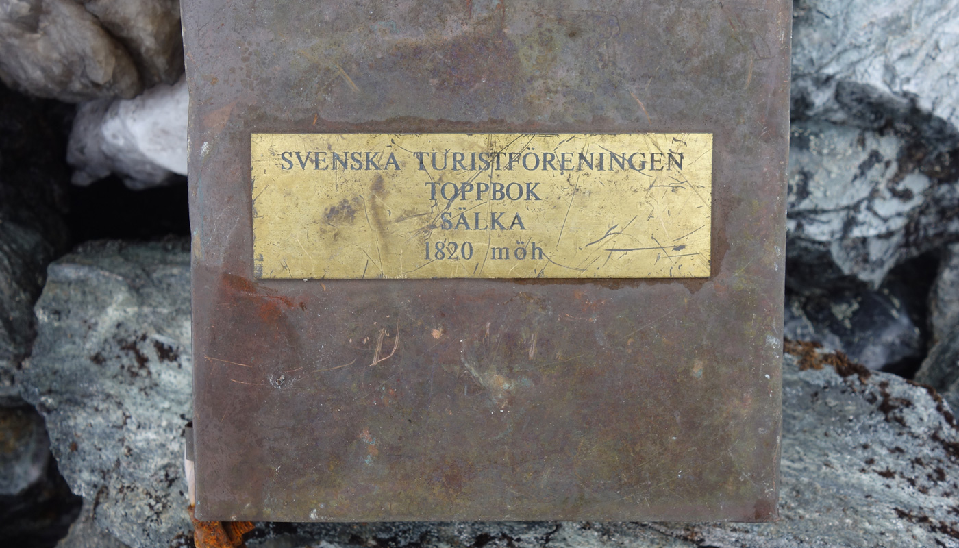
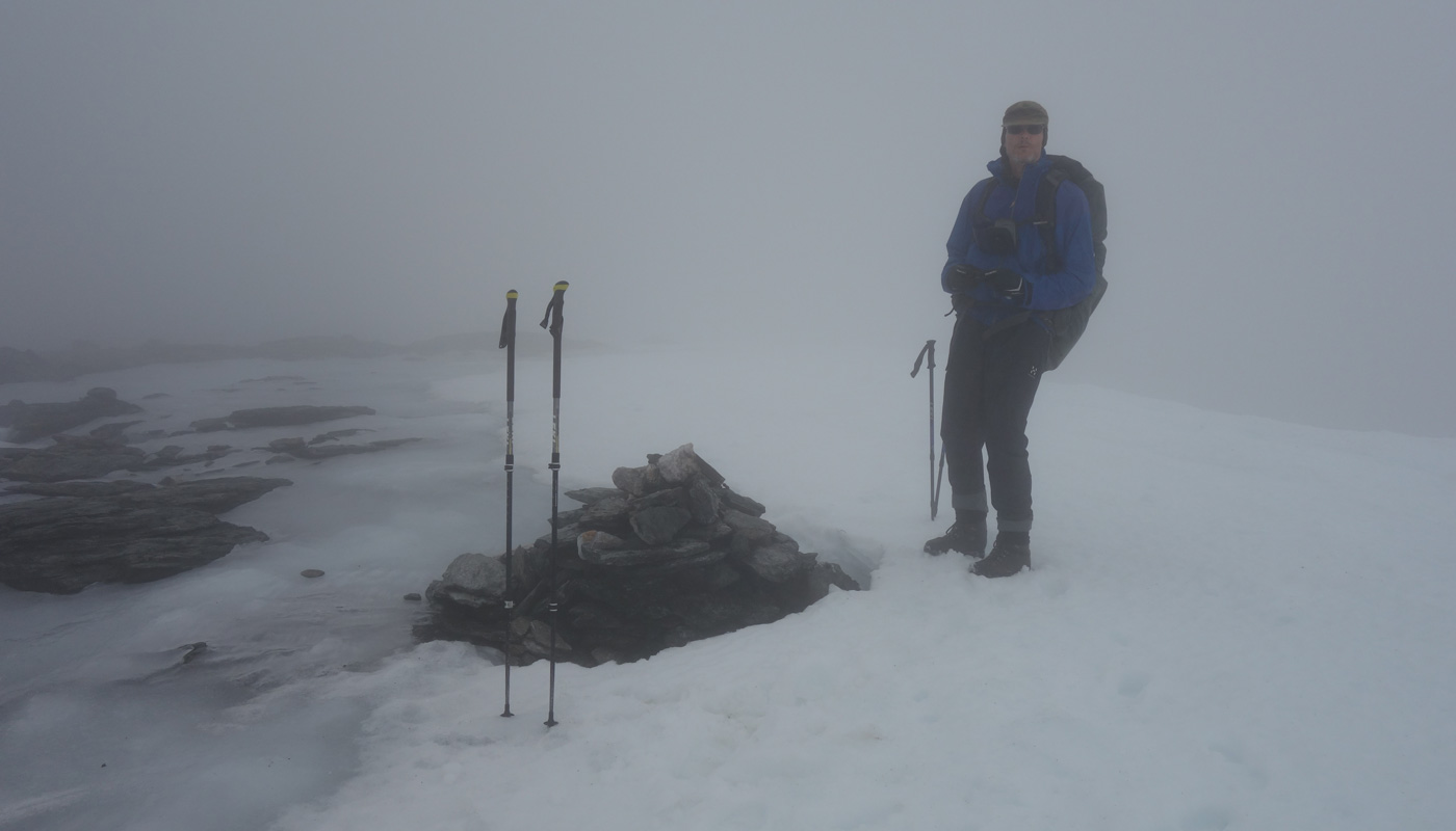
There was a cairn and an empty metal box — no summit register. Fog completely obscured the views. Rain began, and we started descending. We reached 1500 m following our own tracks. Then a thunderstorm hit — heavy rain, strong wind, thunder. We became disoriented and had to check the GPS frequently; eventually we found the correct slope down to 1300 m. We took a chocolate‑bar break. Even at 1300 m there was no visibility, so navigation continued with many zigzags. The GPS batteries died and had to be replaced. Finding a snow bridge to cross the stream took a long time and required another snack break before we could continue around Alip Suoricohkka. The GPS batteries died again, but by then it was easy to follow the slope even in fog. As we descended toward Geargevaggi, visibility gradually improved, and we reached the tent at 20:01. The total distance was 56.10 km; the day trip lasted 11 hours and covered 24.27 km. Because of the shell clothing and wet weather, our gear was soaked. We concluded that the weather had at least spared us from applying sunscreen or constantly taking photos. Dinner was Reiter beef and potato hot pot.
Geargevaggi – Stuor Reaiddavaggi
On Thursday 30 June 2022 we woke at 07:00. The sun was shining again, and the fog had dropped to 1000 m. Breakfast was Reiter beef noodles and mushroom, followed by coffee and biscuits. We spread our wet gear outside to dry in the sun. We began walking at 09:14. Our aim was to move closer to Šielmmáčohkka, and Geargevaggi offered a suitable route. We climbed gently along the northern side of the valley to the watershed at 1200 m. The sun was warm. We took occasional breaks to fly the drone.
We tried to maintain elevation and shortcut toward the Tjäktja Pass on the Kungsleden trail. A rocky cliff blocked our way, forcing us to descend slightly, then climb again. Soon we saw the Kungsleden far below in Tjäktjavaggi, along with the Tjäktja Pass shelter.
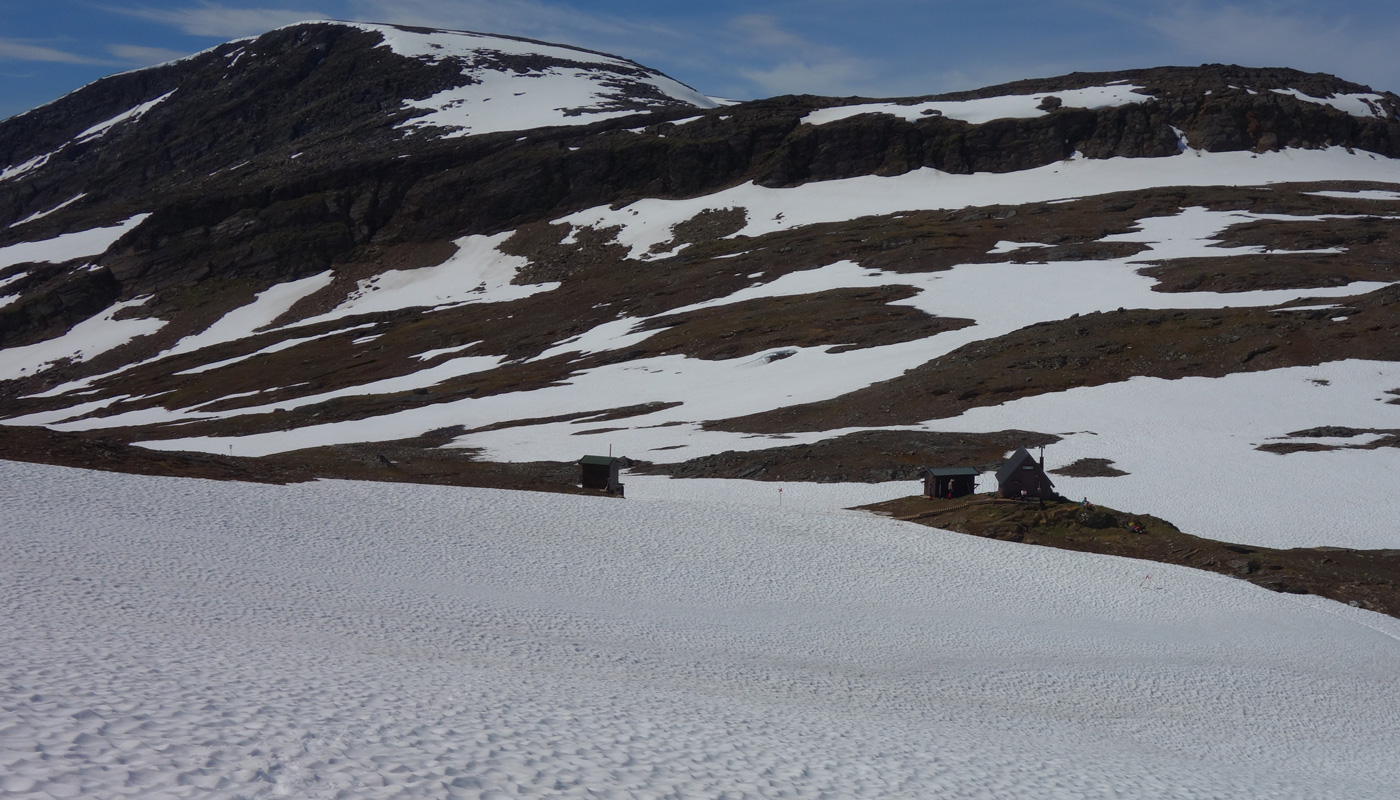
Another cliff blocked direct access to the pass. We did not want to descend all the way down, so we climbed higher. We had to ascend to 1250 m and then descend northward to 1200 m before finding a place where we could attempt to descend the cliff. Here the snow continued all the way down, allowing us to slide — the slope was steep. We continued to the nearest stream for a break, eating chocolate bars and dried meat. Then we walked past the Tjäktja Pass and its shelter — many hikers were resting there. We began another ascent, aiming to reach the vicinity of Šielmmáčohkka. One possible route was Šielmmávággi, but we had already travelled through it on a previous trip in 2010. This time we aimed for a new route between Tjäktjatjåkka and Ceakcabakti. We climbed to 1300 m, traversed for a while, then climbed a side slope to reach the col. The ascent continued to 1539 m, after which we walked along the northern shore of the 1506 m lake. The weather clouded over quickly. The slope down into Stuor Reaiddavaggi was snow‑covered — an opportunity to test the downhill skis again. They worked well; I skied down to about 1000 m, all the way to the trail leading to Nallostugan — there was snow the entire way. Meanwhile, the rest of the group, who had descended on foot, had already found a good campsite.
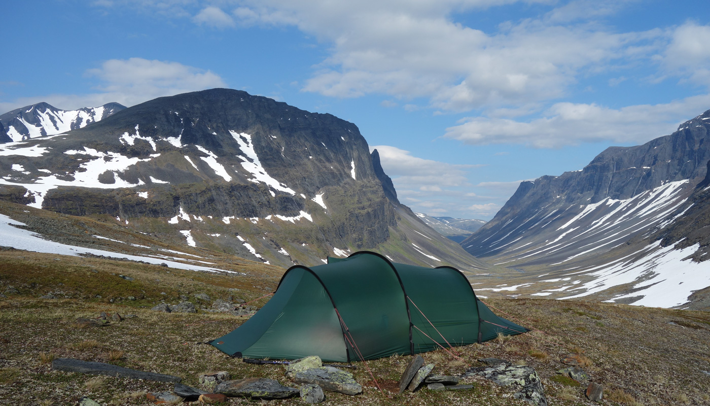
It must be said that the downhill skis do not necessarily speed up travel, but they do add interesting variety to hiking. We camped at 17:52 at 1058 m on the western side of Stuor Reaiddavaggi, beside a stream flowing from the Tjäktjatjåkka glacier. The distance counter had reached 72.0 km; the temperature was +23°C. The cloudy weather cleared again. We dried shoes and socks and flew the drone. Dinner was Reiter pasta with beef and pepper sauce and salted peanuts. Then another thunderstorm arrived with heavy rain and strong wind, but the tent held up well — we had replaced the poles with 10 mm ones instead of the previous 9 mm.
Šielmmáčohkka
On Friday 1 July 2022 we woke up at 06:00. We started the day with a Reiter rice with beef and pepper meal, followed by coffee and biscuits. The thunder and rain had ended during the night, and the weather was cloudy and calm. The clouds were higher than the mountain tops, which was important, since our plan for the day was an ascent of Šielmmáčohkka. We packed our day‑hike gear and started walking at 08:10. First we headed to the upper part of the stream flowing from the 1078 m lake, where a convenient snow bridge allowed us to cross easily. We then climbed first on rocky ground, then on snow, continuing between the Nallo lakes toward the foot of Šielmmáčohkka. We began the ascent by following a steep snow gully to the left, reaching the moraine ridge of a small glacier. From there we traversed right until we reached the beginning of the snowfield leading to the saddle between the Šielmmáčohkka summits. We took a break, eating chocolate bars and dried meat.
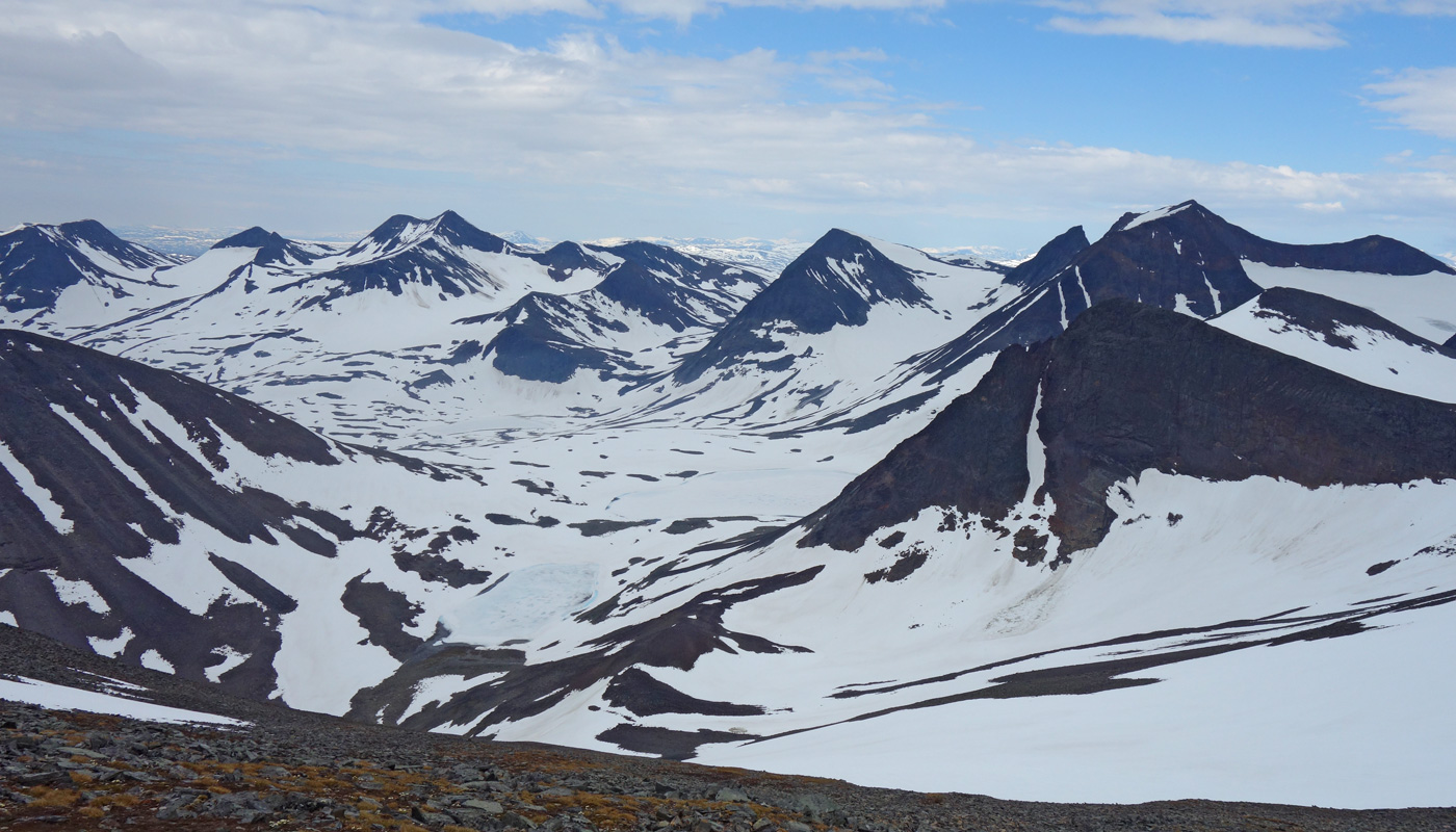
We continued climbing on snow until the steepest section, where we moved onto rocks for a while. After that the slope eased, and after a long ascent we reached the saddle at 1827 metres (GPS reading). There was some wind and still cloud cover, so we decided to put on our summit gear—shell jackets and trousers. The final ridge to the summit was fairly steep and rocky, and we soon had to leave the trekking poles behind. The summit was reachable without actual climbing; hands were rarely needed. The only issue was that the weather turned sunny during the ascent, and we began to feel hot inside the shell layers. Fortunately we soon reached the summit and could rest while enjoying the views. We also ate chocolate bars and dried meat. The summit offers fine views in all directions, and we even had mobile phone reception.
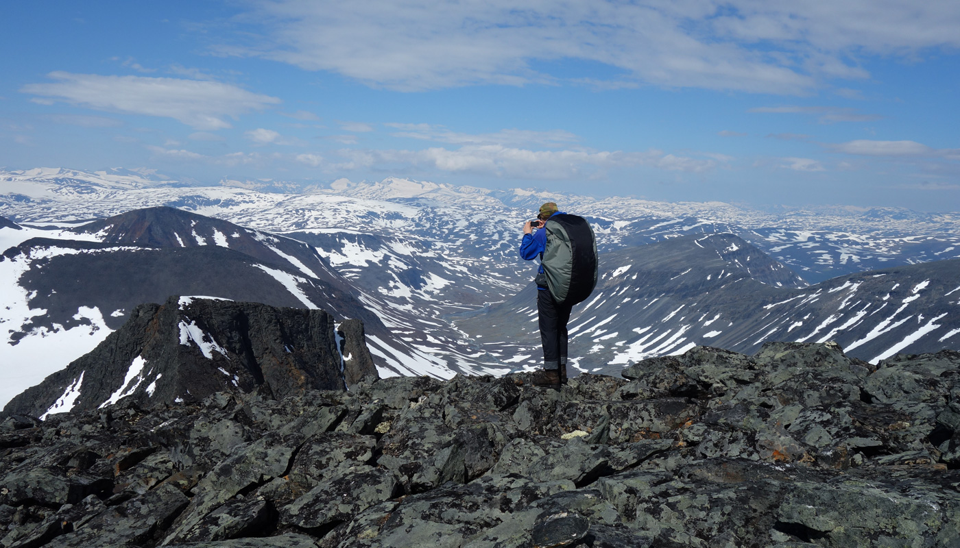
After admiring the scenery for a while, we descended the ridge back to the saddle and removed our shell layers. The descent continued entirely on snow, as the surface had softened in the sun and there was no risk of slipping. There were some icy patches, so I did not ski down to avoid the risk of falling. We reached the tent at 16:40. Total walking distance was now 85.66 km. The sun was shining; we dried our boots and socks and ate chocolate bars. The tent was too hot, so we cooked and ate outside. We had already gone through the entire Reiter selection, so meals were now repeats. Dinner was again Reiter chicken korma curry, with salted peanuts and sports drink. We noted that for once the summit day had coincided with good weather.
Stuor Reaiddavaggi – Alesjaurestugorna
On Saturday 2 July 2022 we woke at 06:00. Breakfast was Reiter beef stroganoff, followed by coffee and biscuits. At this point we reviewed our food supplies and noticed that we had two extra Reiter meals and one extra packet of biscuits (2 × 250 g + 175 g = 675 g). No harm done. Outside the sun was shining and it was already hot. We started walking at 08:13. First we headed to the snow bridge at the outlet of the 1078 m lake. Our goal was to reach Alesjaurestugan, where there is a bridge over the Aliseatnu; we assumed that fording that river would not be possible. Since we had already travelled through Šielmmávággi on a previous trip, we chose an alternative route via the Västra Bossos glacier. We climbed first to the Nallo lakes, where we flew the drone for a moment.
We then continued west of the 1242 m lake into a gully leading to a smaller lake. We drank from the stream flowing out of the lake. The ascent up the left side of the gully was very steep snow, ending in difficult boulder fields. Eventually we reached the top of the pass at 1480 metres. From there we moved onto the edge of the Västra Bossos glacier and flew the drone again.
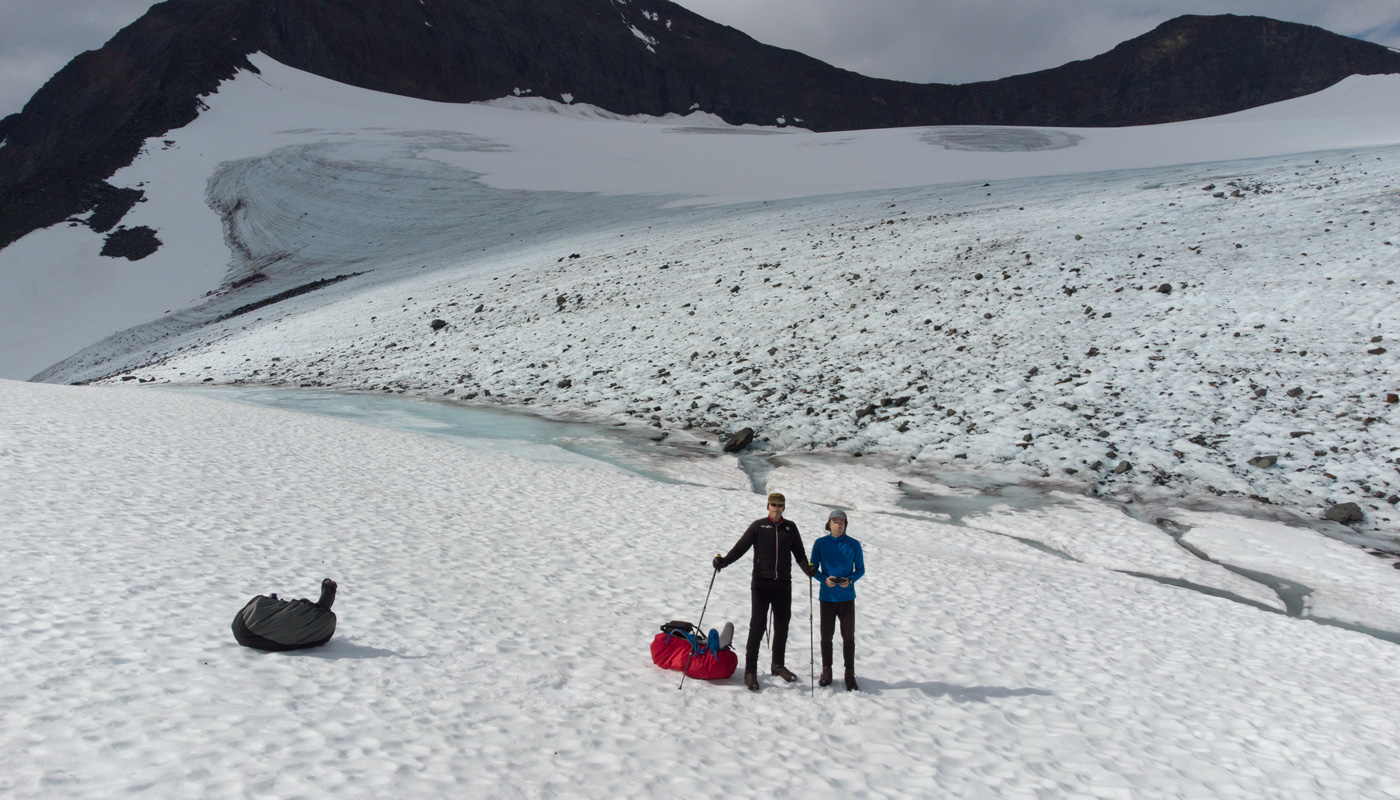
The weather clouded over slightly. We descended on snow along the glacier’s edge, staying off the glacier itself. We reached the moraine ridge without difficulty and crossed the meltwater streams. We took a break, eating chocolate bars and dried meat. The weather cleared again and the sun returned. The Bossosjohka flowing in the valley below was already very powerful here, and we did not want to ford it. There would be a bridge lower down on Kungsleden, but we expected to find a snow bridge sooner. Indeed, we soon found one where the river flowed through a narrow gorge. After crossing, we continued down the valley; the snow had melted here, and we walked on tundra and boulders. Reaching the edge of Alisvaggi, with Kungsleden already visible, we took a break, ate chocolate and meat, and flew the drone. We descended diagonally toward the trail and joined Kungsleden a couple of kilometres before Alesjaurestugan. We met a few hikers along the way.
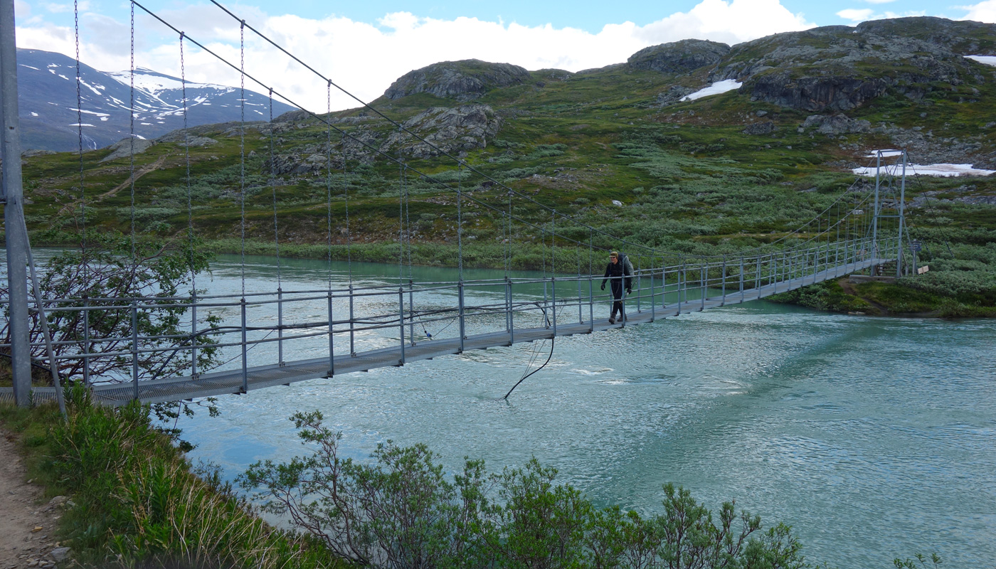
From Alesjaurestugan we continued another kilometre southwest, until at 17:13 we found a tent site beside a stream at 803 m elevation. The distance meter showed 104.7 km. Dinner was Reiter beef and potato hot pot, with salted peanuts and sports drink. The weather was sunny and warm; the tent was hot, and there were many mosquitoes outside, some even inside. We concluded that the campsite should have been 100–200 metres higher to avoid the insects.
Alesjaurestugorna – Gallanvaggi
On Sunday 3 July 2022 we woke at 06:00. Breakfast was Reiter pasta with beef and pepper sauce, with coffee and biscuits. The weather was cloudy and it began to rain during morning preparations. We packed our backpacks inside the tent, then took the tent down and packed it as well. We started walking at 08:20, aiming to cross the mountains back into Norway. According to the map, the shortest route would pass by Mount Gungar, allowing us to bypass the Gallanjohka watershed. First we headed southwest, climbing gently.
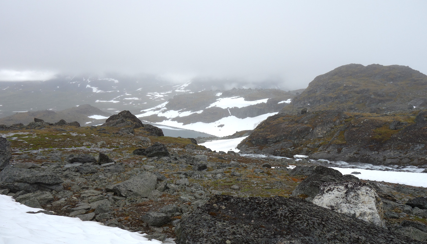
We then passed Gardderiehppi and headed into a gully rising toward the mountains. We took a break, eating chocolate bars and dried meat. The rain had stopped; there was some wind and the temperature was +7°C. When standing still it felt cold. By chance I had brought a down jacket for testing, and this was the first and only time on the trip I put it on. It worked well; I did not get cold. We continued up the gully for a while, then entered the clouds and lost all visibility. Ahead lay 5 kilometres of high mountain terrain, mostly snow‑covered, with no terrain features to guide us. I recalled the zig‑zagging we had done when returning from Sälka and navigating by GPS, which consumed both time and batteries. Then I remembered that we also carry a compass—and we could simply use that. Norway is west, so we set the compass to west and followed it. Occasionally we checked our position with the GPS. We passed north of Gungar’s summit. Then we tried to turn southwest, but a steep side slope made progress difficult. We took breaks and ate chocolate bars. At times we ended up in boulder fields; the rocks were slippery, and one fall occurred, fortunately without injury. Because of the steep slope we had to descend lower onto snow, then climb again to about 1370 metres before the final descent began. We reached the 1027 m lake Gallanjavri; visibility improved lower down and we could see the lake. A strong stream flowed from the 1176 m lake above, but we crossed it on a snow bridge. We took a chocolate break on the shore. We continued past the 993 m lake. Suddenly the weather changed: the clouds dispersed and the sun came out. We removed our shell layers and flew the drone.
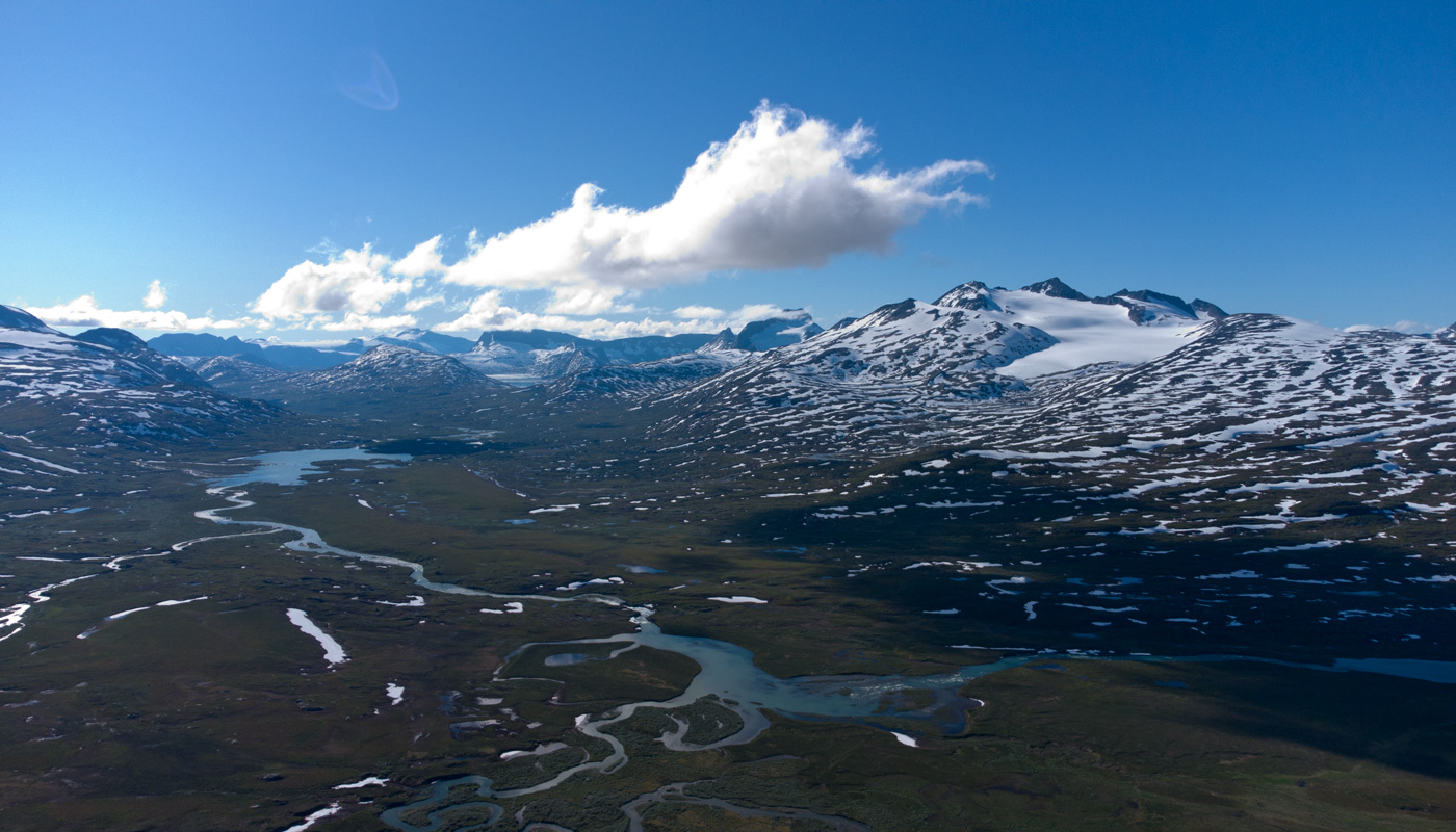
We finally reached Norway and soon found a tent site at 881 m between two streams at 18:15. Total walking distance was 122.3 km. The tent was hot; we dried gear and flew the drone outside. Dinner was Reiter chicken and noodles hot pot, with salted peanuts and sports drink. Storsteinsfjellet was clearly visible from the camp. There were mosquitoes here too, though not bothersome. In the evening, mare’s‑tail clouds appeared, indicating worsening weather.
Gallanvaggi – Cunovuobmi
On Monday 4 July 2022 we woke at 05:00. Breakfast was Reiter beef stroganoff, with morning coffee and biscuits. It had rained during the night, but the morning was sunny and warm again. We started walking at 07:14, aiming for the Caihnajohka bridge, whose condition we had already checked earlier in the trip. At the bridge we took a break, flew the drone, and ate chocolate bars and dried meat.
The final stretch to the car followed an easy marked trail. We reached the car at 10:47, with the distance meter showing 132.1 km. The backpacks now weighed 15.74 kg and 18.62 kg. The toll for the bridge used on the Norwegian side came to €11.50 (112 NOK). We drove back to Finland, stopping once to make coffee. Rainy weather was approaching from the west.
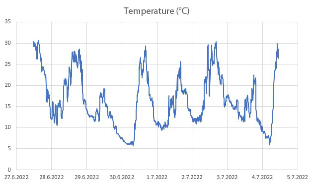
Notes: A pleasant trip that went largely according to plan, with mostly favourable weather. Total ascent during the trip was 6,803 metres. The greatest ascent in a single day was on the third day, when we climbed Sälka—1,525 metres in total. The abundant snow still present in the mountains made travel easier in many places by covering the boulder fields. Snow bridges helped with stream crossings, and no fording was required. The hiking boots leak and the trekking poles have broken tips—both need replacing. The Therm‑a‑Rest Prolite Apex Large worked well as a sleeping pad; a pillow should be acquired. A down jacket is light to carry and eliminates the need for a fleece. Shell clothing gets wet from condensation; a thin merino base layer under the shell might help with warmth during breaks. The downhill ski prototype has probably reached its final form; it works well.