Routes
Daily stages on map
This summer we planned another shorter hiking trip, with about five days available. The chosen destination was the Kevo Canyon and the fell Guivi (641 m) in Utsjoki. Based on advance information, it would be possible to complete a 3–4 day hike along the marked trail. We also knew from earlier that relatively close by, on the Norwegian side, lies the fell Rastigaisa (1066 m). Visiting it seemed interesting, as it is the highest fell in the surrounding region. We therefore made a plan that included both destinations: first a day trip to Rastigaisa, and then the Kevo Canyon, where movement is allowed only on the marked trail from 15 June onward due to nature reserve regulations.
Friday 13.6.2014: Driving to Kolari, overnight stay.
Rastigaisa
Saturday 14.6.2014 wake‑up at 04:30, coffee, gear into the car, on the road at 05:06. Through Kittilä and Sodankylä, coffee in Ivalo, then from Utsjoki into Norway along the Teno River road to Levajoki. Parked the car at 11:37 (526 km). Packed daypacks. Cool, cloudy weather with occasional drizzle. Base layer + shell clothing. Started walking at 12:00. First along a wide, well‑marked trail through birch forest, then a stream crossing on stones. The trail continued with gentle ascent until we left it at a suitable point and climbed straight up the slope. South of the 415 m summit we reached a flat treeless area. The weather cleared slightly and Rastigaisa became visible. The headwind was fairly strong.
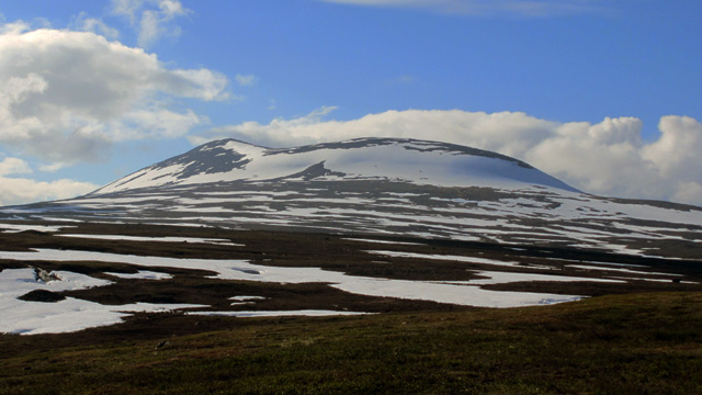
There was still snow in hollows and along the edges of slopes, and it carried well underfoot. We took breaks behind rocks, eating sandwiches, pastries, and hot cocoa from thermoses. The eastern/southeastern slope of Rastigaisa was still entirely snow‑covered. We considered ascending from the northeast, where the slope looked gentler, but decided to continue straight ahead. A heavier rain shower passed with strong wind; the rain stopped but the wind seemed to increase. The steeper ascent began around 800 m. We climbed as far as possible on rocks, then continued upward on snow. The snow was firm, and we had to kick hard to get secure footholds. The slope was quite steep, and looking down was not appealing. Soon the slope eased and we reached the rocky summit ridge. The wind was now very strong and made it difficult to stay upright. Clouds broke occasionally, revealing the summit.
We walked to the saddle at 979 m (according to the map) and then began the gentle ascent to the summit.
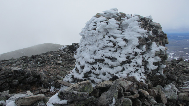
The summit was marked by a large cairn. Occasionally the clouds opened enough to reveal some scenery. After taking photos we began the descent. The route we had used for the ascent was too steep to safely descend, so we continued westward from the summit. The strong headwind and cold caused our glasses to ice over, making progress difficult. Lower down the slope eased, and we were able to descend southward. Descending the large snowfield was easy, and the wind was lighter below. The weather also improved. On the return we took another break around 400 m, then descended slowly back to the birch forest and the trail. The stream crossing went well again, and we reached the car at 20:00. Day trip duration: 8 hours, elevation gain about 950 m, distance 22.4 km. After changing clothes we drove via Karasjok and Karigasniemi to the start of the Kevo trail at the Sulaoja parking area, arriving at 21:53 (112.7 km). After pitching the tent we ate pasta + canned stroganoff. Slept at 23:30; light rain during the night.
Sulaoja Parking Area – Fiellujoki Campsite
Sunday 15.6.2014 wake‑up at 07:00. Breakfast: pasta pouch and canned meatballs, leftover sandwiches and pastries with instant coffee. Packed camp, started walking at 09:00. Rain began at the same time, cool weather, fleece + shell jacket. First along the nature trail around the Sulaoja spring, then via the Luomusjoki campsite to Luomusharju. Easy trail, occasional stairs, dry birch forest terrain.
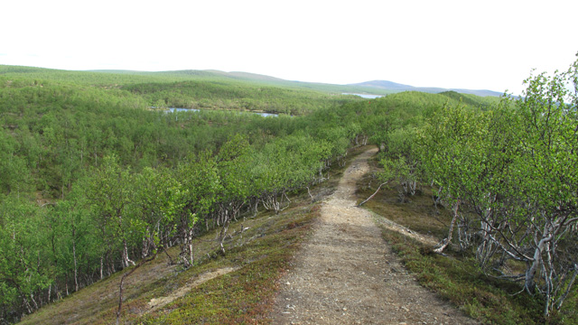
Occasional clearing, cool wind from the west. At Lake Luomusjärvi a rain shower began and the wind strengthened. Drink break by the lake. After the ridge the rain stopped. We continued past the Ruktajärvi wilderness hut toward the Kevo park boundary and the next campsite (Geavvogeašláttu). There we took a break and ate chocolate bars. Some hail fell, then the weather cleared. Next the trail climbed into treeless fell terrain, then descended again into birch forest at the next campsite (Suohpášája). Break behind a rock, sheltered from the wind, eating chocolate bars. We continued to the Kevo Canyon viewpoint, where we admired the scenery and took photos.
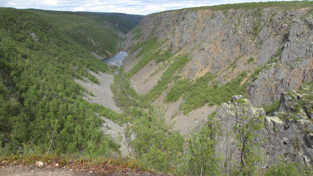
We continued along the trail, which descended twice into side ravines of the canyon and climbed back up, with stairs installed to ease the ascent. Finally we descended into the Fiellujoki ravine. During the descent the Fiellu waterfall was clearly visible, and stairs again helped the descent.
The campsite was on the opposite side of the Fiellujoki, so we waded across. The water was deep enough that we had to switch to wading shoes (Feelmax). We set up camp at 18:20. According to GPS we had walked 26.5 km. Campsites were poor due to rocky terrain, but we managed to pitch the tent. Dinner: Reiter Hungarian Stew + salami and salted peanuts. Slept at 20:00.
Fiellujoki Campsite – Guivi Wilderness Hut – Guivi Fell – Guivi Wilderness Hut
Monday 16.6.2014 wake‑up at 06:00. We photographed the Fiellu waterfall; the sun was shining. Breakfast: Reiter Pasta Carbonara, instant coffee, biscuits. Packed camp. Weather became cloudy, cool, with occasional snowflakes drifting in the air. Fleece + shell jacket. Started walking at 08:25, climbing out of the ravine via stairs, then across flat fell terrain until the trail turned into a gentle ascent. At a trail junction we continued toward Guivi. First flat terrain, then a couple of small stream ravines, then flat again. The north wind strengthened, and small hail began to fall, later turning into larger hailstones. In the marshy section the trail followed long boardwalks. Hail turned to snow; temperature +1°C according to GPS.
After the marsh the trail continued across open fell. It was too cold to stop for a break. We reached the Guivi wilderness hut at 12:38 (13 km). We took a break inside, eating salami and a chocolate bar. Then we put on shell pants and went outside to pitch the tent. After resting briefly in the tent, we packed necessary items into jacket pockets and at 14:00 began the ascent to the summit of Guivi.
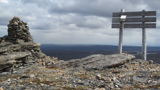
The snowfall had stopped, but the wind was strong and the weather cold. Occasionally the sun shone through clouds. We reached the summit at 15:30. Visibility was fairly good, but we could not stay long due to the cold. We ate chocolate bars and returned the same way, reaching the tent at 16:39 (8 km). Occasional sunshine, warm inside the tent. Dinner: Reiter Chicken Pasta. Slept at 19:00; light snowfall during the night.
Guivi Wilderness Hut – Ruktajärvi Wilderness Hut
Tuesday 17.6.2014 wake‑up at 06:00. Reiter Pasta Carbonara, instant coffee, biscuits. Packed camp. Dry weather, occasional sunshine, cool, fleece + shell jacket. Started walking at 08:15. First gently up the valley, then onto flat terrain. Sunshine increased and the weather warmed slightly. We removed shell jackets and applied sunscreen. Long stretches of flat open fell, a couple of stream crossings, then descent into birch forest and to Akukammi, where we arrived at 11:15.
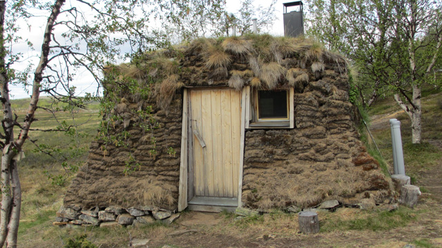
Break, chocolate bar. Continued at 12:00. The trail rose and fell gently across ridges and stream valleys. We reached the Njavgoaivi wilderness hut at 13:48. Break, two chocolate bars. The hut was cold, but the nearby kota was warm. Continued at 14:30, ascending into treeless fell terrain for about four kilometers, then descending into birch forest and to the Ruktajärvi wilderness hut. Camped by the stream at 16:24 (22.2 km).
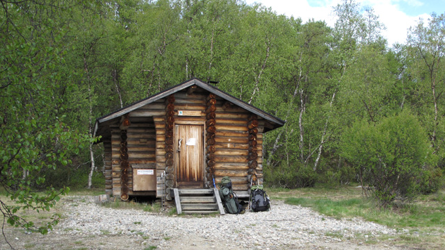
The sun shone briefly, then it became cloudy. An excellent walking day: sunny, no rain, not too warm, not too cold, plenty of water available, no mosquitoes, easy terrain, clear trail, and several good break spots. No other hikers seen. We could have continued all the way to the car, but likely would not have had energy to drive far afterward. Dinner: Reiter Pepper Beef Rice Stew. Slept at 19:00. Cirrostratus clouds suggested rain for the next day. Rain began during the night.
Ruktajärvi Wilderness Hut – Sulaoja Parking Area
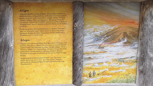
Wednesday 18.6.2014 wake‑up at 05:00. Reiter Pasta Bolognese, instant coffee, biscuits. Rainy, cool weather, fleece + shell clothing. Started walking around 07:00 along the familiar trail via Luomusharju to the Luomusjoki campsite, where we took a break and ate a chocolate bar. Then a couple more kilometers to the car, arriving at 10:30. Fresh snow had fallen overnight on the Ailigas fells.
After changing clothes, we drove via Kautokeino to Sonkamuotka, where we had coffee and pastries, then continued to Tornio for another coffee and pastry, and finally drove on to Oulu. The total hiking distance was 101.4 km (track log).
Notes: The weather was somewhat cool, but warm enough while moving. Thanks to the down sleeping bag and air mattress, nights were not cold. There was enough food. The gas canister ran out on the morning of the fourth hiking day; it boiled eight pots of water. The backpack was not weighed, but the estimated weight was around 13–14 kg, and it felt very light. The terrain was easy, and lighter footwear would have been sufficient. A longer hike in the Rastigaisa area should definitely be done someday.