Routes
Daily stages on map
In autumn it was time to head out again — the northern fells were calling. Time was limited, so I needed to choose an area close to the road. The Abisko mountains felt like a better destination than Stora Sjöfallet (Nieras, Kallaktjåkka), especially since I had already visited that area during the summer. The Kilpisjärvi region would have been another option, but memories from last autumn were still very fresh. So I set out alone to Abisko, and this time to Ballinvaggi. Because of last year’s autumn trip experiences, I made this trip earlier in September, though I still prepared for cold conditions.
On Wednesday 18 September 2019 I started driving at 17:20, refueled in Tornio and bought travel snacks, refueled again in Kolari and stayed overnight.
Abisko turiststation – Siellanvaggi
On Thursday 19 September 2019 I woke at 05:30, dressed, ate, and started driving at 06:20: Pajala–Junosuando–Vittangi–Svappavaara–Kiruna, arriving at the Abisko parking area at 10:00. Changed clothes. The mountain summits were in clouds, and higher up the fells were snowy. Occasionally the sun peeked through the clouds, temperature +2°C. Light snowfall came with the west wind. I wore fleece pants, ski sweater, gloves, beanie, neck gaiter, and a base layer underneath. Backpack weight 24 kg. At the start of Kungsleden the gate was no longer there.
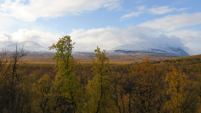
The trail followed the Abiskojåkka river; there was a bit of frost on the ground, and soon the snowfall stopped. I walked past the Abisko canyon, then to Marmorbrottet, where I drank water from the stream. A bridge crossed Nissonjohka, then I turned onto the Tältlägret trail at the junction. The trail climbed upward past Tältlägret, then snow began to appear and the trail disappeared. I climbed to cloud level; snow began falling again, with a fairly strong west wind. Along the edge of the ravine I continued into Ballinvaggi, where it was snowy. I crossed a stream almost immediately and then walked on flat grassy ground until near the end of the valley I had to bypass the stream bends on the right side.
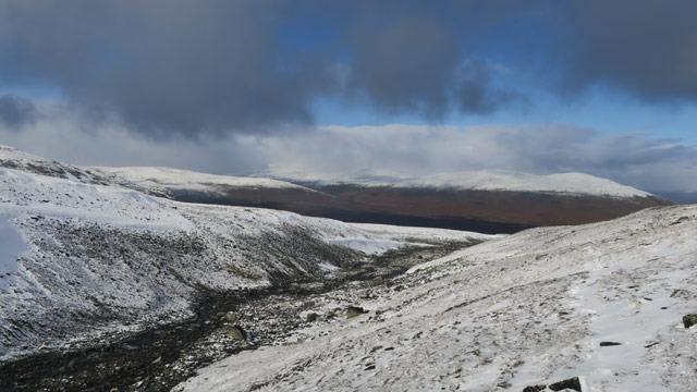
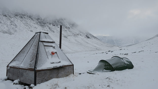
I climbed over a ridge and turned into the next valley. Here the headwind was strong and more snow fell; I had to weave around drifts that had accumulated on the sheltered sides of banks. Then came more difficult rocky terrain; the accumulated snow made it especially tricky because I could no longer see footholds or holes properly, and progress was slow. Then the reindeer herders’ hut came into view. My intention was to camp next to it. First I filled the water container — the stream had to be fetched from quite far away. Camping on snow was already familiar from last year. I kicked aside most of the snow and pitched the tent; the ground was already frozen and the stakes were difficult to anchor. I placed the tent on the sheltered side of the hut; there was no other wind protection. Snow continued to fall. I got into the tent at 16:36. I ate Reiter Rice with beef and pepper and a chocolate bar. Then I inspected the surroundings outside; it was very cloudy, so I did not go on longer excursions. I rested in the tent for the evening. Having learned from last year’s experience, I had brought two sleeping bags. I briefly considered whether to put the synthetic or the down bag on top; recalling online dew‑point discussions, I put the synthetic bag on the outside. Inside the double bag I stayed warm, especially with a thick wool sweater on. When darkness came, I ate a sandwich and drank cocoa. I considered my trip plan: it was cloudy with no visibility, and snow made rocky terrain difficult. I could perhaps make day trips from this camp and then continue down Siellavaggi to Kungsleden and exit via that route to Abisko. Snowfall continued during the night; I did not feel cold.
Trips to Siellanjunni and Ballinbogicohkka
On Friday 20 September 2019 I woke at 05:30, but continued resting and woke again at 08:10. Reiter Rice with beef and pepper, coffee and bread. Then I set out toward Siellanjunni; the weather was cloudy with occasional light snowfall. I descended into Siellavaggi to a stream, filled my bottle, then climbed the slope on the left side of the streambed until the rocks ended. Ahead was old icy snow on a steep slope, impossible to climb. I moved right, where there was rocky ground, and reached the mountain ridge.
There was almost no visibility. I left one trekking pole here as a marker so I would know where to descend. I continued to the 1461 m summit of Siellanjunni. The summit was in cloud; no views. I returned following my own tracks in the snow back to the trekking pole. Since visibility was poor, I did not continue along the ridge in the other direction but descended and was back at the tent at 12:05. I ate bread and drank cocoa. Then I went out again with the camera, climbing above the tent; I saw some ptarmigan in the rocks. The weather was slightly clearer, so I climbed higher and higher. Siellanjunni came into view, as did Tjåmuhas (1743 m). I had already climbed so high and put in so much effort that I decided to continue all the way to the 1661 m summit of Ballinbogicohkka. The snowy rocky terrain caused some difficulty, but I reached the summit; it was in cloud with no views. I descended and was back at the tent at 15:53. It was still cloudy; temperature in the vestibule was +3°C. Dinner was Reiter chicken and noodles hot pot, with a chocolate bar for dessert. I boiled water for the thermos, drank coffee and ate biscuits. In the evening there was cocoa and a bun.
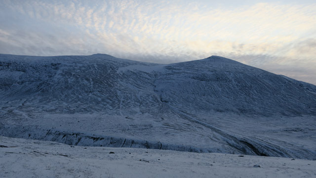
I felt a sore throat, my voice was gone — apparently some illness had struck. Fortunately I had no need to use my voice. During the night the weather cleared and cooled; two sleeping bags and two sleeping pads were necessary, as well as a thick wool sweater. There was moonlight and frost at –8°C. I drank hot water occasionally. Moisture from breathing froze on the inner tent ceiling.
Siellavaggi – Ballinvaggi, trip to Tjåmuhas mountain
On Saturday 21 September 2019 I woke at 06:00. It was less cold, but again very cloudy. I dried the inner tent with fleece gloves and packed away the down bag so it wouldn’t get wet. I rested; it was still dim. Then breakfast: coffee, bread, and Reiter chicken and noodles hot pot. I thought about heading to Kungsleden, but walking 15 km to Abisko along it felt dull. I decided to return to Ballinvaggi even though the rocky terrain there had been difficult. The weather was cloudy, wind from the west with snowfall, temperature –3°C. I packed most things inside the tent and finally took down and packed the tent. I began walking toward Ballinvaggi. Soon I found reindeer tracks in the snow — I had thought I heard a reindeer bell during the night. I assumed the reindeer had chosen a route avoiding the worst rocks, so I followed their tracks. This allowed me to avoid almost all rocky terrain. In Ballinvaggi there was a north wind and slightly clearer weather. I walked north along the valley until I found a suitable tent site on a bank beside a stream. Pitching the tent was easy and I was inside at 12:04. I ate bread and drank cocoa.
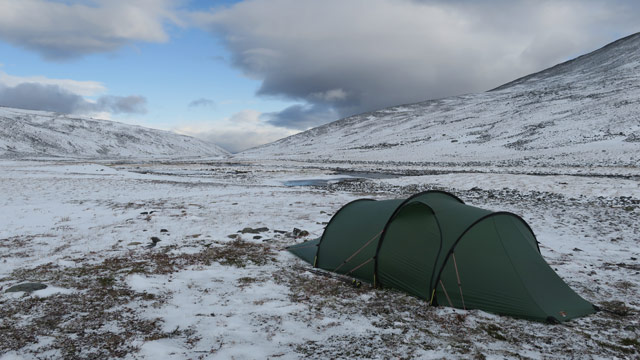
Then I set out toward the small glacier‑carved valley on the west side of Ballinvaggi. The ascent was very rocky. There was still a bit of glacier left in the valley. I continued up to the ridge behind the valley. The wind was strong and snow blew in; visibility was poor, but I still climbed along the ridge to the 1688 m summit of Tjåmuhas. The summit was in cloud; no views. I did not bother continuing to the 1743 m summit, as it would have required descending first and then climbing again, and there would have been no views anyway — without a GPS device one might easily get lost. I returned to the tent, arriving at 16:04. I ate coffee and a bun; the main meal was Reiter pasta bolognese with beef. At times there was strong north wind and snowfall; temperature in the tent was +2°C, outside –1°C. Ventilation worked well now; no condensation. In the evening it was –4°C outside. I boiled water for the thermos and enjoyed a coffee‑cocoa mix and two slices of bread. During the night it was –4°C, with coffee and a bun as a night snack.
Trip to the end of Ballinvaggi, Ballinvaggi – Abisko turiststation
On Sunday 22 September 2019 I woke when I felt like it. I reduced my food supplies: Reiter pasta bolognese with beef, coffee, bread, biscuits. The weather was slightly clearer on the west side of Ballinvaggi; the eastern peaks were in cloud. I set out toward Ballinriehppi, the head of the valley. Tjåmuhas, Ballinbogicohkka and Siellanjunni were visible. I walked at a brisk pace southward all the way to the terminal moraines of the Ballinriehppi glaciers.
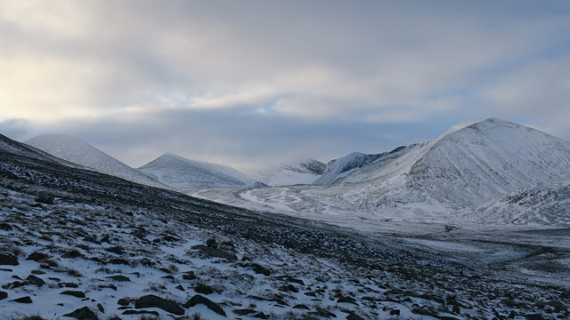
The terrain was rocky but fairly level. Then I got the idea to climb onto the glacier’s terminal moraine — this turned out to be quite difficult. At the base of the moraine there were large boulders covered by 10 cm of snow. The moraine was steep‑sided, and eventually I had to use all fours to climb up. Higher up I could walk again and reached the top of the moraine; behind it were more ridges. I walked along them until I had an unobstructed view of the glaciers. Walking was difficult; the ridges consisted of boulders of various sizes, with deep gaps between them, and snow covered both stones and gaps. Descending from the ridges also required all fours at times. Once I got through that, I walked briskly back to the tent, arriving at 12:34. The sun occasionally shone on the tent, otherwise it remained cloudy. I drank coffee‑cocoa mix and ate two slices of bread and biscuits. I weighed my options: I would have to start the return journey by the next day at the latest. I decided to leave immediately — I had done all the trips that were reasonable given the weather. I packed my gear and tent and began walking toward Abisko along the same route I had come.
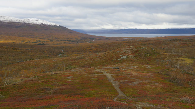
Below Tältlägret I drank from a stream, and again before Marmorbrottet. On top of the Marmorbrottet hill I stopped; the sun began to shine just then. In view were the familiar peaks Nissoncorru, Pallentjåkka, Ballinbogicohkka and Tjåmuhas. It was a moment suitable for meditation, but other tourists arrived, so I continued. Total hike length: 59 km. I started driving at 17:06, and it took until nearly midnight.
Notes: the weather did not favor summit attempts; snow made rocky terrain difficult. Of the traditional hiking foods, only Reiter meals were consumed at the usual rate; of the 21 chocolate bars I had brought, only three were eaten, and only one packet of biscuits. Bread and buns with toppings were consumed. The developing respiratory infection did not seem to hinder walking, although I coughed at times and had no voice. The mountains south of Abisko would be worth visiting again, preferably in late spring or early summer on skis.