Routes
Daily stages on map
As autumn arrived, I set out for another fell hike at the turn of September and October, as I had done in the two previous years (2016 Ounastunturi, 2017 Abisko). This time I was traveling alone. For that reason, I chose the familiar Kilpisjärvi region as my destination, more precisely the Pältsa area west of Kilpisjärvi. From Norway’s Signaldalen it would be convenient to head into the fells. According to online trip reports, one can even ride a mountain bike from Signaldalen to Gappohyttan, so I considered cycling myself. Due to slightly heavier gear (more food, clothing and two sleeping pads), the backpack became so heavy that I left cycling out of the plan.
Wednesday 26 September 2018 at the end of the afternoon I packed my things into the car and started driving; it had rained all day and was still raining. I refueled the car in Ii, and a second time in Kolari as evening was already falling. The rain continued; in Muonio I stopped at a store to buy cheese and salami to replace the cheese and salami I had forgotten at home. The car’s thermometer showed the outside temperature dropping during the drive, and it was only +2 degrees. Before Karesuvanto the temperature dropped to one degree and the rain turned into sleet. The temperature then dropped to zero and the snowfall became quite thick; snow began to appear on the ground at the roadside and soon on the road itself. The road surface seemed slippery, so I had to slow down to 50 km/h. Oncoming trucks flashed their lights occasionally. The radio warned that snowfall was making driving conditions difficult in the municipality of Enontekiö. I recalled something learned on a 2000 trip: it is a long way to Kilpisjärvi. About twenty kilometers before Kilpisjärvi I pulled over and let a truck pass; I was then able to drive in the track it had plowed over Finland’s highest road point, Muotkatakka 565.8 m, to Kilpisjärvi. I headed to the parking area of the Malla Strict Nature Reserve and arrived there at 23:00. Due to the poor and slippery conditions, I did not want to continue in the dark into Norway on the winding road descending to Skibotn, so I placed a sleeping pad on the car floor and crawled into my sleeping bag. For supper I had Café Latte and a couple of sandwiches with Kalle’s caviar.
Signaldalen – Beside the 1062 m saddle between Moskkugaisi and Pältsa
Thursday 27 September 2018 the night was rather cold; I got up around 06:00. Outside the weather was clearer and the moon was visible above Pikku-Malla; snow could be seen on the fell slope. I ate two caviar sandwiches for breakfast. I started the car; the thermometer showed –1 degree. While waiting for the windshield to defrost, I noticed one of the car’s headlights was out—apparently the reason trucks had flashed their lights at me during the night. I replaced the broken bulb, then after 07:00 I began driving toward Norway. The road was a bit icy and it was better to keep the speed low; fortunately there was no other traffic. As I descended, the temperature rose, and down by the fjord it was 4 degrees. I continued along the fjord road and then turned into Signaldalen.
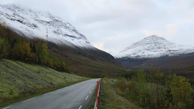
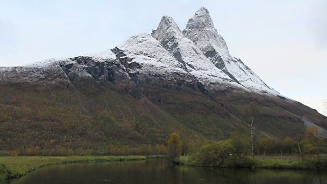
I stopped occasionally to admire Otertinden, until I reached the parking area at the end of the valley. I prepared my gear and around 09:00 started along the trail leading to Gappohyttan. The backpack weighed an estimated 23–25 kg, but did not feel too heavy while walking. The weather was partly cloudy and turning sunnier; I wore base layer, fleece pants and a ski jacket, a beanie and neck gaiter, and ski gloves. The wind was not bothersome. The trail was quite rocky and constantly ascending—difficult to ride by bike. In the increasing sunlight the scenery looked beautiful; some autumn colors still remained in the trees. Approaching the treeline, snow began to appear on the ground, and above the treeline there was 10–30 cm of snow, light powder snow. An ATV track was visible under the snow, and there was slightly less snow along its edge; I followed the track until it disappeared in flatter terrain. Visibility was good and I could already identify Pältsa to the right; I headed toward it, trying to avoid the deepest drifts. In places the wind had piled snow up to a meter deep, and wading through them was difficult. Fortunately the cuffs of my fleece pants were tight enough that snow did not get into my boots. Occasionally I encountered streams from which I scooped water with a mug. Soon I saw Gappohyttan higher up on a ridge. I walked southward, crossed the trail leading to Gappohyttan and soon also the Nordkalottleden. Seeking areas with less snow, I continued over the Masealvarri ridge until I saw Njearrejávri below. The lake was partly frozen; I headed toward its northwestern end. Descending closer to the lake, I reached a bog where water appeared between tussocks, sometimes hidden under snow. Njearrejohka had little water but was partly frozen, making the crossing a bit tricky. After crossing, I set down my pack briefly and filled my water bottle and thermos, since finding water higher up might be difficult.
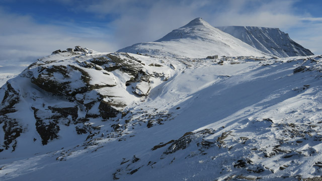
Ahead was now a climb of over 300 meters to the 1062 m saddle. I ascended more or less directly; near the top I had to bypass a steeper section on the right. During the ascent it occurred to me that I would likely have to pitch the tent on snow, since I had not seen bare ground since passing the treeline in Signaldalen. From the saddle I descended slightly; as soon as I saw a small trickle of water seeping between stones, I decided to camp. The weather was still sunny, not very cold, and there was little wind. I kicked away most of the snow from an area the size of the tent; under the snow was some slush. I pitched the tent; the stakes did not penetrate the frozen ground well, so I pushed them diagonally into the slushy snow.
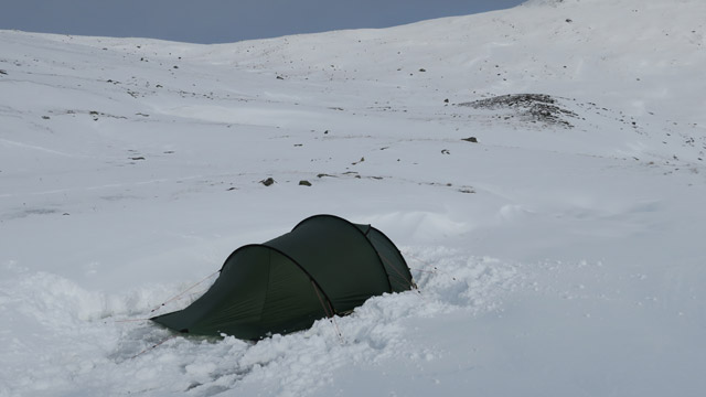
Around 15:00 I was already inside the tent; soon the scenery disappeared into cloud and light snow began to fall. I ate a Reiter Pasta Carbonara with ham meal, then a couple of sandwiches with cheese, salami and Kalle’s caviar, with a mug of cocoa and some chocolate. In the evening the weather cleared and cooled; for supper I had more cocoa and a bun. The wintry conditions in the fells came as a slight surprise, and I wondered whether I would be able to drive back to Finland with summer tires if the cold weather continued. The night was cold even though I had both a foam pad and an air mattress under me; in the down sleeping bag I wore socks, wool socks, base layer, fleece pants, fleece sweater, beanie and neck gaiter.
Beside the 1062 m saddle between Moskkugaisi and Pältsa – Pältsa – Signaldalen
Friday 28 September 2018
I woke at 06:00 (or the alarm rang—I had barely slept due to the cold), and lay waiting for daylight. The water in the bottle was partly frozen.
Outside the weather was clear and the sun was rising. I fetched water from between the stones outside; I could get half a mug at a time and filled the thermos. The gas stove worked somewhat after warming the canister under my shirt. I ate a Reiter Pasta Carbonara with ham meal. Then I emptied the backpack, loaded only what I needed for a day trip, and began ascending toward Pältsa’s 1267 m peak. I now wore base layer, fleece pants, fleece sweater, shell pants and ski jacket, with beanie and neck gaiter, and ski gloves. My fingers and toes were cold, but during the steep ascent they gradually warmed. The final ascent to the summit was fairly steep, with good views. Then I walked along the summit ridge until I descended to the saddle before the 1442 m summit.
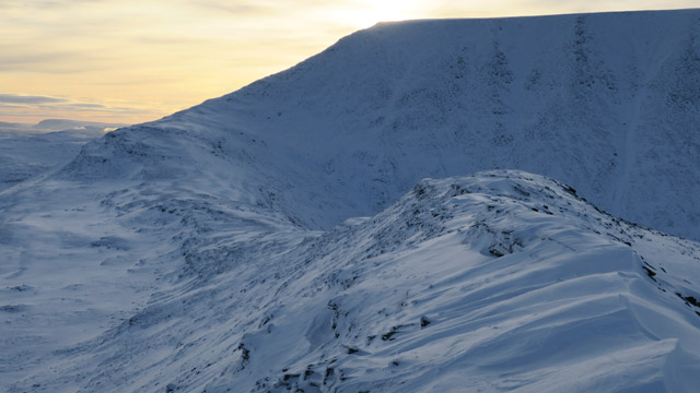
I continued toward the ridge leading to the flat 1442 m summit of Pältsa. The ridge was a bit steeper at the end, but still walkable, not very narrow, and the ascent caused no difficulty. At the summit the views opened again; the sun was shining and it was no longer cold. The summit is quite flat; from the northern edge to the southern tip is just under a kilometer. I went to the southern tip to look down into the Pältsa valley, then returned the same way via the saddle and the 1267 m peak to the tent.
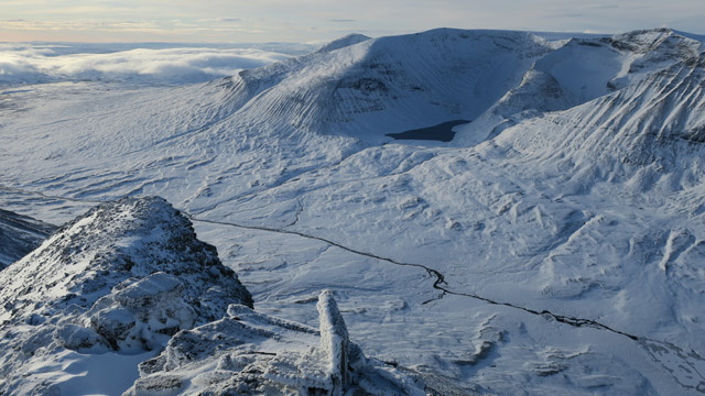
Clouds seemed to be approaching from the west-northwest. I reached the tent at 10:52, made coffee and ate four cheese–salami sandwiches. I figured it was better to leave while the weather was good; another cold night in the tent did not appeal, and the road between Skibotn and Kilpisjärvi would likely be thawed and dry after a sunny day. In addition, the approaching cloudiness might mean more snowfall and generally worse weather. I packed the backpack, took down the tent, and at 11:57 started the return journey toward the car. The descent from the 1062 m saddle to Njearrejohka went quickly; the river was slightly more frozen, but I got across.
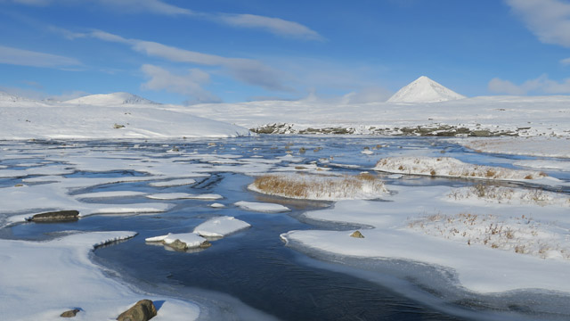
Then I headed to the Nordkalottleden; the trail was still visible despite the snow. I followed it toward Gappohyttan. On earlier trips in 2003, 2004 and 2008 I had walked this section “as if in a fog”, but now I realized that the scenery here is actually quite impressive. Before reaching Gappohyttan I cut across to the trail leading to Signaldalen; the trail markers were easy to see. I walked fairly briskly toward Signaldalen; cloudiness increased and some snow fell. Down in the valley it was already cloudy. I reached the car at 16:19, changed shoes and started driving at 16:32. Along the fjord road it was foggy and rainy, temperature +5 degrees. Turning toward Kilpisjärvi, the weather cleared and cooled; at the Finnish border it was –1 degree, but the road was dry. As the evening progressed the frost continued and the temperature dropped to –5 degrees as I drove south. I refueled in Kolari and arrived home at 00:30.