Routes
Daily stages on map
Abisko - Lairevaggi
On Saturday, June 28, 2003 we drove in the morning from Pajala through Vittangi, Svappavaara and Kiruna to Abisko. The views from the road toward the fells were fairly good; Lapporten was clearly visible from the car, and Lake Torniojärvi was calm. There still seemed to be quite a lot of snow in the high terrain. We started the hike from the roadside at the point where the Nordkalott Trail crosses the road, around 11:00 a.m. There was a trail sign next to the road. Scrubby terrain, small steep rises and dips, occasional boardwalks, one metal bridge over a river, plenty of mosquitoes, cloudy but dry weather, no wind. A break at Pålnostugan at the northwest end of Lake Torniojärvi: muesli, fruit soup, and drying footwear. After that, ascent toward the border, brush and thickets. In the forest the route was marked with red paint on tree trunks. At the border, a steep climb to Lappjordhytta, a short break there, then more ascent. Soon we reached the tree line and entered open fell terrain, with patches of snow here and there, through a pass at over 900 m. Fine views across Lake Torniojärvi to the south and back west toward Norway. On the fell the route was marked with red paint dots on rocks or cairns. Then a descent, a demanding river crossing and another one immediately after; we searched for a suitable crossing point for a while, as the bridge marked on the map did not exist. Then another couple of kilometers of gentle ascent along the valley slope. Camp at 8:00 p.m. at the first dry and level-looking spot. Slightly cloudy, not cold, though the night was a bit chilly. Dinner: pasta packet, tea, cookies.
Lairevaggi – Luotnajavri
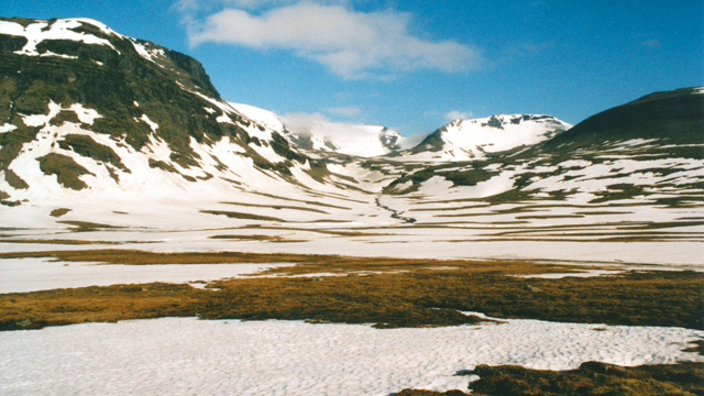
On Sunday, June 29, 2003: Reiter bag and coffee, cookies, sun shining from a cloudless sky, no wind, warm. In the neighboring valley there was a lot of snow. We set off at 10:00. Ascent along the valley, highest point around 950 m, large continuous snowfields higher up, fortunately firm. Near streams the snow had sagged and those spots were better to bypass. Lower down, several stream crossings. We descended along the valley; one demanding river crossing, wading across on surface rocks with pant legs tightened around boot tops, taking 30–45 minutes. Strong sunshine. Muesli break below the rapids. Several shoe‑drying breaks. The valley ends and a view opens down into Sördalen.
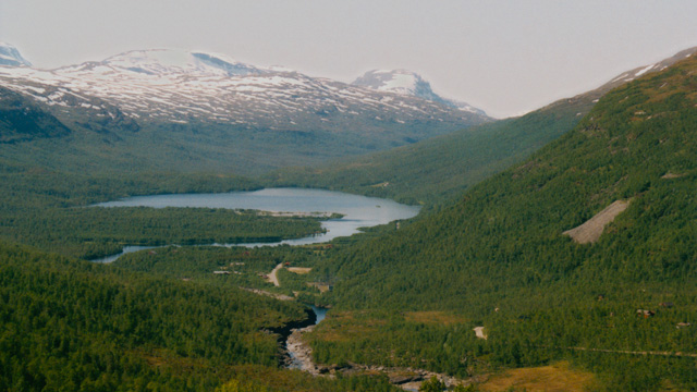
We descend to the Altevatn dam, cross it, walk a couple of kilometers through birch forest along the road. The sun begins to burn the skin. Then another 5 km along the trail, across a narrow bridge over the rapids, and camp at 8:00 p.m. by the first proper stream. Washing in the lake. Arms, neck and face sunburned. Pasta packet, tea, cookies.
Luotnajavri – Vuomahytta
On Monday, June 30, 2003: breakfast bag, coffee, cookies. Sun shining from a cloudless sky, no wind. We set off at 10:00 and walked 7 km through lakeside brush, crossed the river via a bridge at a magnificent set of rapids, passed Gaskashytta, muesli break by a stream, reached the tree line, then ascent along the valley to 950 m, lots of snow higher up, reindeer, sun shining all day. Then descent along the valley, walking until 10 p.m., camp below Vuomahytta on the lakeshore. Pasta, tea, cookies.
Vuomahytta - Dividalshytta
On Tuesday, July 1, 2003: breakfast bag, coffee, cookies. Sun shining from a cloudless sky, no wind, need to protect from the sun. Set off around 10:00. Descend into the valley, then walk along the river, brushy and at times wet and muddy. Muesli break before the suspension bridge.
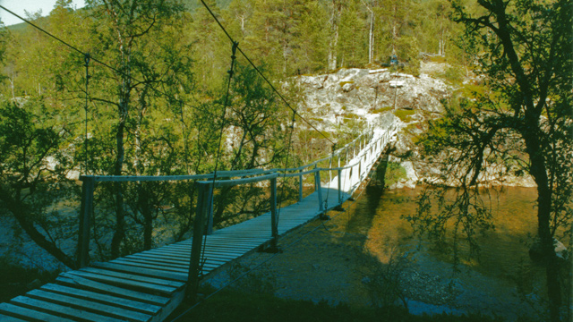
Then past a striking stretch of rapids, across another bridge, along the riverbank for a couple of kilometers, then ascent through pine forest and birch woodland to Dividalshytta. Camp at 7:00 p.m. in the birch forest next to a stream. +38°C in the tent, plenty of mosquitoes and horseflies outside, a small gust of wind in the evening. Pasta, tea, cookies in the tent.
Dividalshytta – Daccavaggi
On Wednesday, July 2, 2003: breakfast bag, no coffee, water and cookies. Still sunny and hot. Set off at 10:00. Ascent up the slope of Jerta, highest point around 950 m.
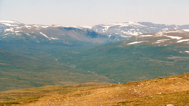
Descent into a valley with a difficult river crossing using running shoes, muesli break on the riverbank, walking through fell terrain, occasional bogs, ascent over Jalguhas, camp on the far slope by a lake at 7:00 p.m. Pasta, tea, cookies.
Daccavaggi – Gassavaggi
On Thursday, July 3, 2003: breakfast bag, coffee, cookies. Weather has changed; we are in cloud. Dry the outer tent before packing. Set off at 12:00, walk along the valley to Daertahytte, sun begins to shine, muesli and coffee there, ascent into the fells, at times needing to lighten the load.
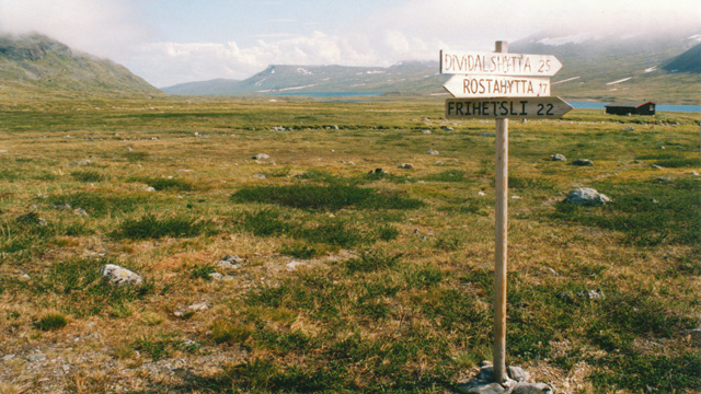
Ascent in sunny warm weather, highest point 1050 m, plenty of snow, phone signal returns. Gradual descent, entering cloud, searching for a campsite by a stream, camp at 9:00 p.m.
Gassavaggi – Gappohytta
On Friday, July 4, 2003: breakfast bag, coffee, cookies. Dry the outer tent. Set off at 9:40, descent through fell terrain, one river crossing over a snow bridge, to Rostahytta, across the river via suspension bridge.
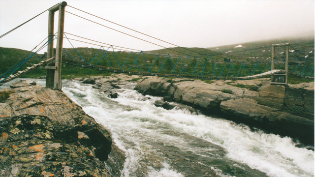
Muesli break, blueberry soup cooking, ascent up Isdalen, sun shining strongly enough to remove jacket and switch to a base‑layer shirt. Fine waterfall on the left, magnificent scenery, ascent to nearly 1000 m, lots of snow and frozen lakes, good views toward Måskugaisi, Isdalfjellet, Måskonvarri. Descent along the valley, clouding over at the far end, no visibility toward Paras. Gentle descent along the fell, wide river crossing, walk to Gappohytta, a bit past it, camp at 10:00 p.m. Feet wet and cold. Pasta, tea, cookies.
Gappohytta - Kilpisjärvi
On Saturday, July 5, 2003: Reiter bag, coffee, cookies. Dressing in the tent, packing backpacks, taking down the inner tent, drying and packing the outer tent. Still cloudy. Set off at 9:00. Relatively even fell terrain, occasional streams, foggy, almost no wind. Descending below the cloud layer, the air warms. Several stops to remove base‑layer clothing during the descent to Lake Gåldajávri. Then along the lakeshore to the Three‑Country Cairn, then to Kuohkimajärvi hut, arriving around 2:20 p.m. Pasta, coffee, cookies. At 5:00 p.m. departure toward Koltaluokta, arriving at 5:50 p.m.
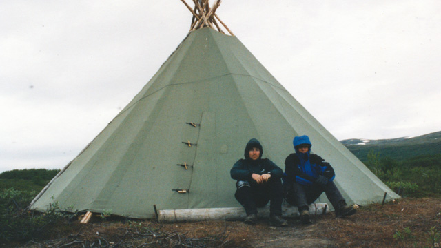
The boat arrives at 6:30 p.m., we board, it departs at 8:30 p.m., arrives at Kilpisjärvi at 9:00 p.m. Walk up to the road, into the car, drive to Kolari. Total distance for this hike: approx. 164.8 km, ascent 3740 m and equivalent descent.
Abisko - Kilpisjärvi
Notes: food was not excessive — perhaps slightly too little. Too many spare clothes; the fleece was mostly used as a pillow. Running shoes mainly for moving around camp. Travel pillow unnecessary. A 450 g gas canister lasted 7 days. Trekking poles would have been useful. Shorts could be good.