Routes
Daily stages on map
For the summer 2020 hiking destination we agreed already in autumn 2019 on Saltfjellet–Svartisen National Park in Norway. During the COVID spring, entering Norway was uncertain due to travel restrictions, and we even planned an alternative trip to the far north of Finland. However, travel to Norway was permitted again in June. Travel to Sweden was not, so the drive became quite long — about 1200 km each way. Saltfjellet–Svartisen National Park was fairly unfamiliar to us; we acquired topographic maps of the area, and there was also information online. Harri Ahonen’s book, Hiking Routes of Northern Scandinavia provided additional information about the routes and huts. The park has many marked trails and mountain huts, but we assumed there would also be suitable terrain for independent trekking. The park can be accessed from all directions; we decided to start our hike from the Tollådalen parking area in the northern part of the park. Several glaciers lie within the park, the largest being the two‑part Svartisen glacier. According to advance information, the winter snowpack had been heavy and melting slow, so water obstacles were to be expected; on the other hand, higher up the snow would ease walking. On Tuesday 14 July 2020 we woke at 05:00 and began driving north at 06:00. We took a coffee break in Kolari, refueled the car, and bought a 5‑liter water container for cooking. In Sonkamuotka we stopped again for coffee and pastries for one euro. In Kilpisjärvi we bought more travel snacks. At the border the Norwegian police checked our IDs. In Skibotn, at a parking area by the sea, we took a longer break and prepared a three‑course meal (pasta packet, canned meatballs, ham‑paste–cheese sandwiches), followed by coffee and pastries. In Narvik we refueled again.
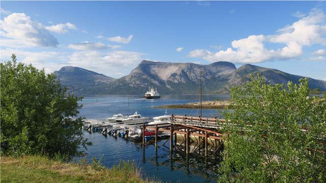
At Skarberget we had to wait a moment for the ferry, which carried us about 7 km across the sea to Bognes. Invoice €18.30 (180 NOK) for the round‑trip ferry crossing arrived only on 9 May 2022. The final stretch to Tollådalen was gravel road; we arrived at the parking area by the Gammåga stream at 00:33. We got out of the car, gathered our gear, walked about 30 meters and pitched the tent. After cheese sandwiches and a Reiter Hunter’s stew meal we began resting around 02:00. It rained during the night.
Tollådalen parking area – Ørfjellryggen
On Wednesday 15 July 2020 we woke at 10:00. Reiter pasta with beef and pepper, bread, coffee, pastries. We walked back to the car and finalized the backpacks. We didn’t weigh them, but estimated 22 and 21 kg. We started walking at 12:11, first along a marked trail ascending through birch forest. The rain had stopped during the night; it was partly cloudy with moderate wind and warm weather.
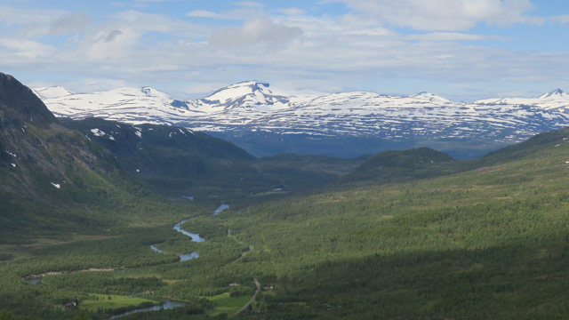
The ascent was fairly steep and leveled only at the treeline when we reached the Reinhornskaret saddle. We took a break here; as the weather was clearing, sunscreen was appropriate. Next we crossed the Harondalselva stream on stones. We then ascended to the Steinskaret saddle. From the saddle we viewed the ice‑covered Nordre Bjøllåvatnet lake. We had now reached the high fell terrain, where walking is unobstructed and easy, so we could leave the marked trail. Maintaining altitude, we circled the north end of the lake and took a chocolate bar break. Then we continued southeast toward the Ørfjellryggen ridge, trying to avoid the larger streams descending from the upper lakes; the terrain was rocky and snowy. Our aim was to get near the 1751 m Ørfjellet mountain, the highest peak in the national park, and possibly attempt a summit later. Above 1000 meters, camping possibilities looked scarce due to rocky ground and extensive snowfields. So we decided to find a campsite, and after some searching we pitched the tent at 18:32 at 1036 m by a small pond. GPS showed 15.15 km walked. The campsite had pleasant views toward Ørfjellet. Reiter pasta carbonara was dinner. After that we went outside to try flying the drone.
The wind was a bit strong and the drone seemed at times to fly away, but it returned. We went to rest at 21:05. The night was a bit chilly.
Ørfjellryggen – Ørfjellet – Låpptåvaggetjahtsa
On Thursday 16 July 2020 we woke at 06:00. Reiter chicken curry with rice, coffee, biscuits, pastries. Sunny weather, some thin clouds, almost no wind. We set off at 08:07. We ascended along snowfields and around water obstacles to a saddle southwest of Ørfjellet at just over 1200 m. We took a break here, ate chocolate bars, and flew the drone. The wind increased, clouds thickened, and some rain fell, but not much. Then we began the ascent toward the summit of Ørfjellet, leaving the backpacks in the saddle. The slope was steep rocky terrain at first, then steep boulder fields. The weather improved again and the rocks dried. Strangely, the stones did not move much.
We had to use our hands at times, and at 1425 m we realized the trekking poles were only a hindrance, so we left them there and took a chocolate bar break. The slope continued as boulder fields and occasional rock slabs. Soon we had to use our hands constantly for balance and sometimes for climbing. We concluded this was no longer a “walking summit” — it was more like crawling. Near the end of the ascent we had to move to the far right of the south slope to reach the ridge. Along the ridge we progressed a short distance, then could circle left again, and soon we were at the summit. We considered the ascent challenging and wondered how the descent would go. At the summit we took photos, enjoyed the good views, and ate chocolate bars.
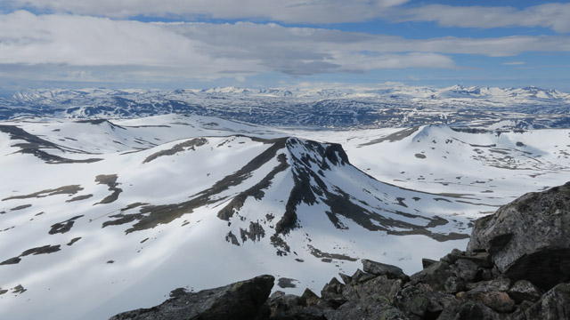
The descent went fairly easily, though mostly on all fours. At the saddle we rested and ate more chocolate bars. No tent sites were visible nearby — only snow and sloping rocky terrain. So we had to continue walking. We assumed camping would be possible near Lönstindvatnet in the Låpptåvaggetjahtsa valley, since the lake lies on the western, less snowy side of the mountain chain. Our route crossed two nearly 1300 m saddles, mostly on snow. Along the way we ate another chocolate bar. We descended into Låpptåvaggetjahtsa; it was rocky and snowy there as well, and we had to search for a tent site, but eventually found one.
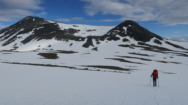
At 19:32 we camped at 1077 m on the east side of Lönstindvatnet by the outflow stream of a smaller lake; the distance walked was 31.48 km. Reiter Hunter’s stew and salted peanuts were dinner. We washed our faces in the stream. The sun still shone in the evening, but in the western sky there was red twilight — I recalled reading that this foretells worse weather for the next day.
Låpptåvaggetjahtsa – Kvitsteindalen
On Friday 17 July 2020 we woke at 06:00. Reiter chicken noodle hot pot, coffee, biscuits. Cloudy weather, no rain, moderate wind, not very warm. We set off at 08:14. We ascended southward to a 1158 m ridge; walking on snow was easy.
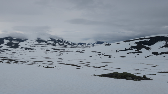
The descent into the next valley was gentle; we headed to the watershed area east of the 963 m lake, where there would likely be no large streams under the snow. During the descent we saw two moose; they saw us too and galloped across the snow to the valley bottom and eastward out of sight. We crossed the valley, Niesskemvaggetjahtsa, then ascended southward again, avoiding small lakes. We took a chocolate bar break at the shore of the 1025 m lake. Soon we descended into Semskdalen, again heading toward the watershed; snow covered the valley floor and water obstacles caused no issues. Our goal was to camp only in the next valley, so we now ascended southwest toward the northern end of Fetterbakk mountain. On this route we would encounter a somewhat larger stream flowing from lakes higher up. Indeed, the stream carried a lot of water, but a snow bridge appeared usable and we crossed it.
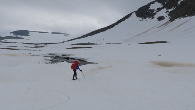
We sat down for a break. While eating chocolate bars, heavier rain began, so we put on shell jackets. After passing the end of the mountain, the rain intensified, so we added shell pants and shell gloves. We walked along the west side of Fetterbakk, ascending toward a saddle at about 1100 m. We reached the clouds and visibility dropped to zero — only snow and cloud. At this point we checked direction with the GPS. We descended toward the Kvitsteinelva river; lower down the ground became snow‑free and visibility improved, making it possible to search for a campsite. A suitable site was found at 15:30 at 893 m by a small stream; Kvitsteinelva was about 100 meters away. Distance walked: 48.12 km. Reiter stroganoff with rice and salted peanuts were eaten as an early dinner. Shell clothing was wet, otherwise everything was fine. Rain continued all night, with little wind and no cold. In this kind of weather the tent interior becomes quite damp due to condensation.
Kvitsteindalen – Austergilvatnet – Gilatinden
On Saturday 18 July 2020 we woke at 06:00. Reiter pasta with beef and pepper, coffee, biscuits. The rain had just stopped, a light breeze had picked up, and the clouds were beginning to thin. Sunshine appeared, so we dried our shell clothing outside and waited for the tent to dry as well. Eventually we broke camp and packed our backpacks. At this point the question arose: where were the glasses? After a moment of thinking they were found on the clothesline inside the inner tent, already packed into the backpack. We set off at 09:03. We descended toward the Bjöllådalen valley, where there was supposed to be a bridge across the valley river — without a bridge the river cannot be crossed, at least not this early in summer. We reached the birch forest and the marked hiking trail. We followed the trail through the brush and confirmed that the bridge was indeed in place.
After crossing the bridge we took a break and tried flying the drone again — and yes, it flew. We ate chocolate bars. The weather improved further and became quite sunny and warm. Our intention was now to climb westward out of the valley to the Lappflyttarskardet pass at nearly 800 m and continue west from there. We first climbed steeply upward, then diagonally toward the pass. A herd of reindeer was grazing on the opposite side of the pass. We walked north of the Tespvatna lakes and crossed the stream flowing out of Langtjönna on stones. Before the next ascent we took a break and ate chocolate bars. The reindeer herd ran past us higher up the fell. We headed there as well, aiming for the northern corner of Lake Austergilvatnet, where we assumed there would be a tent site. We camped at 15:22 at 863 m beside the stream flowing into the lake from the north. The lake was frozen and the terrain mostly snow‑covered. The distance meter showed 59.04 km.
We flew the drone again and then ate chocolate bars. The weather was sunny with no clouds — a perfect moment for a summit attempt. We surveyed the surroundings and decided that Gilatinden, 1416 m, would be a suitable target. At 16:50, with day‑trip gear, we began ascending the snow toward the southern end of Gilatinden’s ridge. We crossed the outflow stream of the 933 m lake via a snow bridge. After 1100 m the ascent became steeper snow slope; the ridge was rocky. We took a chocolate bar break. The ridge rose gently toward the 1416 m summit at its northern end. Views extended in many directions. Already during the ascent the wind had strengthened, and now increasing cloud cover appeared in the western sky, along with red twilight and mare’s‑tail clouds — all the signs of worsening weather at once. We quickly considered descent options; returning the same way felt long and the wind came from that direction, so we decided to try another route. The ridge seemed to end immediately after the summit, so it might not be passable. Thus we descended steeply in rocky terrain first westward, then reached a snow patch that continued north.
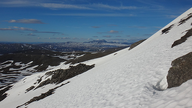
By descending steeply along snow sloping westward we were able to circle around the north and then east sides of the mountain while descending. We continued along snow back toward the tent, cutting over the 1129 m ridge. We reached the tent at 21:36; the distance meter now read 69.78 km. In the tent we prepared Reiter meat‑vegetable stew, and rain began at the same time. Salted peanuts served as dessert. Rest at 23:00.
Austergilvatnet – Northern slope of Jalggisoajvve
On Sunday 19 July 2020 we woke at 08:00. Reiter chicken curry with rice, coffee, biscuits. Outside there was thick fog, no rain, no visibility. We set off at 10:20, following the stream northward. Soon the rain increased slightly and we had to put on shell clothing. We then turned northwest and followed the valley northward for a while.
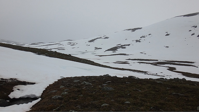
We took a break and ate chocolate bars. Then we climbed over a ridge to the west and descended to the Jamikjåhkå stream. We crossed the stream on stones; fortunately no water entered our boots. We continued north until we reached the Tollåga river. We had hoped we might be able to cross it, but upon seeing it we realized the hope was futile. There was plenty of water and current, and no snow bridges in sight. We followed the river downstream; it had impressive rapids and small waterfalls. Soon we reached Jamikjåhkå again and crossed it via a snow bridge. We took another short break and ate chocolate bars. We continued eastward along the mountainside and crossed the Losbekken stream. The rainy and foggy weather persisted, and now there were mosquitoes as well. Our shell clothing was wet, and even under the shells our clothes were damp with sweat. We decided we had walked enough and searched for a campsite. We found one and camped at 16:37 at 751 m; the distance meter showed 84.21 km.
At the same time the weather began to clear and soon the sun was shining on our camp. The tent was even warm, and the mosquitoes found their way inside. We dried our clothes outside and flew the drone. Reiter peppery beef stew was dinner. The weather clouded over again. Rest at 21:20.
Northern slope of Jalggisoajvve – Storpåsk
On Monday 20 July 2020 we woke at 06:00. Reiter pasta carbonara, coffee, biscuits. Cloudy, then rain, and fog as well. We set off at 08:11. Shell‑clothing weather again. We continued east toward the Stallogropvatnet pond; the goal was to cross the watercourse and continue to Midtistufjellet. First we encountered a stream descending from KrukkiNjunni; we had to search far up the slope for a crossing point, eventually finding a snow bridge. We then descended to Stallogropvatnet; an ATV track crossed the outflow stream. We decided to wade across here. We changed into wading shoes; the water reached slightly above the knee, but there was almost no current, so the crossing was easy. The rain had stopped, so we removed our shell clothing while changing footwear. But the rain began again immediately, so we put the shells back on. Then we were ready for the next ascent and headed toward the slope of Midtistufjellet. It was steep at first, then more gradual. The fog offered no visibility. The GPS guided our route. We took a break at 947 m and ate chocolate bars.
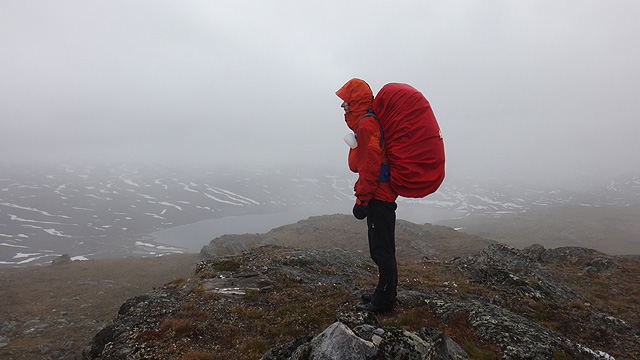
We continued to the 1097 m summit. The wind was stronger there, temperature +5°C, and it felt cold. We walked along the ridge northwest to the 900 m saddle, where we ate chocolate bars. Then we headed north over Storpåskfjellet. The descent from this mountain was quite steep; the snow on the slope was icy in places, and we had to traverse eastward to reach gentler terrain. Down in the Storpåsk valley we searched for a tent site, but found none. We climbed a short distance up the slope of Bjöllvassfjellet until we found a good spot by a stream. We camped at 15:17 at 792 m; the distance meter read 100.5 km. Reiter meat‑vegetable stew was early dinner. Rainy and foggy weather continued. We decided to rest early and wake early the next morning to allow time for driving. Rest followed.
Storpåsk – Tollådalen parking area
On Tuesday 21 July 2020 we woke at 04:00. Reiter Hunter’s stew, coffee, biscuits. Rainy and foggy weather continued. After breaking camp we set off northward. Using the GPS we followed the side of Bjöllvassfjellet until we reached the Holmvatnet pond, where we joined a marked trail. We followed the trail for a while and then cut northwest to the trail leading to Lake Djupvatnet.
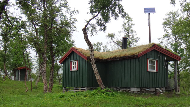
We reached the trail conveniently near the treeline and continued down into the forest. The trail continued through brush all the way to the parking area. After changing clothes and packing our gear we drove, still in continuous rain, to Kilpisjärvi. After refueling we continued to Kolari for the night. The next day we drove home. Notes: Saltfjellet was a rather peaceful hiking area — worth visiting again. The JrGear Venture sleeping pad we tested was slippery; for the rest of the trip I used the Thermarest NeoAir pad. Shell clothing is too sweaty; perhaps a rain poncho would be worth trying in the future.