Routes
Daily stages on map
On our summer 2018 hiking trip, we decided to explore a bit of the Varanger Peninsula National Park in Norway. In recent years, trip reports have appeared online, which sparked our interest in the area. Established in 2006, the national park offers a suitable destination for a few days’ hike for trekking tourists. First, we acquired 1:50 000 topographic maps of the area (3 pcs, Norge-serien Hamningberg, Vardö and Jakoselva). With the help of online trip reports, Google Earth and the topographic maps, some kind of route plan took shape. Based on the map review, there are no very large elevation differences in the area, so easy terrain would be expected. We prepared for independent trekking, meaning we took a tent for accommodation and food supplies for 10 days.
Vadsö, parking area – Nattfjelldal
On Saturday 28 July 2018 at 05:00 in the morning, we started driving from Oulu towards the north. We refueled the car at Kärkkäinen in Ii. Kuivaniemi, Simo, Kemi, Tervola, Rovaniemi, Sodankylä, Vuotso were left behind, until at Saariselkä we stopped at the Kuukkeli shopping center to buy 5 liters of spring water. In Inari we refueled the car again at Neste and had doughnut coffee at the same time. Kaamanen, Utsjoki, Nuorgam, Bolmak, Skippagurra followed, until we turned the car towards the Varangerfjord. We drove along the fjord-side road all the way to the town of Vadsö and there turned onto Markvegen, heading towards the fells.
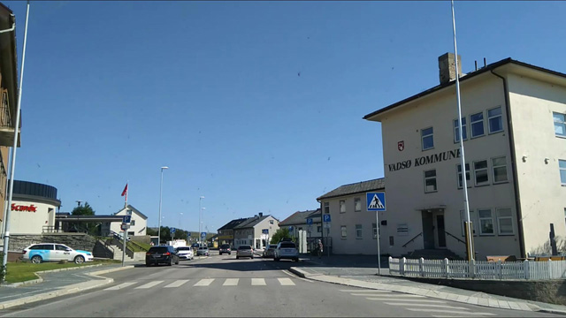
At the end of the road there was a large parking area that had been built recently, where we parked the car at 15:04. At the parking area we prepared a nourishing meal from spring water, a pasta meal packet and canned meatballs, which we then ate. This is a tried and tested meal that gives enough energy to hike even 30 km on the first day of a trek. Then we changed into hiking clothes; due to the hot (+24 degrees) weather, our gear consisted of shorts and a thin shirt. Packing and weighing the backpacks, 22.88 kg and 22.62 kg. There had been a heatwave for a long time in the summer of 2018, and there might not necessarily be water in the terrain, so we both took an extra liter of spring water with us. From the parking area, a marked trail leads towards Nattfjelldal, which we had planned as our destination for the first day. We started along this trail; at first there was a gentle ascent, and due to the hot weather we walked slowly. Soon an older Norwegian man caught up with us, greeting us and, as is customary, asking about our nationality and the purpose of our trip. Reaching back into the recesses of memory for school Swedish, we replied that we were on a longer trek than just a day trip (på langtur) and that we were Finnish. He said that his ancestor had also been Finnish, who had come to Varanger in the 1890s from Sodankylä. He himself was on his way to the family summer cottage a couple of kilometers away, below Nattfjelldal by the stream. He remarked that the fells here are not very high and thus the terrain is easy, but he warned that there would be plenty of boulders once we got a bit further into the fells. He considered our hiking pace a bit slow and us young, to which we replied that everything is relative. He also inquired whether we had hiking experience, which we assured him we did, although in our minds we perhaps placed a small question mark on that. Our walk had progressed to the stream Storelva; we stopped to drink water from the stream and the Norwegian man continued his brisk pace, wishing us good luck. Once the peace of the wilderness had returned around us, we continued to Nattfjeldal; after the last summer cottages were left behind, we crossed the valley stream and climbed up the southern, left side of the valley. We ascended the valley side at a gentle incline, following the edge on dry dwarf-shrub heath. As we progressed, better and better views opened down into the valley; the end of the valley was already like a gorge or canyon, with steep walls and a waterfall at the head of the valley pouring down into the canyon floor.
The waterfall had rather little water flowing in it and we crossed the stream just above the waterfall. Soon we found a suitable tent spot and made camp at 19:40 at an altitude of 327 m; we had covered 8.8 km. For supper we had Reiter pasta with beef and pepper. The weather was still warm and sunny, and there were no mosquitoes. In the evening it was still warm enough to go wash our faces at the stream. Night’s rest began at 22:05; it was not cold.
Nattfjelldal – Björnskardet – Björnskardet – pass
On Sunday 29 July 2018 we woke up at 06:00; it was sunny, cloudless and calm. For breakfast we enjoyed Reiter Hunter’s stew (Beef noodles and mushrooms) and a cup of instant coffee plus 5–7 biscuits. The hot weather continued, and during a long day’s hike the sun exposure would be high, so we equipped ourselves with clothing that covered the skin; shorts were not an option now, instead we wore thin base layer trousers and a thin long-sleeved shirt, gloves, a cap and a thin gauze towel arranged under the cap to cover the neck, ears and partly the face as well; the nose and chin got a layer of sunscreen. We also filled our water bottles in case there would be no water along the way. We started walking at 08:10, heading north. First we would have to cross the 406 m high Steinfjellet fell. Before the ascent we found a stream and drank a few cups of water from it. The crossing of the fell went well and there weren’t too many rocks either. In the next hollow we reached the Ridelva stream, where there was a bit more water flowing; we stopped on the bank for a break and ate chocolate bars. Next up was the 545 m high Falkfjellet fell; we headed north towards the summit and started the ascent on a gently sloping hillside that became increasingly rocky. Once we reached the fairly flat, rocky summit plateau, we noticed with the help of the GPS device that we had come somewhat to the east of the summit. Using the GPS, we then searched for the summit and soon saw the cairn marking it about a kilometer away. So we headed there to conquer the summit.
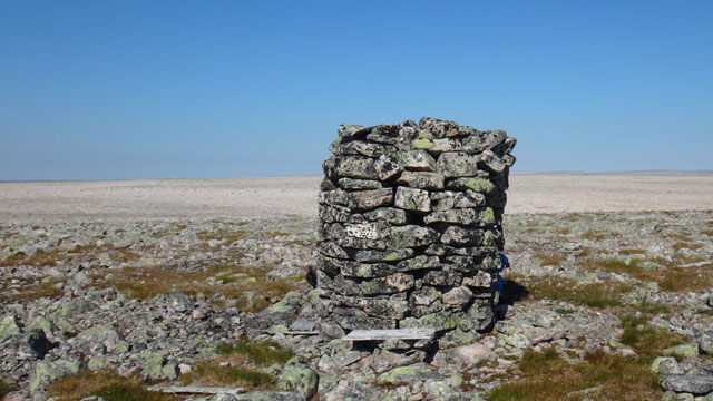
There was some wind on the summit; the cairn provided shelter from the wind and the sun, and we took a break in its shade, eating beef jerky. Our next goal was Björnskardet, a narrow, steep-sided pass between two fells. The northern slope of Falkfjellet was very rocky as well and descended quite gently, making the distance feel long. We took a snack break on the slope, drinking water from our bottles. Eventually we reached the bottom at 300 m and came to a flowing stream. On the stream bank we took another break and ate chocolate bars. Then we followed the stream towards Björnskardet, looking for a place for the tent. We found a suitable tent spot and at 16:34 we made camp on a grassy meadow by the stream at 248 m altitude; the walking distance for the day was 18.8 km.
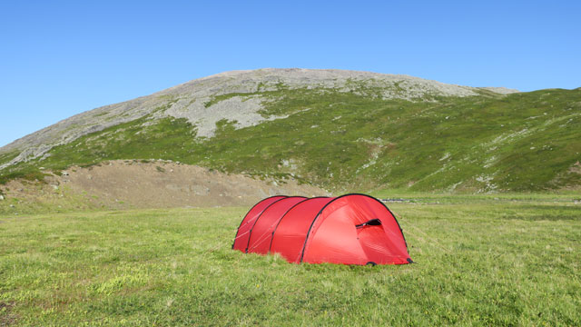
Resting in the shelter of the tent was now needed. After resting, at 18:03 we set off without backpacks for an evening walk to see the Björnskardet pass and the Björnskardhytta open hut on the other side. Passing through the pass was rather difficult due to the rocky terrain and at times steep slopes, but the pass was short and after it the going was easier, although before reaching the hut we had to cross two steep-sided stream ravines (these could have been bypassed from the east, but we went straight). Björnskardhytta is a small open hut maintained by the local Red Cross, with sleeping places for four, a stove, firewood, a gas cooker and other necessary equipment. A small stream flowed next to the hut and behind it there was an outhouse. We took a quick look inside the hut and then started back towards the tent. In the direction of the evening sun in the west, the highest 634 m and 636 m peaks of the Skipskjölen fell group appeared dark. To the east, the Komag river valley continued towards the distant Barents Sea; the higher ridges surrounding the Andre porten river bend stood out from the evening haze. We also saw one hiker down in the river valley, moving eastward. After once again passing through the Björnskardet pass, we reached the tent around 21:00. For supper we prepared Reiter chicken noodle hot pot and ate the rest of the day’s beef jerky portion. At the end of the long day we concluded that the weather had been a bit too hot for walking, but fortunately we had found enough water in the terrain. For the next day we ordered a shorter and easier walking route. There were no mosquitoes here either, and it was not cold at night.
Björnskardet – Skipskjölen
On Monday 30 July 2018 we slept a bit longer; wake-up was only at 06:15. The sunny, hot weather continued. For breakfast we had Reiter pasta bolognese with beef and instant coffee with biscuits. The dehydration and general fatigue caused by the previous day’s hike and the warm weather needed to be corrected, so at first we just rested, sipping sports drink. Our ability to function returned quite quickly. For the day’s walking section we set off at 10:25, again wearing sun-protective clothing. We soon realized we were actually in good climbing form, so we set our sights on the nearby 571 m summit of the fell. We gained elevation quite quickly and views opened up behind us. We were able to avoid boulder fields for the most part, but the steeper final ascent to the fell ridge was a boulder field. The Varanger fells are low, so we reached the summit fairly quickly.
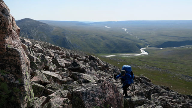
We sat down and took a break, eating chocolate bars. The view extended quite widely; below the 636 m summit of Skipskjölen we could even see a patch of snow. Our next goal was to get our camp near the 636 m summit to have a good setup for a possible summit attempt. From the rocky fell we descended in a west-northwest direction to about 400 m altitude, where the terrain was less rocky and more suitable for walking. Then we continued west at the same elevation. The terrain was dry, and while chewing beef jerky during a break we felt some concern about getting water—would there be any water source ahead that would allow us to camp? Our worries eased when at the next stream marked on the map we found water flowing between the stones. We took a break there, drinking mugfuls of water. The surroundings of the stream were rocky, so it wasn’t really suitable for camping. After refilling on fluids, we continued over a small ridge towards the next stream valley marked on the map. To our delight, we found grassy ground there and at 15:40 we were able to camp on the grassy bank of the stream at 422 m altitude after a 9.5 km day’s walk. There was probably less water in the stream than usual, but still enough. The weather was still very warm, but a wind had picked up and clouds had started to gather in the sky. So already around 17:35 we set off on a summit trip towards the 636 m summit of Skipskjölen. The ascent went easily, though there were rocks. On the summit there were a couple of large tors—rock slabs spared by erosion—surrounded by boulders; on top of the higher tor there was a large cairn. In a hollow of the cairn we found a film canister sealed in a plastic bag, containing a piece of cardboard.
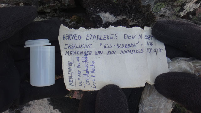
According to the text on the cardboard, three Norwegians had founded the 633 club, which one could only join here on the summit by writing one’s name on the cardboard. We didn’t have a pen with us, so we couldn’t join the club. The view extended in all directions; we saw, for example, an unusually high lake at 548 m to the west, the high escarpment of Krokfjellet to the north, and to the east the beginning of the Sandfjorddalen valley and the Komag river valley. We also went to see the northern side summit of the fell at 614 m before descending, using a snow patch on the slope to get down to less rocky terrain. We then continued to the tent, where we arrived at 20:01. The length of the summit trip was 4.7 km. The sun had gone behind clouds and a few raindrops fell. We ate a Reiter Beef Stroganoff with rice meal. It didn’t rain any more. Night’s rest began at 21:55.
Skipskjölen – Njuvvcagurjavrrit
On Tuesday 31 July 2018 we woke at 06:00; there was a bit of thin cloud in the sky, but also sun, and it shone warmly. A fairly brisk wind blew from the west. We quickly gulped down Reiter peppery beef stew (Rice with beef and pepper), coffee and biscuits in the shelter from the wind. We started walking at 08:22. Another hot day was expected and we again wore sun-protective clothing. Now we took a compass bearing towards the Ragnarokk open hut, which we had seen the previous day from the summit of Skipskjölen.
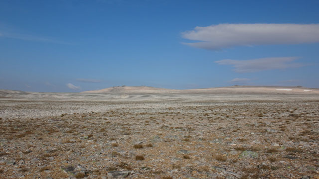
We trekked across a dry, barren gravel and boulder plain, with an occasional tuft of grass here and there; the landscape brought a desert to mind. The hot weather suited the mood. When the hut did not appear ahead of us, we had to dig out the GPS device again and more precisely determine our location and that of the hut. We realized we had walked a bit too far east and the hut would be about 800 meters to our left. There we found the Ragnarokk hut, on the edge of a dry stream ravine. The hut was freshly painted; next to it was a new outhouse still lying on its side, waiting to be set upright. This hut too was maintained by the Red Cross, with four sleeping places and the necessary open hut equipment. As an extra, there was a radio that could be powered by cranking a handle on its side. We cranked and listened, eating chocolate bars and beef jerky at the same time. The program was in Russian at first, but we also found a Norwegian channel. We read the hut’s guestbook and a magazine with an article about the last people in the Svalbard area who died of scurvy in 1920. Fortunately, we had ascorbic acid in our sports drink powder. After the break we headed down along the stream channel next to the hut; a bit lower there was already some water in the stream. We continued following the stream until the channel turned into a steeper-sided ravine. We turned left over a ridge and then descended into the Gargasjohka ravine. The ravine offered a suitable rest spot on the grassy bank of the cheerfully babbling stream; we stopped to refill on water and eat chocolate bars.
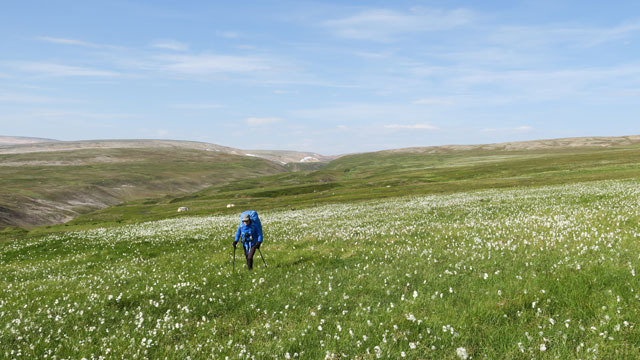
Then we climbed out of the ravine on its north side to a flat, bog-dotted fell heath at just over 300 m altitude. Walking here was easy, as the hot summer had dried out the bogs. In the hot weather we were at risk of drying out too, and we had to drink water at every stream we came across; the morning wind had already died down. When we then saw Björnskardhytta again on the lower slope, we decided to retreat into the open hut for shelter from the blazing sun. In the hut we ate the rest of the day’s beef jerky and read the guestbook. There was also a book about partisans operating in Finnmark during the Second World War and some photo books. One of these dealt with Norwegians’ outdoor life in Finnmark, focusing on fishing and hunting; we did not look more closely at the other works. We rested in the hut and even slept for a while; then, refreshed, we continued the day’s journey towards the Njuvccagur lakes valley to our east. We reached the smaller, southern lake of the valley. We descended, looking for a tent spot, but the lake shore and valley bottom turned out to be wet grassy ground. We walked south along the valley but found no suitable tent site. As the valley ahead also seemed to narrow, we decided to climb up the eastern side of the valley and look for a camp spot higher up. There would be no water there, so we filled our 10-liter container with water and only then started up the slope. We didn’t have to climb more than about 40 meters in elevation before we found a fairly flat and dry-looking tent spot. We made camp at 18:37 at 232 m altitude; the day’s walking distance was 16.1 km. This was already the fourth hot hiking day and the warmest so far. The chocolate bars in the backpack had softened badly in the heat; Marabou Dubbel Nougat had turned completely liquid and, worst of all, its wrapper had opened and the liquid had spread into the backpack. Cleaning operations followed. For the evening meal we enjoyed Reiter chicken risotto. The evening continued calm and sunny; as the evening went on, the worst heat eased. I took an evening walk to a small lake about half a kilometer higher up the slope and went for a dip. After that I felt light as I bounded back down to the tent; the scenery was beautiful in the golden evening sun.
Njuvvcagurjavrrit – Langryggvatna
On Wednesday 1 August 2018 we woke at 06:00; the weather was still sunny and calm, and another warm day was ahead. For breakfast we had Reiter noodle pot carbonara (Pasta Carbonara with ham), plus instant coffee and biscuits, as per our morning routine. We had been entertaining the idea of visiting the Sandfjorddalen area, possibly Telegrafhytta, if our walking condition, the weather and other conditions allowed. On the map there seemed to be a couple of slightly larger lakes in that direction, Langryggvatna, which would likely have water and thus offer a chance to camp. We decided to head for these lakes. Sun-protective clothing and other gear were again in use; we set off a bit after 08:00. Our direction was straight towards the lakes; the terrain was fell heath, with some rocky sections. Some clouds appeared in the sky during the morning, and there was a bit of wind. After 6 km of walking we took a chocolate bar break northeast of Ovllanddeoaivi, from where the remaining part of the day’s route was clearly visible. The journey continued across a fell plateau; the bogs here too had dried out, there was some grassland, the ground was cracked from dryness and we saw dried-up ponds. Now the terrain brought to mind a savanna, a treeless one. Some antelope patrols seemed to be moving in the distance. This plateau was enlivened by a couple of cross-cutting ravines with streams flowing and greener grass. At the 12 km mark we took another break in a stream ravine and ate chocolate bars. We then trudged over the last ridge and got a view of the Langryggvatna lakes. At 14:05 we made camp on the northwestern shore of the larger, southern lake at 253 m altitude; the day’s hiking distance was 11.9 km.
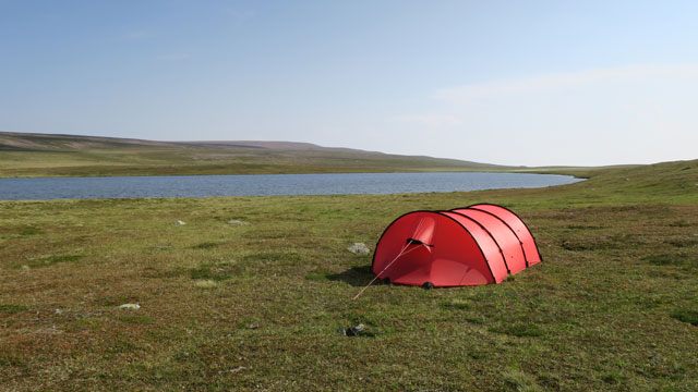
The roughly fifteen swans that had been staying on the lake were not interested in our company, but quietly departed toward the south‑southeast, some flying, some walking. The not‑so‑quiet gulls remained on the lake. We got our camp water from the stream flowing into the lake from the north; there were plenty of signs of swan activity in the terrain, and the water quality caused some concern. The weather remained hot, the lake water was fairly warm, and it was possible to swim a little. The oppressive heat then turned into a thunderstorm, with a few raindrops falling. The thunderstorm did not come directly over us; a southwest wind carried it past us via the north. At the end of the day, dinner was Reiter chicken curry with rice (Chicken korma curry) topped with salted peanuts. Before going to sleep, we considered the next day’s plan. We estimated that our trekking condition would not allow us to continue all the way to Telegrafhytta, because we needed to reserve time for returning to the car. Instead, we could make a day trip to Telegrafhytta; without heavy loads it would be easy to make a round trip.
Langryggvatna – Telegrafhytta – Langryggvatna
On Thursday 2 August 2018 we woke at 05:00; the weather was still warm and sunny, and we noticed the wind had shifted—now it blew from the north. Breakfast was Reiter hunter’s stew (Beef noodles and mushrooms), coffee and biscuits. Equipped with sun‑protective clothing and only the necessary day‑trip gear in our packs, we started walking at 06:40. The direction was first north, climbing to about 300 meters. At the same time more clouds appeared in the sky and the wind strengthened. When we reached a side ravine descending into Sandfjorddalen, the wind was already quite strong and we had to hold on to our caps so they wouldn’t blow away. We turned northeast, following Sandfjorddalen along its southern side at about 300 m altitude. At the upper end of the next steep side ravine there was shelter from the wind and water available, and we took a break with a chocolate bar. Continuing on, we came to a point where the slope down into Sandfjorddalen was quite steep; here the wind was so strong it made us stagger, and taking photos was difficult due to the shaking. Still, the journey progressed, and after passing a few more side ravines we finally reached the ridge descending toward the Sandfjordelva near Telegrafhytta. We descended the ridge and, upon reaching the riverbank, searched for a suitable place to cross. The river had enough water that it required wading. The best crossing point was found upstream of a small island in the river, where the current was weaker and the water not too deep. Having learned from our 2017 wading experience, we removed our long trousers before crossing, changed into Feelmax wading shoes, and put on shell jackets to maintain thermal balance. The water was very cold here, but the crossing went easily; the water reached up to our knees.
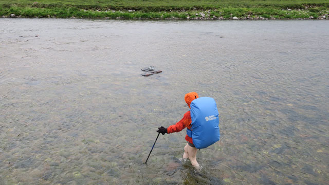
We then walked to Telegrafhytta, arriving at 11:20, and sitting on the bench in front of the hut we dried our feet and put our long trousers and hiking boots back on. According to the sign on the hut wall, Telegrafhytta is maintained by the Vardö sports fishing and hunting association. The hut was in good condition, and even the roofing felt looked new. In the vestibule a new outer door was waiting to be installed. The hut had four sleeping places, a stove for heating, and a gas cooker in the vestibule. We took a break inside, read the guestbook—there was no other reading material. Our snacks were chocolate bars and beef jerky. Outside, the weather became more overcast and the sun no longer shone; the wind was strong here as well. Before long we concluded that it would be best to start the return trip so we would reach the tent before evening, since this was a day trip. Up on the fell the wind had been too strong, so we decided to return down in Sandfjorddalen, following the riverbank. From above it had looked like the southern bank would be easier to walk; on the northern bank the riverbank seemed to drop steeply into the river in places. So we waded across the river again and started walking along the valley, following reindeer paths—sometimes through tall grass, sometimes through dwarf‑shrub heath. Even down in the valley the wind was strong and gusty.
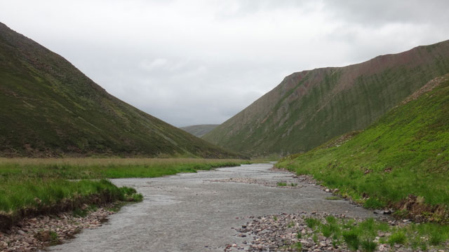
Following the reindeer paths went well until we reached a point where the riverbank was steep rock, and the river seemed to have a lot of water and current at the base of the cliff. The only option was to follow the reindeer path and bypass the steep rock from above. Even above the cliff the side slope was quite steep, and the gusty wind occasionally affected balance, making this section rather exciting. We managed without mishap. Soon, however, rain began and we had to put on shell clothing. Then we turned away from Sandfjorddalen, following a gently rising side ravine toward the south. The wind and rain now came from behind, making the going easy. We reached the tent at 17:40; fortunately the tent had survived the strong wind without damage. The day trip totaled 24.1 km. On previous days the temperature had been over 25 degrees; now it was only 14 degrees with rain and wind. Since it was already evening, we ate Reiter chicken risotto and salted peanuts and went to sleep at 20:00.
Langryggvatna – Skallelva
On Friday 3 August 2018 we woke at 06:00; the weather was foggy with drizzle, the wind was light, and the temperature outside was 11 degrees. Breakfast was Reiter pasta with beef and pepper, followed by instant coffee and biscuits. The rainy weather slowed down the morning routine. We studied the day’s route on the map; the goal was the bridge crossing Komagelva, which to our knowledge is the only bridge in the national park. It is not marked on the map, but we knew its location. The challenge in the foggy weather was finding the bridge, as visibility was limited. For some reason on this hike I had become enthusiastic about using the compass for navigation, and now the text at the bottom of the map revealed that here the compass points almost 15 degrees too far east. The error is presumably due to the magnetic north pole not being where it “should” be but drifting around. This explained why earlier we had not hit the Falkfjellet summit or the Ragnarokk hut directly. Fortunately, we could still trust the American satellites. We set off at 08:50 wearing shell clothing. Despite everything, we took a compass bearing and proceeded across fairly even fell terrain. Walking was easy, and there were enough lakes and other features in the terrain to keep us oriented. At one pond there was a swan with four cygnets; the cygnets took flight, while the adult stayed on the pond waiting for them. Then ahead of us rose Ryggfjellet, a several‑kilometer‑long fell that fortunately is not very wide. The fell’s damp boulder fields slowed progress a bit. From the ridge we headed for a break in a ravine starting from a 296 m lake; it offered shelter from the wind, which was not very strong, but under the shell jacket the shirt was wet, and stopping made it easy to get chilled. After eating chocolate bars we descended to just over 200 m onto a flat bog area. The bog was still fairly dry and easy to walk, but the cloudberries were ripe, and eating them slowed us down. Next we descended into a valley where the Hubejohka flows; blueberries grew on the slope. Despite this, we soon reached the Komagelva bridge. There a group of Norwegian‑looking outdoor enthusiasts were gathered with fishing rods. Some sat on the riverbank, some walked back and forth on the bridge, and there were people sitting on the opposite bank as well; one person stood in the river fishing. We waited on the bank until the group settled and the bridge was free again. Komagelva flows between steep banks at the bridge, and crossing it by wading would have been difficult here.
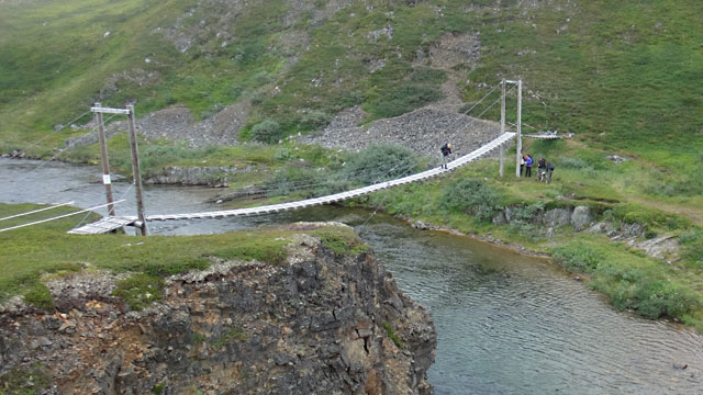
We crossed the river and then climbed a steep slope to about 160 m altitude and stopped for a break. We ate chocolate bars and beef jerky and studied the map. Ahead was a fell ridge, through which a winding valley seemed to run, with a stream and ponds according to the map. We hoped to find a good campsite there. Continuing on, we entered terrain shaped by glacial meltwater—so‑called kame terrain. We saw a terrace, mounds, and even a fairly deep depression, a kettle hole left by a melting block of ice. The valley we were heading toward was apparently a marginal meltwater channel. However, there was no water in the valley anymore; the stream and ponds had dried up. As we progressed, visibility worsened; the valley sides guided our movement until at about 250 m altitude the valley ended. Using the GPS, we headed toward a 263 m pond; the terrain there was wet and did not offer a good tent spot. We climbed to 280 m between two banks for shelter from the wind and took a break, eating chocolate bars. From there we decided to head west toward Skallelvskardet to look for campsites. In the fog we could not see much of the scenery; the terrain became quite rocky. Through the fog we heard Skallelva before we saw it; judging by the sound, the river flowed over bedrock. Soon the rock appeared, and then the river came into view. We crossed the river on stones. The terrain was uneven and rocky, and we found a tent spot only after walking a good distance downstream.
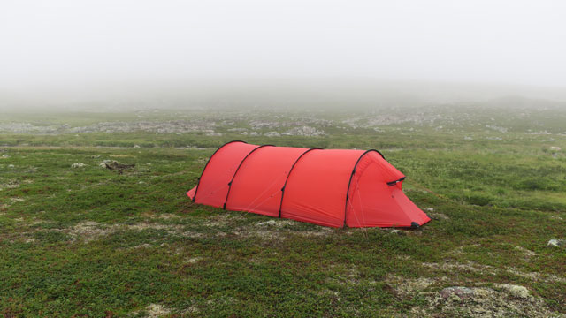
We camped on the bank of Skallelva at 17:32 at 205 m altitude; during the day we had walked 20.4 km. For supper we ate Reiter beef stroganoff with rice and salted peanuts. Night’s rest began at 20:00.
Skallelva – Nattfjelldal
On Saturday 4 August 2018 we woke at 06:00; outside the weather was still foggy, but it was not raining and there was no wind. It now seemed that our hike would not last the full ten days, so we had to make difficult decisions about which of the delicious Reiter meals we would forgo and which we would eat. This morning’s breakfast was Reiter pasta with beef and pepper. After that we drank instant coffee and ate biscuits. We packed our things and set off at 08:55, heading for Stabbursdalen, marked on the map, where the Aitejohka flows. We thought we might find the next campsite there, and likely water as well. Visibility improved during the morning; the weather brightened and even some sun appeared. Soon we had to remove our wind jackets. The terrain was hilly, with some rocky areas and some dry streambeds; nothing particularly memorable. We progressed first at about 250 m altitude, then climbed a bit higher. After about 8 km we took a break and ate chocolate bars. Then the journey continued; the terrain became even rockier. We then reached the next named river on the map, the Ridelva.
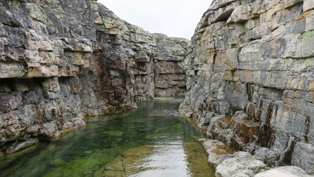
Here the river flowed in a canyon carved into the rock, which was in places quite narrow and steep‑walled. We descended into the canyon and crossed the river on stones. We took a chocolate bar break and examined the canyon more closely; compared to the rest of the day’s terrain it was quite interesting. Then the journey continued; we finally reached Stabbursdalen, but there the water was very low and there was no flat tent spot, so we decided to continue to the next stream. There was no flat ground there either—only a downward‑sloping side hill. A fairly large herd of reindeer galloped past us up the fell. We continued all the way to Nattfjelldal, descended into the valley, and on the grassy bank of the river we found a campsite; a few birches grew in the area.
We camped around 17:00 at 171 m altitude; the day’s walking distance was 17.8 km. During the afternoon the weather had become cloudy; the temperature outside was 18 degrees. Soon it began to rain. Among the many dinner options, the final choice was Reiter noodle pot carbonara (Pasta carbonara with ham). Later in the evening the rain paused and I tried to take an evening walk into the Nattfjeldal canyon, but then the rain started again and I returned to the tent. Night’s rest at 21:00.
Nattfjelldal – Vadsö, parking area
On Sunday 5 August 2018 we woke at 05:00; the weather was still rainy and the clouds were low. Reiter peppery beef stew (Rice with beef and pepper) became the last meal of this trip and was eaten in silence. This was followed by the instant‑coffee‑and‑biscuits ceremony. We packed our things under the outer tent and finally packed the outer tent as well. The rain had already stopped when we started hiking the final stretch to the car shortly after 07:00. The trail was already familiar and did not inspire much enthusiasm. At the Storelva bridge we again drank water from the stream. From behind us on the right, from the direction of Frökendalen, a rain area arrived with the wind and reached us shortly before we got to the car; fortunately the rain was not heavy. We arrived at the car at 09:08 at 92 m altitude; the walking distance for the day was 5.9 km. The total walking distance of the entire hike was 146.2 km.
Hike 2018
We weighed the backpacks and changed clothing. Then we started driving, this time circling the southern shore of the Varangerfjord to Sevettijärvi, where we stopped for doughnut coffee. The car was refueled again at Neste in Inari, and the journey continued south.
Notes: not once during the nights did we feel cold. Using the map and compass while walking was interesting, and perhaps necessary in the terrain of the Varanger Peninsula, because the terrain does not guide movement the same way as the large fell valleys of Sweden. A positive feature of the terrain is the complete absence of brush. Other characteristics include the low height of the fells and the long, gentle shapes of the terrain; crossing and bypassing fells requires some patience. The most idyllic features of the terrain are the numerous stream valleys and ravines. The western and northern parts of the national park would be worth exploring someday.