Routes
Daily stages on map
The fells south of Abisko, the “Abisko Alps”, have become a favourite hiking destination for me. Abisko has a good and free parking area, and from there it is easy to reach the fells along established trails. The mountains are fairly close and in some places you may even get phone signal. The terrain is quite easy, with no brush. So I decided to head to that region again for my autumn solo hike, especially since we had already visited the Pältsa area, my other favourite, during the summer trip. Of course, the preliminary plan again included a possible visit to the Mårma area.
Friday 8 September 2023 Driving, food stop in Pello, refuelling and overnight stay in Kolari.
Abisko Turist parking area – Gaskariehppi
On Saturday 9 September 2023 wake‑up at 04:00, driving at 04:20. There were roadworks between Pajala and Junosuando, so I had to drive slowly. I arrived at the Abisko Turist railway station parking area at 07:38 after 300 km of driving. I changed into hiking boots and shouldered my backpack, which weighed about 21 kg. The weather was cloudy but dry, +15°C, hardly any wind. At 07:54 I headed up into the birch forest to look for the trail leading to Bajip Njahkajavri, which I soon found. The autumn colours had not yet properly appeared. I continued past the lake; the trail narrowed slightly as it approached the Nissonjohka canyon. At the last stream before the canyon I filled one water bottle, since higher up there might not be streams. I couldn’t really get a view into the canyon; I didn’t want to descend lower because the slope was steep and brushy. I saw three hikers on the opposite side. My main interest, however, was directed upward towards Nissonsnuohkki; the final ascent looked rather steep.
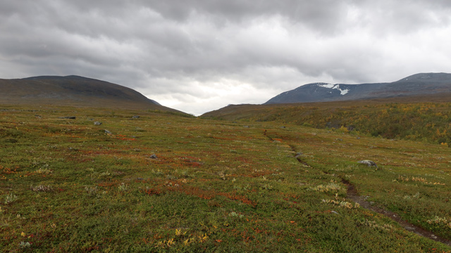
I reached the top without major difficulty, using my hands for balance in a few places. I continued towards the 1374‑metre summit; the wind now strengthened considerably. Behind the summit, in shelter from the wind, I took a break, ate a chocolate bar and drank some water. I had my own GPS device with me for the first time, and it showed that I had walked 12.69 km. I continued along the ridge; it was quite rocky and the wind was bothersome. I descended slightly, then climbed again above 1500 metres. After this ascent my strength began to fade; I decided not to go all the way to the summit of Nissoncorrú, since I had already visited it on the 2017 trip, and instead cut below the summit plateau towards the south. On the rocky side slope I stumbled a bit and even fell, but fortunately without injury. I noticed a small stream on the slope and scooped water with my mug, eating a chocolate bar at the same time. It felt like I had had enough mountain hiking for the day. I reached the ridge at 1600 metres, continued to the intermediate summit at 1645 metres, and from there followed the ridge southwards. There was a small dip in the ridge with pleasant views down into Nissonvaggi.
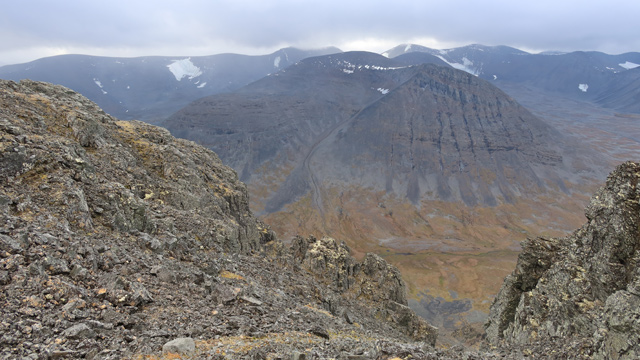
I continued along the ridge until the slope downwards became gentler. I descended the rocky and grassy slope; my legs felt weak. Still, I reached the valley. I took a break by a stream; it began to rain lightly, so I put on my shell clothing, ate a chocolate bar, and sent an “all OK” message home with the GPS device — I had walked 20 km. I climbed out of Nissonvaggi into Gaskariehppi and walked to the southern shore of the lake at 1131 m. Finding a tent site took time; it was difficult to find a flat, stone‑free spot. Eventually I found a place between two small stream branches. I had a one‑person tent with me, which didn’t require much space. The wind remained strong and pitching the tent was challenging; I had to crawl on top of it to keep it from flapping too much. I anchored the windward guy lines by looping them around a trekking pole (yes, I had bought new poles since the last trip — two Leki Sherpas helped distribute the load) and placing large stones on top of the pole. I got into the tent at 17:31; distance covered 24.07 km, time 9 h 53 min, ascent 1950 m, descent 1208 m.
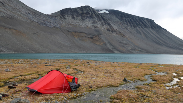
I had managed to walk the first day’s route as planned, but it felt like it had required far too much effort; with a heavy pack it was difficult to climb the ridges and summits. In addition, the wind was now too strong for ridge walking, it was raining, and the clouds were low. So the trip plan had to be updated to match reality — as has been necessary on almost every hike. I drank some sports drink in the tent. Then I ate a Reiter meal and a couple of slices of bread with salami. The tent was comfortable enough when lying down. It wasn’t cold. The rain stopped during the evening. During the night the wind eased, the sky cleared, and a crescent moon appeared in the northeast; stars and even northern lights were visible.
Gaskariehppi – Siellajohka
On Sunday 10 September 2023 the wind strengthened again in the early morning; the tent roof occasionally pressed against my face and I had to support it with my hands during gusts. Rain came with the wind as daylight arrived. I ate the rest of the Reiter meal and drank morning coffee. I considered my options — should I wait for better weather? I requested a weather forecast with the GPS device: 100% rain today, 90% tomorrow, 100% on Tuesday, and snow on Wednesday. So no improvement anytime soon. The tent site offered no shelter from the wind, so I decided to move to a better place. While packing, the wind shifted and soon one end of the tent came loose and flapped wildly. I packed quickly and headed down towards Nissonvaggi. Lower down the wind was weaker and the rain soon stopped. I walked north along the valley edge and soon reached the campsite from the 2017 trip. There the wind was strong again. I continued west past Pallentjåkka; the terrain was easy but the headwind was fierce. I climbed onto Ballinsnuohkki, where there is an old stone reindeer fence. Here the wind was strong enough to make walking difficult; my beanie almost flew off and the rain cover wouldn’t stay on the pack. I descended quickly into Ballinvaggi; it was windy there too.
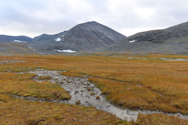
There were no sheltered tent sites in Ballinvaggi. I sent an OK message with the GPS and continued walking, eating a chocolate bar as I went, and turned towards Siellavaggi. I walked to the reindeer herder’s hut in Siellavaggi, arriving at 14:10 after 14 km. I went inside; there was no wind indoors. I boiled water for coffee and ate biscuits. Then I tried pitching the tent on the sheltered side of the hut, but it didn’t work — the hut didn’t provide enough shelter and the wind tossed the tent too much. I concluded that camping in such wind wouldn’t be pleasant anyway. At 15:15 I headed lower into the Siellajohka ravine. I crossed the stream dry‑footed and soon found a sheltered tent site.
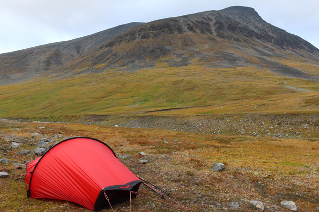
I reached the tent at 16:01; distance 700 metres, elevation 912 m. The day had been extremely windy and now the weather was cooling. I decided to monitor the weather here; sheltered tent sites were scarce. From here I could make a day trip to Adnjetjårro or Giron, and Siellavaggi offered an easy route down to Kungsleden and out if the weather became impossible. I ate another Reiter meal, drank cocoa and ate bread. During the night there was wind and rain, and it was chilly. Still, I wasn’t cold — I now had a Thermarest NeoAir Xlite NXT pad (R‑value 4.5) and a WM Alpinlite sleeping bag (Tcomf –7°C).
Adnjetjårro
On Monday 11 September 2023 the rain continued in the morning; no hurry to get up. I fetched water from the stream and then ate the morning Reiter meal and drank coffee. The rain stopped and the clouds lifted. I decided to go on a day trip towards Adnjetjårro. At 09:04 I began climbing the slope; the route was familiar from the 2019 trip, though this time I followed the right side of the stream. The ascent was fairly steep and I got hot because I had put on my shell clothing. The sun occasionally shone through the clouds. I soon reached the 1400‑metre saddle. I didn’t bother climbing Siellanjunni (1457 m), having visited it in 2019. Instead I headed for the 1489‑metre summit. The ascent was easy and from the summit there were views all the way to Norway. The ridge continued fairly level, so I kept going. I reached an edge with a view down to the glacier below. From there a somewhat steeper rocky ascent of about 300 metres brought me to the highest summit of Adnjetjårro. The wind was strong and cold. I took some photos but didn’t stay long.
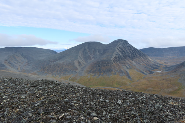
I descended the ridge in the rocky terrain and reached the saddle where a small glacier descends to the left. I took more photos and jogged uphill to the 1649‑metre summit to warm up. From there I looked towards Siellacohkka (1637 m); it was 2.3 km away along a wide and fairly level ridge, and the same distance back, since the route down to Siellavaggi started from here. I left Siellacohkka for another time and began descending the rocky slope. Soon I reached shelter from the wind. The slope was steeper at first, then gentler. I watched the nearby glacier for a while, then walked calmly down into the valley, drinking from streams along the way. On flatter ground I sent a message home, then followed the valley edge towards the tent. There was now a tailwind and darker rain clouds approaching. Rain began shortly before I reached the tent. Inside I waited for my damp clothes to dry under the shell jacket; the thin base layers dried quickly from body heat. I drank cocoa and ate bread and biscuits. A helicopter flew over the tent towards Ballinvaggi, soon returned and continued southeast along Siellavaggi. When my clothes were dry, I changed into night layers and a down jacket and got into the sleeping bag. The day trip was 11.04 km — a good outing with some views, though I forgot to eat the day‑trip snacks. In the evening I ate a Reiter meal. The rain continued; I thought it might soon snow. Later I snacked on salted nuts and a protein bar and drank sports drink. The rain stopped, the wind continued.
On Tuesday 12 September 2023 the night was still reasonably warm; it rained heavily at times. In the morning the clouds were low. I went down to the stream for water; the stream was in a fairly deep ravine here. I prepared and ate breakfast, then made coffee. I considered a day trip but decided against it if the cloud didn’t lift. A helicopter flew overhead again. The rain clouds stayed low.
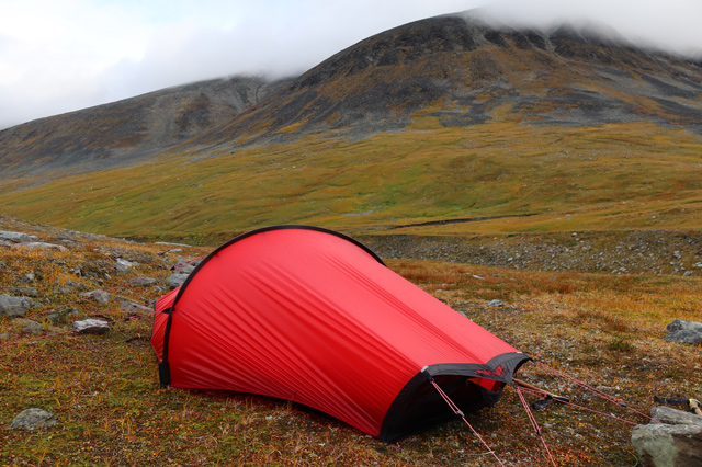
Around noon I made more coffee. It wasn’t cold. My Akto tent has an inner height of 93 cm; the fully inflated sleeping pad is 7.6 cm thick, so the maximum living height was 85.4 cm. My straight‑back sitting height is 101 cm, so I had to lie down. The rain continued almost nonstop and the cloud didn’t lift. Temperature was +6°C. This became the first full rest day of my entire hiking career. When the rain paused briefly, I went down to the stream to arrange stones to make crossing easier, but the rain soon returned. At 18:30 I prepared and ate a Reiter meal. Around 21:00 I made cocoa and ate biscuits and a chocolate bar. It rained during the night.
Hoŋga and the 1792 m summit
On Wednesday 13 September 2023 wake‑up at 06:15; the clouds were low, it was raining, temperature +3°C. Higher up it had snowed during the night. I ate breakfast, drank coffee, and ate bread and biscuits. Waiting for better weather was pointless — it was time to move. I planned to spend this day still in the mountains and leave the next day. At 07:50 I set off with day‑trip gear along Siellavaggi towards the southeast. The rain had conveniently stopped. I crossed the stream, as I thought the eastern side of the valley would be easier; the terrain was familiar from the 2010 and 2022 trips. I walked slowly to avoid overheating. Ahead, the clouds broke and sunlight came through.
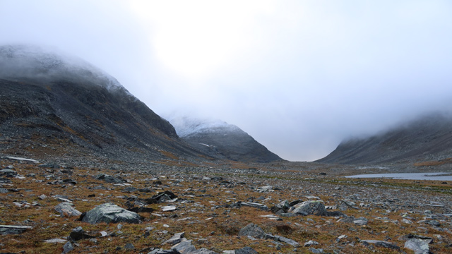
Soon a bit of blue sky appeared. Reaching the second lake at 1110 metres, I took a break, cleaned the camera lens, ate an energy bar, and drank from the stream. At the same time strong wind and thick cloud came from the northwest along the valley, and it began to rain. I filled my water bottles and then began climbing the slope to the left. The initial ascent was fairly steep but walkable. Higher up the slope eased, the wind weakened, and the rain turned to snow. There was some snow on the ground. I continued up a rocky gully with limited visibility. Finally I climbed a steeper side slope and reached the saddle between Hoŋga (1725 m) and the 1792 m summit. From there I climbed the snowy rocky slope towards Hoŋga. The wind strengthened again and visibility was poor. The ascent was steadily steep; soon I was on the summit.
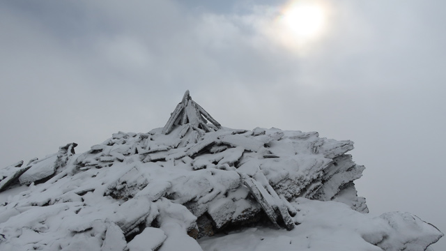
From the summit there was a drop to the south; I didn’t dare step onto the very last metre of the summit because the wind from behind was so strong. I took a couple of photos. Then I returned down to the saddle. There I ate an energy bar and drank some water from the bottle. At times there was a hint of sunlight. Next I began climbing the slope towards the 1792 m summit. According to the latest measurements it is the highest peak in the Abisko Alps, so I had to visit it. The slope was rocky and snowy, fairly steep but otherwise easy to climb. The clouds broke occasionally and I caught glimpses of Hoŋga’s summit and down into Alisvaggi.
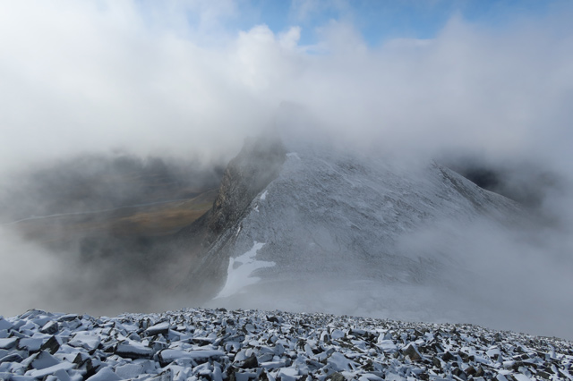
The summit was flat and very windy. I could see the upper part of the ridge descending southeast, and briefly down into Guhkesriehppi as well. I took some photos. While admiring the views and snapping pictures I suddenly noticed that the shell mitten was no longer on my right hand. I remembered taking it off to use the camera. I searched for it for a moment, but it was gone — the wind had taken it. Fortunately I still had a windproof ski glove on, so my hand didn’t get cold. Darker clouds now arrived at the summit and the weather turned gloomy. I headed along the gentle ridge towards the 1776 m summit; I had visited it already on the 2022 trip and knew that from there it was easy to descend towards Ballinvaggi. On the 1776 m summit visibility was still poor; I checked the direction on the GPS and turned north. The slope was fairly steep; I realised I was slightly too far west, corrected my direction, and soon visibility improved and I saw the edge of the ridge leading down. I reached the ridge, from where there were views down into Gaskariehppi, Nissonvaggi and Ballinvaggi.
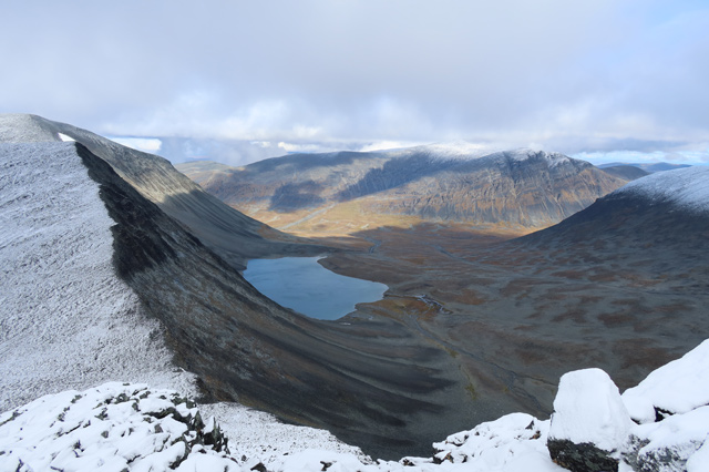
I took photos for a moment, then walked along the level ridge to the 1646 m summit. I looked towards the 1628 m summit and considered visiting it as well. For that reason I descended straight down to the saddle rather steeply. In the saddle I reconsidered and decided to leave the 1628 m summit for another time — my legs were getting tired. I walked down into Ballinvaggi, drinking from streams along the way. I sent an OK message home, then continued into the valley between Ballinvaggi and Siellavaggi. I counted that this was already the eighth time I had walked this valley; the terrain was becoming familiar. I passed below the reindeer herder’s hut, and at the same time it began to hail. At the stream I filled my second bottle; the other was still full. I reached the tent at 15:33; the trip duration was 7 h 52 min and the distance 18.59 km, with 1282 m of ascent and 1319 m of descent. At the tent I put on wool socks and a down jacket and placed my feet inside the sleeping bag. Then I made coffee and ate biscuits. Hailstones rattled against the tent fabric. Good weather was forecast for tomorrow, and I had already decided to leave the mountains. I had now covered these Siellavaggi peaks quite well; I should still visit Guhkesriehppi someday. I ate the evening meal before going to sleep.
Siellajohka – Abisko Turist parkkipaikka
On Thursday 14 September 2023 I woke at 05:00; it was still cloudy, a little snow/hail had fallen during the night, but it was no longer snowing.
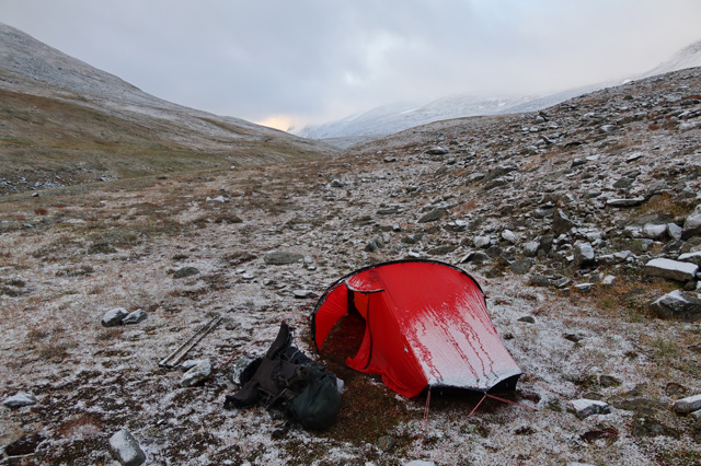
After the Reiter meal I drank coffee and ate bread. The weather was fairly cool, with hardly any wind. I packed my things and the tent; I had stayed at this camp for four nights. I walked along the side of Siellanjunni, trying to maintain altitude. Lower down the Siellajohka ravine had steep sides and some brush; higher up it was easier to walk. After a while I saw down between Giron and Garddenvarri — the sun was shining there. I then descended into Garddenvaggi, crossed the stream on stones, and the terrain here was wet meadow. I climbed higher onto drier ground, then took a short break to change from shell clothing into fleece trousers and a wind jacket.
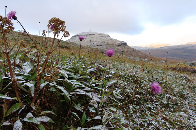
I continued up the slope to Kungsleden. There I immediately met a hiker who praised the weather for finally being good; I didn’t mention that it was thanks to my decision to leave the mountains. I continued along Kungsleden, passing some hikers and meeting others. The sun was shining and there wasn’t much wind. Walking on this “highway of the mountain world” was rather dull; I focused mainly on keeping up the pace. After the Tältlägret junction I moved to the higher trail along the ridge and stopped for a break; I had walked 17.58 km. I ate a bar and drank water. Then I walked the remaining distance to the car, arriving at 12:32; the day’s walk was 22.65 km. Then I drove 623 km home.
Notes from the trip: I need to buy shell mittens. I also need to try to lighten the backpack and load further — maybe then I could finally reach the Mårma area.