Routes
Daily stages on map
Nikkaluokta – Laddjuvaggi
On Monday, June 27, 2005 we woke at 4 a.m. and began the drive north. At Aavasaksa we stopped at a service station for coffee and pastries. The station sold gas canisters, so we tested the ones we had with us in the parking lot — and as it turned out, one 450 g canister didn’t work. We bought a new one, which worked fine. The journey continued into Sweden via Överkalix, Gällivare and Kiruna. In Kiruna we drove around the town and ate pizza, then continued toward Nikkaluokta. Along the way the steep cliffs lining Laddjuvaggi began to appear.
At Nikkaluokta we got out of the car and changed clothing, putting on the full outfit: base layers, wind pants and jackets, caps and gloves. A bus also arrived at the same time. We started walking around 1 p.m. in warm, sunny weather with a light westerly wind. The trail was easy through birch forest, with one river crossing via a bridge. Along the way a busload of hikers overtook us. After less than two hours of walking we reached the boat dock. The boat was leaving in half an hour, so we waited and took photos.
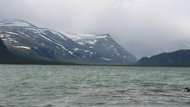
All hikers present fit into the boat. The boat trip to the western end of Lake Laddjujärvi was about 6 km and cost 130 SEK per person (round trip 200 SEK). After the boat ride we continued along the trail in a line with the others from the boat. As we approached the bridge over the river coming from Tarfala Valley, the group had already spread out and we were walking alone. After the bridge the Fjällstation was ahead of us. We passed it on the south side and climbed the hill next to the station to take photos and eat chocolate bars.
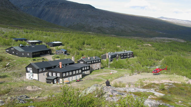
We then continued along the trail toward Västra leden and followed it for a while. We saw one tent lower in the valley; no other hikers were visible. About three kilometers from the Fjällstation we pitched the tent. The slope was already quite steep and it looked like there would be no tent sites further ahead. There were no signs for Östra or Västra leden — presumably they had not yet been put up after winter. Pitching the tent (Nallo 3 GT) was somewhat difficult. The last time we had pitched it was once in summer 2004, and a few times in summer 2003 (see the 2004 and 2003 trip reports). It felt like we had too few stakes, and we had to secure a couple of guy lines with rocks. Later we realized the stakes were the correct number — some had simply been placed in the wrong spots. The weather was clearing and cooling, with no wind. We camped around 8:15 p.m. at 840 m elevation. For dinner we prepared a 250 g Reiter meal and coffee, and ate cookies. The stove (Pocket Rocket) worked well. The tent site was poor — uneven and sloping — and despite wearing plenty of clothing it was cold at night. Because of this, and the evening coffee, we slept very little.
Laddjuvaggi – Kebnekaise – Tjäktjavagge
On Tuesday, June 28, 2005 we woke at 4:30 a.m. The sun was shining from the northeast, it was calm and cold, and the thermometer outside the tent showed +1°C. The peaks of Tuolpagorni and Vierramvarri were visible from the campsite, with a cloudless sky behind them. Since the weather looked good, we decided to continue along Västra leden toward Kebnekaise. If the weather had been poor, the alternative would have been to follow Laddjuvaggi to Singistugan.
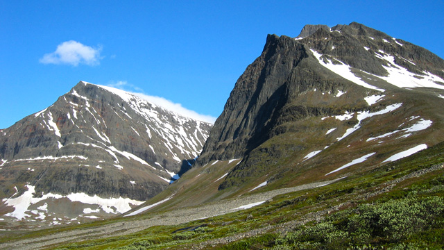
For breakfast we prepared a 250 g Reiter meal and coffee, and ate cookies. We dried and packed the tent, packed our backpacks, and set off around 7:00 a.m. No jacket was needed. We applied sunscreen (SPF 20) to exposed skin. We followed the route along Kittelbäcken, climbing the steep edge of the ravine. We reached the stream’s source shortly after 8:00, crossed it on rocks, took a break, drank water, and took photos. We continued upward toward the saddle between Tuolpagorni and Vierramvarri. Most of the ascent was on snow, fairly steep. We reached the saddle around 9:20, sat down, ate a chocolate bar and nuts, and took photos. The air was calm and the sun now shone from the east. It was warm with hardly any clouds. We then continued up to the summit of Vierramvarri (1720 m), arriving around 10:40. We took another break there — warm, calm, some snow on the summit, and plenty of photography. We descended from Vierramvarri into Kaffedalen. The slope was snowy and steep, making the descent difficult. On the slope we met a Finnish hiker who had started at 3:00 a.m. and had already been to the summit of Kebnekaise earlier that morning. In Kaffedalen we took a break, ate Russian salami and cookies, drank the rest of our water, and tried to fill our bottles with snow, hoping it would melt during the ascent. Shortly before noon we began climbing the slope of Kebnekaise. The slope was steep and snowy, and the ascent slow. We reached Toppstugan around 13:05. There we took a break, ate chocolate bars, and took photos. Snow was melting on the metal roof in the sun, dripping from the eaves — I filled my bottle from this, which took some time.
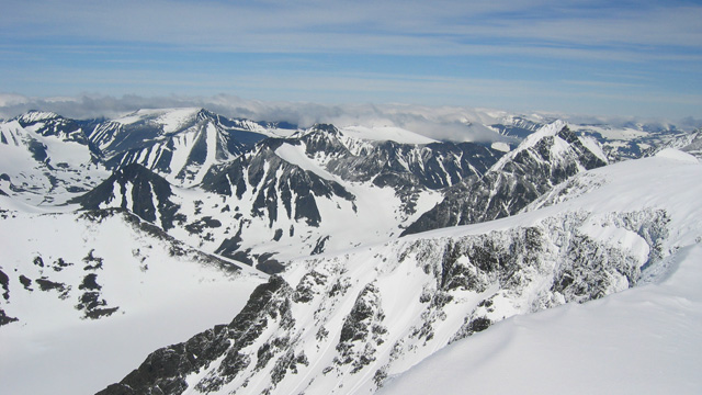
We continued to the summit, arriving around 14:00. The weather was calm and sunny, warm, with good visibility. There was plenty of snow in the landscape. We took photos. The snow and constant sunlight were dazzling. We then began descending. On the slope we met five hikers coming up. Back in Kaffedalen at our backpacks we took a longer break, melted snow for water with the stove, and together with the remaining water in my bottle this was enough for a fruit‑soup‑and‑muesli meal. It was still very sunny and warm. We then headed for Durlings leden, descending the valley between Guobirtsokkan (1506 m) and the 1614 m peak toward Singivaggi.
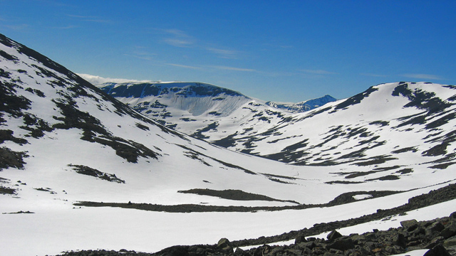
In our advance planning we had considered the ravine between the 1614 m peak and Vierramvarri too steep, so we did not descend there. At first we had to climb a bit because the ravine wall was too steep lower down. The slope was rocky. Later the wall eased and we descended to the valley floor along a strip of snow, where water was again available. In the valley we saw a tent site cleared among the rocks. We moved to the other side of the valley and descended in sunshine, wading through snow for about 4 km until the snow thinned. Before reaching Singivaggi we crossed the river in the valley bottom on rocks. From Singivaggi we continued along the south side of Singijohka into Tjäktjavagge and camped by the river. Along the way we saw four hikers. This time we carefully chose a flat, stone‑free tent site, and the mysteries of tent pitching were finally resolved.
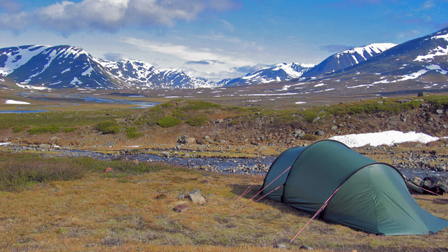
We camped around 21:00, elevation 780 m. We had been on the move for a total of 14 hours. Because of the sunshine and walking on snow, our eyes stung slightly. At this point it felt like we had had enough of high‑fell (and snow) walking for this trip, and the idea of following the Kungsleden to Abisko crossed our minds. For dinner we prepared a 250 g Reiter meal. It was not cold during the night.
Tjäktjavagge – Junction between Hukejaurestugan and Gautelihytta
On Wednesday, June 29, 2005 we woke around 09:00. It was sunny and warm, with hardly any clouds and no wind. For breakfast we prepared a 250 g Reiter meal and coffee, and ate cookies. We took down the tent — no drying needed — packed our backpacks, and applied sunscreen. We set off around 10:30, crossed Singijohka via the bridge, and took a short break at the Guobirjohka shelter around 11:15, taking photos. Another break followed at the Guobirjohka bridge around 11:35.
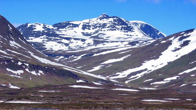
At this point we needed to lighten clothing, and I switched to shorts instead of wind pants. The cap stayed on, as did gloves to prevent chafing from the trekking poles. We met a few hikers during the morning. Around 12:10 we stopped again for photos. After passing Guobirvagge we turned west onto the trail leading to Tsutsavaggi. We took a break at the mouth of Tsutsavaggi near the bridge over Tjäktjajåkka around 13:30, ate fruit soup and muesli, took photos, and dried shoes and socks. The journey continued through Tsutsavaggi in warm sunshine. Occasionally we stopped for a chocolate bar. Nordkalottleden runs through the valley, though on this section it was not well marked — but the winter route poles were visible, so there was no risk of getting lost. The valley was mostly easy walking, except for one boulder field beneath a cliff. There were good views toward Kebnekaise. A river flows along the valley floor, and at some point it must be crossed. No specific crossing point was marked. Sometimes the river widened into lakes; sometimes it ran in a narrow rock channel.
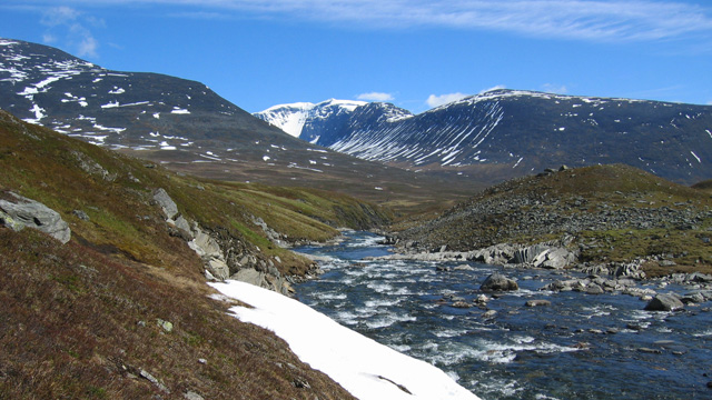
At the crossing point marked on the map there appeared to be a waterfall and a narrow channel, with a frozen lake above it. We did not attempt to cross there. Instead, we crossed at the next narrow point upstream, where the river was about 30 meters wide with a small island in the middle. The water reached about knee‑deep, with small stones on the bottom. Using neoprene wading shoes and trekking poles, the crossing was fairly easy, though the water was cold. After drying our feet we continued up the valley. The route now climbed the southern side, where the terrain became rocky with large boulders scattered around. We took a chocolate‑bar break, then continued to the junction of the trails leading to Hukejaurestugan and Gautelishyttan. About 20 meters from the signpost, on a meadow by the river, was a flat tent site about three meters from the water. We pitched the tent there around 20:55 at 960 m elevation. The day’s hike had taken 10.5 hours. For dinner we prepared a 250 g Reiter meal and ate Russian salami. It was not cold during the night.
Junction between Hukejaurestugan and Gautelihytta – Southeast corner of Lake Gautelis
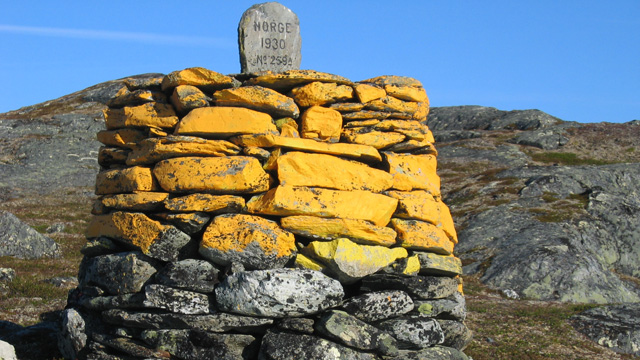
On Thursday, June 30, 2005 we woke around 7:30. For breakfast we prepared a 250 g Reiter meal and coffee, and ate cookies. We took down the tent; the inner surface of the flysheet was slightly damp, so we shook it before packing. We packed our backpacks and applied sunscreen. The sun shone from a cloudless sky, and there was no wind. It looked like this would be another heat‑wave hike, similar to 2003 when four days of heat and sunshine continued uninterrupted. We started walking at 09:45. The terrain was rocky with large boulders scattered around, with small ups and downs but no major elevation changes. There was still a lot of snow — in every hollow and along streams the snow was thick. After a couple of kilometers we reached a point where the map indicated a bridge over Gearbiljohka — but no bridge existed. Some remnants of a bridge seemed to lie in the water on the opposite bank, suggesting a bridge had once been there. The river flowed strongly in a rock channel, making wading impossible. We searched upstream for a crossing point where the river narrowed after a small lake. Even there the current was strong and the river fairly wide, with water somewhat above knee‑deep. After considering the situation, we decided not to wade — the cold water and long crossing would quickly numb our legs (there was still ice in the lake). Upstream was a lake with narrower sections marked on the map, which might offer crossing points. Downstream was another small lake, after which the river flowed about one kilometer into Lake Huvkijärvi, dropping 50 meters in elevation — likely forming a deep, fast channel. We decided not to search downstream (though in hindsight it might have been worth trying). So we followed the lakeshore north. The lake remained wide, with no suitable crossing points. The terrain was flat but very snowy, making progress slow. After about 4 km we checked a narrow point, but the lake was still partly frozen and too deep to cross without swimming. We continued around the lake. At the northeast corner there were two crossings: the first required Coverboots, the second was possible in hiking boots. At the northwest end of the lake, on a ridge, was a reindeer herder’s hut. We took a long break there, eating muesli and fruit soup, making coffee, and eating cookies, chocolate bars and salami. The chocolate had melted in the pack. After 17:30 we packed our backpacks and continued walking. Our goal was to return to the Nordkalott Trail. First we walked about 2 km south to bypass Lake 941 and its outflow, then turned southwest and reached the trail around 19:00, about one kilometer from where we had begun the lake detour earlier that morning. The detour had taken the entire day, covering just under 10 km. We continued along the trail, reaching the Sweden–Norway border around 20:00, and photographed the border cairn. Shortly after the cairn the trail turned sharply north. We continued another 5 km. For the rest of the way there was almost continuous snow, as the trail followed the eastern edge of the ridge.
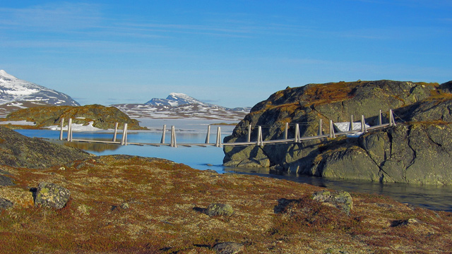
According to the map there was supposed to be a bridge on the route — and fortunately it was indeed there. Immediately after the bridge was a smaller stream crossing, which we did using Coverboots. One of us crossed first and threw the boots back across the stream. By now it was close to 22:00, so we began looking for a tent site. After less than 200 meters we found a flat spot on a ridge beside a small stream and pitched the tent at 930 m elevation. We camped around 22:30, having walked 18 km in 12 hours and 45 minutes. We prepared a 250 g Reiter meal. Before sleeping we photographed the surroundings and discussed the route ahead, deciding to adjust our plan.
Based on the day’s experience we concluded that the high fells (around 1000 m) still had a lot of snow, which did not support weight well and made walking difficult. We decided to skip the passes above 1200 m that were part of the original plan — especially since we had already climbed enough during the Kebnekaise ascent. We planned a new route: down Caihnavaggi, then to Cunojavri and Unna Allakas hut, and from there to Riksgränsen. We also decided to wait until evening the next day before walking, to avoid the heat.
Southeast corner of Lake Gautelis – Caihnavaggi
On Friday, July 1, 2005 we woke around 08:00 when the sun heated the tent so much that sleeping was no longer possible. The sky was cloudless and there was no wind. The heat continued, and waiting until evening to walk seemed sensible. We propped up the vestibule wall using trekking poles and a cord to improve ventilation. Around 09:00 we made coffee and ate cookies. We tried staying in the tent for shade, but it soon became too hot. We went to the nearby river to photograph the rapids. After noon we prepared a 250 g Reiter meal in the shade of a large rock, made coffee, and ate cookies. It was getting hot and there was little shade, so we decided we might as well start walking.
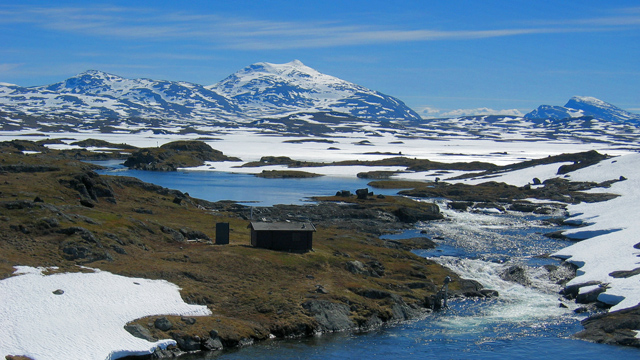
The tent did not need drying, and we left the inner tent attached when packing. We packed our backpacks, applied sunscreen, and set off around 15:18 toward Caihnavaggi. The terrain was similar to the previous day — rocky and stony, with snowy hollows and streambeds. One fast‑flowing stream we crossed via a snow bridge; others required only a couple of long steps. Around 16:50 we reached Gautelishytta, where we took a long break in the hut’s shade, ate chocolate bars, and drank water.
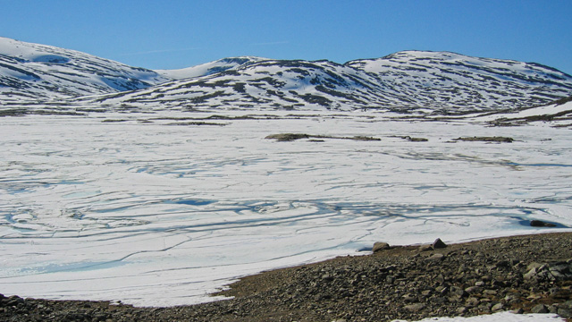
After 17:30 we continued. First there was a steep ascent, then the usual undulating rocky terrain, gradually rising. Snow appeared again in hollows, and we began to avoid the snow by zig‑zagging along bare ridges and rock patches. Under Trehakfjellet we crossed the outflow of a lake by hopping across rocks near the surface. We took a chocolate‑bar break before descending slightly toward the start of Caihnavaggi. Then came an ascent to just over 1200 m. For about 2 km the route along the valley floor was entirely snow‑covered, and we had to wade through snow that did not support weight well. Progress was slow. As evening advanced, the valley floor fell into shadow, which improved the snow’s firmness somewhat. We took a short break at the 1200 m contour after crossing the highest point of the pass, then descended along snow to the shore of Lake 1094. The final part of the descent was boulder‑strewn. At lake level there was no snow. Here the route followed the lakeshore — contrary to the map — and we crossed the lake’s outflow at its very beginning, where the river was shallow and easily crossed in hiking boots. We then descended gently along snow to the shore of Lake 1004. Here we encountered the river flowing from Lake 1091 to the west. It was wide and fast‑flowing. We moved about 200 meters upstream to a point where the river looked shallow. Each of us chose our own crossing line, and using trekking poles we managed to hop across rocks without getting our boots wet. We then walked along snow for just under a kilometer to the yard of Caihnavaggehytte. We saw someone moving near the hut but continued immediately down the valley along the trail. After about a kilometer it felt like we should soon find a tent site, and about another kilometer later we found a suitable spot on a ridge after a small lake. A river roared in a deep gorge nearby, and a smaller stream flowed into it close to the tent site. It was 01:05 when we began pitching the tent. We had walked 17 km in 9 hours and 47 minutes. The tent went up quickly since the inner tent was already attached. We prepared a 250 g Reiter meal. It was not cold during the night.
Caihnavaggi – Lake Sjangelis
On Saturday, July 2, 2005 we woke around 10:20. The sun was shining, the tent was at +30°C, outside the sky was cloudless, no wind, and the heat continued for the fifth day. We prepared a 250 g Reiter meal and coffee, and ate cookies. We took down the tent — no drying needed — left the inner tent attached, packed our backpacks, and applied sunscreen. We started walking around 12:00. The route descended toward Cunovuobmi. At first the terrain was easy fell heath, sloping steadily to the right, but the last couple of kilometers before the mapped crossing of Caihnajohka were willow thickets, making progress slow. At the mapped ford we were pleased to find a bridge. The river here was clearly not fordable — fast current in a deep rock channel. We took a break at the bridge and ate chocolate bars. Soon it became clear that there were mosquitoes — the first of the entire trip — so the break was short. We continued along Cunovuobmi toward Cunojavrrehytta. Cunovuobmi was a broad valley: first bog, then heath, with almost no elevation change. To the west rose Storsteinsfjellet, 1865 m.
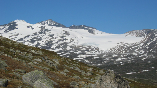
After a little over two kilometers we reached a river. One rock had “bru” written on it, but no bridge existed. The river was fairly deep, though not very wide, flowing in several channels. It could not be crossed in hiking boots, so we switched to neoprene wading shoes and waded across. We continued across level heath toward Cunojavrrehytta and the bridge marked about one kilometer before the hut — but again, no bridge existed. The river here was deep and fast. We followed the river upstream until we reached the point where it flowed out of Lake Cunojärvi. About 30 meters from the lake the river looked shallow enough. It was about 20 meters wide, with a small island in the middle where rocks broke the surface. The strongest current was between the island and the far bank. We switched to wading shoes. Reaching the island was easy; from there we waded about 10 meters upstream over larger rocks on the bottom, and the rest of the crossing succeeded as well, with water up to mid‑thigh. We continued to Cunojavrrehytta, arriving around 17:05. We took photos and continued around the lake toward Unna Allakas hut. At the east end of the lake we took a break on the sandy shore and ate muesli. Mosquitoes swarmed in the bushes but fortunately stayed there. The views west and southwest toward the mountains were excellent. After a couple more kilometers we reached Unna Allakas a little before 20:00. We sat for a while and took photos. One hiker and the hut warden were also outside.
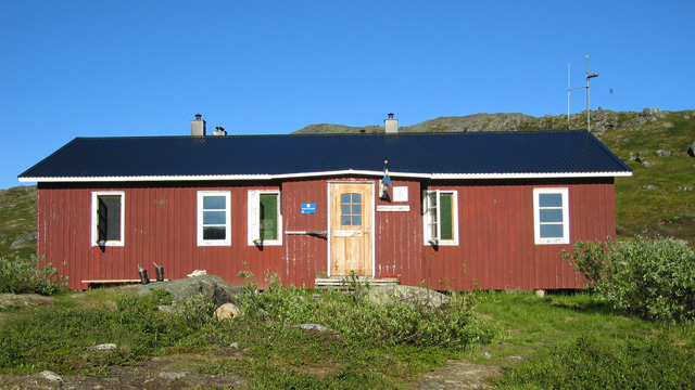
We asked about the upcoming route and received advice for the next stream crossing. The route continued down into the valley and then climbed toward Ruovssokjohka. The river flowed steeply down the mountainside and was fast. It looked impossible to cross at the trail, so we climbed up along the river for over a kilometer, gaining about 150–160 meters, until we found a possible crossing point. Here the river ran in a deep gorge with large boulders on the bottom, splitting into two channels with an island in between. We crossed the first channel on rocks near the surface; each of us got one boot slightly wet. On the island we searched for a crossing point for the second channel, moved about five meters downstream, switched to wading shoes, and crossed through white, foaming water. Trekking poles were essential for probing and balance. Fortunately the river was not deep here, and we got across. We climbed steeply out of the gorge to the 900 m contour and headed northeast, reaching the trail about half a kilometer before Lake Sjangelis. Following the trail, we began looking for tent sites and found a suitable one by the lake, below a small bank. We camped around 22:37. The 19 km day had taken 10.5 hours. The tent went up quickly, and we prepared a 250 g Reiter meal. It was not cold during the night.
Lake Sjangelis – Dossagevaggi
On Sunday, July 3, 2005 we woke around 09:00. The weather was the same as before: sun, +30°C in the tent, cloudless sky, no wind, continued heat. We prepared a 250 g Reiter meal and coffee, ate cookies, took down the tent, packed our backpacks, and applied sunscreen. We set off at 11:00 toward the Stuor‑Kärpel shelter. We first climbed to 1020 m on a ridge, taking photos with good views toward the mountains of Sweden and Norway, and back toward Caihnavaggi where we had come from the previous day. The route continued along snowy slopes to the Valfojåkka shelter, where we arrived shortly after 13:00.
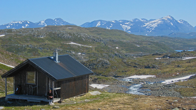
We took a break, read the hut’s guestbook, ate two chocolate bars, and dried socks and boots in the sun. Three Swedish hikers arrived from the north; we asked them about the upcoming river crossing and learned that it could be crossed via a snow bridge. We continued. There was still plenty of snow, and it did not support weight well. We crossed the river via a snow bridge above Lake 946, then climbed again to about 1040 m and descended to the shore of Lake 1016.
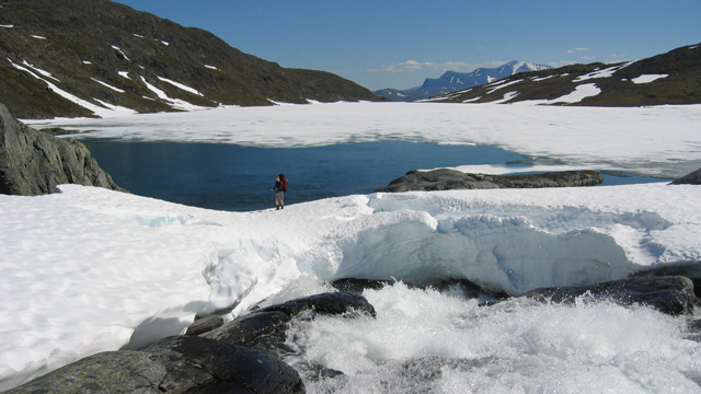
The lakeshore was rocky, so the route had boardwalks along its entire length — though now partly covered by snow. After the lake the route crossed rocky terrain with much snow, with bare ridges emerging here and there. We climbed slightly to the eastern side of the valley where there was less snow. After a couple of kilometers we believed we were in mobile‑phone range. We stopped, made a call, and arranged a ride from Riksgränsen for the next day. We ate muesli; it was around 18:00. After the break we continued down the rocky, snowy valley to the Stuor‑Kärpel shelter, where we rested and drank water. It was after 20:00 and the sun shone from the west. We decided to continue a few more kilometers so that the next day’s walk would be short and we would reach Riksgränsen on time. After about a kilometer we reached another river crossing requiring wading shoes. There was now less snow and walking was easier; the boulder fields also decreased. The route followed the river, and suitable tent sites appeared here and there. We continued until we were about two kilometers from Lake Gatterjärvi, near the 931 m contour. We camped on a flat grassy meadow a couple of meters from the river. It was around 22:30. The 18.2 km day had taken 11.5 hours. The tent went up quickly with the inner tent already attached. We prepared a 250 g Reiter meal and set the phone alarm for 06:30. It was not cold during the night.
Dossagevaggi – Katterjåkk
On Monday, July 4, 2005 we woke at 06:30. The valley and tent were still in shadow, but the weather was again sunny, cloudless, no wind — another hot day ahead, the seventh in a row. The outside temperature in the shade was +10°C. We prepared a 250 g Reiter meal and coffee, and ate cookies. As the sun rose higher it began to heat the valley floor, and the tent soon reached +30°C. We took down the tent — no drying needed — packed our backpacks, applied sunscreen, and set off at 09:00. The route followed the river at first. Soon we reached a difficult section where the river ran in a narrow channel between steep walls. The trail crossed a bad boulder field and then a steep slope with a 10‑meter drop to the river. After this we took a short photo break. The route then continued across level ground along the shore of Lake Gatterjärvi to Katterjaurestugan and the bridge over Gatterjohka.
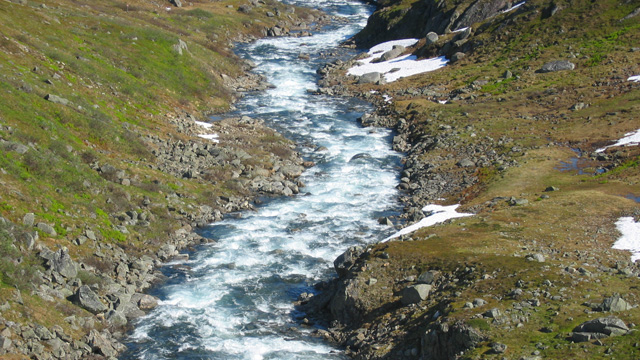
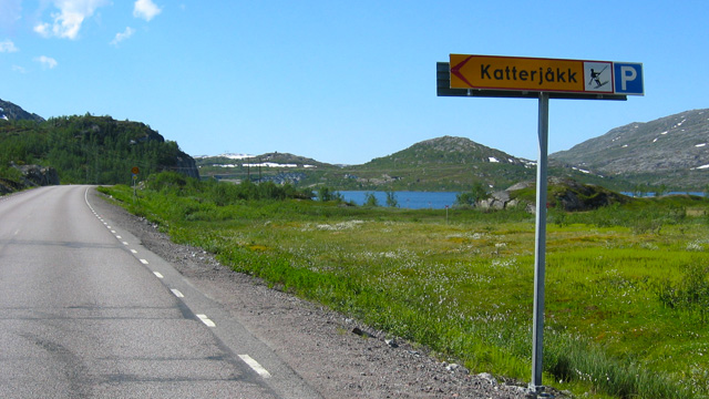
After the bridge the trail became wide and easy, with no snow. Soon ski lifts and ski‑resort buildings came into view. We followed the gravel road to Katterjåkk Turiststation, passed under the railway, and reached the main road. We arrived at the road at 12:00. We waited for our ride, made coffee, and ate cookies. The ride arrived at 16:00 and we got into the car.
Notes from the trip: It is good to test gas canisters and stove compatibility beforehand. Swedish crowns are useful when hiking in Sweden. A small 225 g gas canister lasted 4 days. Wind jacket and wind pants are often too warm when hiking with a backpack; fleece pants were quite good, as was a base‑layer shirt. A microfleece shirt with a collar might be even better. Neoprene wading shoes were excellent for river crossings — with trekking poles they work for most streams, and Coverboots are unnecessary. The shoes are light, dry quickly, and are good as camp shoes. High‑SPF sunscreen is essential. Shorts were necessary. Light‑colored clothing is good in hot weather.
A Pocket Rocket stove and one pot were sufficient; carrying a full Trangia set is unnecessary. The sleeping bag’s advertised extreme rating of –8°C is greatly exaggerated — in reality the extreme is closer to 0°C; below freezing the bag is inadequate. Hiking boots were good, as were the socks. Sunglasses are needed. Keeping a hiking diary was useful. A 5‑liter collapsible water container was good for camp use. A mug hanging from the backpack’s chest strap was convenient.
We had plenty of instant coffee — even 100 g would have been enough. 250 g of milk powder would have been sufficient, and sugar could have been half the amount we carried. We usually drank coffee only once per day. Salted peanuts were good for snacking. Chocolate was problematic in the heat. Reiter meals, muesli and fruit soup were fine. We had enough food — though we didn’t remember to eat muesli every day, nor two bars every day. We carried food for 10 days, but the hike lasted only 8, so we carried extra weight. The weather was excellent. Doing the trip at a slightly different time might reduce snow and water.