Routes
Daily stages on map
For this year’s hike we decided to explore the rugged mountains of Swedish Lapland more closely and chose Abisko as our destination, a place known as a paradise for hikers and wilderness travellers. We had driven in the same region in 2003 and 2005. Abisko is also the starting point of the Kungsleden, the most beautiful and popular long-distance trail in northern Sweden. This time the plan was a shorter trip, and we had reserved only 5 days for the journey. Although Kungsleden offers the possibility of hut accommodation and buying food along the way, we decided to camp and carry our own provisions. Good footwear and waterproof clothing are essential for mountain hiking. The backpack must be suitable for carrying all equipment.
13 August 2010, Friday
Departure from Oulu at 15:00, by car to Kolari, arrival at 19:00, refuelling, dinner, sleep at 22:30/23:30.
Abisko – Vierrovaggi
On Saturday 14 August 2010 we woke at 02:30, had coffee, and started driving at 02:53. We arrived in Abisko at 06:00, parked at the Abisko Turist railway station, ate breakfast, changed clothing, packed the backpacks, weighed them (17.70 kg / 17.02 kg), and started walking at 07:00.
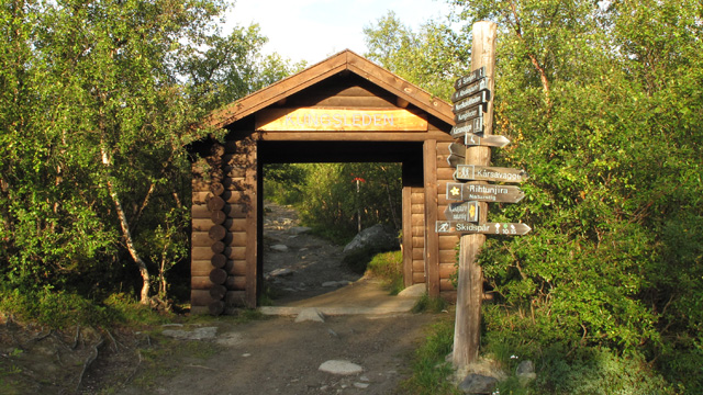
The weather was partly cloudy, not cold, with fog lying over the northern end of Torneträsk. Hardly any wind. We followed the wide Kungsleden trail south along the Abisko River. After 6 km we turned onto the trail leading to Tältlägret. This trail was narrower but still easy to walk. When we reached the treeline the trail disappeared, and we continued upward toward Ballinvaggi, where we took a break and ate chocolate bars. The valley was mostly easy terrain, and crossing the stream flowing along the valley floor was effortless.
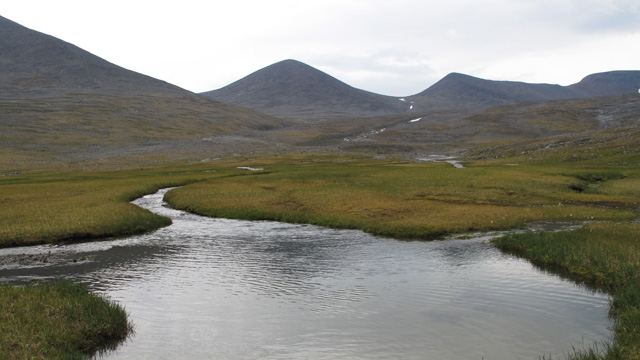
We continued through a short side valley into Siellavaggi and took a break by the wall of Renvaktarstugan, eating chocolate and salami. A southeast wind had begun to blow and light rain fell. We continued along the eastern side of Siellavaggi toward the southeast, walking into the wind, which strengthened to moderate force. Rain increased slightly and we had put on our shell clothing. At the end of the valley there were boulder fields and some talus near the last lake. After passing these we took a break and ate chocolate; the sun even appeared briefly. We continued along the slope eastward at about 1040 m, thinking this would help us avoid the brush in the Aliseatnu valley below. Soon a strong westerly wind began to blow, bringing heavy rain. After crossing the streams flowing down the slope we descended past the turf hut and Renvaktarstugan to the bridge over Aliseatnu in the middle of birch thickets. With rain still falling we climbed toward Vierrovaggi and soon left the brush behind; the rain also stopped. We continued to the bridge over Vierrojohka and camped at 19:15 beside the bridge, where there were several tent spots on the east bank.
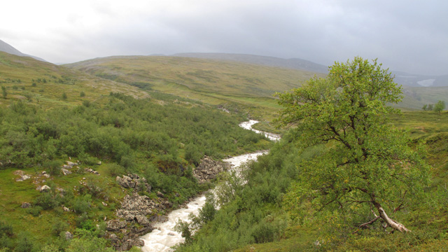
The river water was good, mineral-rich glacial meltwater. We ate a Reiter meal and salami as rain began again; the wind was brisk. The day’s terrain was generally easy mountain terrain without major sights. Sleep at 22:30.
Vierrovaggi – Visttasvaggi
Sunday 15 August 2010: wake at 05:30, cloudy, windy, no rain. We rested to recover from the previous day, ate Reiter + coffee + biscuits, and started walking at 10:45. We ascended the eastern side of Vierrovaggi along the river; the sun now shone, but the westerly wind was strong. Ahead it was cloudy and visibility was poor. At about 1000 m snow began to fall as small hard pellets. We took a break and ate chocolate. We reached Mårmastugan at 14:00; the wind was very strong and snow continued.
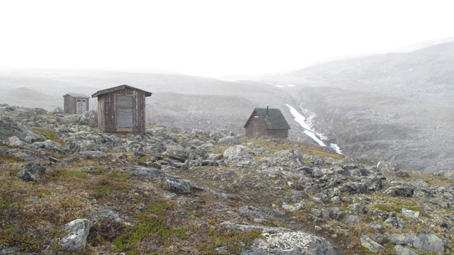
We rested 30 minutes and ate muesli + fruit soup + chocolate + salami. A German couple arrived, saying they had turned back due to wind and snow while attempting to reach the Mårma pass at 1600 m. We continued anyway; the terrain was mostly boulders. The final ascent to the pass was fairly steep but walkable. The westerly wind was so strong it pushed us sideways, and the rain cover of the backpack blew away and vanished somewhere into Leavasvaggi. Snow pellets blew in the wind, but visibility was good enough to follow the cairns marking the route. The sun shone from the south, warming us enough to stay comfortable despite the wind. The pass height was 1604 m. We descended in strong wind over boulders, taking a chocolate break sheltered by a bank at about 1300 m; snowfall ended. Farther down, Vassajavri had heavy waves.
After the lake we climbed slightly to cross Vassanjunni and then descended diagonally along the slope, taking chocolate breaks, past Vassaloamijavri toward Vistasstugan.
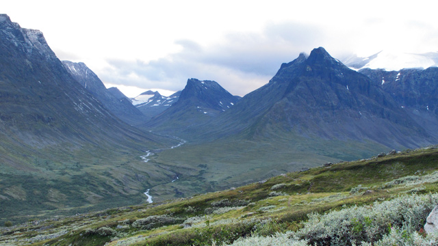
The sun set behind clouds and mountains; the wind remained strong. We camped after crossing the bridge over Vistasjohka, beside the stream flowing from Stuorr Reaiddavaggi, at 21:45. We placed stones on the tent pegs due to the wind. The day was strenuous because of the many ascent and descent metres and extensive boulder fields. During the descent from Mårmapasset the views south and west were excellent. Reiter meal. The tent handled the wind well.
Visttasvaggi – Sielmmanjira
Monday 16 August 2010: wake at 07:30, wind had calmed, no clouds, warm sun. Reiter + coffee + biscuits, walking at 10:15. We followed a clear trail into Stuorr Reaiddavaggi toward Nallo; no brush, easy terrain, one chocolate break. The landscape was dominated by the Nallo peak.
There was talus below Nallo’s slopes. We reached Nallostugan at 14:00 and rested on the bench outside in warm sunshine with a light westerly breeze. We ate chocolate and salami and continued at 14:20 toward Sielmmavaggi. The weather remained excellent — sunny with a cooling breeze. The ascent to the 1078 m lake was fairly steep, then level boulder fields along the shore, then another steep ascent in talus to 1200 m.

The ascent continued more gently in boulders to 1311 m, where we took a break and ate salami and chocolate. We descended the pass and continued along the edge of Sielmmanjira until we found a flat grassy tent site at 1093 m, camping at 19:00. Down in the valley we could see Tjäktjastugan and Kungsleden. Evening sun shone long into the camp. Reiter + coffee + biscuits. Sielmmavaggi was very rocky in August; the best views were eastward rather than westward.
Sielmmanjira – Abisko National Park border
Tuesday 17 August 2010: wake at 06:00, some clouds, morning sun still behind the mountain, +1°C outside. Reiter + coffee + biscuits, walking at 08:45. We first walked at about 1000 m along the eastern side of Alisvaggi above Kungsleden to Bossosvaras, where we took a chocolate break. We descended to Kungsleden and followed it to Alesjaurestugan, crossed the yard, and continued a couple more kilometres before another break with chocolate and salami.
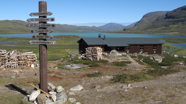
The sun shone from a cloudless sky and it was warm; hardly any wind. We continued past the Alis, Radu and Miesak lakes, taking one more chocolate break. Some scenery was visible, but the interesting features were far away.
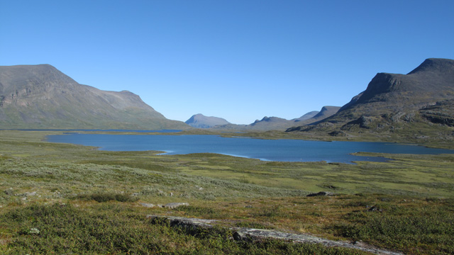
It is clear that the best scenery in the Kebnekaise–Abisko region lies away from Kungsleden. The trail was easy and busy; we counted 143 hikers coming toward us. Before Garddenvarri we took another break with chocolate and salami. We descended to the Siellajohka bridge, filled a 5‑litre water container, and continued another kilometre to the Abisko National Park boundary. Camp in birch forest at 21:09. The sun set soon and the temperature dropped. Reiter meal.
Abisko National Park border – Abisko
Wednesday 18 August 2010: wake at 06:45, +2°C in the tent and –2°C outside, frost on the tent and ground. Sun behind the mountain, some thin cloud, fog over Abiskojaure. Reiter + coffee + biscuits, walking at 09:09. We followed Kungsleden to the bridge leading to Abiskojaure hut and continued toward Abisko.

We took a break after 8 km and ate chocolate and salami. The sun shone again and the morning clouds had cleared; it was warm. One advantage of hiking in August is that despite the brush, insects were almost nonexistent. The trail was wide and easy, with no major sights. We counted 72 hikers coming toward us. We reached the parking area and the car at 15:09. Backpacks now weighed 14.90 kg / 13.38 kg. According to the GPS track log we had walked 112 km. After changing clothes we drove off at 15:33, arriving in Oulu at 22:03. Total driving distance 1201.2 km, fuel cost 64 euros.
Hike 2010
Notes: In August there is little snow, lots of boulders, dry trails and easy stream crossings, yet plenty of drinking water and hardly any mosquitoes. Nights are cold. Away from Kungsleden there are few other hikers. Food: eating was minimal; some provisions remained uneaten. Equipment: Powerstretch fleece clothing is very versatile for summer hiking and suits almost all conditions. Only a shell suit and base layer are needed in addition. The Joutsen 900 QTM sleeping bag feels somewhat poor — it gets wet easily and feels cold even when it shouldn’t. The Artiach Light Plus sleeping pad may contribute, as its insulation is weak. The backpack rain cover should be strapped on more securely. For the next trip: more days, shorter daily distances, more day trips without the backpack, food can be reduced slightly (skip muesli, coffee + biscuits only in the morning), bring an air mattress? wool base layer?