Routes
Daily stages on map
For the 2016 hike we chose the Kebnekaise region in Sweden. We already had some earlier experience from the area from our trips in 2005 and 2011, and a little also from 2010. In addition to Kebnekaise, Sweden’s highest mountain, the region has several other high peaks. Among these, Kaskasatjåkka (2076 m) seemed like a suitable goal for us, as it is a so‑called “walking summit” and does not require mountaineering skills. We also intended to explore Kaskasavagge and Unna Reaiddavagge, and possibly climb another peak along the way. The Kebnekaise area is well suited for hiking because the terrain is clearly defined, the risk of getting lost is low, and there are marked trails and bridges over larger streams. Therefore, the area can be crowded in August during the peak hiking season. We reserved 7 days for the trip, including travel days. Our equipment was otherwise typical, but this time we brought our larger tent again, the Hilleberg Keron 4 GT (5.5 kg).
Nikkaluokta – Cievrrajavri
On Saturday 30.7.2016 we began driving at 04:00, refueled in Aavasaksa, and arrived in Nikkaluokta at 10:00. We parked the car in the long‑term parking area (25 SEK/day). We ate at the parking area, then changed clothes and finalized our backpacks. The pack weights were 18.82 kg and 19.34 kg. We notified the local lodging company’s reception about the parking. There were many people around the company yard and the bus stop. We started the hike at 11:20, elevation 471 m. It was sunny, calm, and warm. Since we had already started hikes from Nikkaluokta a couple of times before, we wanted a slightly different route for the first day. The Swedish mountain map shows a trail from Nikkaluokta through the forest to Govggenjunni, and we decided to follow this trail.
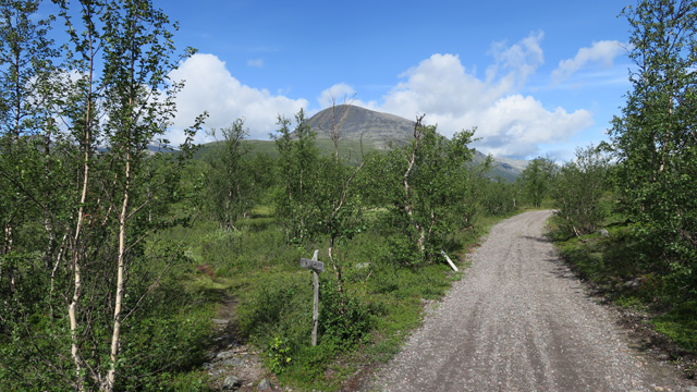
At first we walked along the road for a while, then found the trail at the marked location; the sign read “Kåge.” The trail climbed upward through dry forest terrain of birch, pine, and aspen groves, with no water sources visible. We reached the treeline after 4 km. From there began a gently rising treeless area, also without water. Eventually we found a small stream in the northwest corner of this gently rising area (also marked on the map). We took a break here, drank water, and ate chocolate bars. Then a steeper ascent to the 1162 m summit followed. We first examined the left side of the slope, but it looked steep, so we decided to climb straight up because we saw a greenish “strip” leading toward the summit. We assumed the grassy strip might indicate a gentler and less rocky route. The ascent went reasonably smoothly, though climbing 280 vertical meters steeply with a backpack in hot sunshine was tiring.
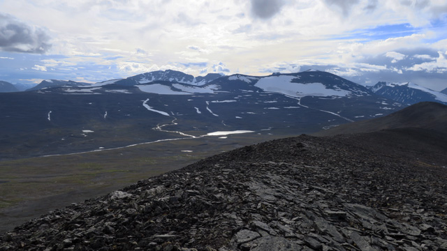
An eagle circled close to us and then glided away. We reached the summit at 14:20, having walked 6.45 km. We concluded that this was a convenient route from Nikkaluokta to open mountain terrain. We took a break and ate beef jerky and drank water. Ahead of us the ridge continued gently upward toward the summit of Kåkittjårro, and we followed it from one minor summit to the next. The ascent to the 1411 m summit was slightly steeper. We took a break and ate chocolate bars before the 1535 m main summit. The next summit was slightly higher at 1559 m. The wind had now strengthened and cloudiness increased. We then descended toward Cievrrajavri; at this point it began to rain and we put on shell clothing. At the bottom we crossed the Cievrrajohka stream and followed its tributary upward looking for a campsite. Soon we found a good, flat, moss‑covered spot at a bend in the tributary. Camp at 20:30, elevation 1153 m, distance 18.3 km. Reiter Pasta Bolognese. Rest at 22:22. An interesting but somewhat strenuous day; the rocky ridge made progress slow, water was scarce up high, but the scenery was good.
Day trip to Kaskasatjåkka
On Sunday 31.7.2016 it rained at times during the night. Wake‑up at 07:00. Reiter beef stroganoff, coffee and biscuits. Outside there was thick fog with visibility 50–100 meters, warm and humid, almost no wind. Our plan was a day trip to Kaskasatjåkka, and a rest day from carrying full packs felt necessary. We packed day‑trip gear and about 6 liters of water in a container, since higher up there might be none. In limited visibility we started at 09:00. Using the GPS we ascended a gentle rocky slope toward the saddle between Tarfaltjåkka and Tarfalcorrun at 1560 m. The steeper section before the saddle was climbed via a snow patch. At the saddle at 1568 m we took a break and ate chocolate bars. Then followed a steeper rocky ascent to the 1803 m summit, also called Tarfalpakte. Here the ridge narrowed and the western side seemed to drop steeply, though only fog was visible. Then the ridge widened again; we took another chocolate‑bar break and put on shell clothing due to light rain before the gentle ascent to 1900 m. The GPS showed 1907 m at the Tarfaltjåkka summit; we signed the paper in the summit box.

Then we headed toward Kaskasatjåkka. In the fog we initially went the wrong way and had to correct our direction using the GPS, adding some detours. Eventually we found the correct descending slope, which was steeper than expected. We reached the saddle between Tarfaltjåkka and Kaskasatjåkka at 1744 m. The ridge leading to Kaskasatjåkka appeared gradually steeper in the fog. We climbed the rocky ridge until we encountered what looked like a vertical rock wall. Using our hands we climbed to the base of the wall. Forward progress was not possible there, but the wall could be bypassed on the left, allowing us to reach the gently rising upper slope. The summit had a large snowfield, though the actual summit was snow‑free. GPS showed 2065 m; we reached the summit at 14:15. The scenery resembled what we had seen on Pårte, Galdhøpiggen, Niak, and Parás — meaning fog.

We returned to the 1744 m saddle, climbed back to Tarfaltjåkka (1907 m), and followed the ridge to the 1568 m saddle, carefully watching the GPS to stay on route. Break and chocolate bars at the saddle, then using snow patches where possible we descended to the tent. Below 1200 m visibility improved. At the tent at 18:15, distance 17.4 km. Reiter Pasta Carbonara. Rest at 19:30. We saw no views due to fog, but we reached the summit, and 10–15 meters of the route was a bit exciting due to steepness. A good workout nonetheless.
Cievrrajavri – Kaskasavagge
On Monday 1.8.2016 wake‑up at 07:00. Reiter Pasta Bolognese, coffee and biscuits. Clouds remained low and it rained intermittently. We packed camp and left at 09:40 toward Kaskasavagge. Clouds were at about 1300 m, so no views. We tried to maintain 1150 m elevation and avoid the worst boulder fields, since rain made the rocks slippery. Near the 1127 m lake there was a lot of boulder terrain, but otherwise we managed to bypass much of it. We descended diagonally into Kaskasavagge, took a break and ate chocolate bars at about 1000 m on the southern slope. Continuing westward, on a slippery lichen‑covered area one of us slipped and sprained the left ankle. Walking felt uncertain for a moment, but gradually improved with trekking‑pole support, though progress slowed. Due to poor visibility we did not visit the 1114 m glacier lake. We crossed Gaskkasjohka on stones at about 1080 m; boots almost got wet, though they were already quite wet anyway.
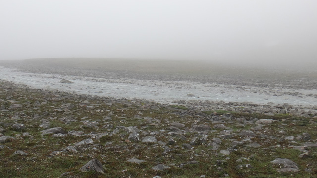
There were many slippery boulder fields higher in Kaskasavagge, and the notoriously difficult boulder field on the right side of the 1167 m lake had to be crossed very slowly and carefully. We took a chocolate‑bar break before this section.
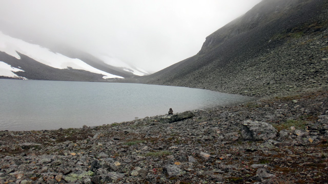
After passing the highest point of the valley we saw a spot where we could try to find a campsite. Near the watershed there is a small, less rocky mound, and we found a tent site there. Camp at 16:40, elevation 1208 m, distance 14 km. Reiter chicken pasta. Elastic bandage on the ankle. Rest at 18:48. Rain and fog all day, clothes and boots wet, scenery unseen due to fog, surprisingly rocky terrain. Poor visibility, wet weather, and the ankle sprain led us to decide not to attempt more summits but instead begin returning toward Nikkaluokta.
Kaskasavagge – Vistasvagge
On Tuesday 2.8.2016 wake‑up at 07:00. Reiter Pasta Carbonara, coffee and biscuits. Still rainy and foggy, so we did not hurry with morning tasks. At 10:40 we started walking toward the saddle between Pyramiden and Knivkammen. We ascended a long snowfield on the right side of the slope, and due to poor visibility ended up on the left side of Knivkammen’s glacier moraine. We climbed the steep loose moraine slope and eventually reached the saddle at 1460 m, where we took a break and drank water.
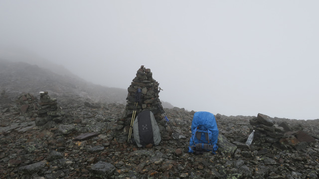
The descent into Unna Reaiddavagge had concerned us beforehand, but there was still plenty of snow, and after the initial steep section the descent was easy. Lower down the fog was even thicker. We walked a short distance on level ground and then noticed a snowfield sloping downward. We followed it to its end, where there was a rock step; on the right we saw another snowfield leading lower, so we moved onto it and descended to the shore of the lower lake in Unna Reaiddavagge at about 1100 m. Visibility was better lower down. We continued eastward along the valley toward Vistasvagge. We stayed on the southern slope of the valley to avoid having to ford the stream lower in Vistasvagge, since our plan was to continue toward Nikkaluokta. At first the terrain was fairly easy; lower down the slopes steepened and we had to traverse a long stretch of steep sidehill. Nothing extremely difficult appeared, though in some places a fall could have caused trouble. There were some boulder sections. The weather improved slightly as we progressed, though visibility remained poor higher up. We took chocolate‑bar breaks at 6 km and 12 km. After the valley ended we reached Vistasvagge and followed moose trails through birch forest until we reached more open terrain with some gravel ridges. Camp at 17:52, elevation 587 m, distance 11.9 km.
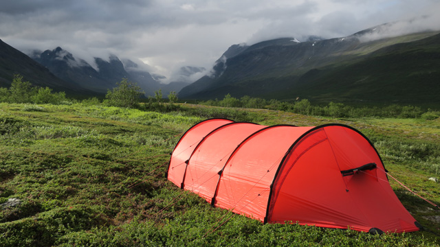
Reiter beef stroganoff. Elastic bandage on the ankle. Rest at 20:00. Cloudy and rainy all day, no scenery visible. The ankle held up as long as steps were taken carefully. The eastern part of Unna Reaiddavagge seemed pleasant, and even the brushy parts of Vistasvagge were not bad since there were no mosquitoes.
Vistasvagge – Cievrrajavri
On Wednesday 3.8.2016 wake‑up at 07:00. Reiter paprika beef stew, coffee and biscuits. Still rainy and cloudy. We started walking at 09:40. First we headed toward the hiking trail coming from the Vistasjohka bridge, which appeared almost immediately. Then we ascended along this trail to the Njunni plateau at 1040 m. The trail first climbed diagonally upward through birch forest; above the treeline the ascent became somewhat steeper. In the warm, rainy, foggy weather and on the steep ascent it became hot; there was no wind. The trail continued across the plateau. We saw one tent pitched there. Then the trail continued as a rocky descent toward Kaskasavagge, the slope gradually easing. Soon we reached the Kaskasavagge bridge, which is not a so‑called “summer bridge,” as some maps indicate, but a permanent one.
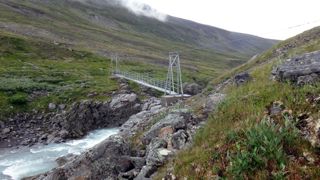
We left our backpacks here and walked to the Kaskasavagge shelter for a break, eating chocolate bars. The shelter had been renovated recently: the surfaces had been painted and a new metal roof installed. At the same time the stove had been removed, and now the shelter contained only benches/platforms, a table, a guestbook, cleaning supplies and one wool blanket. After the break we returned to the bridge, crossed it, and then climbed rather steeply toward Cievrralahku.
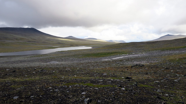
The weather was a bit clearer and again we tried to avoid the worst boulder fields. At the 12 km mark we took a chocolate‑bar break. We continued toward our previously used campsite. We set up camp at 16:50, elevation 1153 m, distance 14 km. Heavier rain began again once we were already inside the tent. Reiter Hunter’s Stew, salted peanuts. Elastic bandage on the ankle. Rest at 19:00. It rained on and off all day, gear was wet. The ascent to Njunni turned out to be fairly easy after all, thanks to the good trail. The ankle hardly bothered anymore. Cievrralahku is starting to feel familiar.
Cievrrajavri – Ponds beside Garmaspakti
On Thursday 4.8.2016 wake‑up at 07:00. Reiter chicken‑vegetable pasta, coffee and biscuits. The rain had stopped during the night, the weather was now drier, clouds higher, though the summits were still in cloud. Morning routines went calmly and we started walking at 10:00. We crossed mostly flat and easy terrain to the reindeer herders’ hut. We took a break by the hut wall and ate chocolate bars. The weather was improving.
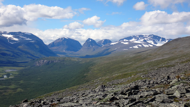
We then crossed a stream channel and climbed the slope to about 1150 m, continuing at that elevation around the north side of Cievrratjåkka. There were no major boulder fields on this route; occasionally there were grassy meadows with good tent spots. We continued around the east side of Cievrratjåkka, where we took a chocolate‑bar break. From there we headed toward Garmaspakti to see whether any views were visible.
At this point the weather turned completely sunny and visibility was excellent. After admiring the scenery for a while we took another chocolate‑bar break.
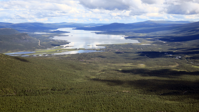
We then descended to the small ponds at about 940 m to look for a campsite. We soon found one and set up camp at 15:26, elevation 949 m, distance 12 km. It was still sunny and fairly warm, and we used this rain‑free moment to wash in the pond and dry our gear. Then it began to rain again and we retreated into the tent. At this campsite we even had phone reception. Reiter beef stroganoff. Rest around 19:00. For the first time in a while we had drier weather and even some sunshine. The route was easy and the campsite good.
Ponds beside Garmaspakti – Nikkaluokta
On Friday 5.8.2016 wake‑up at 05:00. Reiter paprika beef stew, coffee and biscuits. The night had been dry and cooler, which suggested clear weather for the day. The sky was indeed cloudless. We packed camp a bit faster this time and at 07:20 began descending the slope toward the trail along Cievrrajohka.
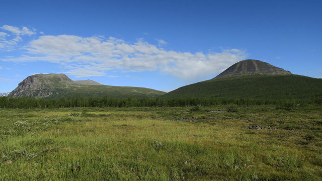
The sun was already warming quite a bit. One tent was visible on the slope. After finding the trail we descended into birch forest, where the shade made walking cooler. The map’s trail markings did not seem accurate, but this riverside trail was clearly visible and easy to follow. We then reached the larger trail leading to the Kebnekaise mountain station and the bridge over Cievrrajohka. We took a break at the bridge and ate chocolate bars.
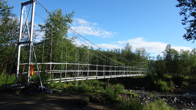
Several tents were pitched in the forest near the bridge. More tents and hikers appeared on the final stretch to Nikkaluokta, and about ten hikers came toward us. The real crowd became apparent when we reached the yard of the local lodging and restaurant business in Nikkaluokta.
The start of the Fjällräven Classic hiking event was just about to begin, and a large group of participants was eagerly waiting to rush toward Abisko. We were lucky to get off the route before the mass start. We watched the start for a moment, then paid 150 SEK for parking at the reception and walked to the car. We reached the car at 10:25, elevation 467 m, distance 7.6 km. Backpack weights were 15.66 kg and 15.84 kg. Driving at 10:45.
Notes: The larger tent worked well, with slightly better ventilation. We gained more experience hiking in wet weather — nothing stays dry, but with shell clothing you stay warm while moving, and clothes dry reasonably well in camp. Food requirements were modest: besides breakfast and dinner, we ate on average two chocolate bars and a little beef jerky per day (500–600 g + water). The particularly bad weather reduced our interest in climbing more peaks, and the hike became relaxed valley walking with moderate daily distances, so energy consumption was not high. We saw no other hikers in the actual terrain, only a couple of tents. Total hiking distance 108 km according to the GPS trip meter; track log distance 95.1 km (50 m interval). Total ascent 4 km 514 m and descent the same.