Routes
Daily stages on map
For this summer our hiking party had planned a trek to the Signaldalen area in Norway. It offers excellent opportunities for fell hiking, as there are plenty of fells in the region. In addition, thanks to earlier trips to the nearby areas in 2003, 2004, 2008, 2018 and 2021, the region was already somewhat familiar, so it was easy to head there again. A new piece of equipment this time was a solar panel for charging power banks. The daily food plan was the familiar one: Reiter meals morning and evening, coffee and biscuits in the morning, chocolate bars during the day, plus dried meat/salami, salted nuts and sports drink as desired.
Friday 14 July 2023 We first drove to Kolari, where we spent the night.
Signaldalen – Signalneselva
On Saturday 15 July 2023 the alarm was set for 05:30, we started driving at 05:56 and reached the large parking area at the end of the valley in Signaldalen at 10:23. Next to the parking area there is a table and benches under a shelter. We prepared and ate the traditional first‑meal‑of‑the‑trip: pasta with cheese sauce extended with a can of pork stew, followed by coffee. The weather was cloudy, fairly warm, and almost windless. We changed into hiking clothes and finalised the backpacks; their weights were 22.14 kg and 23.40 kg. Then we drove the backpacks to the trailhead at Vassdal farm, returned by car to the parking area, and walked the almost three kilometres back to the backpacks. Along the road many Swedish cars with trailers were parked; we assumed they belonged to reindeer herders who had driven their ATVs up into the fells. The trail/ATV track left the road westwards towards the fells. At first the track ran through forest and we had to cross several branches of the stream; the stream was in flood and keeping our boots dry was challenging and not entirely successful. Eventually we had to cross a strong stream by balancing on a tree trunk. After that a fairly brisk ascent continued up to the treeline.
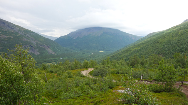
The weather remained cloudy but dry; at the treeline a northwesterly wind began. Several ATVs came down the track. One Norwegian hiker with a dog also came; we petted the dog and chatted with its owner, learning that Swedish reindeer owners were currently marking calves in the fells. Higher up we soon saw several tents/lávvus and a couple of cabins at the eastern end of the Vassdalen valley. We continued near Signalnesvattnet and camped by Signalneselva at 15:13 at an elevation of 539 metres; we had covered 9.19 km and the temperature was +14°C. We fetched water from the stream into the camp water container, then ate chocolate and dried meat. The wind was moderate. As an evening walk we circled Signalnesvattnet (3.09 km). After the evening meal we went to sleep at 20:09.
Lemmetfjellet
On Sunday 16 July 2023 we woke at 06:30. The night had been warm and dry. The morning was sunny and the few clouds were dissipating.
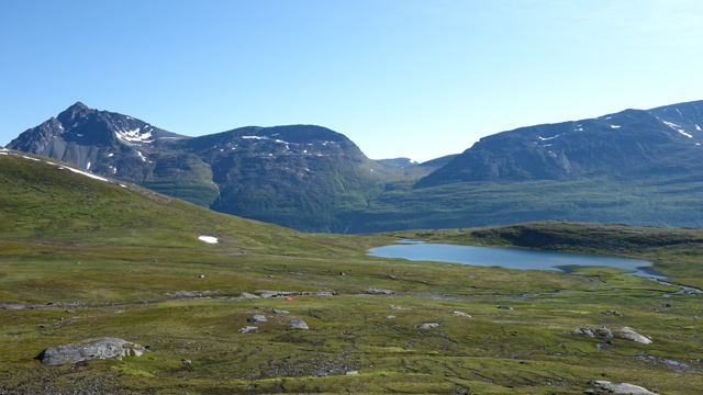
A helicopter flew overhead. After breakfast and coffee we decided to go on a day trip because the weather was so good. A slope rose right next to the tent, leading to the 1516‑metre summit of Lemmetfjellet. We set off at 08:19, climbing straight up the slope until a steep rock wall forced us to move left, where we could continue the ascent. We climbed a ridge leading upward. At times we flew the drone. The ascent became a bit steeper; we climbed on snow and rocks. After a chocolate‑bar break we soon reached the 1399‑metre summit of Istinden. From there we descended to the 1217‑metre saddle. From the saddle we climbed a rocky slope towards the ridge leading to Lemmetfjellet and reached the base of the ridge at the 1315‑metre saddle. The ridge was at first a bit narrow but not difficult or very steep. We reached a flatter area, then the ridge continued steeper again. Soon progress on the ridge became too challenging and we moved onto flatter snow on the north side. After walking on snow for a while we climbed steeply on rocks back to the ridge and continued to the summit. The wind was strong enough that flying the drone was not practical; we took photos and admired the views.
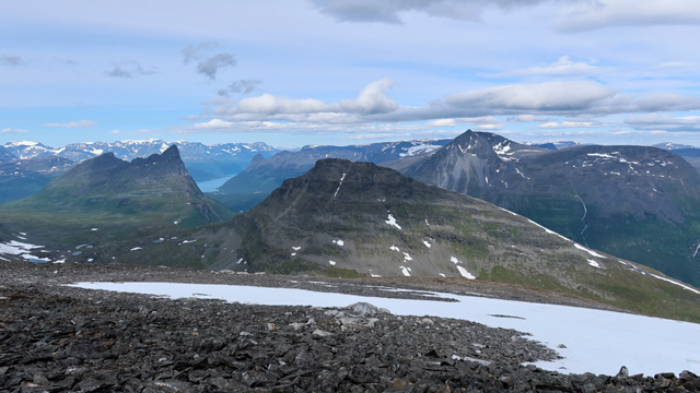
Clouds seemed to be coming from the west; we estimated the weather would worsen soon. The sun still shone but the wind increased. We descended quickly to the 1217‑metre saddle, then climbed back to Istinden, continued behind the summit into shelter from the wind and took a chocolate‑bar break. Then we descended a long stretch on snow and afterwards down the ridge. The final part was steeper and the wind was very strong; we had to hold onto our hats. We reached the tent at 16:44, with 23.97 km on the tracker. The wind remained strong, the sky clouded, but the weather was warm. After camp chores and dinner we went to rest at 20:00. We briefly wondered whether the tent would withstand the wind, but we had confidence in our Hilleberg Keron. During the night there was wind and rain; one tent peg came loose and had to be re‑set, otherwise no issues.
Signalneselva – Finndalen
On Monday 17 July 2023 the alarm was at 06:00; outside the weather was clearing and the wind had calmed. After breakfast we packed our gear and the tent into the backpacks. At 08:15 we started walking towards Vassdalen, passed the reindeer‑roundup area, crossed a couple of reindeer fences; no reindeer were visible, only a few herders. We ascended gently into Vassdalen along the northern side of the valley, avoiding boulder fields. Near the watershed we went to the stream in the valley bottom. We took a break there and flew the drone.
Music track: Chug Along Little Engine by Eric Matyas
Source: www.soundimage.org
We then continued along the southern side of the valley; at first the going was easy, but soon we encountered brush. We descended to the valley bottom by the stream, which was already quite strong here. We continued along the ATV track by the stream; at some point the track crossed to the other side, but we continued along reindeer paths. After about 9 km we took a chocolate‑bar break. The brush continued and turned into birch forest. The vegetation thickened and the side slope down to the valley bottom became steeper. We tried to maintain altitude; progress became extremely difficult on the steep rocky slope where birches grew not only up and down but also sideways. Winding between trees and bushes was very slow and it felt like we were not advancing at all. The weather was warm, windless, and there were horseflies. At the 12 km mark we had to take another chocolate‑bar break.
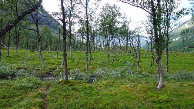
Then the going became easier again for the final stretch to the base of the western ridge of Vassdalsfjellet, which we reached at 16:47; the tracker showed 37.91 km, elevation 547 metres. The campsite was otherwise good, but there was no water. So after pitching the tent we descended into Finndalen to look for water. We did not have to go all the way to the valley bottom; we found a small stream on the slope. We filled the 10‑litre water container and carried it back up in a plastic bag. After resting it was time for dinner. There were occasional showers, then sunshine again; we tried using the solar panel but did not get much charge. During the night a herd of reindeer gathered around the tent. It rained again at night.
Vassdalsfjellet
On Tuesday 18 July 2023 we woke at 06:00; the reindeer had left, and the weather was foggy, so we rested another two hours. Then we had breakfast and coffee. We did not break camp, as the plan was to make a day trip to the summit of Vassdalsfjellet, 1576 metres. On our 2008 trip we had climbed its slopes but stopped at 1441 metres; the weather had been foggy then too. Now we would approach the summit from a different direction; according to information online, this route might be feasible. After 10:00 we set off with day‑trip gear, climbing the slope above the tent.
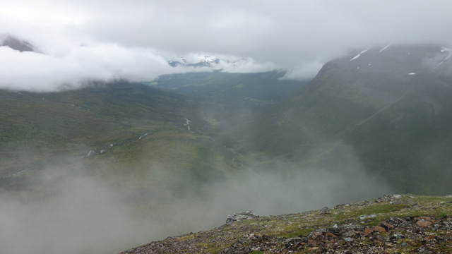
The slope was grassy and fairly steep. Soon fog covered all visibility. The slope narrowed into a ridge, which became narrower and steeper. At times there were steeper steps followed by gentler sections. Then we encountered a small intermediate summit, which we bypassed on the right (south) side. We progressed a bit further, then another steep rock barrier appeared.
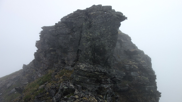
We tried to find a bypass on the right. We attempted a couple of gullies leading upward; we got a little way up but then it became too steep. Finally a third gully looked easier and we climbed quite high, but again it became too steep and there were no handholds. We had to descend. We returned to the ridge where we had originally started looking for a bypass. We concluded that we would have to return to the tent. However, we decided to check the left side of the ridge; it was steep, but we managed to climb a bit higher, then had to leave the trekking poles because we needed our hands. As we crawled upward two eagles flew past us. We could only guess at the drop below; the fog hid everything. We found a rock gully that might lead higher. Fortunately one member of the hiking party is more capable in extreme situations and managed to reach a handhold and pull himself onto the rock. Then he helped the other member up. The ridge continued a bit gentler upward, then narrowed so much that we no longer dared to continue.
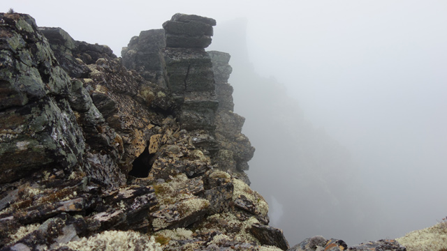
We descended to the right (south) side and found a rocky gully leading diagonally upward; through it we reached the ridge again. After that the ascent was easy and we reached the flat summit plateau. The terrain was open and flat enough that with the fog blocking visibility we needed navigation. We used the GPS device. We first reached the 1383‑metre summit, then passed north of the 1389‑metre summit, found a small pond and drank. We continued to the southern cliff edge of the fell, then followed the edge to the 1459‑metre summit. We took photos and sent “all OK” messages home since there was mobile signal. We then continued towards the saddle before the 1576‑metre summit. According to prior information, a steep snowy slope led there and below it was a glacier. Fog still prevailed and visibility was very limited. We reached the upper edge of the snow. The snow looked steep; downward we saw only white emptiness.
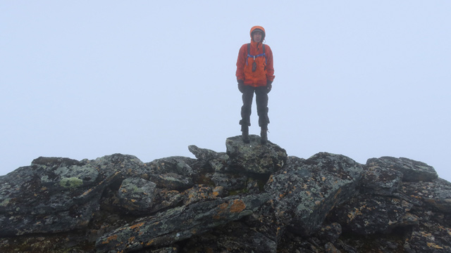
We threw large stones onto the snow; they did not sink but slid quickly out of sight. The snow was dense. We had no tools with us, as the trekking poles had been left on the ascent route. If a boot slipped on that snow, the smooth Gore‑Tex clothing would guarantee speed and danger on the glacier below. We hesitated for a while, then suddenly heard the voice of reason telling us to turn back. Once again Vassdalsfjellet remained un‑summited. We returned along our ascent route, following the upright stones we had placed as markers. We took a chocolate‑bar break, then continued partly with GPS assistance to the 1384‑metre summit. After that the route became confusing; we experienced déjà vu and soon saw the same marker stones again and our own footprints on a snow patch. Eventually we found our way to the western edge of the summit plateau, where the narrow ridge downward begins. We descended, trying to find a passable route; the GPS was of limited help. We tried one route, returned, and tried again.
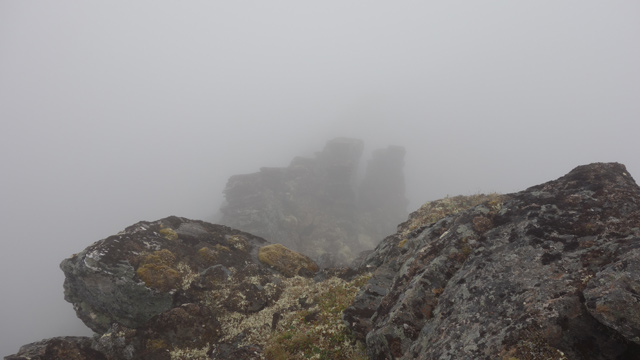
Slowly, keeping close contact with the ridge rocks, we descended; Gore‑Tex is not too slippery on rock and a couple of tears probably appeared. When it finally looked like we would make it down and could breathe again, we realised we had gained a lot of experience and did not need more of this kind. A relieved downhill walk followed, then we remembered the trekking poles. We had apparently descended a different route than we had climbed, and the poles were somewhere up the slope. We did not have the energy to retrieve them and accepted the loss.
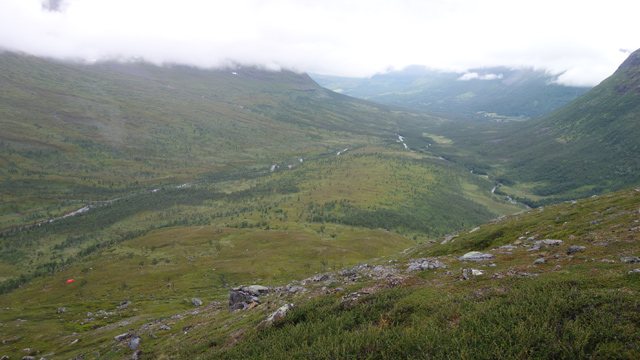
We descended, and lower down the visibility was better, and soon we saw the tent. We reached the tent at 21:17; the duration of the day trip was 11 h 3 min, the distance 16.4 km. The total distance was now 54.31 km. After the evening meal we went to rest at 23:30. A pleasant day trip overall — we got quite high up, and it was nice to get down again; the foggy weather eased any fear of heights since you couldn’t see down. Perhaps one day we will try for Vassdalsfjellet a third time and retrieve the poles at the same time.
Finndalen – Reiersdalen
On Wednesday 19 July 2023 we woke only at 07:30. The foggy weather continued, there was no wind. After breakfast we packed our things and at 09:30 started descending into Finndalen.
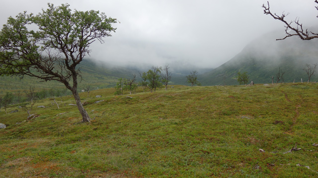
Soon we ended up in brush, birch forest, and bog — everything was wet. In the forest we found tree branches that helped us cross the stream flowing in the valley bottom by stepping on stones. They also worked as walking sticks, so we took them along. We climbed up along Dohpparjohka into the pass between Doppartinden and Sohtungaisi. The ascent continued for quite a while, then came a gentle descent. The terrain was rocky. Ahead of us was the next valley. We crossed the valley’s watercourse and then stopped for a break. After eating chocolate bars we continued along the eastern side of the valley easily to the lake at 713 m. We stopped again and flew the drone. Continuing on, we soon noticed a pair of ermines in the rocky bank by the lake. We watched their movements for a while — curious and lively creatures.
Music track: Adventures in Suburbia by Eric Matyas
Source: www.soundimage.org
We then went around the end of Gaibbinjunni and descended into Reiersdalen. We climbed up the valley again past Gaibbiriehpijohka. After that we crossed Gaibbijohka on stones, using the tree branches again for support. We reached the tent site at 16:23; the tracker showed 67.99 km, elevation 580 metres, temperature +13°C. Soon it began to rain. After dinner we studied the map. Our next goal was the Pältsa valley; originally we had planned to approach it from the south, but now decided to go from the north instead. In this weather there would be no views anyway, so shortening the route made sense.
Reiersdalen – Pältsan laakso
On Thursday 20 July 2023 we woke at 06:00. The foggy weather continued. After breakfast we packed the camp. After 08:00 we began climbing diagonally up the slope northeast towards Njearrecahca. The sun shone brightly above the fog layer, but little of that brilliance reached us; visibility was only a few dozen metres. We walked close to the steep slope of Isdalsfjell and followed it. There were occasional showers. We reached the Njearrecahca saddle, soon saw the lake at 913 m, and then descended into Isdalen. We crossed the stream flowing there north of the lake at 853 m. Then it was time for a break — we ate chocolate bars; we had covered 9 km. Continuing on, we soon reached the border marker between Norway and Sweden and the marked hiking trail.
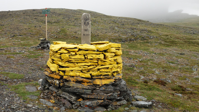
We continued as directly as possible towards Bealcancahca, and soon found ourselves on a fairly steep slope on the north side of Moskkugaisi. The GPS gave direction and altitude; visibility was zero. Eventually we reached the saddle and descended into the Pältsa valley. Lower down the fog was thinner. We found a tent site before the valley lake, near a stream. We camped at 14:59, elevation 788 metres, total distance now 83.59 km, temperature +10°C. There were many mosquitoes here. We ate chocolate bars in the tent; it was no longer raining. The day had been so wet that both our boots and socks were soaked. Better weather would now be very welcome. Soon it began to rain lightly, then more heavily. We ate dinner, and afterwards it rained a lot. We thought the weather was “promising” — rarely had we hoped so much for better weather. We began resting at 18:40.
Pältsa
On Friday 21 July 2023, true to our habits, we woke at 06:00. The weather remained stable — meaning fog. But it wasn’t raining. After breakfast we waited in the tent for the weather to improve. The wait was pointless, so at 10:30 we set off for a day walk towards Pältsa. At first it didn’t rain, then soon it did.
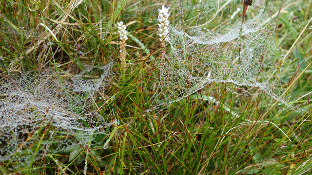
Using the GPS for direction, we walked to the base of the col between Pältsa’s summits. Then we climbed steeply to about 1000 metres, and realised we had climbed too directly towards the 1401 m summit. We traversed sideways for a while and then continued to the col between the summits. We took a break and, since there was mobile signal, sent messages home. We also checked the weather forecast online — it predicted rain for the entire 10‑day outlook. We ate chocolate bars. Then we climbed the steeper rocky slope to the 1401 m summit. There were no views at all; the fog and rain were such that the drone could not fly. We returned down to the 1165 m col and continued immediately to the start of the ridge leading to the 1442 m summit. We took a break and ate chocolate bars. We looked up at the ridge disappearing into fog; we had not been here before, so we were curious what the ascent would be like. It turned out to be quite easy, and soon we were on the summit plateau. We walked to the summit, found the summit book and wrote our names in it.
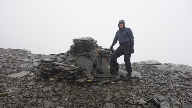
We continued walking all the way to the southern end of the summit plateau, then turned back and descended the ridge leading north. The descent was easy; we continued to the 1267 m summit and past it for a while, then descended into the Pältsa valley and headed for the tent. We reached camp at 18:00; the tracker showed 97.84 km, temperature +9°C. After dinner we considered the weather forecast; it seemed clear that waiting would not improve the weather, and in these conditions boots and socks would not dry. The only way to “improve the weather” was to leave the fells. We decided to do that the next day. I predicted that the weather would improve on the way to the car once we had crossed Njearrejohka. In fact, the rain stopped already during the evening.
Pältsa valley – Signaldalen
On Saturday 22 July 2023 we woke at 04:00. The weather was still foggy. After breakfast and coffee we packed the camp and at 05:55 set off towards the Bealcancahca saddle at 1062 metres. The GPS gave direction in the fog, though the route still ended up with many bends.
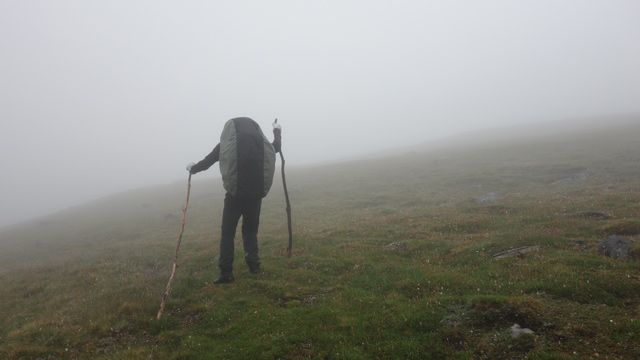
We reached the saddle and continued over it. At this point the sun began to shine through the cloud. We descended easy grassy slopes to Njearrejohka, crossed the river on stones using the tree branches once more, climbed to the marked trail and left the sticks there for the next river crossers. Then we followed the marked trail to Gappohytta; the weather clouded again briefly. At Gappohytta we searched for the route down to Signaldalen; we saw one hiker smoking on the cabin terrace and a cyclist packing gear outside. About five tents were pitched near the cabins. After finding the correct trail we continued. At the next stream we took a break, ate chocolate bars and flew the drone.
Music track: Travelling by Aylex
Source: https://freetouse.com/music
The weather improved; the surrounding peaks became visible. At the treeline we had to change from shell clothing to lighter gear, and ate another chocolate bar. We followed the ATV track down to the Signaldalen parking area, where we arrived at 12:56. The total distance on the tracker was 119.6 km (GPS log 111.4 km), elevation 94 metres, temperature +21°C, with sunshine between clouds.
Hike 2023
Notes from the trip: trekking poles must be acquired. The Pältsa summits are now familiar to the whole hiking party; the ridge on the Moskkugaisi side still needs to be walked someday — then the camp could be in Isdalen. We also found a new way to lighten gear: if you bring a solar panel, you can safely leave sunglasses and sunscreen at home — it’s fog and rain all the time anyway.