Routes
Daily stages on map
As the summer of 2014 progressed, it began to feel like I could still fit in a second hike. I quickly made a plan and chose Halti, a familiar destination. This would be my first solo hike; from Kilpisjärvi to Halti it would be easy enough to walk alone along the marked trail, and I still hadn’t seen the views from Halti’s summit, since during the 2012 trip the summit was in clouds. I planned the hike to last 3 days. The core of the food supply consisted of two Reiter double‑meal pouches I already had at home. Salami and milk powder were left out this time, as well as the knife.
Parking Area – Kahperusjoki
Monday 28.7.2014: departure from home at 09:00, grocery stop in Tornio, bought two packs of noodles as backup meal additions, plus other snacks. In Kolari after 13:00, coffee break. At Kilpisjärvi Nature Centre parking area at 16:45. Ate two pastries, drank juice, poured the remaining juice into a bottle, Gatorade into another bottle, packed food into the backpack, pastries along, started walking after 17:00. Cloudy but dry, slight northwesterly wind, warm breeze, low clouds over Kilpisjärvi and higher clouds elsewhere. Clothing: fleece pants, base‑layer shirt + running jacket, running cap, no gloves, no trekking poles. I ascended the familiar Nordkalott Trail toward Lake Tsahkaljärvi; no mosquitoes.
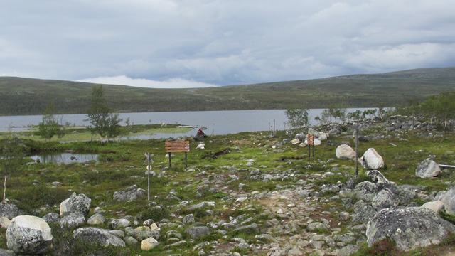
I followed ATV tracks along the lakeshore; water level was low. After the lake, a drink break at the bridge, then more ascent along the Nordkalott Trail. I drank from a couple of streams along the way and ate one chocolate bar while walking without stopping. At Saarijärvi the wilderness hut yard had people; I took a photo of the hut and drank from the stream. Low cloud arrived at Saarijärvi, but I continued and got ahead of it. During the ascent the weather was clear, though lower down it was cloudy. At the top of the ascent, in the saddle between Duolljehuhput and Guonjarvarri, at 21:15, I took a break and removed the backpack. Snack: chocolate bar and juice. My knees felt a bit sore, so I decided to start using trekking poles. I descended into Guonjarvaggi, where I hopped across the stream on stones. I photographed the Kuonjarjoki wilderness hut and continued almost 3 km along the trail to the Kahperusjoki area, where we had also camped during the 2012 trip. Pitched the tent around 23:00; there were mosquitoes.
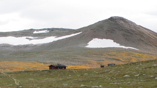
Warm, cloudy but dry weather, very little wind. The backpack was light, the route familiar, and progress was quick. Knee issues disappeared thanks to the trekking poles and the mostly downhill terrain. I ate two pastries and a chocolate bar, drank Gatorade (saving the Reiter meals and gas). Slept at 00:06. Walking distance according to map route markings: 23.7 km.
Kahperusjoki – Halti – Govdavaggi
Tuesday 29.7.2014: rain during the night, but not cold. Wake‑up at 06:30, no more rain, low clouds, brighter horizon in the west. Ate a noodle pack (60 g, quick to prepare: noodles in a cup, a little water added), plus a cup of coffee and a pastry. Packed the tent, started walking after 08:00. Clothing: running jacket, base‑layer shirt, fleece pants. The trail continued toward Meekonlaakso; at Meeko it was occasionally sunny, almost no wind.
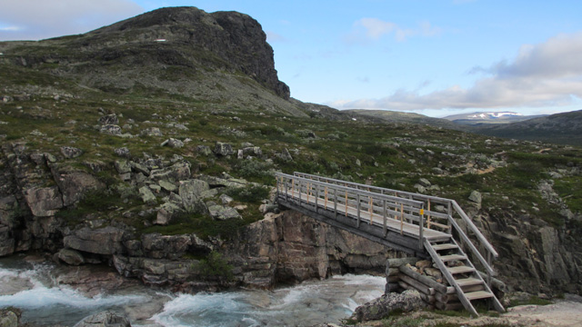
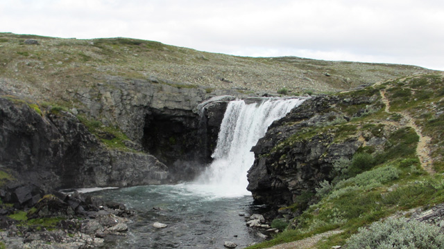
Crossed the Bierfejohka bridge, then followed the trail under Meekonpahta to the Vuomakasjoki bridge. Ate a chocolate bar while walking after the bridge. Ascended to Pitsusköngäs, then to Lake Pitsusjärvi. Took a photo of the wilderness hut and continued a couple more kilometers toward Govdavaggi.
Then I looked for a tent spot. A couple of tents were already by the river, so I went a bit higher up the trail and crossed Govdajohka (water level low enough to cross easily). Pitched the tent after 13:00. Ate a pastry and a chocolate bar, drank a mug of cocoa. The weather looked favorable, so I packed day‑trip gear into the backpack and at 14:30 headed toward Halti. Dry weather, scattered clouds, good visibility, warm. I ascended Halti along the trail; other hikers were coming down.
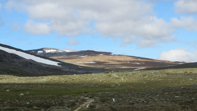
The ascent was rocky, with almost no snow left. I reached the summit around 16:30, took photos, visibility was fairly good. Signed the summit book, entry number 112260. Started descending at 16:45, reached the tent at 18:45. Still good weather, occasional sunshine. Drank cocoa, ate a chocolate bar, salted peanuts, and half a Reiter Spaghetti Bolognese. My legs felt the strain, and I had a couple of blisters; walking ability felt noticeably reduced. I likely wouldn’t have the strength to climb any other peaks, so the return should begin the next day. I still had enough food for two days if needed. Slept at 21:30. Walking distance according to map route markings: 33.9 km.
Govdavaggi – Parking Area
Wednesday 30.7.2014: warm night, no rain. Wake‑up at 06:00, low clouds, fell summits in fog — time to head back. Breakfast: half a Reiter Spaghetti Bolognese, a cup of coffee, three mini cinnamon rolls. Packed the tent, started walking after 08:00. Clothing: running jacket, base‑layer shirt, fleece pants. Walked to Lake Pitsusjärvi, to the hut, along the lakeshore, then to Pitsusköngäs. After the waterfall I looked across the Vuomakasjärvi valley toward the slope of Meekonvaara, where an ATV track seemed to lead toward the Dapmotcahca saddle. This confirmed my idea to shortcut across the fells toward Kilpisjärvi; walking the Nordkalott Trail again did not appeal. I descended to the west end of Vuomakasjärvi. Water level was low enough to cross the stream dry‑shod in hiking boots. Break afterward, ate a chocolate bar. Then ascended the slope along the ATV track; wind strengthened and clouds thickened ahead. From the Dapmotcahca saddle I could see across Bierfevaggi to the lake at 838.5 m, which I aimed for. I descended into Bierfevaggi, crossed the streams easily, then took a break and ate another chocolate bar.
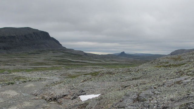
Then another ascent on fairly rocky terrain; Goddejohka was visible below, wind was strong. I passed above the 838.5 m lake on the slope. I continued toward a ravine rising west‑southwest from the lake and ended up on the steep southern wall of the ravine in heavy boulder fields. After a while the terrain eased and I reached the flatter grassy bottom of the ravine, then more rocky terrain. Near the top I put on my shell jacket. At about 950 m I reached the clouds and visibility worsened. I still saw the lake at 979.4 m and continued east of it toward the lake at 957.7 m, descending gently. I dropped below the cloud again. I continued past the lake at 955.1 m, crossed its outlet stream, and walked down the valley. Then I turned west‑southwest following the Duolljehuhputjohka, which flowed in a deep ravine. I reached Norway, crossed a reindeer fence, and took a chocolate‑bar break. Ahead, Sadgevarri was clearly visible; I decided to proceed directly south of it and Lake Sadgejärvi. I crossed Buolvirjohka (Duolljehuhputjohka) and then Aldojohka easily, and due to a bend in the river I crossed it once more. Then I entered dense willow thickets for at least 500 meters. There were marshy patches and water holes to bypass, and I had to jump across one 1.5‑meter‑wide stream. Slowly I reached the Sadgejohka flowing out of Lake Sadgejärvi. I waded across at the lake outlet; water was knee‑deep at most, with a gravel and rounded‑stone bottom.
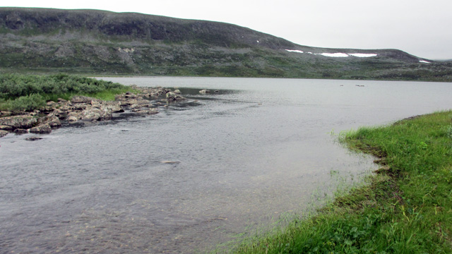
The willow thickets ended at the river and the terrain became easy again. I approached Coahppejohka, which looked fairly swift, but I managed to cross without getting my boots wet at a wide, rocky section. I ascended Jeageloaivi, crossed another reindeer fence, and continued north of Masetjavri to the Nordkalott Trail, where I took another chocolate‑bar break. I followed the trail down to the Nature Centre parking area, reaching the car at 19:59. Walking distance measured from the map: 35.7 km.
Hike 2014
Total distance 92.1 km (based on map route markings and map measurement; no GPS used). Notes: Snow was scarce and water levels low, making crossings easy and marshes dry. The weather during the Halti ascent was reasonably good and I finally saw the views; otherwise it was cloudy. The tent was fairly easy to pitch and take down alone, though there wasn’t much wind. A major improvement in cooking occurred when I realized that Reiter meals can be poured into a food cup and hot water added there — this keeps the pouch cleaner and easier to handle as waste. Without a GPS device, estimating walking distances is largely guesswork, and during the day there’s little sense of intermediate distances; afterward one can only estimate using the map. Hiking alone went reasonably well; a smaller and lighter tent would naturally be better for solo trips.