Routes
Daily stages on map
Signaldalen – Near Finnelvvatnet
On Monday, June 23, 2008 we left Oulu at 05:00, reached Kolari at 08:30, continued at 10:00. Refueled in Kolari. In Kilpisjärvi we visited the store and bought bread, sausage, pastries, soda and chocolate as trail food. After 14:00 we continued toward Skibotn in sunny weather with clear views of the surrounding mountains. After the Skibotn junction we stopped several times to photograph the Arctic Ocean and the mountains lining the fjord. From the junction we turned onto the Signaldalen road, stopping frequently for photos — especially of Otertind.
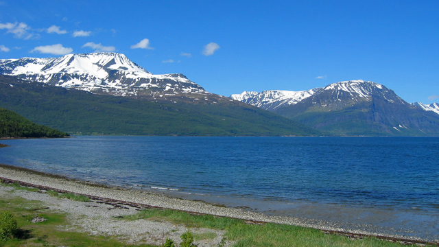
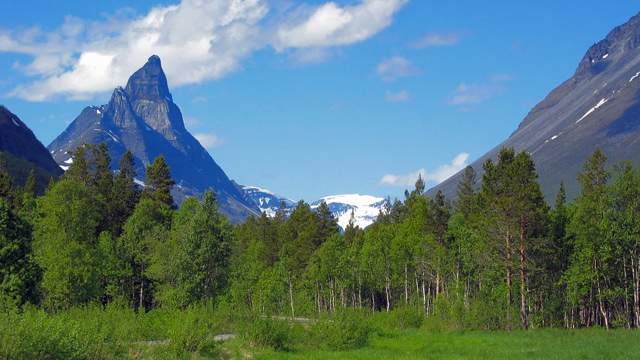
In Signaldalen the road turned to gravel. At the end of the road was a large open area suitable for parking. We changed into hiking clothes and finished packing. This year’s plan was to visit Vassdalsfjellet, Måskugaisi and Paras. The walking portion began at 16:13 in sunny, even hot weather. The route followed a cart track through lush birch forest along the Paraselva river, with some spruce on the slopes. The ascent was gentle, with only a slightly steeper section after about two kilometers. After just under three kilometers, at Skredbekken, we saw remnants of a German WWII road — stones laid as bridge abutments and some decayed bridge beams. The stream was small and easily crossed dry‑shod. From here we descended to the valley bottom toward the river, as advance information indicated a bridge. We found it near the confluence of Nedre Finnelv and Paraselva, just upstream of the junction.
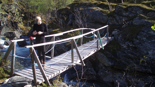
After the bridge the route climbed diagonally along a steep slope, following the old road trace. Above the treeline the slope eased. We took a break and ate a chocolate bar. Ruins of an old bridge were visible in the river — a stone abutment still intact — but the river carried too much water to cross here. We followed the river upstream for about a kilometer and crossed the steep‑walled gorge via a snow bridge. We continued on a mostly snow‑free slope toward Finnelvvatnet, descended slightly, and crossed Övre Finnelv via another snow bridge. Snow cover increased somewhat. After about a kilometer we saw Finnelvvatnet. A flat, dry campsite was found about half a kilometer before the lake at 700 m elevation by a small stream at 21:18. By now the weather had turned cloudy. After pitching the tent we lit a fire and grilled sausages for supper, with rye bread and sauerkraut. Rain began only at 23:42, after we had already gone to bed. It rained through the night; the sound made sleeping difficult. Day’s distance a little over 8 km. Snow bridges made river crossings much easier. Packs were heavy, weather warm at times, otherwise easy walking.
Vassdalsfjellet
On Tuesday, June 24, 2008 the rain stopped around 06:00. We peeked outside and saw low clouds and fog — visibility was poor. Breakfast was Real Turmat beef stew (one pouch per person), eaten from the pouch, plus coffee and cookies. We discussed the day’s plan and decided that despite the fog we would explore Vassdalsfjellet — we had come this far and had no time to wait for better weather. At 10:35 we began walking toward the mountain (gear: shell jacket, wind pants, hiking boots, gaiters (one person), gloves, beanie, trekking poles, chocolate bars and glucose tablets in pockets, Gatorade in bottle). We ascended diagonally up the slope toward the lake, alternating between rock and snow. After crossing a stream bed we continued straight up a snow gully. Snow continued all the way to Finnelvskardet; in the pass the snow cover was continuous. On the far side the slope of Vassdalsfjellet rose steeply — first rocky, then snowy.
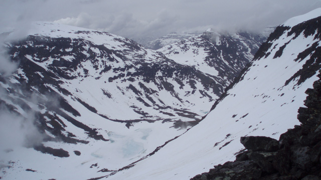
Above the 1100 m contour was a flatter area. We traversed south for a couple hundred meters to the base of the southeast ridge. After considering route options, we attempted a direct ascent westward up a steep snow slope toward the summit. The slope steepened quickly; the snow was soft but provided good footholds. Visibility worsened above 1200 m and was nearly zero above 1300 m. The steep slope was exhausting — breaks were needed every 10–20 steps. Around 1430 m the snow ended at a steep rock wall of loose stones and slabs. We climbed a few meters, using hands for support; trekking poles were a hindrance. We knew descending this way would be nearly impossible. We traversed left onto the ridge leading to the summit but found it too steep to continue. Visibility improved slightly, revealing a steep snow slope dropping into Finndalen. Continuing westward looked difficult. According to GPS our high point was 1441 m at 13:26.
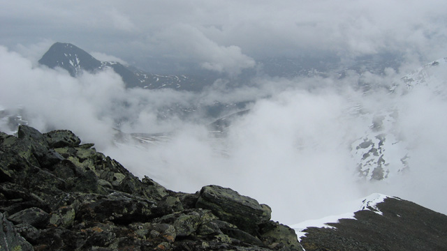
We sat on rocks taking photos. The descent looked steep with loose stones. After some searching we descended the southeast ridge, taking chocolate‑bar breaks, and reached the 1100 m plateau easily. From there we followed our ascent route back to the tent, arriving at 16:23. After resting we ate canned moose meat with noodles and rested more. Rain began around 18:00. After sufficient rest we packed our backpacks inside the tent, then took down the tent and at 23:38 began walking toward Måskugaisi in rain and a northwesterly wind.
Near Finnelvvatnet – Måskugaisi – Njearrelahku
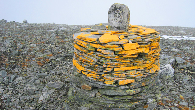
On Wednesday, June 25, 2008 we walked through the night in strong tailwind and rain, crossing both Finnelv rivers via the same snow bridges as before. After crossing Övre Finnelv we turned south and, with no visibility, navigated by GPS to the eastern ridge of Corrovahgaisi. After about 7 km we stopped at 03:32 at 957 m on a flat area and camped. It was still raining, windy and cold. Water was fetched from about 100 m away. Without eating we tried to sleep, but rain noise, wind and cold made it difficult. Around 10:00 we considered rest sufficient and the rain stopped. We ate Reiter Pasta Carbonara (one pouch each) and coffee with cookies. At 11:53 we continued south toward Sweden and the Njearre river. The river crossing was difficult to do dry‑shod but succeeded reasonably. After crossing we climbed southeast to 1062 m into the saddle between Pältsa and Måskugaisi, then continued on snow to the summit of Måskugaisi. On the summit the sun peeked through clouds a few times; Pältsa was occasionally visible, otherwise no visibility. We reached the summit at 15:54 and took a chocolate‑bar break behind border cairn 290 B.
We descended the same way. Njearre river was even harder this time; no good crossing point existed. Eventually we jumped across without worrying about wet boots — water was nearly knee‑deep and boots soaked. Soon after, around 18:00, rain began again. Walking uphill into wind and rain was unpleasant. We reached the tent at 19:17. Dinner was reindeer‑meat stew and Pasta Bolognese. Around 20:00 we began resting. Rain and dampness made sleep difficult. Outside temperature +4°C.
Njearrelahku – Paras – Near Gappohytta
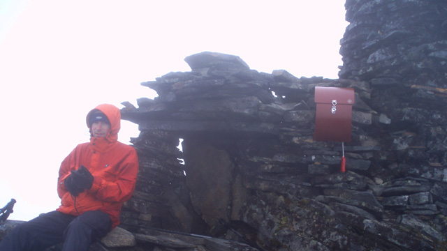
On Thursday, June 26, 2008 we finished resting around 04:00. After coffee we packed inside the tent and took it down. Rain stopped around 06:00. At 06:18 we began walking east toward Paras. After five foggy kilometers we camped at 08:07 by the headwaters of Visiedgajohka near the trail to Gappohytta, on the east side of the trail. Gappohytta was visible higher on the slope. A strong northwesterly wind blew; cloudy but no rain. We ate rice with Mexican‑style minced‑meat sauce. After resting we left at 11:22 for a day trip to Paras. Wind increased during the ascent; clouds thickened around Paras and visibility was zero. Using GPS we climbed to 1100 m on the east ridge, then turned west up a steep slope toward the summit. Between 1100–1200 m we climbed on snow, then on rocks, with a final snow patch before the summit ridge. On the ridge the wind was strong and we had to lean into it. We reached the summit at 14:40, sat behind a stone cairn for shelter, ate a chocolate bar and took photos.
We descended roughly the same route using GPS. Wind increased further. We reached the tent at 17:23. Rain began immediately. Dinner: olive‑cheese pasta with canned meatballs. Then we rested. Strong wind shook the tent; rain drummed; the tent was damp; outside temperature +5°C. Sleep came only in short intervals.
Near Gappohytta – Signaldalen
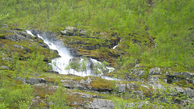
On Friday, June 27, 2008 we stopped resting at 05:30. Rain ended around 06:00. After eating Reiter Chili con Carne and drinking coffee, we packed and at 07:56 began walking toward the trail to Signaldalen. We descended in headwind through Parasdalen birch forest and reached the car at 10:49. Along the way we saw a fox and some reindeer and took one break. Distance 9 km, easy route. Then by car to Kolari, coffee break at Sonkamuotka.
Notes from the hike:
Total hiking distance about 30 km, plus over 30 km from day trips. Weather was not favorable for views or photography, but otherwise the trip was pleasant and there were no mosquitoes. The GPS device was extremely helpful — without it travel would have been difficult, as visibility existed only on the first day. The route and schedule worked well and the hike never felt overly strenuous. Snow conditions were good, water plentiful, food good and sufficient.
Gear notes: Windstopper pants are not ideal — they leak in rain and are too warm in heat, poor as the only pants. Haglöfs Actives 020 shirt dried too slowly. Rubber boots were good for approaches but unsuitable for steep day‑trip ascents and rocky terrain. Fleece gloves were insufficient — they became soaked and hands got cold. Hiking boots still leaked, as last year. Otherwise clothing was fine. Two sleeping pads were useful — one against the tent wall to protect from moisture. However, in wet weather the Nallo 3 GT tent is not ideal — ventilation poor, interior damp, and the low inner‑tent foot end easily touches the fly and wets the sleeping bag. Down bags get wet quickly in this tent. The Pocket Rocket + Trangia 1.5 L pot setup worked excellently; all cooking was done in the vestibule as usual.
Gear improvement plans: new tent (Keron 4 GT), waterproof gloves in addition to fleece gloves, better footwear — either Lundhags boots or new traditional hiking boots. Sleeping bag can remain the same. A larger backpack may be needed for a larger tent.