Routes
Daily stages on map
The first hike of summer 2023 took place in the high fells of Käsivarsi. The plan was to spend four days hiking and camping in the fells. This time the second member of the hiking party was my 15‑year‑old daughter, an enthusiastic hiker as well. We took along all the gear needed for independent trekking; the backpacks weighed 20.4 kg and 6.9 kg at the start. On 5 July 2023 we first drove to Kolari for an overnight stay.
Parking area – Paihkasvaara
On Thursday 6 July 2023 we woke up at 06:15, and after breakfast we started driving towards Kilpisjärvi at 07:00. We arrived at the Nature Centre parking area a little after 10. The weather was fairly sunny and warm. After changing into hiking clothes we shouldered our backpacks and began following a small trail through birch forest towards the northwest end of Ailakkavaara. Quite soon we left the trail and crossed a reindeer fence. We descended into a small ravine to a stream and filled our water bottles. Then a somewhat steeper ascent began, taking us up to the flat summit ridge of Ailakkavaara.
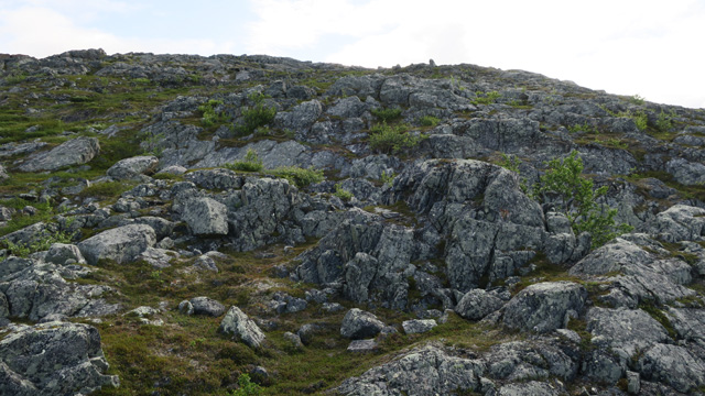
The ascent was not very rocky, mostly bedrock and peat. Higher up the fell was easy to walk. We took breaks and ate chocolate bars. Then we walked onto Ailakkapahda, which offered fine views down to Ailakkajärvi; we also saw a rough‑legged buzzard and five hikers. We also visited the summit of Beaivvasnjunni, the highest point of Ailakkavaara. Even up here the weather was warm and there were many mosquitoes. We then descended lower and, circling around the southern side of Paihkasvaara, walked to the stream descending north from Termisvaara to look for a tent site. We camped at 16:57 near the stream, which had plenty of water. After a Reiter meal we rested; the tent was quite hot, while outside there were mosquitoes. For supper we had cocoa and sandwiches. We went to sleep at 22:00. The day felt rather strenuous due to the ascent and warm weather.
Paihkasvaara – Termisjärvi
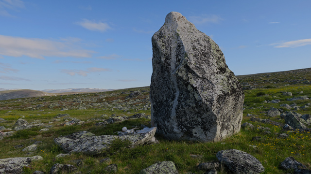
On Friday 7 July 2023 the alarm rang at 06:00; the sun was already heating the tent strongly and there was no wind. After the Reiter breakfast we didn’t feel like making coffee, it was simply too hot in the tent. We broke camp and at 07:47 started walking towards the Termis sacred stone, which we had already seen from afar the previous day. The stone was quite large and impressive.
From there we continued to the ridge of Termisvaara and further to the western summit at 1028.8 m. At the summit we wrote our names in the summit book and ate chocolate bars. There were mosquitoes here too, enough to be bothersome, so we soon continued. We proceeded north of the eastern summit and descended rather steeply to the lake at 811.2 m. Then we descended an even steeper rocky slope to the eastern end of Termisjärvi. We found a tent site by the lake next to the trail at the foot of Jolla‑Malla and camped there at 12:00. The tent was hot, and outside there were mosquitoes and blackflies. We rested, drinking sports drink and eating biscuits. We concluded that the weather was now too hot for hiking. Rest continued until 16:30, when a refreshing breeze arose from the east. We set out on a day trip to Jollanoaivi, 1026.3 m. The ascent was at first steep and rocky. The rocks also spelled the end for the camera that slipped from my hand—it broke. Higher up the ascent was gentler, only the very end was a bit steeper again. There was rocky terrain the whole way, but not the worst kind, and the rocks were dry, which made walking easier. The summit offered wide views in all directions. There were no mosquitoes.
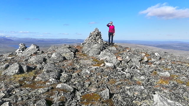
We ate two chocolate bars and drank water. The return to the tent went without problems and we arrived at 19:12. We ate a Reiter meal and finished the evening with coffee, cocoa and tuna sandwiches. We went to sleep at 23:00. This day no longer felt very strenuous.
Termisjärvi – Salmivaarat
On Saturday 8 July 2023 we woke at 08:20; the sun was shining and warming the tent, outside there was wind from the west and therefore fewer mosquitoes than before. After the Reiter breakfast we again didn’t feel like making coffee, so after breaking camp we started walking west at around 10:30. We walked to the Termisjärvi wilderness hut, where we met four other hikers. We took a break inside the hut, made coffee and cocoa, and ate biscuits. At 12:15 we continued along the trail. Then we got the idea to climb up the slope to the right towards Salmivaarat; ATV tracks also led in that direction. We first climbed to the 895 m summit, which had good views. We then descended to the lake at 797.4 m; after a fairly long search we found a tent site by the lake shore and camped at 14:00. We first enjoyed sports drink, then set out to visit the 895 m summit rising behind the tent. There was just enough wind there, so no mosquitoes. We lounged on the summit in the sun for a long while, eating a couple of chocolate bars.
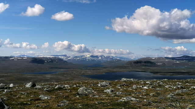
Then we headed south to the 845 m summit of Coahpebakt. While we were standing there, a Hornet fighter jet flew past us along Dierpmesvaggi. After returning to the tent we focused on resting and getting nutrients: we ate tuna, bread, salami and smoked vendace, and drank the oil from the vendace tin as well as sports drink. There was now just enough wind at the tent too, so insects were not a problem. For dinner we had a Reiter meal, and later coffee, cocoa and chocolate bars. We went to sleep after 22:00. A relaxed day with favourable weather. It was worth climbing to Salmivaarat and finding such a fine and peaceful campsite so close to the parking area and busy hiking routes.
Salmivaarat – Parking area
On Sunday 9 July 2023 we woke to cloudy weather, though it wasn’t raining. After the Reiter breakfast we broke camp. Ahead was the return to the car. We first followed the stream to Muvravaggi, then climbed steeply to the top of Muurivaara. The views from there were also quite good. We then descended to the next ravine and climbed steeply to the top of Masetvarri.
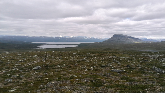
We followed an ATV track there until we descended and reached the Nordkalott Trail by the reindeer fence near Tsahkaljärvi. We continued along the trail by the lake shore and finally down to the parking area.
Jollanoaivi 2023
Notes: At lower elevations in early July it is good to have a mosquito head net and/or repellent. The Salmivaarat campsite could serve as a base camp if one ever dared to try fell skiing in late winter.