Routes
Daily stages on map
For this year’s hike we once again chose the Swedish mountains — there is certainly no shortage of them. The Kebnekaise area has a dense network of huts and clearly marked trails with bridges and boardwalks, so hiking there is straightforward. Except for the Laddjuvaggi and Vistasvaggi valleys, there is very little brush. Because of vacation schedules we set out already in early June, which beforehand felt a bit uncertain due to the snow conditions.
Nikkaluokta – Cievrralahku
Saturday 4 June 2011, Nikkaluokta at 07:30 — breakfast, change of clothes, final packing. Backpacks weighed 23.5 kg and 24.5 kg. We started walking at 08:34. At first we followed the wide trail leading to the Kebnekaise mountain station through leafless birch forest. Calm, partly cloudy, fairly warm. At the Cievrrajohka bridge we took a break and had a drink. Rain began, so we put on shell clothing.
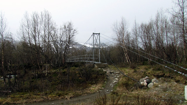
We continued until we reached a sign pointing to a trail leading to old trapping pits. We turned onto that trail and climbed slowly northward with the goal of reaching the Cievrralahku plateau. Above the treeline the clouds thinned and the rain weakened. The climb was warm work, and once the slope eased we took a break. For a while the walking was easy, but around 1100 m continuous snow began — and it did not carry well. Higher up, on a steeper side slope, the snow carried better. Snow continued all the way to the Renvaktarstuga, where we took another break. The wind had strengthened considerably, the rain had stopped, and some snow blew in with the wind. We continued northwest into a headwind. The snow cover was continuous and carried poorly — every step had to be stamped firm before stepping on it. Progress was extremely slow, though the effort kept us warm. Near Cievrrajávri there were a few snow‑free rocky mounds, and we decided to camp there, as no bare ground could be seen ahead. Visibility was limited anyway; the wind had become very strong, with storm‑force gusts. We reached the campsite at 18:50, elevation 1160 m, distance walked 18.9 km (GPS track 17.3 km). Pitching the tent was difficult — the fabric had apparently shrunk when dry, and the pole sleeves felt too short for the poles.
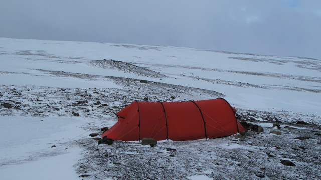
We eventually got the poles in place. All guy lines had to be secured with large stones, and we built a small stone wall for wind protection. During the day the scenery was mostly in clouds, snow made travel difficult, and by evening the wind was strong with blowing snow. Temperature slightly below freezing. No mosquitoes.
Cievrralahku – Darfaljohka bridge
Sunday 5 June 2011 — the strong wind during the night made sleeping difficult, though the first night in a tent is rarely restful anyway. In the morning the wind was still strong from the west‑northwest and some snow blew around. Snow had drifted into the tent vestibule, though fortunately not into the boots. We decided to wait for calmer weather. The sky brightened a little and sunlight appeared between clouds; the wind eased, and at 13:00 we began walking westward on snow toward the Tarfala valley. The snow carried fairly well thanks to the overnight frost. Higher up the wind strengthened again. With shell clothing and windproof mittens we stayed warm, though our cheeks stung a bit. The final ascent to about 1560 m, the saddle between Darfalcohkka and Darfalcorrun, was fairly steep. Strong gusts occasionally forced us to brace ourselves against the slope. The view into Darfalvaggi was very wintry — peaks in cloud, ground covered in snow.
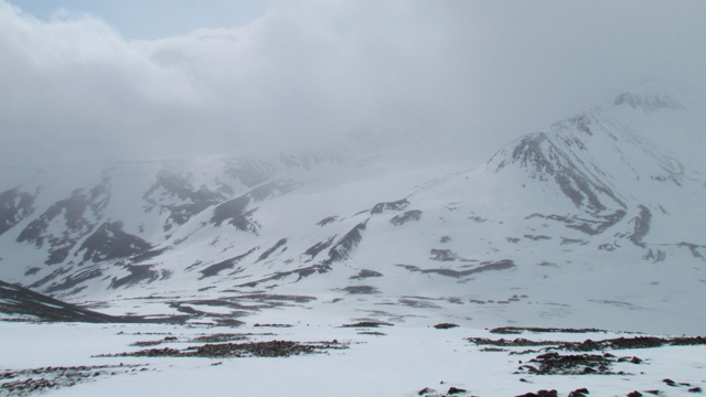
There seemed to be no snow‑free tent sites in Darfalvaggi, so we decided to descend toward Laddjuvaggi in hopes of more summer‑like conditions. At first we slid down the steep slope, then tried the mini‑skis. The snow did not carry well and skiing was poor. We continued on foot down the slope to the south. A little above 1000 m bare ground appeared and we found a trail. Lower in the valley we took a break. The wind calmed and the weather cleared.
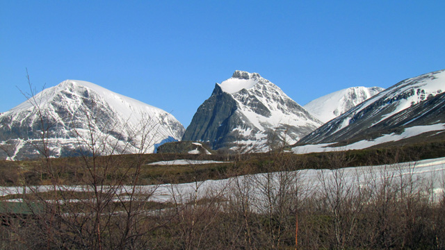
Toward evening the sun began to shine. We reached the treeline and soon the bridge over Darfaljohka. We camped beside the bridge at 19:50, elevation 650 m, distance 11.6 km (GPS track 10.2 km). The wind was now light, the sky clear, and the temperature dropped. The night was cold and we felt chilly at times. Wind, blowing snow, and winter conditions higher up; down in the valley early spring — leaf buds on the birches and a cuckoo calling in the evening. No mosquitoes.
Day trip to Skarttoaivi
Monday 6 June 2011 — around 06:00 the sun rose from behind Darfalcorrun and warmed the tent. The sky was nearly cloudless. Because the weather was excellent, we decided to make a day trip toward Skarttoaivi. We packed daypacks and took about 7 litres of water in the collapsible canister we normally use in camp. We started walking at 08:30, first a couple of kilometres to the Kebnekaise mountain station. The station was still closed; a couple of tents stood nearby. From the station we descended to Laddjuvaggi and crossed the bridge (Elsas bro). We took a drink break — the weather was already hot, exactly the summer conditions we had hoped for. We then followed Laddjujohka eastward, sometimes through heavy boulder fields. When the southern slope looked climbable, we began ascending — first through birch forest, then above the treeline. The climb was steep and required frequent breaks. At about 900 m we turned west toward the 1293 m summit. Snowfields appeared again, but the snow carried well. We circled south of the 1293 m summit to a flat area at about 1280 m and took a break. Beyond this point the snow cover was continuous. It still carried well, and we climbed southwest to 1580 m on the ridge. Clouds began to appear from the south and the wind strengthened. On the ridge the wind was strong enough that we put on shell jackets. We walked along the ridge to 1640 m, from where the summit of Skarttoaivi was visible.
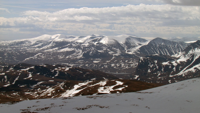
Because of the strong wind we did not continue farther. We took photos and began the return. Some of the group had carried mini‑skis and now switched to them, skiing down to 1260–1280 m.
The snow was not ideal — patches of new snow reduced glide — but the speed was still good. We then descended on foot along our ascent route, taking a break at about 1100 m. We continued down to the valley floor and crossed Laddjujohka dry‑shod — the water level was low. In the valley it was calm and hot. The final 1.5 km to the tent went quickly up a gentle slope. We arrived at 16:20, distance 17.14 km (GPS track 15.5 km). The tent interior was +40°C, so we sat outside in the shade. Cloud cover increased slowly during the evening, and we anticipated poor weather the next day. Thanks to the favourable weather, the day was excellent for a day trip — spring‑winter conditions higher up, bright snowfields, and clear sunshine. There were views toward Kebnekaise.
Darfaljohka bridge – Kuoperjåkka shelter
Tuesday 7 June 2011 — rain began during the night. We packed the camp in rain and started walking at 09:50. We passed the Kebnekaise mountain station and continued west along Laddjuvaggi. It rained continuously. There were bridges over streams, glacier‑smoothed rock slabs, and tundra. We took a break after 7 km. As we continued, the rain stopped. Ahead we saw and heard a slush avalanche — a huge mass of water, snow, ice, and stones rushing down the gully between Skarttoaivi and Liddubakti. When we reached the spot, we saw that the avalanche had nearly reached the hiking trail. We waited a while and saw two smaller avalanches come down.
We continued up the valley across increasing snowfields. The weather was cloudy but dry. We took another break at 12 km. From there we climbed northwest up the slope, following a stream on snow to nearly 1000 m, where views — though cloudy — opened toward Tjäktjavaggi and its surrounding peaks. Avoiding streams, we descended to Kungsleden and reached the bridge over Singijohka. Break at 18 km. We followed Kungsleden to the Kuoperjåkka shelter, crossing many snow patches along the way. We camped on heath 100 m above the shelter at 19:03, distance 20.69 km (GPS track 18.6 km), elevation 780 m. Rainy morning, cloudy afternoon and evening. Progress was slow due to snowfields and meltwater. Still no mosquitoes, and brush was minimal.
Kuoperjåkka shelter – Unna Räita hut
Wednesday 8 June 2011 — rain during the night, easing in the morning, then stopping. We started at 10:30. We followed Kungsleden, detouring around snowfields and streams. Gaskkasjohka flowed strongly and was flooding, but we crossed dry‑shod. After 7 km we reached Sälka huts around 14:00 and took a break. The hut warden had not yet arrived. The weather cleared and became sunny. Considering the decreasing cloud cover, the sun’s position, and the uphill nature of the coming route, we decided to remove our shell jackets. We continued toward Stuor Reaiddavaggi. Above Sälka the slope was full of snow and water, and one boot got wet, but progress continued. Continuous snow began at 1000 m. Stuor Reaiddavaggi ahead was almost completely snow‑covered, and the lake was frozen. Streams flowed under the snow, making travel difficult. We took a break and put on mini‑skis.
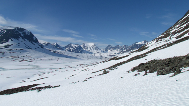
We skied up to about 1100 m, where the snow still carried somewhat, and continued skiing and wading, occasionally crossing narrow rocky patches. The stream from the Reaiddajiegna glacier was open lower down, so we climbed higher to a point where it flowed in a deep gully — there was still thick snow over the stream and we crossed easily. The sun shone brightly from the west, no wind, and it was warm while moving. Fortunately water was available here and there. We gradually approached Unna Reaiddavaggi. The side slope became steep, so we abandoned the skis and continued on foot. Unna Reaiddavaggi was also snow‑covered up to the watershed. At the watershed we took a break. We then moved to the north side of the valley and crossed snowfields and boulders toward the Unna Räita hut. Before the hut, another stream flowing under the snow caused trouble — one boot got wet. We reached the hut at 23:00. One tent site had been cleared in the rocks in front of the hut, but it was snow‑covered and too small for our Keron 4 tent, so we stayed inside the hut.
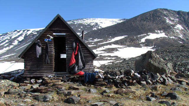
Distance walked 22 km (19.4 km according to the GPS track), elevation 1230 m. A mouse or similar rodent tried a couple of times to enter the hut, but we managed to scare it away with threatening gestures. The early part of the day was cloudy, but later it turned sunny and hot. Unfortunately the snow began to collapse too much and meltwater started to make travel genuinely difficult. The scenery in Stuor Reaiddavaggi and Unna Reaiddavaggi was magnificent.
Unna Räita Stuga – Darfaljohka bridge
Thursday 9 June 2011 — in the morning the sun again rose from behind Räitatjåkka, there were hardly any clouds, the weather looked excellent, and we decided to use the day to complete the “yo‑yo” route. We dried gear for a while outside the hut in the sunshine. We set off at 11:30. The stream next to the hut was now very swift and had to be crossed downstream via a snow bridge. The route continued along a rock ledge with a 150‑metre drop into the eastern part of Unna Reaiddavaggi. Soon we reached a downward‑sloping snowfield — easy to walk on, the surface not slippery. The snow continued almost continuously up to the saddle between Pyramiden and Knivkammen, where at 1457 m we took a break after the steep climb and photographed the scenery.
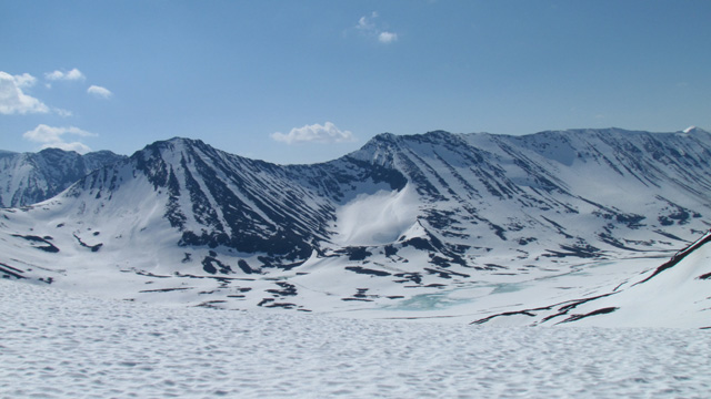
We descended into Kaskasavaggi first through boulders, then skiing with mini‑skis — the snow on the south‑facing slope was already soft. We aimed for the watershed of the valley, assuming it would offer the driest crossing. We managed to cross on skis with dry feet, though there was some water under the snow. We took a break on a small snow‑free patch of ground — the rest of the valley was entirely snow‑covered. We then continued upward toward the next saddle on snow; the final part of the climb was again steep. At the saddle at 1464 m we took another break, put the skis back on, and descended into Guobirvaggi. We aimed our descent toward the head of the stream flowing from the 1193‑metre lake. There the snow still covered the stream, though lower down it was open, and on the lake there was water on top of the ice. We crossed the watercourse smoothly on skis. Some clouds had begun to gather in the south and east. For the next ascent we again went without skis, and climbed almost entirely on snow to the highest point at 1491 m. We descended along the right side of Gaskkasjavri on snow, and after the lake angled slightly right to reach the route leading down toward Darfalvaggi. We followed the glacier’s edge along the lateral moraine to the shore of Darfaljavri.
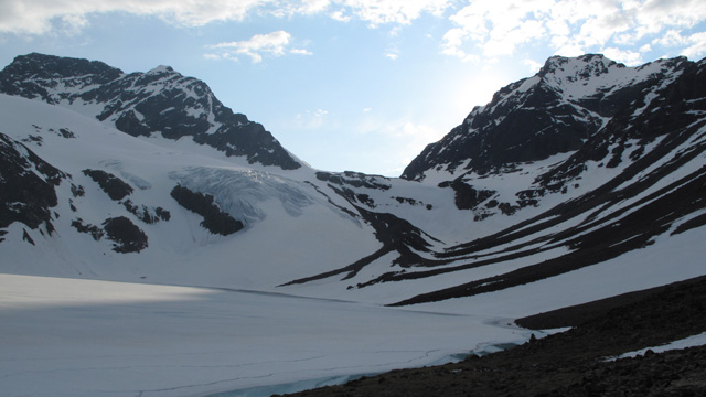
On a snow‑free bank by the stream at the lake shore we took a break. By now evening had arrived and the sun slipped behind Gaskkasbákti. It was calm, and the clouds had disappeared. Walking along the lake on snow, avoiding streams, we reached the familiar trail. Darfalvaggi was now in flood — the river in the valley floor ran strongly. With occasional breaks we walked slowly down the valley to the familiar campsite beside the Darfaljohka bridge. The birches now had leaves. We reached camp at 23:30, distance 20.32 km (17.8 km according to the GPS track). Fortunately the good weather lasted all day. The scenery was wintry and snowy; on steep slopes the snow carried reasonably well, on gentle slopes one had to watch out for streams under the snow. Using skis helped somewhat with the descents.
Darfaljohka bridge – Nikkaluokta
Friday 10 June 2011 — the morning sun again warmed the tent at 06:00, and the weather was hot from the start, with no wind. After so much trudging in snow and dealing with meltwater, the general opinion had shifted: all that remained of the hike was the march back to Nikkaluokta. We set off at 09:50. The trail was wide and equipped with boardwalks; there was no snow at this elevation anymore.
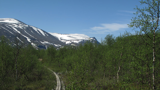
Drinking from streams along the way, we marched to the eastern end of Laddjujavri, where the café was still closed. Boat traffic on the lake had not yet begun. We rested on a bench. The final stretch to Nikkaluokta followed. We arrived at 15:30, distance 18 km (17.0 km according to the GPS track). In Nikkaluokta the local restaurant and accommodation business had just opened its summer season — it was still quiet. According to the GPS trip meter we walked a total of 125.65 km; the GPS track log (50 m point spacing) gave 116.4 km. In continuing heat we drove back to Oulu, arriving at 22:30.
Hike 2011
Notes: Despite the wide range of weather, a simple three‑layer clothing system (base layer – fleece – shell) worked in all conditions, except for the boots, which failed whenever water was deeper than the boot shaft. Longer skis would have been better; the mini‑skis sank too much. Food: bringing muesli proved unnecessary — none was eaten. The same for the fruit soup and glucose tablets. One jar of Gatorade powder was used. We ate 2–3 chocolate bars per day and 2 metwursts. In future: Reiter meals morning and evening, coffee and biscuit in the morning, 3 bars, 2 metwursts, perhaps Gatorade. In early June there is still too much snow in the mountains — above 1000–1100 m the ground was snow‑covered everywhere. Hiking in collapsing snow is not pleasant, and stream crossings can be difficult. Advantages of the early‑June timing: no mosquitoes and no other hikers — even on Kungsleden we saw neither, though a few appeared in the brush of Laddjuvaggi.