Routes
Daily stages on map
The plan was to make a longer 8–10 day trip in the direction of the 2006 and 2007 hikes, with the destination being Sweden’s Sarek — a national park of dramatic mountains, narrow valleys, glaciers and powerful rivers. We had read many online trip reports and studied the area map (Fjällkartan BD10) for half a decade. To maximize camp comfort, the tent was now a Hilleberg Keron 4 GT. In addition to a regular sleeping pad, we carried an inflatable mattress. We had deliberately abandoned the idea of an ultralight pack — clothing was plentiful, food supplies likewise, plus a separate daypack and mini‑skis. Daily distances were planned to be moderate, around 15 km/day, with the possibility of a few summit trips without full packs. In previous years, early summer in the Swedish mountains had meant a lot of snow, so the mini‑skis were brought along in case they helped with snowy descents. This summer’s hike was also the 10‑year anniversary trip with the same team.
Suorva – Guhkesvagge
On Sunday, June 28, 2009 we left Oulu at 03:56, drove via Tornio, Ylitornio and Gällivare to Suorva, crossed the dam and parked next to an abandoned caravan, arriving at 10:06. We ate a Reiter lunch (250 g shared) inside the caravan. Final packing and weighing of backpacks: 30.5 kg (35% of body weight) and 24.5 kg (36% of body weight). We began walking at 11:40 in cloudy weather. At first we moved through brush, then found a trail leading above the treeline. The first ford was at Njavvejågåsj. Wearing lightweight wading shoes, we balanced across stones at about the 840 m contour on the BD10 map; the current was fairly strong.
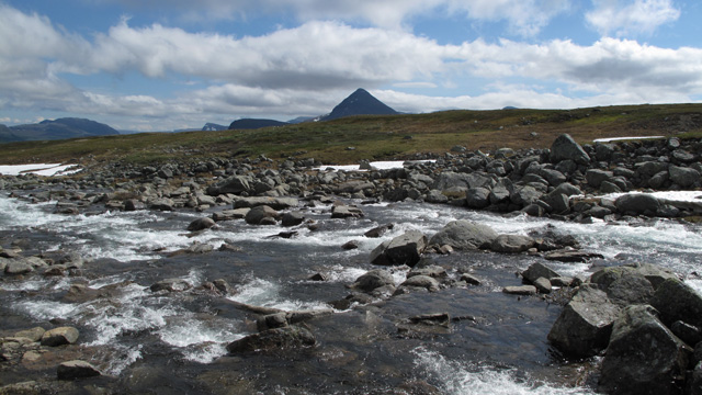
In the now sunny weather we continued after drying our feet and eating a chocolate bar, ascending to about 900 m. We crossed Njiravjågåsj dry‑shod and took another chocolate break. There was some willow brush along the way. We had to ford both Lulep and Alep Niendojågåsj. As we progressed, the scenery improved with the peaks and glaciers of Ähpar.
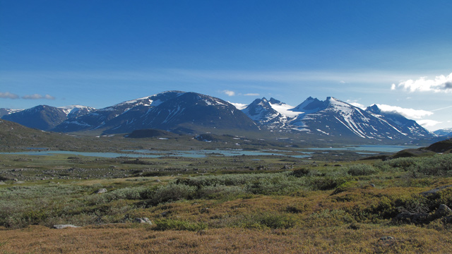
We crossed Guhkesvakkjåhkå via a bridge and camped at 22:32 by Vuojnesjågåsj. The day felt heavy due to multiple fords and willow thickets, and the heavy packs certainly added difficulty. After dinner we went to sleep.
Day Trip to Vuojnestjåhkkå
On Monday, June 29, 2009 we woke at 07:00. Sunny, no clouds, hot inside the tent. After a Reiter breakfast, instant coffee and pastries, we decided that since the weather was excellent, we would climb Vuojnestjåhkkå and plan the rest of the trip afterward. At 09:00 we began ascending the ridge toward the summit, taking a break to eat pastries.
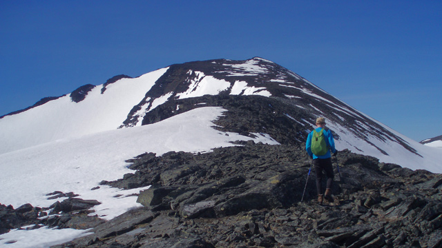
The ascent was easy and never steep. We reached the summit at 13:00. The views were magnificent in the cloudless weather; GPS showed 1974 m. After taking photos we began descending. Since we had noticed large snowfields during the ascent, we decided to descend on mini‑skis, which we had carried with us.
The skis worked well and we were able to descend long stretches. The final section, between about 1300–1000 m, was especially good — steep enough for frequent slalom turns to control speed. We returned to the tent after 16:00. It was extremely hot, +33°C inside the tent with no wind. We decided not to move camp that day but rest and wait for cooler weather. After dinner we had instant coffee with pastries, cookies and chocolate.
Guhkesvagge – Låddebakte – Bielajåhkå
On Tuesday, June 30, 2009 we woke at 04:00. It was cool: 5.5°C in the tent, 4°C outside. After breakfast and coffee we broke camp and began walking toward the central areas of Sarek as the sun rose behind us.
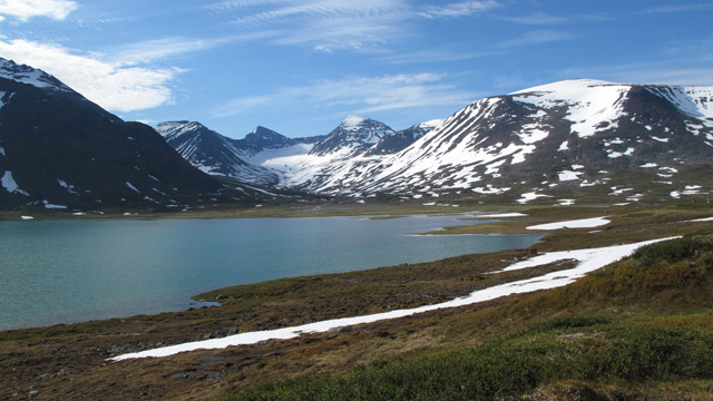
We crossed Vuojnesvarasjin, continued along Lake Bierik and past the Bielaj lakes, taking a chocolate break along the way. After 10.1 km we camped near Bielajåhkå at 10:45. Sunny, no wind, already warm. Lunch was cereal muesli and fruit soup, followed by coffee and cookies. We packed daypacks and at 13:00 headed south toward Snavvavagge and Låddebakte. The trail into Snavvavagge traversed a steep slope descending toward the Rapadalen valley, with willow thickets and rocky sections. In rain or with heavy packs it would be very difficult; with light daypacks and dry weather it was manageable. In Snavvavagge we took a short break and drank sports drink. We crossed Alep Snavvajågåsj by hopping on stones at about 970 m, shortly after the stream leaves Snavvajávvre. From there we climbed a steep, rocky slope toward Låddebakte, reaching the summit around 17:00. GPS showed 1538 m. The weather was cloudless, no wind, and the views down into Rapadalen and toward the mountains and glaciers to the west and south were breathtaking.
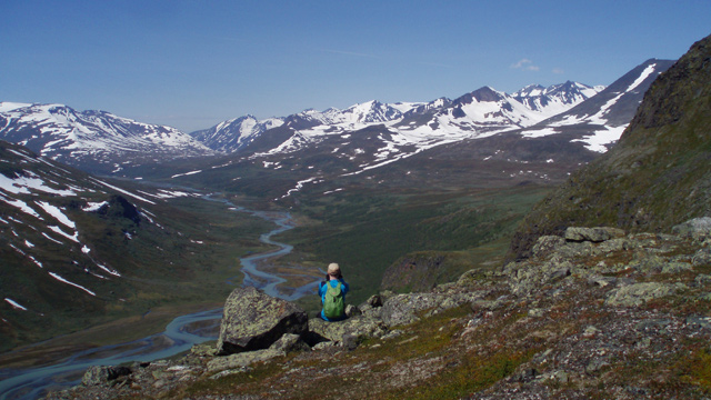
We took photos and ate salami (50 g/person). We descended back to Snavvavagge — no ski slopes this time — ate glucose tablets with water, and continued along the difficult trail back to the tent. We arrived at 21:10. The trip was strenuous and we were hungry, so we ate another Reiter dinner.
Bielajåhkå – Alggavagge
On Wednesday, July 1, 2009 we woke at 06:00. Breakfast, coffee and cookies. We broke camp and left at 08:37. In partly cloudy weather we headed toward Skarja. We crossed Tjågnårisjågåsj and Mahtujågåsj via snow bridges, taking a chocolate break at the latter. At Skarja we crossed Smajlajåhkå via a bridge.
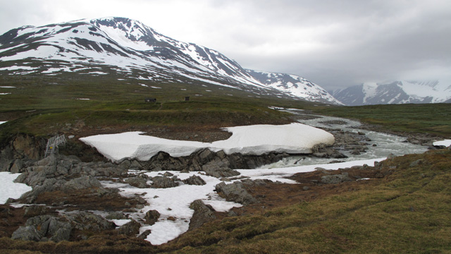
Soon after Skarja it began to rain and we changed into shell clothing. We continued along Guohpervagge to the point where Guohperjåhkå splits into several branches around the 800 m contour. We hopped across the branches dry‑shod. After climbing to a reindeer fence we noticed the wire mesh had come loose from a post, so we repaired it using a stone as a hammer. We took a break and ate muesli (100 g/person), fruit soup and salami. We continued along Alggavagge to Niejdariehpvagge, where we forded Alggajåhkå using lightweight shoes. Due to rain we saw little scenery. We camped by Niejdariehpjågåsj at 19:14.
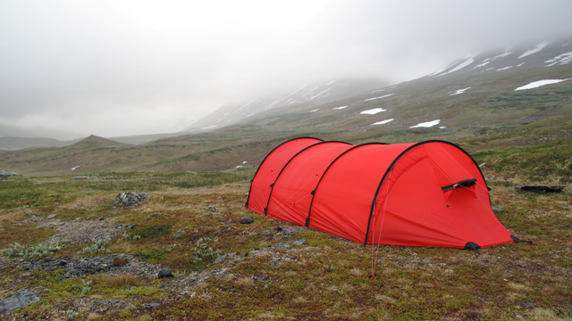
Light rain turned into heavy rain. Dinner: Reiter + coffee + cookies.
Alggavagge – Tjågnårisskajdde
On Thursday, July 2, 2009 we woke at 06:00. Reiter + coffee + cookies. Foggy, rainy weather. We waited to see if the weather would improve, but at 09:55 we broke camp and began ascending Niejdariehpvagge along its eastern side.
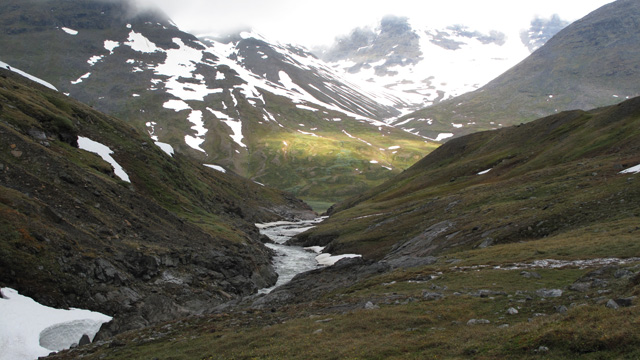
The weather gradually improved during the ascent, and by the time we reached the top of the valley at nearly 1200 m, the sun was shining. The upper valley was very snowy. During the descent into Sarvesvagge the peaks of the Pårte massif were beautifully visible. At 950 m we took a break behind a bank for shelter from the strong northwesterly wind. After chocolate and salami we continued westward along Sarvesvagge.
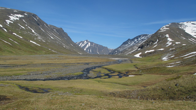
The terrain was rocky. We forded Jiegnavakkjågåsj at a point where it split into three channels. After drying our feet and eating chocolate, we continued past Sarvesvagge and northward to the confluence of two unnamed streams with Tjågnårisjåhkå — marked as Tjågnårisskajdde on the map. We camped at 19:48. Dinner: Reiter. A strenuous day; the initial ascent had tired our legs.
Tjågnårisskajdde – Nasasvagge
On Friday, July 3, 2009 we woke at 07:00. Cloudy but no rain. Reiter + coffee + cookies. We left at 10:09, first crossing Tjågnårisjåhkå by hopping on stones. The sun soon appeared. We continued gradually upward toward Rissajåhkå, which we forded below a waterfall at just under 880 m.
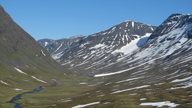
Since the map showed two more streams ahead within a few hundred meters, we continued in lightweight shoes. After crossing the second stream we dried our feet and ate chocolate. We continued toward the west end of Alggajávvre, where a boat was supposed to be available for crossing. There were two boats — both on the opposite shore — so we could not cross. We did not want to ford the lake outlet. Thus we did not visit the Alkavare chapel. We continued downstream along Miellädno for about two kilometers and crossed the river via a bridge. After the bridge we took a break and ate muesli + fruit soup. We then climbed diagonally northward to about 1140 m and descended into Nasasvagge. The valley was snowy and the lake frozen; there were no good tent sites near the lake. We continued to the far end of the valley, crossed the outlet stream via a snow bridge just after the reindeer fence, and camped at 18:33 at 964 m by the stream. The site was nearly level. The view down into Guohpervagge was impressive. Dinner: Reiter.
Nasasvagge – Ruohtesvagge
On Saturday, 4 July 2009 we woke at 07:00. Sunny with a few clouds, wind from the northwest. Reiter + coffee + biscuit. We set off at 09:35, descended into Guohpervagge, walked about a kilometre northwest along the valley, and crossed Guohperjåhkå by hopping on stones where the river split into several channels. It required quite a bit of zig‑zagging to find a dry‑shod route. On the far side we attempted to cross Gasska Låvdakruvtasj, but due to the strong current it was not possible in hiking boots. We did not want to ford either, so we headed upstream to look for a snow bridge. The river ran in a deep gorge, and searching for a snow bridge there did not seem appealing. We decided instead to reach Ruohtesvagge by crossing Låvdaktjåhkkå via a pass just under 1300 metres. Originally the plan had been to ascend along Alep Låvdakruvtasj, but the route change made little difference. We climbed toward the pass; at 1000 metres snow patches began to appear, and from 1100 metres onwards the terrain was completely snow‑covered. At 1150 metres we crossed the river easily on snow. We continued to the pass at 1300 metres, where we took a break and ate muesli. On the far side the snow slope continued unbroken for a long distance downhill, so we decided to switch to skis.
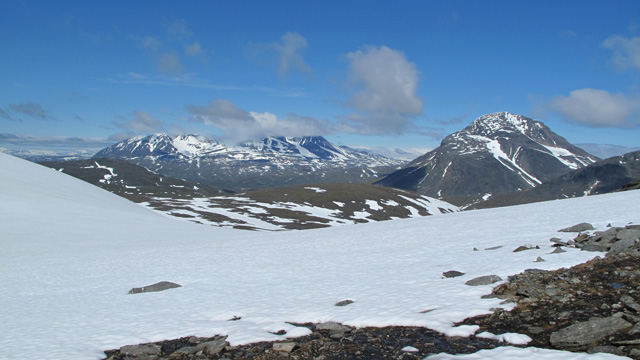
On mini‑skis we descended 1.5 km to about 1090 metres near Jålle hill. On firm snow and a gentle slope, skiing with a backpack worked well. We continued on foot down into Ruohtesvagge, crossing the streams we encountered by hopping on stones. We walked to the level of Nijakvagge, crossed the stream descending from the gorge, and camped at 982 metres at the mouth of Nijakvagge. Dinner: Reiter.
Ruohtesvagge – Nijak – Oarjep Tjievrajavrre
On Sunday, 5 July 2009 we woke at 06:00. Cold morning, +3°C outside. Reiter + coffee + biscuits. We set off at 08:37. Up Nijakvagge along its northern side, first on rocky ground, then on snow in the valley bottom. We ascended the valley to 1270 metres; cloudy weather, little visibility. Still, we decided to climb Nijak since it was right there — perhaps the summit would be above the clouds or the weather might improve. We climbed scree and rocky slopes to a flat area below Nijak’s small glacier, then ascended the rocky slope to about 1800 metres, where we turned right and soon reached the summit. The ascent was steadily steep and somewhat tiring, but technically easy. From the summit there was little to see — only cloud. During the ascent we took a chocolate break; on the summit we ate salami.
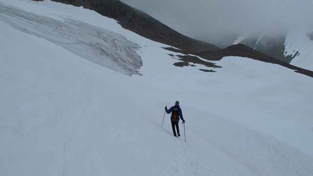
After returning to our packs we ate another chocolate bar and continued east along Nijakvagge, descending past Nijakriehpjavrasj and maintaining about 1100 metres. Shortly before Suottasjvaratja we descended to 1000 metres and crossed Suottasjjågåsj by hopping on stones at 980 metres. We continued along the southern slope of Lulep Gassavarasj toward Oarjep Tjievrajavrre, and camped on the north shore of the lake by the stream connecting the two Tjievrajavrre lakes at 19:45. Our legs were somewhat tired from the day’s rocky terrain. Dinner: Reiter.
Oarjep Tjievrajavrre – Sliehkkojavrre
On Monday, 6 July 2009 we woke at 07:00. Reiter + coffee + biscuits. Cloudy weather, cool wind from the east, no rain. We left at 09:47 toward Vuosskelvagge. The terrain was quite rocky and progress slow. After a chocolate break we continued past the foot of Unna Atjek and along the shore of Nuortap Atjek, through the yard of Renvaktarstugan, to the stream flowing out of the lake. By now it had become routine to cross streams by hopping on stones, so we did the same here — 25–50% of footwear got wet, but it didn’t seem to bother the wearer. After the crossing we took a break and ate muesli and fruit soup.
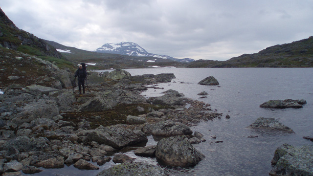
We continued descending gently, eating chocolate occasionally, until we reached Sliehkkojavrre, where we camped at the east end at 17:55. Reiter + coffee + biscuits.
Sliehkkojavrre – Suorva
On Tuesday, 7 July 2009 we woke at 06:00. +3°C outside, light rain. Reiter + coffee + biscuits. We left at 08:17, descended along the stream through brush, and continued to the car. According to the track log we had walked about 170 km; the GPS trip meter showed 183 km. We reached the car at 09:36 and changed clothes. Pack weights were now 23.76 kg (–6.74 kg) and 14.36 kg (–10.14 kg). Fresh snow was visible on the surrounding mountains from the night. We drove from Suorva to Gällivare, Ylitornio and Tornio, reaching Oulu at 17:30. Roadworks on Sweden’s E10 and rainy weather slowed travel. We also drove up to the top of Dundret (821 m) in Gällivare.
Notes from the hike: The Hilleberg Keron 4 GT tent was excellent — spacious and free of condensation. The Exped Airmat inflatable pad was good, though somewhat narrow. A large gas canister lasted 4.5 days. Mini‑skis were fun to use. Clothing: a separate wind jacket was unnecessary; the shell jacket sufficed whenever a jacket was needed. Gaiters were not needed at all. A stretch‑fleece shirt worked well due to the constant breeze; PS fleece pants were worn most of the time.