Routes
Daily stages on map
This year we planned a somewhat longer hiking trip, preparing for a journey of about 10 days. We chose Sweden as our destination, since it had been several years since our last visit there. We decided to explore the southern parts of Sarek National Park, the Pårte region, because during our 2009 Sarek trip this area had remained unvisited. The Pårte region is easily reached from Kvikkjokk via established trails, bordered by Rapadalen in the east and Sarvesvagge in the north. According to advance information, snowmelt had been delayed this year and there was still a lot of snow in the mountains even in summer. Larger water crossings should therefore be avoided. In preparing our gear, we aimed to keep pack weight reasonable by limiting food and clothing, and we left the mini‑skis at home. In planning the route, we tried to avoid long daily distances and intended to camp at 2–3 base camps from which we would make day trips with lighter gear.
Kvikkjokk – Stuor Dahta – Slope after the lake
Friday 10.7.2015 wake‑up at 05:00, coffee, driving at 06:00. Refueling in Tornio, arrival in Kvikkjokk at 12:30, rainy weather on the way. Parked at the end of the road, cooked food and ate, changed clothing. Backpack weights: 20.4 kg and 20.1 kg. Weather turned sunny. We walked along the Kungsleden trail for a few kilometers through spruce forest; mosquitoes were plentiful. Streams were frequent enough that thirst was never an issue, and the trail was not flooded.
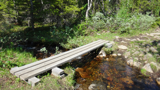
At a junction we turned toward Pårek, still on a good trail with boardwalks across marshy areas, through forest. After the Dahta lakes we began looking for a campsite and found one conveniently by a small stream. Camp at 16:40, distance 9.8 km, elevation 565 m. Ate salted peanuts, resting at 17:50.
Slope after Stuor Dahta – Gådokvagge
Saturday 11.7.2015 wake‑up at 06:00, sunny, Reiter Serbian stew, coffee + biscuits. Packed camp, walking at 08:00. First through spruce forest, then birch forest, ascending until at 700 m we reached the Pårek plateau. The Pårte mountain was already visible.
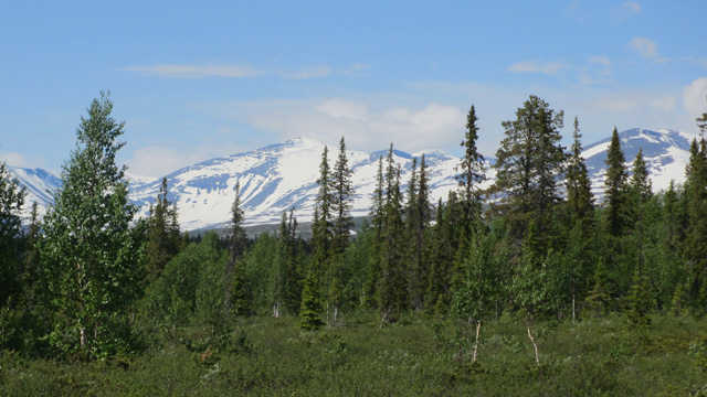
Easy trail all the way to the Pårek lakes crossing point (8 km). We found that the water could not be crossed in hiking boots without getting them wet. With wading shoes the crossing was manageable, though the water was very cold and we had to stand on rocks to warm our feet occasionally. After the crossing we took a break and ate chocolate bars. We continued along the trail, ascending slightly, then leaving the birch forest and heading toward the saddle between Pårektjåhkkå and Stuor Jierta. Streams were crossed on snow bridges. On a slope break we ate salami and chocolate bars. At the saddle at 1200 m there was continuous snow, which did not carry well, so we bypassed it on the right. After the saddle the snow carried again, and we descended along a snowy streambed into Gådokvagge to the bridge over Gådokjåhkå. After the bridge: break + salami + chocolate bar.
We continued another three kilometers and camped at 17:11, distance 20.8 km, elevation 964 m. Reiter Pasta Carbonara. Still sunny, no mosquitoes. Rest at 19:30.
Day trip to Gådoktjåhkkå
Sunday 12.7.2015 wake‑up at 06:00, Reiter potato stew, coffee + biscuits. Slightly cloudy, no wind, no rain. Packed day‑trip gear and left at 07:50 toward the summit of Gådoktjåhkkå. The ascent was steep immediately from the tent, then gentler. At 1200 m the snow began and continued almost continuously to 1800 m. Snow carried well. Weather turned sunny and warm during the ascent. The 1885 m summit was a broad plateau; from there we descended to the 1800 m saddle and then climbed to the 1928 m summit, arriving at 11:30.
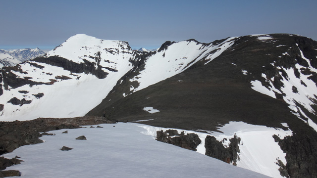
The views were excellent in nearly all directions, with wide vistas of Sarek’s mountains. To the north there was a steep drop. We examined the ridge leading to Gådokgaskatjåhkkå (1978 m) and concluded it would be difficult to traverse. Ate salami + chocolate bar. At 12:30 we began descending, first to the 1885 m summit, then choosing an eastern descent route. This was unwise, as there was no snow to ease the descent, so we descended through boulder fields to the saddle between the 1885 m and 1670 m summits, then along the western side of the 1670 m summit to the 1524 m summit. Thirst began to bother us, so we descended southwest to a stream at 1200 m. Drank, ate a chocolate bar, then continued to the tent. We saw stoats in the rocks. Back at the tent at 16:15, distance 13.1 km. Still sunny and warm. Reiter Hungarian stew cooked outside the tent because it was too hot inside. Rest at 18:40.
Gådokvagge – Gådokvagge, day trip to Lullihatjårro
Monday 13.7.2015 wake‑up at 06:00, Reiter potato stew, coffee + biscuits. Sunny weather. We decided to move our base camp slightly westward, since our planned day trip would head that way. Packed camp and started walking around 08:00. Soon we reached a stream from Jiegnavagge; we had to search a bit for a dry‑boot crossing, as snow bridges were only higher up. The crossing succeeded, and after a short walk we camped at 08:45, distance 2.3 km, elevation 1039 m. After pitching the tent we packed day‑trip gear and left at 09:30 toward Lullihatjårro.
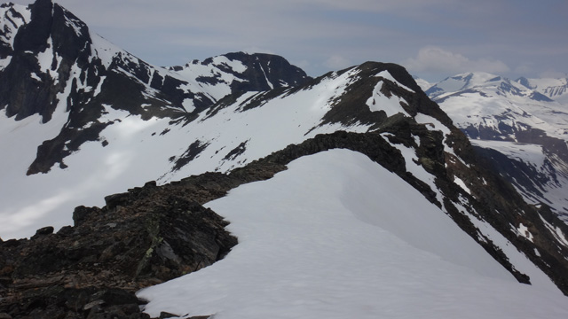
We crossed the Skajdejågåsj stream on a snow bridge and continued west. We ascended snow toward the steep southern slope of Lullihatjårro, then climbed a steep snow slope higher up. The slope eased and we reached the 1586 m summit, where we took a break and ate chocolate bars. We continued partly on snow, partly on rocks, until reaching the summit ridge. We reached the 1784 m summit and saw that the ridge continued easily to the 1785 m summit, so we continued there. Shortly before the summit we left our trekking poles and used hands for the final climb. We reached the summit at 13:10.
The summit offered excellent views of the Pårte glacier and surrounding peaks. Also good visibility northward. Ate salami and chocolate bars. We began descending at 13:30. Before the 1586 m summit we turned onto the eastern slope and soon found a suitable snow slope for an easy descent. Back at the tent at 16:23, still sunny and warm. Reiter Pasta Carbonara cooked outside. Rest at 19:30.
Gådokvagge – Luohttolahko
Tuesday 14.7.2015 wake‑up at 06:00, Reiter Hunter’s stew, coffee + biscuits. Sunny weather. Packed camp, walking at 08:00. First toward Skajdejågåsj, which we crossed on a snow bridge at 1140 m, then continued on continuous snow toward Lullihavagge, warm weather. After the highest point of Lullihavagge at 1350 m we descended slightly, then took a chocolate‑bar break. Then we continued toward the slope rising to the 1544 m summit — the well‑known “shortcut” to Luohttolahko, though the slope is steep. We tried to maintain as much elevation as possible and from 1237 m climbed a steep snowy side slope. This worked well and at 1292 m the slope eased. We reached a nearby stream and took a drink break. Then we ascended to 1513 m until the climb ended. The view toward Lullihajavrré and Luohttolahko opened up. After a salami + chocolate bar break we climbed to the 1544 m summit, with wide views west and north. We descended on snow to Luohttolahko, which was still almost entirely snow‑covered, with frozen lakes.
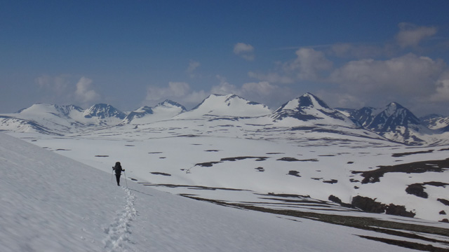
According to advance information, there should be one tent spot nearby, and fortunately we found it on a low ridge among the snowfields. Camp at 14:45, distance 11.6 km, most of it on snow, elevation 1241 m. Still sunny; we dried sweaty gear and washed in the stream beside the tent. Reiter Chicken Korma Curry. Rest at 18:30.
Day trips to Nåite and Lullihatjåhkka
Wednesday 15.7.2015 wake‑up at 06:00, Reiter Pasta Bolognese, coffee + biscuits. Cloudy but dry, +6°C, no wind. At 08:30 we left for a day trip to Nåite. First on snow; the southern slope of the mountain was snow‑free. We reached the summit at 10:30; it was in cloud.
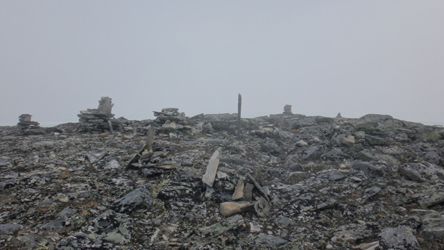
We ate chocolate bars while watching the clouds move, then descended at 11:30. On the lower slope we encountered a herd of reindeer. Back at the tent at 13:04, distance 8.6 km. Ate salami and chocolate bars, refreshed day‑trip gear, rested briefly, then at 13:50 left for the second day trip toward the Lullihajavrré valley. It might be possible to ascend to the saddle between Lullihatjåhkkå and Tvillingryggen and see the Pårte glacier. We followed snow to the stream draining the valley lakes, which flowed in a shallow snow channel; crossing was easy. Then we ascended on reindeer tracks to a ridge southwest of the lake at 1462 m. From there we continued at the same elevation across the valley glacier toward the steep ascent to the saddle. We reached the saddle at 1650 m and saw the Pårte glacier. The ridge of Lullihatjåhkkå rose steeply from the saddle, and we decided to attempt climbing it. Weather was warm and calm, though cloudy. We left trekking poles at the saddle.
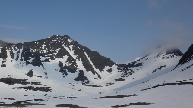
The ascent was on loose boulders, quite steep, requiring use of hands almost the entire time. The climb went reasonably well, and the weather cleared slightly. After 1860 m the terrain became steep not only upward but also to both sides. Our group stopped partly at 1875 m, while some reached 1905 m. We estimated that climbing higher might have been possible, but descending safely would have been too difficult. Perhaps another route would be easier. We took a chocolate‑bar break, then descended back to the saddle. From there we followed our tracks back to the tent, arriving at 19:48. It was cooler at camp with a northwesterly breeze. Reiter Chicken Risotto. Rest at 21:25.
Luohttolahko – Lakes at 1220 m west of Loametjåhkkå, day trip to Loametjåhkkå
On Thursday 16.7.2015 wake‑up at 06:00, Reiter Beef Stroganoff, coffee + biscuits. Cloudy weather, a cold northwesterly wind, no rain. Packed camp, started walking at 08:13, +3°C outside. Following our previous day’s tracks on snow, we crossed the stream coming from Lullihajavrré, then headed south‑southwest and crossed the stream from the Balgatjiegna glacier via a snow bridge. The next stream flowed in a snow channel with little water and was also easy to cross. Then we ascended the slope to 1344 m and soon descended to 1220 m to a pair of lakes on a “shelf,” where tent sites were said to exist. We found a spot by the larger lake at the outflow stream; the lakes were still frozen. Camp at 11:17, distance 6.6 km, elevation 1225 m. Some sunshine, still a cold wind. Ate salami + chocolate bars. Then we packed day‑trip gear and at 13:15 set out toward Loametjåhkkå.
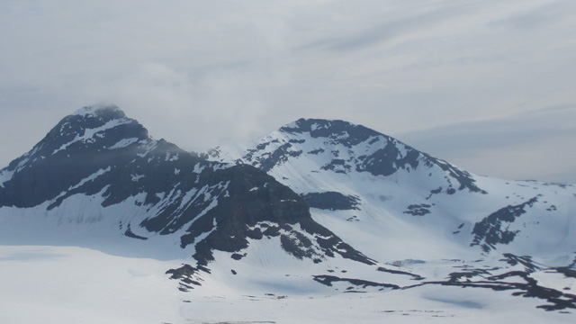
At first we climbed a fairly steep rocky slope, then gentler terrain on snow, and finally steeper rocky ground again. We reached the summit at 1871 m at 14:55. It was cloudy and there were hardly any views. The summit had a steep drop northward onto the glacier. After a chocolate‑bar break we descended and reached camp at 16:50, distance 6.1 km. Reiter Pasta Bolognese. The sun heated the tent strongly and it became too hot inside. Rest at 18:25.
Lakes 1220 m – Pårek Plateau
On Friday 17.7.2015 wake‑up at 06:00, Reiter Beef Stroganoff, coffee + biscuits. +2°C outside, cold northwesterly wind. The plan for the day was perhaps the most demanding of the trip: reaching the summit of Pårte while carrying full backpacks. Packed camp, started walking at 08:30. We followed the “shelf” at about 1260 m, then descended into the Ruopsokjåhkå ravine, crossed the river on a snow bridge at 1171 m, and then climbed a fairly steep snowy slope toward the 1425 m saddle. Near the top the snow surface was hard and required kicking steps, but otherwise the ascent was straightforward, though tiring. At the saddle the wind was strong and thirst began to bother us. We searched for water and shelter on the eastern side of the saddle and ended up climbing to 1517 m before finding a water source. We took a salami + chocolate‑bar break behind a rock at 11:30. Then we climbed a sometimes steep rocky slope until reaching the summit of Pårte at 2005 m at 12:30.
The summit was in cloud, snow was falling, and the summit book was wet; we added our names. Then we descended mostly on snow to the Pårte observatory at 1830 m, arriving at 13:30. We took a salami + chocolate‑bar break sheltered by the observatory wall. The weather cleared slightly and we could see the ridge continuing toward Pårektjåhkkå. We descended the ridge eastward to 1603 m, then climbed to the western summit of Pårektjåhkkå at 1803 m, arriving at 15:45. There were good views toward the Pårte glacier. After the 1803 m summit came the narrowest section of the ridge, though still not very narrow. We continued to the main summit of Pårektjåhkkå at 1805 m, arriving at 16:50.
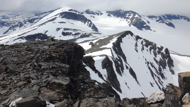
We took a chocolate‑bar break and then descended southward. The slope was rocky and the descent slow. We continued to the snow bridge over the Gasskagårsåjågåsj stream, crossed it, and descended to the trail leading to the Pårek plateau, where we found water again. Evening was approaching, the weather was sunny and fairly warm. At the Pårek lakes crossing point we were now able to cross dry‑shod in hiking boots. We continued along the trail for a few more kilometers until reaching a campsite by the stream flowing from the lake. Camp at 21:30, distance 24.3 km, elevation 700 m. Reiter Chicken Risotto. Rest at 23:00.
Pårek Plateau – Kvikkjokk
On Saturday 18.7.2015 wake‑up at 06:00, Reiter Beef with rice and vegetables, coffee + biscuits. Sunny and calm weather. Packed camp, started walking at 08:05. Weather became slightly cloudy. We descended along the trail into birch forest, then spruce forest, past the Dahta lakes to the Kungsleden trail.
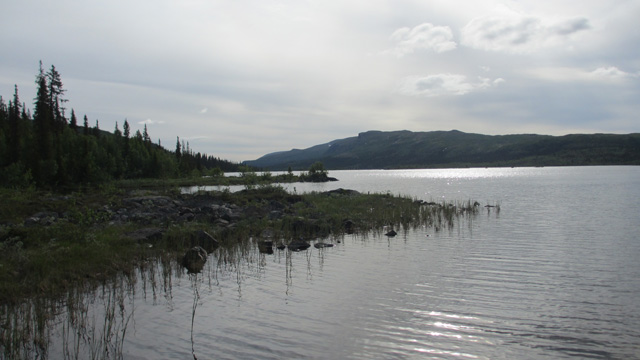
Chocolate‑bar break after the stream crossing near the trail junction. Many mosquitoes in the forest. At the parking area at 12:06, distance 13.3 km, elevation 335 m. Backpack weights: 16.2 kg and 14.0 kg. Changed clothing, packed the car, drove home.
Notes: There was quite a lot of snow, and for that reason we did not want to cross Luohttolahko. Snow travel was manageable by avoiding flat snowfields and staying on slopes. Some areas remain unvisited. Gear worked as usual; the new Xenith backpack and NeoAir Xlite sleeping pad were excellent. One large gas canister lasted 6 days. Preparing meals by dividing the dry ingredients onto plates and adding water afterward made waste handling easier.
Hike 2017
Total hiking distance 136 km according to the GPS track log (50 m point interval). Total ascent 7 km 414 m, and descent the same.