Reitit
Daily stages on map
On our summer 2019 hike we decided to head to the Swedish mountain region, the Sarek National Park. According to Wikipedia, Sarek is known for its remoteness and its high, steep‑sided mountains. The terrain is very rocky in places, especially on the mountain slopes. There are no marked hiking trails. The park is said to be extremely popular among hikers, but it is not recommended for beginners. Some sources even recommend bringing a satellite phone or similar device to be able to call for help if needed. We had already gained some first impressions of the area during our 2009 hike. We decided to start the trip again from Suorva, where one can cross the water via the dam without needing a boat ride. The timing of the hike was early enough that the boat transport from Ritsem would not yet have been available anyway. The planned duration of the trip was a maximum of 10 days. Since we were traveling with our own car, the endpoint of the hike would also be Suorva. The summer hike was also the 20‑year anniversary hike of our hiking group. We prepared for Sarek’s conditions by taking along, in addition to map and compass, a GPS device. Because of the rocky terrain we used sturdy hiking boots. For accommodation we brought a tent, and for meals our own food supplies.
Suorva – Vuosskelvagge
On Monday 24 June 2019 we woke at 03:20, the drive began at 04:02, refueling in Tornio, then Töre, Överkalix, Gällivare, and arriving in Suorva at 10:05. We changed clothes and ate at the parking area. The backpacks weighed 22.8 kg and 22.5 kg. Walking began at 11:20. Cars could no longer cross the dam to the other side, but below the dam there was an open door for hikers next to the gate. The west wind was quite strong and the weather cool; at times a few raindrops fell, at times the sun peeked through the clouds. A wind jacket and beanie were needed. After the dam we considered our route and headed right, up the slope toward Sliehko, because we wanted to get out of the lower‑slope birch forests as soon as possible. The ascent was fairly steep; the sun began to shine more strongly, so it became warm during the climb. We took a break higher up near a lingering snow patch and a stream, and ate chocolate bars. Higher up the wind was quite strong and cold, and the sun had gone behind clouds.
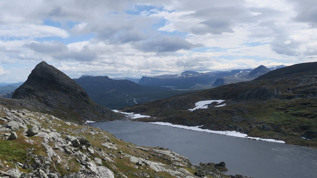
We passed Sliehkkojavrre on its northern side and then ascended gently along the slope of Hallji; the terrain was rocky in places. This stage was familiar from an earlier hike, and we wondered how we would cross the stream flowing out of Lake Nuortap Atjek, since on the previous trip our footwear had gotten wet during the crossing. We took a break and ate beef jerky, then descended slightly toward the stream to inspect the situation. The stream carried a fair amount of water and few stepping stones were visible. The threat of wading—and thus the risk of wet feet—sharpened our senses, and we noticed snow in the streambed about 100 m downstream. Immediately we hoped for a snow bridge! We rushed downstream and indeed there was a snow bridge, somewhat cracked but still usable. We crossed the water and continued onward. Near Lake Nuortap Atjek our pace slowed; after a chocolate bar break we began searching for a tent site. The terrain there is very rocky, but we found a spot. We camped at 18:09 after a 15.4 km hike at an altitude of 925 m. The wind was strong, but more troublesome for pitching the tent was that the tent had shrunk and the poles were difficult to fit into the sleeves. Soon, however, we were able to eat in the shelter of the tent: Reiter Hunter’s stew. The strong wind continued; the outside temperature was +4 degrees. Rest at 20:30.
Vuosskelvagge – Sareklåpptå
On Tuesday 25 June 2019 we woke at 06:00; the wind had eased somewhat, light rain, low clouds, temperature +2 degrees in the tent vestibule. Breakfast was Reiter Chicken noodle hot pot (lactose‑free), followed by instant coffee and biscuits. The morning routine was a bit slow; walking continued at 08:50. Due to the cold weather we wore, among other things, two shirts under the shell jacket, a beanie and neck gaiter, fleece gloves and paclite mittens. The rocky terrain continued and progress was rather slow. We crossed several ridges across Vuosskelvagge; the terrain was also hilly and we encountered stream ravines. We took a chocolate bar break after 4.5 km. Then the Gassalahko plateau with its waters came into view; we headed between the lakes Nuortap and Oarjep Tjievrajavrre, because on the previous trip we had been able to cross the stream between the lakes easily there. We reached the point where the stream flows out of the upper lake; crossing without wetting our boots looked possible—slightly tricky but successful.
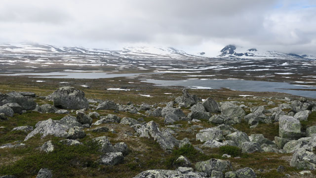
We circled the western end of the lower lake, then took a break behind a rock sheltered from the wind, eating beef jerky and chocolate bars; we had walked 11 km. Then we encountered a somewhat more vigorous stream, likely Vardasjåhkå; we had to search for a crossing point for quite a while, but eventually found a place where we could hop across without wetting our boots. We then ascended gently southward toward the Sareklåpptå area; the stream crossings were easy. We took another chocolate bar break, and at 17:22 we camped after an 18.1 km walk on grass beside a stream at 1137 m altitude. The sun had peeked through the clouds for a while; the weather was drier, but the wind had strengthened again. The tent was pitched despite the wind. We ate Reiter Stroganoff with rice. Outside temperature +4.4 degrees, wind still strong. Rest at 21:30.
Sarektjåhkkå Nordtoppen
On Wednesday 26 June 2019 we woke at 06:30. Cloudy but dry, moderate wind, temperature +3 degrees. Breakfast was Reiter Noodle pot Carbonara, coffee and biscuits. We had been considering a visit to the summit of Sarektjåhkkå Nordtoppen, which according to guidebooks is easily climbed. So we packed day‑trip gear and at 08:55 left the shelter of the tent and headed up the slope past Vardasdievva. Nordtoppen was visible below the clouds, which were high. The steeper ascent began at 1400 m altitude. The rocky slope was relatively easy to climb. At 1800 m the slope eased slightly; we went to the right edge of the slope to look down into the glacier valley between Nordtoppen and Sarekpakta; the vertical north face of Nordtoppen was also clearly visible. We ascended gently to 1960 m, where the summit ridge began. The ridge was almost completely covered in snow; new snow had fallen on the mountains in recent days. The snow was soft. Then clouds began to blow in with the wind, at times reducing visibility to zero. We tried to avoid the northern edge of the ridge, because on that side there was a steep drop and a cornice we had seen earlier. The southern side was presumably gentler, but visibility was poor there as well. At times we stopped to wait for better visibility. Eventually we were able to continue and finally the summit rocks came into view.
At the summit we watched the movement of the clouds for a moment, recalling all the mountain summits from which we had seen nothing due to clouds: Markusfjellet, Måskugaisi, Paras, Nijak, Halti, Glittertind, Galdhöpiggen, Nåite, Loametjåhkkå, Pårte, Kaskasatjåkka, Kallaktjåkka. Yet all summit climbs have been highlights of our trips and unforgettable experiences. There must be some other reason than the views that makes one want to reach summits. The freezing wind and cold cut the reminiscing short and we began the descent. We descended along a long snow patch; behind Vardasdievva we took a break and ate jerky and chocolate bars; even here lower down the wind was strong and it began to rain. We returned to the tent at 14:21, outside temperature +4 degrees. Reiter Chicken curry with rice served as supper. The weather cooled toward evening to +2 degrees; the wind was strong and there was intermittent precipitation. Rest at 20:06.
Sareklåpptå – Bielajavratja
On Thursday 27 June 2019 we woke at 06:00; the wind had been strong all night, small snow pellets came with the wind, and snow had accumulated at the end of the tent. Breakfast was Reiter Peppery beef stew, followed by instant coffee and biscuits. Outside it was +2 degrees with strong wind when we began walking at 08:52 along Guhkesvagge toward the southeast. Fortunately the wind was at our backs. After passing Sarekjavrasj the cloud cover began to break and the sun started to shine; the weather warmed slightly. At Gaskka Sarekjiegna I made a short detour up the slope to the ridge in front of the glacier, from where Sarek’s Stortoppen was visible. We took a break and ate chocolate bars, and removed some shell clothing. The wind continued and the weather remained rather cool. Lulep Sarekjågasj carried a fair amount of water and we had to search for a crossing point; the stones in glacier streams are for some reason particularly slippery. The crossing of Vuojnesjågasj was easier. Before Vuojnesvarasj we took a break and ate beef jerky and chocolate bars after 11 km of walking.
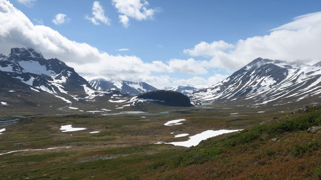
We crossed the Vuojnesvarasj ridge and headed down the valley toward Bierikjavrre. At the 16 km mark we took another break and ate chocolate bars. The wind was now head‑on and had strengthened considerably; gusts made walking difficult. After Bierikjavrre snow began to blow in with the wind. When it was time to camp, we tried to find a sheltered spot due to the strong wind. The terrain was very open, but eventually we found a tent site behind a low bank. We camped at 17:38 after a 20.5 km walk at 831 m altitude. The strong wind made pitching the tent quite difficult. In the tent we prepared and ate Reiter Meat‑vegetable stew and watched to see whether the tent would stay in place. During the evening the snowfall continued and the wind eased slightly. Outside +3 degrees. The cloudy, windy and cold weather led us to plan to stay at this campsite for the time being. Rest at 20:30, outside 0 degrees, still snowing.
Sarvatjåhkkå
On Friday 28 June 2019 we woke at 06:00. The wind and snowfall had continued through the night; the arctic weather conditions did not encourage going outside, so we rested in our sleeping bags until 09:30. Breakfast was a bit late, but as brunch we had Reiter Hunter’s stew, which suited us well. After that we had coffee and biscuits. The weather remained cloudy with no signs of improvement. Nevertheless, we decided to go out for a short excursion today as well; right behind the tent rose a suitable slope for this purpose. At 11:45 we began ascending the lower slope of Sarvatjåhkkå. The slope was fairly steep and of course rocky. The sun peeked out occasionally, the wind was strong, and snow continued to blow in with the wind. Higher up the slope steepened further and we moved left onto a snow patch, where the slope was a bit gentler and the wind weaker. Along the snow patch we climbed to the mountain ridge at 1664 meters; there was some visibility of the surroundings, and the 1909 m summit of Sarvatjåhkkå was visible, as well as the 1711 m summit. Below us lay a small glacier. We first headed to the 1698 m summit and from there to the 1711 m summit. The wind strengthened and visibility decreased. From the summit there appeared to be a steep drop to the west and north. The ridge descended toward the saddle between this summit and the 1909 m summit. We considered continuing in that direction, but the strong wind, wind‑driven pellets, and nonexistent visibility made us abandon the idea. We took a break and ate chocolate bars, then returned to the 1698 m summit.
From there we continued along the ridge to the 1694 m summit, from which there was a steep wall down to the glacier. We then descended lower along the ridge and searched for the snow patch we had used for the ascent. Slightly lower down the visibility improved. Along the snow patch it was possible to slide downhill from 1500 m to 1170 m. We returned to the tent at 17:23, having covered 8.4 km. During the evening there was intermittent precipitation, outside temperature +6 degrees. We ate Reiter Pasta bolognese with beef. The wind calmed. Rest at 20:30.
Bielatjåhkkå
On Saturday 29 June 2019 we woke at 06:00. It had rained all night and was still raining. The weather encouraged continued resting, and so we did until 07:45. At this point the rain decreased and the wind strengthened. We ate Reiter Pasta with beef and pepper, coffee and biscuits. Feeling refreshed, we decided to take another excursion today. We equipped ourselves appropriately and at 10:45 began walking toward Bielatjåhkkå, the mountain rising on the opposite side of the Pielavaltan plateau. We crossed Bielajåhkå easily at the western end of Lake Bielajavratja. The weather remained cloudy with very little visibility. The northwesterly wind was strong and snow blew in with the wind. We ascended the slope fairly steeply; there was plenty of rocky terrain. Higher up the ascent eased and snow covered the ground. White snow and white cloud inspired lively commentary: “Well now there really isn’t much visibility at all.” – “Yeah, not much… at all.” At 1400 m the slope eased considerably and on the flat it was difficult to decide which direction to proceed. At this point the GPS device was useful; we checked the map and were able to continue to 1500 m, reaching the steeper final ascent to the 1573 m summit. At this point the weather cleared slightly and there was a bit of visibility. The wind increased and at the summit it was again extremely strong, making walking difficult. Wind‑driven pellets hit our eyes and made seeing difficult. The temperature was 0 degrees, and our hands were cold.
The harsh weather conditions motivated us to get down from the mountain as quickly as possible. Progressing into the headwind seemed difficult, so we walked with the wind at our backs. The wind came from the northwest–west. Visibility again dropped to almost nothing. We knew there were steep slopes on the eastern side of the mountain that we should avoid. Slightly lower down, on the sheltered side of the summit, we stopped to consider our direction. We estimated that we should head south toward the saddle at 1400 m. The GPS device also had a compass view showing the cardinal directions. E for east? In any case, we apparently managed to walk toward S, because we did not end up on steep ground and we found the saddle. Visibility improved lower down. In the saddle we took a break and ate two chocolate bars. We studied the map to consider our onward route. Toward the southwest it looked possible to descend into Snavvavagge. However, we first headed east to see whether descent was possible there. In a couple of places cliffs prevented descent, but eventually we found a spot where we could descend the steep rocky slope into the valley of the 1141 m lake. The remaining walk to the tent went quickly despite the headwind and pellets. We reached the tent at 18:00, having walked 15.6 km. We reflected that there is nothing better than Reiter—at least nothing we had with us—so Reiter Stroganoff with rice was very welcome. Outside +2 degrees, rest at 20:15.
Bielajavratja – Sluggajåhkå – Slugga
On Sunday 30 June 2019 we woke at 06:00. Wind and snowfall continued through the night; in the morning there was snow on the ground, temperature +2 degrees. Breakfast was Reiter Peppery beef stew, followed by coffee and biscuits. The weather remained quite poor, so we had decided to begin the return journey. We set off at 08:50. Usually, deciding to leave the mountains results in an immediate improvement in the weather; this time the weather improved only shortly before Vuojnesvarasj: the wind eased, snowfall stopped, and the sun began to shine. We took a break at Vuojnesvarasj and ate chocolate bars. We had to remove our shell clothing already before the Guhkesvakkjåhkå bridge.
Behind Niendooalgge we took another break; in the shelter of the wind it was even warm. We ate beef jerky and chocolate bars. The clouds had cleared and the nearby mountains were visible. We even saw cirrus uncinus—mare’s tail clouds—indicating rapid deterioration of the weather. We had been considering a visit to Slugga mountain, so we headed in that direction; the chosen route took us through pleasantly varied willow thickets and rocky terrain. Progress was slow, but we crossed the streams without difficulty. Near the small lake/pond at 802 m we found a tent site and camped at 17:08 at 825 m altitude. The weather was turning cloudy, so we quickly ate Reiter Meat‑vegetable stew and at 18:16 set off at a half‑run toward Slugga mountain. Sluggajåhkå flowed in a fairly deep ravine, but we crossed it with dry feet. The ascent of the mountain was gentle at first, then fairly steep, with rocks and boulders on the slope. Near the top there were cliffs and large boulders; we had to use our hands a bit, reminiscent of the ascent of Saivaara on the 2012 trip. At the summit, 1279 m, the wind was quite strong; we wrote our names in the book in the metal box and took photos. The peaks of Ähpar and Sarek were clearly visible, and in the other direction Lake Pietsaure and more. Then we returned to the tent, arriving at 22:49; the day’s trip was 27.6 km. We ate chocolate bars and rested at 23:30. Soon a strong wind began, and rain started at 00:37.
Sluggajåhkå – Suorva
On Monday 1 July 2019 we woke only at 08:00; it had rained through the night, and the precipitation had fallen as snow—outside the ground was white and snow had accumulated on the tent.
Reiter Pasta with beef and pepper, coffee and biscuits. The rain decreased and turned to drizzle; clouds were low, foggy, no wind. We did not hurry with the morning routine and only at 12:20 began walking toward Suorva. Njavvejågasj required some searching for a suitable crossing point, but we crossed with dry feet. We descended lower and found the start of the trail; it was wet and muddy in the brush, and there were mosquitoes. Finally we walked across the Suorva dam to the parking area, arriving at 16:57 after a 14.1 km walk. The backpacks weighed 19.7 kg and 16.5 kg. Total distance of the entire hike: 130.5 km.
Notes: the large gas canister lasted until the morning of day 8. Instead of a knife we carried a pocketknife, which we did not need. The weather was quite cool; we had to wear a beanie day and night for a week. Sealskinz rain gloves could not be used at all due to cold hands. The NeoAir sleeping pad lived up to its name—new air had to be blown in every few hours. Due to the weather the trip remained somewhat incomplete. As for Sarek National Park, we are not finished yet; many places remain unvisited. The Suorva direction is starting to feel familiar; perhaps another direction should be considered for future trips.