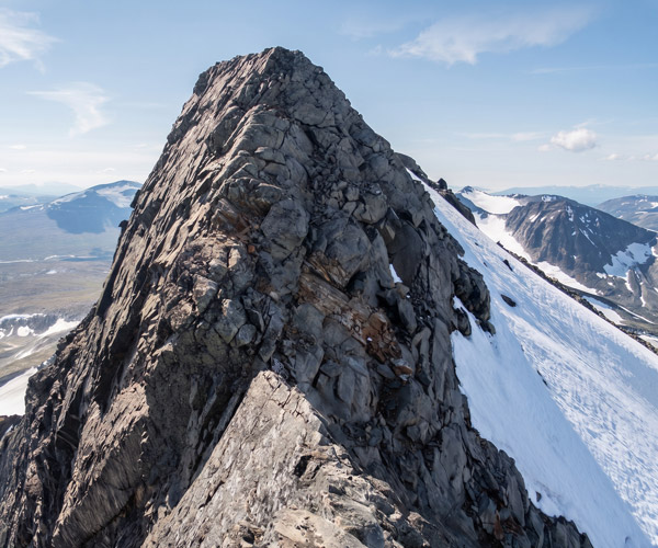
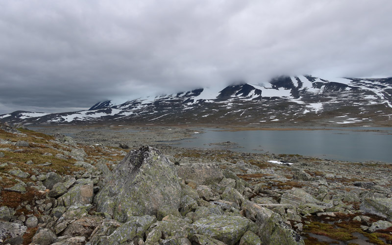
We had agreed that the destination for our summer 2026 hike would be Àhkká fell in Sweden. This fell is one of the few in Sweden to rise above 2000 metres; it stands at 2011 metres. We had already attempted to summit it via the northern route on our 2006 trip, but that attempt was cut short at the north-eastern peak (Nordosttoppen), at an altitude of 2003 metres. The narrow section between the north-east peak and the highest peak (Stortoppen) – known as ‘Haket’ – which required some scrambling, proved too daunting for us.
The climbing section in 2006 (Haket)
It has since emerged from various sources ( www.pekkavaris.net/sarek2007/, https://tunnelivaeltaja.kuvat.fi/kuvat/1998_Sarek, On a fell hike in Sarek – route descriptions, Claes Grundsten, Hiking in Sarek, Fredrik Neregård), that the highest peak could also be reached from the south, in addition to the route across the Hylljökeln glacier, which is the most common route for Swedes. We have neither the equipment nor the expertise for a glacier trek. So we would now set off on a second attempt to reach the highest peak of Mount Àhkká. We also had a couple of additional destinations planned, so in terms of kit we prepared for a 10-day fell trek, which meant we took plenty of Reiter and other provisions with us.
On Saturday 27 June 2026, we set off by car at 05:03, filled up with diesel in Haaparanta and continued via Töre and Gällivaara onto the road to Ritsem. Due to a rockfall that had occurred on 25 May 2026, the road had been closed until 18 June 2026. The road was in rather poor condition. 24 km before Ritsem, we stopped at a lay-by and enjoyed meatballs and pasta in a cream sauce for lunch. For dessert, we had coffee and buns. Whilst we were there, we changed into our hiking gear. We then drove to the car park at the ferry terminal in Ritsem, arriving at 1.20 pm. The weather was windy and it was drizzling occasionally, so we put on our waterproofs. We carried out the official weighing of our rucksacks; they weighed
19,7 kg and
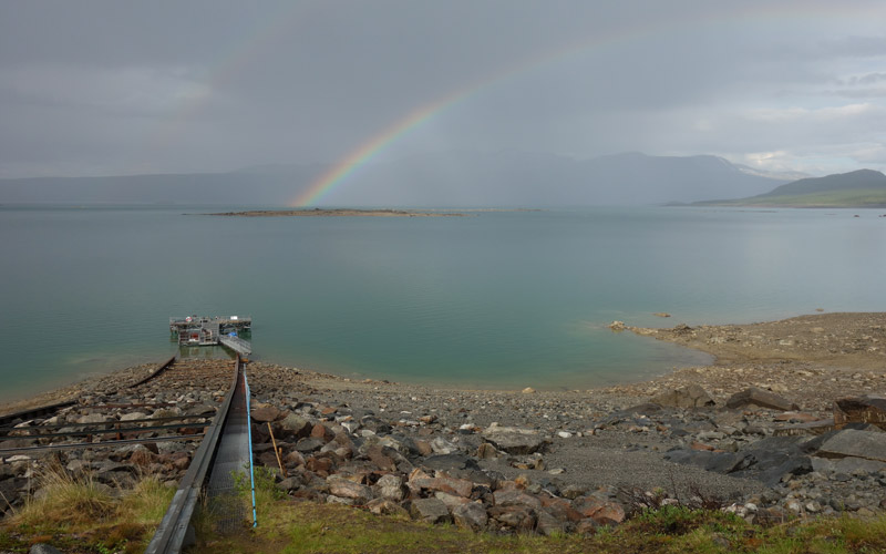
18,6 kg. The ferry, the MS Storlule, which had only started operating this summer season on 26 June 2026, departed from the quay at 14:20 (Finnish time).
The ferry crossing cost was
380 SEK per person (34,26 euros)
, payment by debit card.
We had already met a Swedish family (6 people) in the car park; there were also a couple of other passengers. During the boat trip, the father of the family told us that they were on their way to the STF’s Akkastugan to visit their daughter, who works there as a hut warden. After crossing the lake, we set off following this group along the path towards Akkastugan. The weather was sunnier here, so we had to take off our jackets.
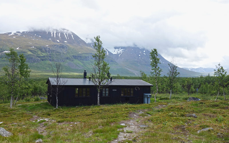
Akkastuga
At the shelter hut, we chatted for a while with the other hut warden; he told us that bad weather was on the way and mede sure we would be able to call for help in case of trouble using the inreach GPS device we had with us.
The others stayed at Akkastugan, whilst we carried on towards Vuojatädno. Work was underway to replace the boardwalks along the path. Before reaching the bridge at Vuojatädno, we had to swap our waterproof trousers for fleece trousers due to the warm, sunny weather.
The bridge over Vuojatädno
After the bridge, we continued for a short while along the Padjelantaleden trail, then turned onto the path leading towards the Akka terraces. We climbed the path through the undergrowth up to the terraces above the tree line; one slope was a bit steeper, but otherwise the going was easy. After the climb, the path ended, so we took a break by the stream and ate some chocolate bars. The weather turned cooler and cloudier, and there was a breeze, so our shell jackets were needed again. We then made our way along the south-western flank of Mount Àhkká as far as Rákkasjåhkå; we didn’t have the energy to go any further, so we decided to set up camp; the evening was already well advanced, at 20:31 (Finnish time).
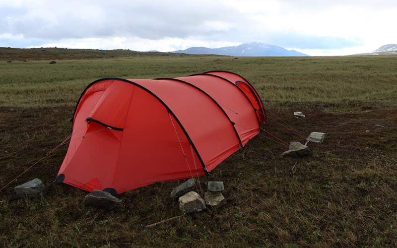
We found a flat spot to pitch the tent, with a small stream running alongside it. The view was provided by Mount Gisuris, bathed in the evening sun. Reiter, meanwhile, took care of the food. From the extensive range of hiking meals, we chose the ‘Pasta Bolognese with Beef’ option, a moderately light meal suitable for the evening. The red tent complemented the colour of the tomato sauce. During the day, we had covered 24.86 km, with a total ascent of 894 metres. It had taken us 6 hours and 35 minutes. The campsite was at an altitude of 867 metres above sea level. The weather turned cooler as night fell.
Sunday 28 June 2026: alarm at 06:30 (Swedish time, which our smartwatches had switched to – and so had we). We didn’t feel particularly cold during the night, even though we were now using camping quilts instead of sleeping bags. The weather was overcast but calm, and the slight chill whetted our appetite; for breakfast we had Reiter Beef Stroganoff with Rice – a hearty meal that would give us the energy to get through the day. We also had our morning coffee and some biscuits. Then it was time to break camp. We were a bit concerned about how we’d get our gear back into our rucksacks; we were both now carrying lightweight rucksacks weighing about 1 kg each, which didn’t have many pockets or lower compartments. We had to stuff everything into the rucksacks from the top, but it all fit in the end. Once we were ready to set off, we continued uphill along the Rákkasjåhkå stream to the Rákkasoalgg saddle at an altitude of about 1,100 metres. There was a bit of a view from there, so we took some photos. We then descended quite steeply over snow, veering slightly to the left. Once we reached a flatter area, we started looking for a spot to pitch the tent. We found a suitable campsite fairly quickly on a grass-covered gravel slope between two streams. We pitched the tent; in our opinion, this was a rather excellent spot for camping. The distance we’d covered so far was 4.06 km; it had taken us 1 hour and 43 minutes, and we’d climbed 290 metres. The campsite was at an altitude of 957 metres. We ended up staying in the tent because it started to rain, so we couldn’t go outside.
We waited in the tent for the rain to stop, sprawled out under the blankets and dozing a little. The rain eventually stopped and we ate some chocolate bars. We then packed all sorts of things we might need on a day trip: a map, a compass, a GPS, a camera, a camera battery, a camera tripod, a down jacket, a windbreaker, a beanie, waterproof gloves, water and chocolate bars. We then set off on our hike towards Mount Àhkká. The threat of rain was ever-present, so we’d put on our waterproofs.
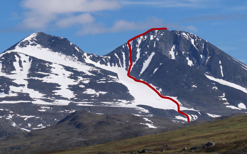
Ascent route to the summit of Àhkká (photo from the last day when the weather was better)
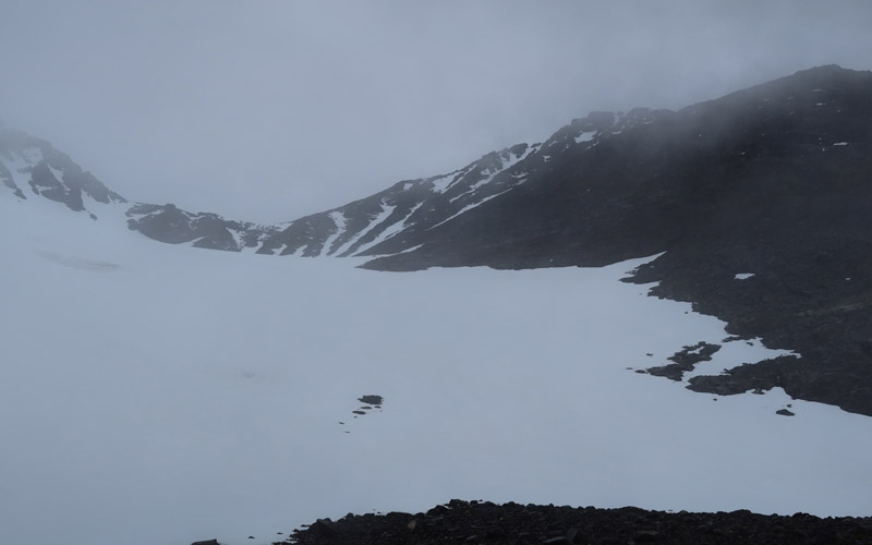
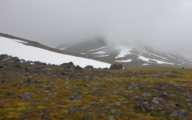
The weather remained overcast; the peaks of the fells were not visible, and even the lower slopes were barely visible. A light drizzle began fairly soon as we made our way through the rocky terrain of the lower slopes towards the marginal moraine of the glacier south of Àhkká. At the foot of the glacier was a fairly small pond; we scooped up a few mugs of water from the stream flowing out of it. Visibility improved slightly as we looked up; we noted that the glacier was almost completely covered in snow, and we could see Borgtoppen (1,961 m) and Stortoppen high above. We reckoned that there was still plenty of snow on the right-hand side of the glacier and that we could make our way upwards along the snow, provided we didn’t venture out onto the outer edge of the glacier, as there might be crevasses there. The plan was to head first to the saddle between Borgtoppen and Stortoppen and from there along the ridge to Stortoppen.
The ascent on the snow was quite steep, but the snow provided good support. Because of the steepness, we had to proceed in a zigzag pattern – this is a well-known method in fells terrain for easing the strain when climbing steep slopes. As we climbed, visibility improved, and we could see the back face of the glacier; we realised it would be difficult to climb from the glacier up to the saddle between the peaks, as we would have to scale a steep rocky slope for tens of metres. So we turned our attention to the slope on the right; we should certainly be able to climb that for at least some distance. The final section of the slope did, however, look steep and rocky. We headed right onto the scree slope. It was quite difficult to traverse, though, as the rocks were slippery and loose. We switched from the scree to a snow gully leading upwards; we could see that the snow extended quite a long way up.
Upwards along the edge of the glacier
The snow-covered slope rose quite steeply; we had to zigzag our way up again. It was so steep that we couldn’t manage more than a few steps at a time before having to stop to catch our breath and rest our muscles. We reckoned there were about six steps between each stop. Could it be that our almost complete lack of exercise over the last couple of years had finally paid off? Looking down, the steepness of the slope was a bit worrying; if we were to fall here, it could end badly – the slide might not stop until we hit the scree further down. The snow chute branched off twice, and on both occasions we chose the left-hand branch. Eventually, the top of the chute came into view; above it, we could see a few rocks and boulders. We climbed up onto the rocks and realised we were on the ridge of the fell, as a steep slope ahead dropped down into a white void. The cloud cover around us was now quite thick, and we couldn’t see much of the ridge above us.
We took a break, ate some chocolate bars and drank some water. We decided to leave our walking poles here; they would only get in the way on the ridge. We reckoned we’d be returning along the same route, so there was no risk of leaving the walking poles behind on the fell (see the 2023 trip). The ridge continued upwards quite gently and was fairly wide; walking along it posed little difficulty. There wasn’t much to see around us: to the left, a snow-covered slope disappeared somewhere downwards; to the right, a dark, vertical cliff face stretched down into the mist. The summit of the fell was covered in snow; the pile of rocks at the top was not visible, nor was much else. We felt a momentary surge of joy at having reached the summit. We made our way along the summit plateau, carefully navigating the snow cornice on the eastern edge, until the plateau clearly came to an end; Haket lay ahead of us, but due to the mist and snow, it was not clearly visible. We took some photographs and set off on our return journey. We found the walking poles without any trouble. We had another chocolate bar break, then moved onto the snow gully and started making our way down it.
From the summit of Àhkká
Descent from the summit of Àhkká
Now the snow felt soft and our feet sank into it just enough to provide good grip. The slope also felt gentler now, and soon we were back at the edge of the glacier. The going remained easy, as if we were out for a Sunday stroll. The wet scree on the lower slope, of course, felt more like business as usual again. We reached the tent at 23:01. Given the rather late hour, we were now treated to a light, vegetable-based Reiter Chicken Risotto with Vegetables. Before falling asleep, we realised that we hadn’t really believed beforehand that we’d have the stamina to make it all the way to the summit of Àhkká. We’d climbed 1,116 metres, and the journey had taken 6 hours and 49 minutes. The GPS recorded the distance as 11.5 km.
Rákkasoalgge – the stream between Suottasjvárátja and Alep Gássávárasj
Rákkasoalgge – the stream between Suottasjvárátja and Alep Gássávárasj – Elevation profile
Monday 29 June 2026: woke up at 08:30. It had rained quite a bit during the night, but now it was clear and the sun was even peeking through the clouds from time to time, although darker clouds were gathering in the west. For breakfast, we fancied something a bit more substantial, so we chose the energising ‘Reiter Rice with Beef and Pepper’ camping meal as our main course, followed by coffee and biscuits for dessert. We broke camp and packed our things. We set off at around 11 am, heading towards Várdojávrre; the plan was to first walk along the ridge between Boavtjosjávrre and Várdojávrre and then head towards Gássalákko. We soon had to take off our outer layers as it was getting warm. We first skirted around some wetlands; the ridge itself turned out to be extremely rocky, so progress there was rather slow.
Rocky terrain as we made our way around the lake
We then climbed over the north-eastern ridge of Várdotjåhkkå and continued towards Suottasjjávrre. First, we went to see if we could cross at the narrowest point of the lake. From the top of the fell ridge, it had looked as though we might be able to cross, but we couldn’t, so we went round the north side of the lake. We then headed south. Dark clouds from the west had now caught up with us and it began to rain. We put on our waterproofs and ate some chocolate bars. We then made our way upstream along the Suottasjågåsj, which flows between Suottasjvárátja and Alep Gássávárasj, until we found a suitable spot on flatter ground where we crossed the stream by stepping from stone to stone. We soon found a place to pitch our tent by a small stream with clear water at 16:23. The rain had stopped earlier, so we pitched the tent at our leisure and fetched 10 litres of water for our camp water container. We then changed into dry clothes. We had walked 13.35 km; it had taken us 5 hours and 25 minutes, and we had climbed 220 metres. The campsite was at an altitude of 978 metres.
We could actually have looked for a campsite further on, closer to our next day-trip destination, Gassakammen, but we reckoned we’d be able to walk there from here. According to the guidebooks, Gassakammen is an easy-to-walk ridge leading to the summit of the 1914-metre-high Gássatjåhkkå fell, making it an absolutely perfect day-trip destination for fell walkers, especially in good weather. Now, however, it was time to eat again; as the day’s walk had been moderate, even a lighter meal would suffice. We opted for the Reiter Chicken Korma Curry; this dish features some rather exotic flavours, such as pineapple and raisins, which take your mind to the warm southern countries.
Whilst we were still digesting our meal, a heavy downpour began. ‘Luckily we’re in the tent; let it rain now, then it’ll be sunny tomorrow, we thought. Then a strong north-westerly wind picked up, buffeting the tent and pushing the rear pole downwards. The sound of the rain hitting the tent fabric was like paper being torn. We realised we were in a fairly exposed spot, with no shelter from the wind nearby. In theory, we should have turned the tent so that the end was facing the wind, but in practice we couldn’t be bothered to go to the trouble. Of course, there was also the fact that on the windward side of the tent the rock was quite close to the surface and the tent pegs hadn’t sunk very deep into the ground. We’d need to place stones on top of the pegs. Of course, the nearest rocky outcrop was at least 50 metres away. Well, we managed to get stones on top of the pegs; we were able to make use of our walking poles by placing a pole on top of a peg and stones on either side of the pole. Then off to sleep.
Tuesday 30 June 2026: woke up at 07:00. Strong winds and rain had continued throughout the night and were still going on. It was also quite cold, with the cloud base at around 1,000 metres. The prevailing weather conditions were therefore not ideal for day hiking or summiting. So we carried on resting; at one point, we had to go and re-secure one of the tent pegs.
By around 12.14 pm, we were already feeling quite peckish; a hearty lunch was now in order, so we opted for the ‘Reiter Pasta with Beef and Pepper Sauce’. A substantial meal calls for a long rest after eating, so we didn’t enjoy our coffee and biscuits until after 2 pm. The weather remained quite consistently unsettled. ‘I don’t think we’ll be going on a day trip now, as we’ll have to keep an eye on the tent to make sure it stays put,’ we mused. So we carried on resting. In the evening, we still had to tighten the tent guy ropes and fetch a couple more stones to place on top of the tent pegs.
We had to secure the tent using walking poles and heavy stones
As our day-trip plans had gone awry, we considered our next move. We checked the weather forecast on our GPS device; according to it, it would still be rainy the following day, but the day after that – Thursday – might be rain-free, albeit cloudy. We decided that we wouldn’t wait any longer at this campsite, but would move on to a new destination the following day and plan our day trip for Thursday instead. The evening needed a bit of a lift, so we dug out a packet of Reiter Pasta Carbonara with Ham from our rucksacks. This is excellent camping food, the flavour of which improves in direct proportion to the number of days spent hiking. We turned in at 9.00 pm.
The stream between Suottasjvárátjan and Alep Gássávárasj – Nijákvágge
The stream between Suottasjvárátjan and Alep Gássávárasj – Nijákvágge – Elevation profile
Wednesday 1 July 2026, wake-up at 07:00. The rain had continued throughout the night; the wind had died down a little, but was still blowing from the north-west. So we would be walking into the wind and rain as the day wore on. This called for some hearty food, so it was clear that we would be having Reiter Beef, Noodles and Mushrooms – that rustic stew also known as ‘the hunter’s stew’. Only after a fairly long meal break were we able to have a cup of coffee and some strawberry biscuits. After packing up, we set off on foot at around 10.25 am, heading north-west towards Nijákvágge.
The going was just as rugged as we’d anticipated; the headwind and rain brought to mind the ‘car wash’ conditions of our 2025 trip on the Kungleden. We climbed gently up the side slope; the prolonged rain had soaked the marshy ground, so our high-ankle hiking boots (Hanwag Brenner Pro Wide GTX/Lundhags Jaure II High) were essential.
In the rain, against the wind, towards Nijakvagge
We reached Nijákriehppejávrásj and, at the same time, the clouds; visibility dropped to a minimum. However, we were already familiar with the area (from our 2009 trip), so we trudged across the scree to the end of the lake. The wind was cooler up here and we felt a bit chilly, especially in our hands.
We took a short break before climbing the rather steep snow slope to the highest point of Nijákvágge. We warmed up a little during the climb and the worst of the chill eased off. There was now less snow in Nijákvágge than on our previous visit. We descended, first on the snow at the bottom of the gully and then down the stony slope on the right bank of the stream. We noticed that further down ahead, in Ruohtesvágge, it was sunny. We reached the edge of Ruohtesvágge and looked for a way to cross the stream; a snow bridge was visible a little further down, and we managed to cross the stream valley easily along it.
It was now time to find a spot for the tent, keeping our next day’s destination in mind. We found a spot that was slightly, but not too, sloping at an altitude of 978 metres at around 2.20 pm, and pitched our tent there. Incidentally, this campsite offered quite good views of Ruohtesvágge, the Ruohtes fells and the glacier. A high-altitude campsite would provide a good starting point for a day trip, although we had to fetch water from quite a distance. Our next destination would be Kantberget, a ridge described in the guidebooks as easy to walk along and offering splendid views, along which one can walk to the highest peak at 1,857 metres.
The brief spell of sunshine soon gave way to rain again. We lay under our blankets, listening to the patter of rain against the tent, and ate a couple of chocolate bars each. We’d covered 9.2 km that day, taken 3 hours and 55 minutes, and climbed 567 metres. We spent the evening resting and keeping an eye on the weather, tucking into a Reiter Chicken Korma Curry whilst daydreaming of sunshine.
Kantberget
Kantberget – Elevation profile
Thursday 2 July 2027: woke up at 07:00. It wasn’t raining, there was no wind, and the clouds were quite thin and high up. Quite decent weather. So, with another day trip ahead of us, we had a hearty, energy-packed meal of Reiter Beef Stroganoff with Rice, as before, to ensure we had enough strength for the day’s outing. We also had coffee and ate some biscuits. We packed our day-trip gear. At 09:20 we set off on our day trip; the ascent began straight from the campsite, heading towards the north-western ridge of Kantberget. First came a wide, steep slope where we had to stop frequently to catch our breath. Down below in Ruohtesvágge, we saw two hikers making their way towards Nijákvágge.
The climb along the ridge to the summit of Kantberget
We then reached the narrower ridge of the fell; the climb was gentler here, the views were excellent, and the sun was now shining. Walking along the ridge was easy; there was a slightly narrower section here and there, but even that wasn’t difficult. A wide scree slope led up to the secondary summit at 1730 metres. At the summit there was a pile of rocks, and we stopped for a moment to take some photos. We spotted two hikers at the start of the Kantberget ridge; they were therefore on the same route as us. From the secondary summit, the route continued towards the main summit at 1857 metres. Initially, we descended along a fairly narrow ridge. At its narrowest point, the ridge was less than a metre wide; we bypassed this section on the right. It was a slightly tricky spot, as we couldn’t get a proper grip on the smooth rock with our hands; we should have gone round a few metres further down, but we managed to get past this smooth section by taking a few small jumps. We took a snack break at this point. The ridge continued, becoming wider, and a broad slope led up to the main summit, now mostly covered in snow. The summit itself was also completely covered in snow. According to my smartwatch, the altitude was 1888 metres. We couldn’t go to the eastern edge of the summit, as there was likely a snow cornice there. We did, however, take a few photographs.
The cloud cover had thickened and further south, in Ruohtesvágge, it looked as though it might even be raining, so we decided fairly quickly to head down. During the ascent, we’d spotted a snow-covered gully leading down towards Ruohtesvágge; we reckoned we’d be able to make our way down it quite easily. At first, the snow slope was quite steep and we had to proceed with some caution; at this point, we saw that the two hikers following behind us had reached the 1730-metre secondary summit. After that, the snow was softer and the descent was easy, like walking down a flight of stairs. We’d previously been thinking of climbing the neighbouring Gavelberget, but now it felt like we’d leave that for another time, given the weather conditions and our waning energy. We made our way across the snow to an altitude of 1116 metres, then continued along the side of the fell to the tent, arriving at 15:33. We had covered a distance of 9.4 km, taken 6 hours and 11 minutes, and accumulated 1165 metres of ascent.
Scenes from the campsite
Back at the tent, we ate some chocolate bars straight away and later enjoyed a delicious meal of Reiter Pasta Carbonara with Ham. It was lovely to lounge about in the sun-warmed tent, savouring the afterglow of a rewarding day’s hike. It’s certainly true that if the sun ever happens to shine in Sarek, it’s well worth climbing to the summit of a fell; rainy days are best spent making your way along the valley floors.
Friday 3 July 2026: woke up at 06:00. It was still sunny, with no wind. It would have been good weather for another summit attempt, but we’d already summited Niják (in 2009) and Kantberget, and in any case it was time to start our return journey. We rummaged through our food supplies right to the bottom and found some Reiter Beef, Noodles and Mushrooms – the hunter’s stew. If we ate that, we wouldn't be caught by hunger! Of course, we had to enjoy some coffee and biscuits too; after all, this has been our morning ritual on hikes for nearly a quarter of a century. We gathered our things together and set off at 08:30.
We first descended to Ruohtesvágge and crossed the stream with ease. We continued along a clear path downstream along the banks of the Nijákjågåsji. The weather was downright hot; in the sky we could see cumulus clouds and a towering thundercloud. We saw two hikers wading across to the other side of the river – the same ones who had been at Kantberget the previous day. They, too, continued their journey downstream. As we walked along, we wondered where on earth they were heading; Gughkesvágge would have been easier to reach via Nijákvagge, so they were probably heading for Àhkká and would have to wade across Suottasjjåhkå, which is notoriously difficult to cross. We ourselves intended to follow the riverbank all the way to Treparksmötet and the Padjelantaleden trail; after all, there’s an easy path to follow there.
On the way back to Ritsem, there were lovely views of the surrounding fells
Just as those two hikers were getting ready to wade across the Suottasjjåhkå ford, it occurred to us that perhaps we could take a slight detour and go via Akkaterraces after all. We decided to go and take a closer look at the possibilities for crossing the watercourse. There wasn’t much water in the Nijákjågåsj at the moment, and we managed to cross easily by walking along the rocks. At Suottasjjåhkå, there was clearly more water and a stronger current; a threshold running diagonally across the river was visible, and boulders could be seen here and there. ‘We could give that a go,’ we thought, and set off to cross the stream by following the boulders and the rocks just below the surface. Soon we were in the middle of the stream; the greenish-grey glacial water was rushing swiftly over the rocks. We began to wonder if we’d perhaps bitten off more than we could chew; on the opposite bank, two hikers were watching our progress, and the knowledge that we had an audience added to the pressure to succeed. We had to manoeuvre a bit and take a few longer strides, but we made it across the stream with dry feet.
After crossing the stream, we had a chat with those two hikers; they were Swedish lads, estimated to be in their early 30s, who had set off from Ritsem, travelled via Sierggavágge to Ruohtesvágge, visited Kantberget and were now on their way to Akkastugan. At Kantberget, they had followed in our footsteps and, as a result, had plucked up the courage to descend the same route as us, even though walking on the snow had initially made them a bit wary. We wished hikers from the neighbouring country a safe onward journey and set off ahead of them to continue our own journey.
We started by following a path along the riverbank, then decided to cut across to the right towards Akkaterasse. However, the slope was rocky, overgrown with bushes and marshy, and didn’t actually cut across, so the Swedes managed to get ahead of us by taking the lower route. Rain was threatening, so we put on our waterproofs and ate some chocolate bars whilst we were at it. However, the rain never really started. We then walked past Sjnjuvtjudisjávrásj to the terraces and found the path running along there. We walked down the path, taking a chocolate bar break before descending into a birch copse. Now the long-awaited rain began, and there was even a single clap of thunder.
We wondered how far we’d be able to walk; in recent years our daily walks have become shorter, and our physical capacity has declined due to our age and sedentary lifestyle. We wondered whether there might be a sauna at Akkastugan, but then we remembered that it’s no longer in use. We also considered the cost of a helicopter ride; Akkastugan has a helicopter landing pad, so we could fly the rest of the way. As we walked along the path through the undergrowth after the Vuojatädno bridge, we remembered that the MS Storlule runs twice a day, with the second departure from Änonjälmmä at 19:35. It was now just after 4.00 pm, and we realised we might just make it in time for this departure. We kept up a brisk pace and arrived at the ferry quay at 5.20 pm – the walk had turned out to be over 25 km! The rain continued, and once we stopped moving, we soon felt the cold. We changed into dry shirts and warm clothes and took shelter from the rain under the small canopy by the notice board.
Waiting for the ship in Änonjálmme
The wait was long, and there was still no sign of the ferry on the lake. We wondered whether the rainy weather might be preventing the ferry from running, or whether the ferry crew had other things to do on a Friday evening. We were already grumbling that perhaps they only run boats here when they feel
like it and don't put summer bridges in place even though it's july! (see 2017 trip). Then, however, the ferry came into view and we were able to breathe a sigh of relief. We then boarded the ferry, where there was one passenger travelling to Vájsáluokta. From Vájsáluokta, we sailed on to Ritsem, where we arrived at 21:20. We changed our clothes and drove to Haaparanta to fill up the car with diesel, then headed home to Oulu.
Notes: We’ve now climbed Àhkká ‘from front and back’; next, we could tackle the other peaks in the massif – Borgtoppen, for example, might be an interesting option. Gassakammen will probably also require another attempt. As for kit, it’s hard to think of any major improvements: the camping tents worked well, and a medium-sized gas canister lasted five days with the Primus Spindel stove; in future, we could probably get by with just two gas canisters. One spare pair of socks is enough. I could do with new shell trousers and a windcheater; the trousers have holes in them and the jacket could do with a hood.